How to get to Gregory A Benbow do by bus?
Click on the bus route to see step by step directions with maps, line arrival times and updated time schedules.
From Rose Gaming Resort, Prince William County
241 minFrom Busch Gardens Williamsburg (Employee Parking Lot), James City County
157 minFrom Lorton, VA - Amtrak Auto Train Station (LOR), Fairfax County
231 minFrom Potomac Mills Mall, Prince William County
216 minFrom Lorton, VA, Fairfax County
226 minFrom UVA Hospital Medical Center, Charlottesville
305 minFrom Amazon Fulfillment Center-Ric3, Richmond
85 minFrom Woodbridge, VA, Prince William County
161 min
Bus stops near Gregory A Benbow do in Richmond
Train station near Gregory A Benbow do in Richmond
- Pathrichmond Main Street Amtrak Station, 13 min walk,VIEW
Bus lines to Gregory A Benbow do in Richmond
What are the closest stations to Gregory A Benbow do?
The closest stations to Gregory A Benbow do are:
- Robinson + Kensington is 276 yards away, 4 min walk.
- Sheppard + Park is 457 yards away, 6 min walk.
- Grove + Boulevard is 487 yards away, 6 min walk.
- Pathrichmond Main Street Amtrak Station is 1058 yards away, 13 min walk.
Which bus lines stop near Gregory A Benbow do?
These bus lines stop near Gregory A Benbow do: 18, 20, BRT.
What’s the nearest train station to Gregory A Benbow do in Richmond?
The nearest train station to Gregory A Benbow do in Richmond is Pathrichmond Main Street Amtrak Station. It’s a 13 min walk away.
What’s the nearest bus station to Gregory A Benbow do in Richmond?
The nearest bus station to Gregory A Benbow do in Richmond is Robinson + Kensington. It’s a 4 min walk away.
What time is the first train to Gregory A Benbow do in Richmond?
The NORTHEAST REGIONAL is the first train that goes to Gregory A Benbow do in Richmond. It stops nearby at 5:19 AM.
What time is the last train to Gregory A Benbow do in Richmond?
The NORTHEAST REGIONAL is the last train that goes to Gregory A Benbow do in Richmond. It stops nearby at 6:52 PM.
What time is the first bus to Gregory A Benbow do in Richmond?
The 20 is the first bus that goes to Gregory A Benbow do in Richmond. It stops nearby at 5:05 AM.
What time is the last bus to Gregory A Benbow do in Richmond?
The 20 is the last bus that goes to Gregory A Benbow do in Richmond. It stops nearby at 10:53 PM.
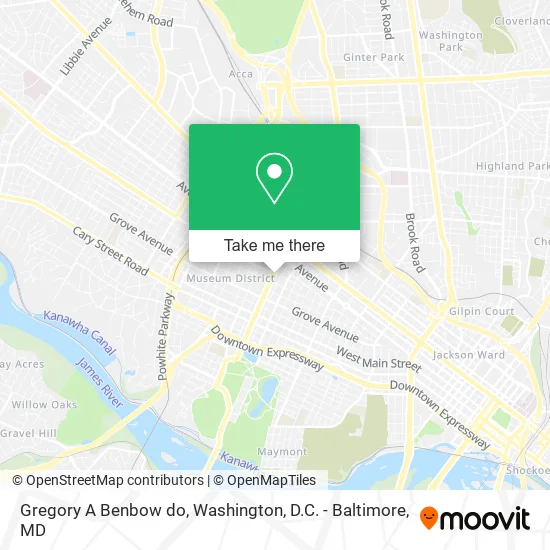
See Gregory A Benbow do, Richmond, on the map
Public Transit to Gregory A Benbow do in Richmond
Wondering how to get to Gregory A Benbow do in Richmond? Moovit helps you find the best way to get to Gregory A Benbow do with step-by-step directions from the nearest public transit station.
Moovit provides free maps and live directions to help you navigate through your city. View schedules, routes, timetables, and find out how long does it take to get to Gregory A Benbow do in real time.
Looking for the nearest stop or station to Gregory A Benbow do? Check out this list of stops closest to your destination: Robinson + Kensington; Sheppard + Park; Grove + Boulevard; Pathrichmond Main Street Amtrak Station.
Bus: 18, 20, BRT, 76, 77.Train: NORTHEAST REGIONAL.
Want to see if there’s another route that gets you there at an earlier time? Moovit helps you find alternative routes or times. Get directions from and directions to Gregory A Benbow do easily from the Moovit App or Website.
We make riding to Gregory A Benbow do easy, which is why over 1.5 million users, including users in Richmond, trust Moovit as the best app for public transit. You don’t need to download an individual bus app or train app, Moovit is your all-in-one transit app that helps you find the best bus time or train time available.
For information on prices of bus and train, costs and ride fares to Gregory A Benbow do, please check the Moovit app.
Use the app to navigate to popular places including to the airport, hospital, stadium, grocery store, mall, coffee shop, school, college, and university.
Gregory A Benbow do Address: 425 N Arthur Ashe Blvd Richmond, VA 23220 street in Richmond
- LabCorp,
- Richard M Clary MD,
- Thomas Veech,
- Surgical Specialists of Richmond,
- George Maughan MD,
- Michael J MacDougall MD,
- Aquino Charles A Architect PC,
- Concierge Home Solutions,
- Friends of the Richmond Mounted Squad,
- Tuscan Villas Condominium Association,
- Major Medical,
- Monument Group,
- Connelly Tattoo,
- Shoppers World,
- Mulberry Painting,
- Auto Locksmith In Richmond,
- Braille Circulating Library,
- St Mark's Episcopal Church,
- Commonwealth of Virginia,
- Virginia Department of Historic Resources
Places Near Gregory A Benbow do (Richmond)
- Museum Of The Bible, Washington,
- Warner Theatre, Washington,
- Rock Creek Tennis Center, Washington,
- Washington National Cathedral, Washington,
- Westfield Montgomery Mall, Montgomery County,
- Amazon Hq2, Arlington County,
- The Anthem, Washington,
- Sibley Memorial Hospital, Washington,
- Marriott Marquis Washington, DC, Washington,
- PG Mall, Prince George's County,
- Basilica of the National Shrine, Washington,
- M&T Bank Stadium, Baltimore,
- Camden Yards, Baltimore,
- National Zoo, Washington,
- Washington DC VA Medical Center, Washington,
- Capital One Arena, Washington,
- National Mall, Washington,
- Pennsylvania Ave NW (3rd st and pennsylvania), Washington,
- National Museum of African American History and Culture, Washington,
- Georgetown, Washington
How to get to popular places in Washington, D.C. - Baltimore, MD with public transit
Get around Richmond by public transit!
Traveling around Richmond has never been so easy. See step by step directions as you travel to any attraction, street or major public transit station. View bus and train schedules, arrival times, service alerts and detailed routes on a map, so you know exactly how to get to anywhere in Richmond.
When traveling to any destination around Richmond use Moovit's Live Directions with Get Off Notifications to know exactly where and how far to walk, how long to wait for your line, and how many stops are left. Moovit will alert you when it's time to get off — no need to constantly re-check whether yours is the next stop.
Wondering how to use public transit in Richmond or how to pay for public transit in Richmond? Moovit public transit app can help you navigate your way with public transit easily, and at minimum cost. It includes public transit fees, ticket prices, and costs. Looking for a map of Richmond public transit lines? Moovit public transit app shows all public transit maps in Richmond with all Bus, Train, Metro, Light Rail and Ferry routes and stops on an interactive map.
Washington, D.C. - Baltimore, MD has 5 transit type(s), including: Bus, Train, Metro, Light Rail and Ferry, operated by several transit agencies, including WMATA, Montgomery County Ride On, Fairfax Connector, TheBus, PRTC, DASH - Alexandria, Arlington Transit (ART), RTA of Central Maryland, MDOT MTA, MDOT MTA Light RailLink, MDOT MTA Commuter Bus, MDOT MTA Local Bus, FXBGO!, Virginia Railway Express (VRE) and MARC