Directions to Groovy Net (Kota Yogyakarta) with public transportation
The following transit lines have routes that pass near Groovy Net
 Bus: 10, 8, JOGJA - TEMPEL, JOGJA - WATES, 6A.
- Train: KRL, PRAMEKS, YIA.
How to get to Groovy Net by bus?
Click on the bus route to see step by step directions with maps, line arrival times and updated time schedules.
From Agen Bus Ramayana Terminal Bus Jombor, Kota Yogyakarta
28 minFrom Gedung Abdullah Sigit FIP UNY, Kota Yogyakarta
37 minFrom Warung Tongseng Jamu & Sate B1 B2, Sleman
72 minFrom Jl.DR.wahidin sudiro husodo sabdodadi, Bantul
62 minFrom Eastparc Hotel Yogyakarta, Kota Yogyakarta
49 minFrom Malioboro, Sleman
34 minFrom Platinum Adisucipto Hotel & Conference Center, Sleman
74 minFrom PT. Bussan Auto Finance ( BAF ) Ruko Permai III Pandega No. 9-11 jl. Ringroad Utara Sleman Yogyakar, Kota Yogyakarta
47 minFrom Kecamatan Ngemplak, Sleman
72 minFrom Berbah Sleman, Yogyakarta, Kota Yogyakarta
54 min
Bus stops near Groovy Net in Kota Yogyakarta
Train stations near Groovy Net in Kota Yogyakarta
Bus lines to Groovy Net in Kota Yogyakarta
- 6A, Gamping - Malioboro - Gamping,VIEW
- 8, Jombor - Jogokaryan - Jombor,VIEW
- 9, Giwangan - Jombor - Giwangan,VIEW
- 10, Gamping - Sgm - Gamping,VIEW
- 11, Giwangan - Rs Panti Rapih - Giwangan,VIEW
- 15, Ngabean - Palbapang - Ngabean,VIEW
- 3B, Giwangan - Condongcatur - Giwangan,VIEW
- 6B, Gamping - Malioboro - Gamping,VIEW
- 13, Ngabean - Godean - Ngabean,VIEW
- 2B, Condongcatur - Xt Square - Condongcatur,VIEW
- 3A, Adisutjipto - Ngabean - Adisutjipto,VIEW
- JOGJA - TEMPEL, Jogja,VIEW
- JOGJA - WATES, Wates,VIEW
What are the closest stations to Groovy Net?
The closest stations to Groovy Net are:
- Tpb - Pasar Legi is 401 meters away, 6 min walk.
- Halte - Tejokusuman (Taman Sari) is 465 meters away, 7 min walk.
- Tpb - Pasar Serangan is 535 meters away, 8 min walk.
- Halte - Ngabean is 865 meters away, 12 min walk.
- Jalan Kapten Piere Tendean 29 is 1038 meters away, 14 min walk.
- Lempuyangan is 2853 meters away, 39 min walk.
- Stasiun Yogyakarta is 4284 meters away, 55 min walk.
Which bus lines stop near Groovy Net?
These bus lines stop near Groovy Net: 10, 8, JOGJA - TEMPEL, JOGJA - WATES.
What’s the nearest bus station to Groovy Net in Kota Yogyakarta?
The nearest bus station to Groovy Net in Kota Yogyakarta is Tpb - Pasar Legi. It’s a 6 min walk away.
What time is the first train to Groovy Net in Kota Yogyakarta?
The YIA is the first train that goes to Groovy Net in Kota Yogyakarta. It stops nearby at 4:35 AM.
What time is the last train to Groovy Net in Kota Yogyakarta?
The YIA is the last train that goes to Groovy Net in Kota Yogyakarta. It stops nearby at 10:04 PM.
What time is the first bus to Groovy Net in Kota Yogyakarta?
The JOGJA - WATES is the first bus that goes to Groovy Net in Kota Yogyakarta. It stops nearby at 5:09 AM.
What time is the last bus to Groovy Net in Kota Yogyakarta?
The 2B is the last bus that goes to Groovy Net in Kota Yogyakarta. It stops nearby at 10:23 PM.
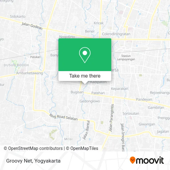
See Groovy Net, Kota Yogyakarta, on the map
Public Transit to Groovy Net in Kota Yogyakarta
Wondering how to get to Groovy Net in Kota Yogyakarta? Moovit helps you find the best way to get to Groovy Net with step-by-step directions from the nearest public transit station.
Moovit provides free maps and live directions to help you navigate through your city. View schedules, routes, timetables, and find out how long does it take to get to Groovy Net in real time.
Looking for the nearest stop or station to Groovy Net? Check out this list of stops closest to your destination: Tpb - Pasar Legi; Halte - Tejokusuman (Taman Sari); Tpb - Pasar Serangan; Halte - Ngabean; Jalan Kapten Piere Tendean 29; Lempuyangan; Stasiun Yogyakarta.
Bus: 10, 8, JOGJA - TEMPEL, JOGJA - WATES, 6A, 9, 11, 15, 13, 2B, 3A.Train: KRL, PRAMEKS, YIA.
Want to see if there’s another route that gets you there at an earlier time? Moovit helps you find alternative routes or times. Get directions from and directions to Groovy Net easily from the Moovit App or Website.
We make riding to Groovy Net easy, which is why over 1.5 million users, including users in Kota Yogyakarta, trust Moovit as the best app for public transit. You don’t need to download an individual bus app or train app, Moovit is your all-in-one transit app that helps you find the best bus time or train time available.
For information on prices of bus, costs and ride fares to Groovy Net, please check the Moovit app.
Use the app to navigate to popular places including to the airport, hospital, stadium, grocery store, mall, coffee shop, school, college, and university.
Groovy Net Address: Jalan Letjend. S. Parman Wirobrajan Yogyakarta street in Kota Yogyakarta
- Lapangan Mancasan, Wirobrajan, Jogja,
- Dunia Celengan,
- Pungky Rumah Jahit,
- 46 Jalan Letjen S.Parman,
- Hotel dwiwarna,
- Sahara Gemstone,
- PT Skatindo Sarana Acara,
- Gudang Computer,
- Mu'allimin International Boarding School,
- Seblak Bloom Patangpuluhan,
- Bu M,
- Gereja Kristen Nazarene (GKN Sonopakis),
- Ketanggungan,
- Kost Rafflesia,
- Madrasah Mu'allimin Muhammadiyah,
- Soto Taman Sari Yogya,
- Prista Cell,
- Atm Bri Syariah Mualimin,
- Rth Winongo Patangpuluhan,
- SMKN 1 Kasihan (SMKI Yogyakarta)
Places Near Groovy Net (Kota Yogyakarta)
- Kids Fun, Kota Yogyakarta,
- Merapi Lava Tour, Kota Yogyakarta,
- Universitas Islam Indonesia (UII), Kota Yogyakarta,
- Ambarukmo plaza, Kota Yogyakarta,
- Universitas Muhammadiyah Yogyakarta (UMY),
- Gereja Dan Candi Hati Kudus Yesus Ganjuran, Kota Yogyakarta,
- Wonosari, Gunungkidul, Kota Yogyakarta,
- Sleman City Hall, Sleman,
- Bangsal Bedah Cendana RSUP Dr.Sardjito,jogjakarta, Kota Yogyakarta,
- Universitas Gadjah Mada (UGM), Kota Yogyakarta,
- Ahli Patah Tulang Cik Verly, Kota Yogyakarta,
- KOPI KLOTOK, Kota Yogyakarta,
- Gua Maria Ganjuran, Kota Yogyakarta,
- Goa Maria Sendangsono,Kulon Progo, Kota Yogyakarta,
- Kebun Binatang Gembira Loka, Kota Yogyakarta,
- Akademi Militer, Magelang, Kota Yogyakarta,
- Jogja Expo Center (JEC), Kota Yogyakarta,
- RS.SARDJITO yogyakarta, Kota Yogyakarta,
- Plaza Pasar Ngasem, Kota Yogyakarta,
- Praktek dr. Ahmad Asmedi,M.Kes,Sp.S, Bantul
How to get to popular places in Yogyakarta with public transit
Get around Kota Yogyakarta by public transit!
Traveling around Kota Yogyakarta has never been so easy. See step by step directions as you travel to any attraction, street or major public transit station. View bus and train schedules, arrival times, service alerts and detailed routes on a map, so you know exactly how to get to anywhere in Kota Yogyakarta.
When traveling to any destination around Kota Yogyakarta use Moovit's Live Directions with Get Off Notifications to know exactly where and how far to walk, how long to wait for your line, and how many stops are left. Moovit will alert you when it's time to get off — no need to constantly re-check whether yours is the next stop.
Wondering how to use public transit in Kota Yogyakarta or how to pay for public transit in Kota Yogyakarta? Moovit public transit app can help you navigate your way with public transit easily, and at minimum cost. It includes public transit fees, ticket prices, and costs. Looking for a map of Kota Yogyakarta public transit lines? Moovit public transit app shows all public transit maps in Kota Yogyakarta with all Bus and Train routes and stops on an interactive map.
Yogyakarta has 2 transit type(s), including: Bus and Train, operated by several transit agencies, including Trans Jogja, AKDP (Angkutan Kota Dalam Provinsi), SatelQu, KAI Commuter, KAI Bandara and DAMRI