Directions to Grow Into (Maia) with public transportation
The following transit lines have routes that pass near Grow Into
 Bus: 5010, 5011, 705, 706, 707.
- Train: LINHA DE LEIXOES, LINHA DE BRAGA, LINHA DE GUIMARAES, LINHA DO MARCO, LINHA DO MARCO.
- Metro: D.
How to get to Grow Into by bus?
Click on the bus route to see step by step directions with maps, line arrival times and updated time schedules.
From Mercado Bom Sucesso, Lordelo do Ouro e Massarelos
45 minFrom Piscina das Marés, Matosinhos e Leça da Palmeira
58 minFrom Hospital Privado da Boa Nova, Perafita, Lavra e Santa Cruz do Bispo
75 minFrom Canidelo, Vila Nova De Gaia
73 minFrom Jardim Senhor do Padrao, Matosinhos e Leça da Palmeira
40 minFrom Muro, Trofa
59 minFrom Regimento de Transmissões (RTm), Ramalde
42 minFrom GaiaShopping, Santa Marinha e São Pedro da Afurada
81 minFrom Museu de Serralves, Lordelo do Ouro e Massarelos
78 minFrom Canidelo, Vila Nova De Gaia
83 min
How to get to Grow Into by train?
Click on the train route to see step by step directions with maps, line arrival times and updated time schedules.
How to get to Grow Into by metro?
Click on the metro route to see step by step directions with maps, line arrival times and updated time schedules.
Bus stops near Grow Into in Maia
Train stations near Grow Into in Maia
Metro station near Grow Into in Maia
- Hospital De São João, 23 min walk,VIEW
Bus lines to Grow Into in Maia
- 705, Valongo-continente,VIEW
- 706, Ermesinde (estação),VIEW
- 707, Hosp. S. João (metro),VIEW
- 5010, MaiaShopping (via Ermesinde),VIEW
- 5011, Valongo (Estação),VIEW
- 5104, Matosinhos (Mercado) (via Ermesinde),VIEW
- 6005, Hospital São João,VIEW
- 6005, Hospital São João (via Maia Shopping),VIEW
- 7001, TECMaia (via Maia),VIEW
- 6012, TECMaia (via Maia),VIEW
What are the closest stations to Grow Into?
The closest stations to Grow Into are:
- Gago Coutinho is 144 meters away, 3 min walk.
- Formigueiro is 223 meters away, 4 min walk.
- São Mamede de Infesta is 346 meters away, 5 min walk.
- António Santos is 541 meters away, 8 min walk.
- Hospital De São João is 1757 meters away, 23 min walk.
- Águas Santas / Palmilheira is 3139 meters away, 41 min walk.
Which bus lines stop near Grow Into?
These bus lines stop near Grow Into: 5010, 5011, 705, 706.
Which train line stops near Grow Into?
LINHA DE LEIXOES (Leca Do Balio)
Which metro line stops near Grow Into?
D (Hospital São João)
What’s the nearest metro station to Grow Into in Maia?
The nearest metro station to Grow Into in Maia is Hospital De São João. It’s a 23 min walk away.
What’s the nearest train station to Grow Into in Maia?
The nearest train station to Grow Into in Maia is São Mamede de Infesta. It’s a 5 min walk away.
What’s the nearest bus station to Grow Into in Maia?
The nearest bus station to Grow Into in Maia is Gago Coutinho. It’s a 3 min walk away.
What time is the first metro to Grow Into in Maia?
The D is the first metro that goes to Grow Into in Maia. It stops nearby at 6:00 AM.
What time is the last metro to Grow Into in Maia?
The D is the last metro that goes to Grow Into in Maia. It stops nearby at 1:28 AM.
What time is the first train to Grow Into in Maia?
The LINHA DO MARCO is the first train that goes to Grow Into in Maia. It stops nearby at 5:24 AM.
What time is the last train to Grow Into in Maia?
The LINHA DE BRAGA is the last train that goes to Grow Into in Maia. It stops nearby at 1:03 AM.
What time is the first bus to Grow Into in Maia?
The 705 is the first bus that goes to Grow Into in Maia. It stops nearby at 5:56 AM.
What time is the last bus to Grow Into in Maia?
The 5104 is the last bus that goes to Grow Into in Maia. It stops nearby at 12:40 AM.
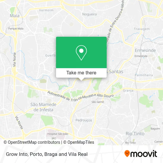
See Grow Into, Maia, on the map
Public Transit to Grow Into in Maia
Wondering how to get to Grow Into in Maia? Moovit helps you find the best way to get to Grow Into with step-by-step directions from the nearest public transit station.
Moovit provides free maps and live directions to help you navigate through your city. View schedules, routes, timetables, and find out how long does it take to get to Grow Into in real time.
Looking for the nearest stop or station to Grow Into? Check out this list of stops closest to your destination: Gago Coutinho; Formigueiro; São Mamede de Infesta; António Santos; Hospital De São João; Águas Santas / Palmilheira.
Bus: 5010, 5011, 705, 706, 707, 6005, 6005, 7001.Train: LINHA DE LEIXOES, LINHA DE BRAGA, LINHA DE GUIMARAES, LINHA DO MARCO, LINHA DO MARCO.Metro: D.
Want to see if there’s another route that gets you there at an earlier time? Moovit helps you find alternative routes or times. Get directions from and directions to Grow Into easily from the Moovit App or Website.
We make riding to Grow Into easy, which is why over 1.5 million users, including users in Maia, trust Moovit as the best app for public transit. You don’t need to download an individual bus app or train app, Moovit is your all-in-one transit app that helps you find the best bus time or train time available.
For information on prices of bus, metro and train, costs and ride fares to Grow Into, please check the Moovit app.
Use the app to navigate to popular places including to the airport, hospital, stadium, grocery store, mall, coffee shop, school, college, and university.
Grow Into Address: Praceta António Gonçalves Lage 54 Formigueiro, 4425-222 Maia street in Maia
- Pavilhao Formigueiro,
- Águas Santas Dojo,
- Pavilhão Municipal de Águas Santas III - Formigueiro,
- Maria Odete Martins,
- Rua Gago Coutinho 32,
- Eu Marketing,
- Rua Bairristas do Formigueiro 356,
- Seabra, Maria Esmeralda Ramos Silva,
- Rui Artur Fonseca, Unipessoal,
- Cerealis,
- Docinho de Parada,
- Rua Doutor António dos Santos,
- Maitex - Indústria Têxtil, S.a.,
- Serviços Municipalizados Águas e Saneamento da Maia - Etar de Parada,
- O Conchas 65,
- Eco-centro de Parada,
- Sangemil, Aguas Santas,
- Rua Manuel Gonçalves Lage 988, Águas Santas,
- Mamajuana Restaurante,
- Manuel Santos Quelhas
Places Near Grow Into (Maia)
- Espinho, Espinho,
- MAR Shopping, Matosinhos e Leça da Palmeira,
- VILA do CONDE PORTO FASHION OUTLET, Modivas,
- Hospital da Prelada, Ramalde,
- Maia, Maia,
- Palácio de Cristal, Lordelo do Ouro e Massarelos,
- El Corte Inglés de Gaia, Mafamude e Vilar do Paraíso,
- Senhor de Matosinhos, Matosinhos e Leça da Palmeira,
- Exponor, Matosinhos e Leça da Palmeira,
- Valongo, Valongo,
- Hospital de Santo António, Cedofeita, Santo Ildefonso, Sé, Miragaia, São Nicolau e Vitória,
- Zoo Santo Inácio, Vila Nova De Gaia,
- Leça da Palmeira, Matosinhos e Leça da Palmeira,
- Parque Aquatico Amarante - Aqua Aventura, Amarante,
- Avintes, Vila Nova De Gaia,
- Canidelo, Vila Nova De Gaia,
- Acesso ao Shopping Parque Nascente, Campanhã,
- Hospital Santos Silva, Vila Nova De Gaia,
- Arrábida Shopping, Santa Marinha e São Pedro da Afurada,
- Rua Calouste Gulbenkian, Lordelo do Ouro e Massarelos
How to get to popular places in Porto, Braga and Vila Real with public transit
Get around Maia by public transit!
Traveling around Maia has never been so easy. See step by step directions as you travel to any attraction, street or major public transit station. View bus and train schedules, arrival times, service alerts and detailed routes on a map, so you know exactly how to get to anywhere in Maia.
When traveling to any destination around Maia use Moovit's Live Directions with Get Off Notifications to know exactly where and how far to walk, how long to wait for your line, and how many stops are left. Moovit will alert you when it's time to get off — no need to constantly re-check whether yours is the next stop.
Wondering how to use public transit in Maia or how to pay for public transit in Maia? Moovit public transit app can help you navigate your way with public transit easily, and at minimum cost. It includes public transit fees, ticket prices, and costs. Looking for a map of Maia public transit lines? Moovit public transit app shows all public transit maps in Maia with all Bus, Train, Metro, Ferry, Funicular and Gondola routes and stops on an interactive map.
Porto, Braga and Vila Real has 6 transit type(s), including: Bus, Train, Metro, Ferry, Funicular and Gondola, operated by several transit agencies, including Metro do Porto, Metro do Porto - Metrobus, CP - Comboios de Portugal, STCP, UNIR Mobilidade da Area Metropolitana do Porto, Getbus - Aerobus, Mobiave, Valpibus, TUB - Transportes Urbanos de Braga, TuViana, Guimabus, Ave Mobilidade, Cávado Mobilidade, Transdev and Câmara Municipal de Santo Tirso