How to get to Growth Control Group by bus?
Click on the bus route to see step by step directions with maps, line arrival times and updated time schedules.
From South Pointe Park, Miami Beach
51 minFrom Mall at 163rd Street, Miami
75 minFrom Everglades Safari Park, Miami Beach
38 minFrom Miami-Dade County School Board Administration Building, Miami
58 minFrom Adrienne Arsht Center, Miami
54 minFrom Flea Market, Miami
66 minFrom Lincoln Road, Miami Beach
28 minFrom Florida International University-Biscayne Bay (FIU-Biscayne Bay), Miami
76 minFrom The Palms Hotel & Spa, Miami Beach
21 minFrom Sawgrass mall ( FL ), Miami Beach
39 min
Bus stops near Growth Control Group in Miami Beach
Bus lines to Growth Control Group in Miami Beach
What are the closest stations to Growth Control Group?
The closest stations to Growth Control Group are:
- 71 St & Rue Versailles is 164 yards away, 3 min walk.
- Collins Av & 72 St is 585 yards away, 8 min walk.
Which bus lines stop near Growth Control Group?
These bus lines stop near Growth Control Group: 100, 279, 79.
What’s the nearest bus station to Growth Control Group in Miami Beach?
The nearest bus station to Growth Control Group in Miami Beach is 71 St & Rue Versailles. It’s a 3 min walk away.
What time is the first bus to Growth Control Group in Miami Beach?
The 100 is the first bus that goes to Growth Control Group in Miami Beach. It stops nearby at 3:02 AM.
What time is the last bus to Growth Control Group in Miami Beach?
The 100 is the last bus that goes to Growth Control Group in Miami Beach. It stops nearby at 3:16 AM.
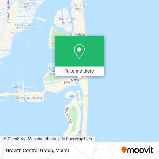
See Growth Control Group, Miami Beach, on the map
Public Transit to Growth Control Group in Miami Beach
Wondering how to get to Growth Control Group in Miami Beach? Moovit helps you find the best way to get to Growth Control Group with step-by-step directions from the nearest public transit station.
Moovit provides free maps and live directions to help you navigate through your city. View schedules, routes, timetables, and find out how long does it take to get to Growth Control Group in real time.
Looking for the nearest stop or station to Growth Control Group? Check out this list of stops closest to your destination: 71 St & Rue Versailles; Collins Av & 72 St.
Bus: 100, 279, 79.
Want to see if there’s another route that gets you there at an earlier time? Moovit helps you find alternative routes or times. Get directions from and directions to Growth Control Group easily from the Moovit App or Website.
We make riding to Growth Control Group easy, which is why over 1.5 million users, including users in Miami Beach, trust Moovit as the best app for public transit. You don’t need to download an individual bus app or train app, Moovit is your all-in-one transit app that helps you find the best bus time or train time available.
For information on prices of bus, costs and ride fares to Growth Control Group, please check the Moovit app.
Use the app to navigate to popular places including to the airport, hospital, stadium, grocery store, mall, coffee shop, school, college, and university.
Growth Control Group Address: 525 71st St Miami Beach, FL 33141 street in Miami Beach
- Remote My Books,
- FedEx Drop Box,
- Yes Cafe,
- USPS Collection Box - Blue Box,
- Mi Tierra Restaurant & Bakery,
- 72 Park,
- St Regis Sunny Isles,
- The PGL(SM) Wellness Center,
- metroPCS Wireless,
- Daniels Jewelry,
- Navarro Discount (CVS / pharmacy),
- Indian Creek Apartments,
- Cafe Prima Pasta,
- Express Garage Doors,
- Wunderbar Duct Cleaning Services,
- Bti Stations,
- King Jesus Miami Beach,
- M&M Parking,
- Holy Smokes Miami,
- Phones and More
Places Near Growth Control Group (Miami Beach)
- Sawgrass mall ( FL ), Miami Beach,
- Hard Rock Stadium, Miami Gardens,
- Marlins Park, Miami,
- Sawgrass Mall, Miami,
- Dolphin Mall Bus, Miami,
- Zoo Miami, Miami,
- Dolphin Mall, Miami,
- Aventura Mall, Miami Beach,
- Miami Freedom Park, Miami,
- Wynwood, Miami,
- Bayside Marketplace, Miami,
- Miami VA Hospital, Miami,
- Port of Miami Cruise Terminal, Miami,
- Miami-Dade County Courthouse, Miami,
- Richard E. Gerstein Justice Building, Miami,
- Keiser University Flagship Campus, West Palm Beach,
- Brickell City Centre, Miami,
- Little Havana, Miami,
- Miami Design District, Miami,
- Aventura Mall, Miami
How to get to popular places in Miami with public transit
Get around Miami Beach by public transit!
Traveling around Miami Beach has never been so easy. See step by step directions as you travel to any attraction, street or major public transit station. View bus and train schedules, arrival times, service alerts and detailed routes on a map, so you know exactly how to get to anywhere in Miami Beach.
When traveling to any destination around Miami Beach use Moovit's Live Directions with Get Off Notifications to know exactly where and how far to walk, how long to wait for your line, and how many stops are left. Moovit will alert you when it's time to get off — no need to constantly re-check whether yours is the next stop.
Wondering how to use public transit in Miami Beach or how to pay for public transit in Miami Beach? Moovit public transit app can help you navigate your way with public transit easily, and at minimum cost. It includes public transit fees, ticket prices, and costs. Looking for a map of Miami Beach public transit lines? Moovit public transit app shows all public transit maps in Miami Beach with all Bus, Train, Light Rail and Ferry routes and stops on an interactive map.
Miami has 4 transit type(s), including: Bus, Train, Light Rail and Ferry, operated by several transit agencies, including Broward County Transit, Miami-Dade Transit, Metrorail, Palm Tran, Tri-Rail, Brightline, MARTY, City of Homestead Trolley, Key West Transit, Treasure Coast Connector, GoLine IRT, Amtrak, Greyhound-us, FlixBus-us and Aventura Express Shuttle Bus