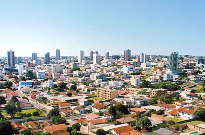
Directions to Guarapuava with public transportation
The following transit lines have routes that pass near Guarapuava
How to get to Guarapuava by bus?
Click on the bus route to see step by step directions with maps, line arrival times and updated time schedules.
Bus stops near Guarapuava
- R. Guaíra, 2936 (Chuveirão Das Tintas), 3 min walk,
- R. Dr. Laranjeiras, 1139 (Restaurante Cheiro Verde), 4 min walk,
- R. Capitão Rocha, 1781 (Hotel Harbor), 6 min walk,
- R. Pe. Chagas, 2957 (Facul. Guairacá), 6 min walk,
- R. Pres. Getúlio Vargas, 1179 (Bosco Auto Escola), 7 min walk,
- R. Vicente Machado, 2183 (Futura Educação Profissional), 7 min walk,
- R. Guaíra, 3442 (Alfana), 7 min walk,
- R. Mal. Floriano Peixoto, 1896 (Igr. Luterana), 8 min walk,
- R. Vicente Machado (Colégio Belém), 8 min walk,
Bus lines to Guarapuava
- 0002 INTERBAIRROS, Alto Da Xv/Adão Kaminski/Mattos Leão/Santana,
- 7 JD. PÉROLA DO OESTE, Jd. Pérola Do Oeste/Via Lagoa,
- 13 CONRADINHO/CDI VIA GUAIRA, Cdi/ Via Penitenciária Industrial De Guarapuava (Pig),
- 14 SOL POENTE/FEROZ II VIA GUAIRA, 14400 Sol Poente/Via Av. Bandeirantes/Via Sol Poente/Feroz Ii/Via Guaira,
- 23 MATTOS LEÃO, Mattos Leão,
- 26 KENNEDY, Kennedy,
- 38 JARDIM MORIÁ, Jd Moriá/Início Detran,
- 45 SÃO CRISTOVÃO, São Cristovão,
- 50 UTFPR/SHOPPING, Utfpr 23:05 Direto Estação Fonte,
- 36 RESIDENCIAL 2000, Residencial 2000/Via São Luiz Ida/Volta,
- 5 BANDEIRANTES VIA RODOVIÁRIA - 05403, Shopping - Fonte,
- 19 COL. AGRÍCOLA VIA RODOVIÁRIA -19403, Colégio Agrícola/Via Rodoviária 4º viagem circular,
- 9 AYRTON SENNA, N. Ayrton Senna,
- 10 VILA BELA, Vila Bela/Cascavel,
- 29 TANCREDO NEVES VIA GUAIRA, T. Neves Via Guaira,
- 52 TANCREDO NEVES VIA AYRTON SENNA, Tancredo Neves Via Ayrton Senna,
- 0001 INTERBAIRROS, Início 07:09 Hotel San Marino/Centro/Bairro Dos Estados/Bonsucesso/Conradinho/Pig/Cedeteg,
- 02 ENTRE RIOS/GUARAPUAVA, Colônia Socorro/Guarapuava,
- 6 VILA CARLI, Vila Carli última viagem,
- 25 PARQUE DAS ÁRVORES VIA KARPINSKI, 1º viagem Parque Das Árvores - Fonte,
What are the closest stations to Guarapuava?
The closest stations to Guarapuava are:
- R. Guaíra, 2936 (Chuveirão Das Tintas) is 223 meters away, 3 min walk.
- R. Dr. Laranjeiras, 1139 (Restaurante Cheiro Verde) is 235 meters away, 4 min walk.
- R. Capitão Rocha, 1781 (Hotel Harbor) is 404 meters away, 6 min walk.
- R. Pe. Chagas, 2957 (Facul. Guairacá) is 467 meters away, 6 min walk.
- R. Pres. Getúlio Vargas, 1179 (Bosco Auto Escola) is 500 meters away, 7 min walk.
- R. Vicente Machado, 2183 (Futura Educação Profissional) is 521 meters away, 7 min walk.
- R. Mal. Floriano Peixoto, 1896 (Igr. Luterana) is 537 meters away, 8 min walk.
- R. Guaíra, 3442 (Alfana) is 545 meters away, 7 min walk.
- R. Vicente Machado (Colégio Belém) is 552 meters away, 8 min walk.
Which bus lines stop near Guarapuava?
These bus lines stop near Guarapuava: 02 PALMEIRINHA/GUARAPUAVA, 13 CONRADINHO/CDI VIA GUAIRA, 34 COAMO, 50 UTFPR/SHOPPING.
What’s the nearest bus station to Guarapuava?
The nearest bus station to Guarapuava is R. Guaíra, 2936 (Chuveirão Das Tintas). It’s a 3 min walk away.
What time is the first bus to Guarapuava?
The 21 SÃO JOÃO is the first bus that goes to Guarapuava. It stops nearby at 6:01 AM.
What time is the last bus to Guarapuava?
The 14 SOL POENTE/FEROZ II VIA GUAIRA is the last bus that goes to Guarapuava. It stops nearby at 12:14 AM.
See Guarapuava on the map
Public Transportation to Guarapuava
Wondering how to get to Guarapuava? Moovit helps you find the best way to get to Guarapuava with step-by-step directions from the nearest public transit station.
Moovit provides free maps and live directions to help you navigate through your city. View schedules, routes, timetables, and find out how long does it take to get to Guarapuava in real time.
Looking for the nearest stop or station to Guarapuava? Check out this list of stops closest to your destination: R. Guaíra; R. Dr. Laranjeiras; R. Capitão Rocha; R. Pe. Chagas; R. Pres. Getúlio Vargas; R. Vicente Machado; R. Mal. Floriano Peixoto; R. Guaíra; R. Vicente Machado (Colégio Belém).
Bus: 02 PALMEIRINHA/GUARAPUAVA, 13 CONRADINHO/CDI VIA GUAIRA, 34 COAMO, 50 UTFPR/SHOPPING, 0002 INTERBAIRROS, 7 JD. PÉROLA DO OESTE, 14 SOL POENTE/FEROZ II VIA GUAIRA, 23 MATTOS LEÃO, 9 AYRTON SENNA, 10 VILA BELA, 29 TANCREDO NEVES VIA GUAIRA, 52 TANCREDO NEVES VIA AYRTON SENNA, 0001 INTERBAIRROS, 02 ENTRE RIOS/GUARAPUAVA, 6 VILA CARLI, 25 PARQUE DAS ÁRVORES VIA KARPINSKI, 30 BOA VISTA VIA KARPINSKI, 3 SANTANA, 4 PRIMAVERA, 35 ATALAIA VIA VICENTE, 01 GUARAPUAVA/ENTRE RIOS, 2 CASCAVEL, 0007 INTERBAIRROS, 15 AEROPORTO, 22 JD DAS AMERICAS, 27 INTERBAIRROS.
Want to see if there’s another route that gets you there at an earlier time? Moovit helps you find alternative routes or times. Get directions from and directions to Guarapuava easily from the Moovit App or Website.
We make riding to Guarapuava easy, which is why over 1.5 million users, including users in Guarapuava, trust Moovit as the best app for public transit. You don’t need to download an individual bus app or train app, Moovit is your all-in-one transit app that helps you find the best bus time or train time available.
For information on prices of bus, costs and ride fares to Guarapuava, please check the Moovit app.
Use the app to navigate to popular places including to the airport, hospital, stadium, grocery store, mall, coffee shop, school, college, and university.
Location: Guarapuava
Popular routes to Guarapuava
Popular routes from Guarapuava
Places Near Guarapuava
How to get to popular places in Guarapuava with public transit
Get around Guarapuava by public transit!
Traveling around Guarapuava has never been so easy. See step by step directions as you travel to any attraction, street or major public transit station. View bus and train schedules, arrival times, service alerts and detailed routes on a map, so you know exactly how to get to anywhere in Guarapuava.
When traveling to any destination around Guarapuava use Moovit's Live Directions with Get Off Notifications to know exactly where and how far to walk, how long to wait for your line, and how many stops are left. Moovit will alert you when it's time to get off — no need to constantly re-check whether yours is the next stop.
Wondering how to use public transit in Guarapuava or how to pay for public transit in Guarapuava? Moovit public transit app can help you navigate your way with public transit easily, and at minimum cost. It includes public transit fees, ticket prices, and costs. Looking for a map of Guarapuava public transit lines? Moovit public transit app shows all public transit maps in Guarapuava with all bus routes and stops on an interactive map.
Guarapuava has 1 transit type(s), including: Bus, operated by several transit agencies, including Pérola do Oeste, ZeniTur Transportes and Expresso Guarios e Turismo Ltda