How to get to Guard One by bus?
Click on the bus route to see step by step directions with maps, line arrival times and updated time schedules.
From Baptist Health South Florida Homestead Hospital, Homestead
35 minFrom Herbert Ammons Middle School, Kendale Lakes-Tamiami
97 minFrom US 1@SW 248 St, Princeton-Goulds
40 minFrom Eureka Drive & U.S. 1, Kendall-Palmetto Bay
57 minFrom Zoo Miami, Kendale Lakes-Tamiami
110 minFrom South Dade Senior High School, Homestead
57 minFrom Baptist homestead hospital, Homestead
55 minFrom Cutler Bay, FL, Princeton-Goulds
93 minFrom SW 137th Ave / US-1, Princeton-Goulds
44 minFrom Robert Morgan Educational Center, Kendale Lakes-Tamiami
72 min
Bus stops near Guard One in Homestead
Bus lines to Guard One in Homestead
What are the closest stations to Guard One?
The closest stations to Guard One are:
- Transitway & Sw 328 St is 435 yards away, 6 min walk.
- S Krome Ave @ #1450 is 679 yards away, 9 min walk.
- Sw 6 Av & Lucy St (Sw 8 St) is 699 yards away, 9 min walk.
- Nw 6 Av @ Lucy St (Sw 8 St) is 729 yards away, 9 min walk.
- Lucy St @ Krome Av is 834 yards away, 10 min walk.
- W-Bound SE 8 St And East Of Krome Avenue is 876 yards away, 11 min walk.
Which bus lines stop near Guard One?
These bus lines stop near Guard One: 35, 602.
What’s the nearest bus station to Guard One in Homestead?
The nearest bus station to Guard One in Homestead is Transitway & Sw 328 St. It’s a 6 min walk away.
What time is the first bus to Guard One in Homestead?
The 602 is the first bus that goes to Guard One in Homestead. It stops nearby at 3:04 AM.
What time is the last bus to Guard One in Homestead?
The 602 is the last bus that goes to Guard One in Homestead. It stops nearby at 3:37 AM.
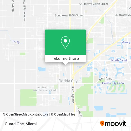
See Guard One, Homestead, on the map
Public Transit to Guard One in Homestead
Wondering how to get to Guard One in Homestead? Moovit helps you find the best way to get to Guard One with step-by-step directions from the nearest public transit station.
Moovit provides free maps and live directions to help you navigate through your city. View schedules, routes, timetables, and find out how long does it take to get to Guard One in real time.
Looking for the nearest stop or station to Guard One? Check out this list of stops closest to your destination: Transitway & Sw 328 St; S Krome Ave @ #1450; Sw 6 Av & Lucy St (Sw 8 St); Nw 6 Av @ Lucy St (Sw 8 St); Lucy St @ Krome Av; W-Bound SE 8 St And East Of Krome Avenue.
Bus: 35, 602, 344, 301, HOMELR, EAST/WEST.
Want to see if there’s another route that gets you there at an earlier time? Moovit helps you find alternative routes or times. Get directions from and directions to Guard One easily from the Moovit App or Website.
We make riding to Guard One easy, which is why over 1.5 million users, including users in Homestead, trust Moovit as the best app for public transit. You don’t need to download an individual bus app or train app, Moovit is your all-in-one transit app that helps you find the best bus time or train time available.
For information on prices of bus, costs and ride fares to Guard One, please check the Moovit app.
Use the app to navigate to popular places including to the airport, hospital, stadium, grocery store, mall, coffee shop, school, college, and university.
Guard One Address: 250 NW 12th St Homestead, FL 33034 street in Homestead
- Gateway Apartments,
- Michael Johnigean,
- Lliny de la Nuez,
- LHG Marine Inc.,
- Rapid Carpet Cleaning,
- K&J Marine Repairs LLC,
- Axolaris Direct,
- Green House Solutions,
- Iglesia Cristiana Pentecostes - MMM Florida City,
- Ces 191,
- Tinos Auto Services,
- Sinar School Uniforms in Homestead,
- Aquatic Vegetation Warehouse,
- Fanmi Island Bites,
- Vince's Rod and Reel Repair,
- Super 8-Florida City,
- Fl DMV,
- Locksmith Commercial Lockout Homestead,
- W Lucy St / Busway,
- SW 328th St / Busway
Places Near Guard One (Homestead)
- Zoo Miami, Miami,
- Richard E. Gerstein Justice Building, Miami,
- Aventura Mall, Miami Beach,
- Marlins Park, Miami,
- Dolphin Mall, Miami,
- Miami Freedom Park, Miami,
- Miami-Dade County Courthouse, Miami,
- Hard Rock Stadium, Miami Gardens,
- Brickell City Centre, Miami,
- Dolphin Mall Bus, Miami,
- Sawgrass mall ( FL ), Miami Beach,
- Keiser University Flagship Campus, West Palm Beach,
- Wynwood, Miami,
- Miami VA Hospital, Miami,
- Sawgrass Mall, Miami,
- Miami Design District, Miami,
- Little Havana, Miami,
- Bayside Marketplace, Miami,
- Aventura Mall, Miami,
- Port of Miami Cruise Terminal, Miami
How to get to popular places in Miami with public transit
Get around Homestead by public transit!
Traveling around Homestead has never been so easy. See step by step directions as you travel to any attraction, street or major public transit station. View bus and train schedules, arrival times, service alerts and detailed routes on a map, so you know exactly how to get to anywhere in Homestead.
When traveling to any destination around Homestead use Moovit's Live Directions with Get Off Notifications to know exactly where and how far to walk, how long to wait for your line, and how many stops are left. Moovit will alert you when it's time to get off — no need to constantly re-check whether yours is the next stop.
Wondering how to use public transit in Homestead or how to pay for public transit in Homestead? Moovit public transit app can help you navigate your way with public transit easily, and at minimum cost. It includes public transit fees, ticket prices, and costs. Looking for a map of Homestead public transit lines? Moovit public transit app shows all public transit maps in Homestead with all Bus, Train, Light Rail and Ferry routes and stops on an interactive map.
Miami has 4 transit type(s), including: Bus, Train, Light Rail and Ferry, operated by several transit agencies, including Broward County Transit, Miami-Dade Transit, Metrorail, Palm Tran, Tri-Rail, Brightline, MARTY, City of Homestead Trolley, Key West Transit, Treasure Coast Connector, GoLine IRT, Amtrak, Greyhound-us, FlixBus-us and Aventura Express Shuttle Bus