How to get to Guardiola by bus?
Click on the bus route to see step by step directions with maps, line arrival times and updated time schedules.
From The Style Outlets Getafe, Getafe
69 minFrom Hospital Universitario Infanta Elena, Valdemoro
67 minFrom Desguaces La Torre, Comarca Sur
133 minFrom Hospital Infanta Cristina., Área Metropolitana De Madrid Y Corredor Del Henares
132 minFrom Balneario Thermas De Griñón, Comarca Sur
149 minFrom Centro Logístico El Corte Inglés, Valdemoro
95 minFrom Nassica, Área Metropolitana De Madrid Y Corredor Del Henares
71 minFrom Centro Comercial Nassica, Getafe
68 minFrom Parla, Madrid, Parla
86 minFrom Poligono Industrial Aimayr, San Martín De La Vega
66 min
How to get to Guardiola by train?
Click on the train route to see step by step directions with maps, line arrival times and updated time schedules.
Bus stops near Guardiola in Aranjuez
Train station near Guardiola in Aranjuez
- Aranjuez, 27 min walk,VIEW
Bus lines to Guardiola in Aranjuez
- 4, La Montaña - Estación de Aranjuez,VIEW
- 5, Circular (La Montaña - FF.CC.),VIEW
- N402, Pza. Emperador Carlos V - Atocha,VIEW
- 1, Circular (Moreras),VIEW
- 2, Circular (FF.CC.),VIEW
- 3, Circular (Glorieta de la Música),VIEW
- 410, Parque De Ocio,VIEW
- 423, Estación Sur De Autobuses,VIEW
- 430, Encomienda - Castillo,VIEW
- VAC158, 005: Ocaña,VIEW
- VAC-231, La Puebla De Almoradiel,VIEW
- VCM625, Aranjuez,VIEW
- VCM-625, Ontígola - Aranjuez (FF.CC.),VIEW
What are the closest stations to Guardiola?
The closest stations to Guardiola are:
- Almíbar - Gobernador is 66 meters away, 2 min walk.
- Abastos - Ayuntamiento is 100 meters away, 2 min walk.
- Ctra. Andalucía - Mercado De Abastos is 187 meters away, 3 min walk.
- Infantas - Estación De Autobuses is 794 meters away, 11 min walk.
- Aranjuez is 2102 meters away, 27 min walk.
Which bus lines stop near Guardiola?
These bus lines stop near Guardiola: 4, 423.
Which train line stops near Guardiola?
C3 (Aranjuez)
What’s the nearest train station to Guardiola in Aranjuez?
The nearest train station to Guardiola in Aranjuez is Aranjuez. It’s a 27 min walk away.
What’s the nearest bus station to Guardiola in Aranjuez?
The nearest bus stations to Guardiola in Aranjuez are Almíbar - Gobernador and Abastos - Ayuntamiento. The closest one is a 2 min walk away.
What time is the first train to Guardiola in Aranjuez?
The C3 is the first train that goes to Guardiola in Aranjuez. It stops nearby at 5:15 AM.
What time is the last train to Guardiola in Aranjuez?
The C3 is the last train that goes to Guardiola in Aranjuez. It stops nearby at 12:40 AM.
What time is the first bus to Guardiola in Aranjuez?
The N402 is the first bus that goes to Guardiola in Aranjuez. It stops nearby at 3:28 AM.
What time is the last bus to Guardiola in Aranjuez?
The N402 is the last bus that goes to Guardiola in Aranjuez. It stops nearby at 2:17 AM.
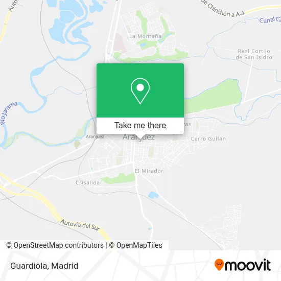
See Guardiola, Aranjuez, on the map
Public Transit to Guardiola in Aranjuez
Wondering how to get to Guardiola in Aranjuez? Moovit helps you find the best way to get to Guardiola with step-by-step directions from the nearest public transit station.
Moovit provides free maps and live directions to help you navigate through your city. View schedules, routes, timetables, and find out how long does it take to get to Guardiola in real time.
Looking for the nearest stop or station to Guardiola? Check out this list of stops closest to your destination: Almíbar - Gobernador; Abastos - Ayuntamiento; Ctra. Andalucía - Mercado De Abastos; Infantas - Estación De Autobuses; Aranjuez.
Bus: 4, 423, 5, N402, 1, 2, 3, 410, 430, VAC158, VAC-231.Train: C3.
Want to see if there’s another route that gets you there at an earlier time? Moovit helps you find alternative routes or times. Get directions from and directions to Guardiola easily from the Moovit App or Website.
We make riding to Guardiola easy, which is why over 1.5 million users, including users in Aranjuez, trust Moovit as the best app for public transit. You don’t need to download an individual bus app or train app, Moovit is your all-in-one transit app that helps you find the best bus time or train time available.
For information on prices of bus, train and metro, costs and ride fares to Guardiola, please check the Moovit app.
Use the app to navigate to popular places including to the airport, hospital, stadium, grocery store, mall, coffee shop, school, college, and university.
Guardiola Address: Calle del Gobernador, 83 28300 Aranjuez street in Aranjuez
- Complementos Merigayo,
- Chiquitren,
- Tienda Yoigo,
- A.Gestión Telefónica Oficinas y Despachos,
- Amazon Counter-Papelería Enzeta,
- Nacex,
- Brigitte Murar Abogados,
- Diana Sanz Sanchez,
- Fcia Arcos Vidal,
- Amazon Counter-Enzeta Shop,
- Moda Hogar Cortinaje,
- Mercadillo Vintage,
- El Chiringuito de Pepe,
- Carniceria Chacon Aranjuez,
- Movi Tab Pc Aranjuez,
- Finca Casa del Cura S.L,
- Jesús Llopis Jiménez,
- Calle Stuart, 79,
- Restaurante Frankfurt,
- Encurtidos/Variantes P
Places Near Guardiola (Aranjuez)
- Wizink Center, Madrid,
- Centro Comercial La Vaguada, Área Metropolitana De Madrid Y Corredor Del Henares,
- Plenilunio, Área Metropolitana De Madrid Y Corredor Del Henares,
- Hospital Clínico Universitario San Carlos, Madrid,
- Estacion de Chamartin, Madrid,
- Centro Comercial Oasiz Madrid, Área Metropolitana De Madrid Y Corredor Del Henares,
- Calle de López de Hoyos 169, Madrid,
- Mercadillo de Majadahonda, Majadahonda,
- Palacio De Vistalegre, Área Metropolitana De Madrid Y Corredor Del Henares,
- Tres Aguas, Alcorcón,
- Mendez Alvaro, Madrid,
- Nassica, Área Metropolitana De Madrid Y Corredor Del Henares,
- Plaza Mayor, Madrid,
- Hospital Universitario La Paz, Madrid,
- Rastro De Madrid, Área Metropolitana De Madrid Y Corredor Del Henares,
- Hospital Universitario Ramón y Cajal, Madrid,
- Centro Comercial Islazul, Área Metropolitana De Madrid Y Corredor Del Henares,
- Centro Comercial La Gavia, Área Metropolitana De Madrid Y Corredor Del Henares,
- Estadio Wanda Metropolitano, Área Metropolitana De Madrid Y Corredor Del Henares,
- Sala La Riviera, Madrid
How to get to popular places in Madrid with public transit
Get around Aranjuez by public transit!
Traveling around Aranjuez has never been so easy. See step by step directions as you travel to any attraction, street or major public transit station. View bus and train schedules, arrival times, service alerts and detailed routes on a map, so you know exactly how to get to anywhere in Aranjuez.
When traveling to any destination around Aranjuez use Moovit's Live Directions with Get Off Notifications to know exactly where and how far to walk, how long to wait for your line, and how many stops are left. Moovit will alert you when it's time to get off — no need to constantly re-check whether yours is the next stop.
Wondering how to use public transit in Aranjuez or how to pay for public transit in Aranjuez? Moovit public transit app can help you navigate your way with public transit easily, and at minimum cost. It includes public transit fees, ticket prices, and costs. Looking for a map of Aranjuez public transit lines? Moovit public transit app shows all public transit maps in Aranjuez with all Bus, Train, Metro and Light Rail routes and stops on an interactive map.
Madrid has 4 transit type(s), including: Bus, Train, Metro and Light Rail, operated by several transit agencies, including Metro de Madrid, Metro Ligero, Tranvía de Parla, Renfe Cercanías - Servicios de Autobús especiales, Renfe Cercanias, Renfe Cercanías, EMT, Interurbanos, Urbanos de Alcalá de Henares, Urbanos de Alcobendas, Urbanos de Alcorcón, Urbanos de Algete, Urbanos de Aranjuez, Urbanos de Arganda del Rey and Urbanos de Arroyomolinos