How to get to Guess by bus?
Click on the bus route to see step by step directions with maps, line arrival times and updated time schedules.
From Zeytinburnu Evlendirme Dairesi, Zeytinburnu
137 minFrom Taksim İett Durakları, Beyoğlu
71 minFrom Bakırköy Dr. Sadi Konuk Eğitim ve Araştırma Hastanesi, Bakirköy
130 minFrom Fişekhane, Zeytinburnu
125 minFrom Habibler, Sultangazi
96 minFrom Şeyh Ebû-l Vefa Hazretleri Türbesi, Fatih
94 minFrom Bahçelievler Semt Polikliniği, Bahçelievler
143 minFrom Bahçelievler Ağız ve Diş Sağlığı Merkezi, Bahçelievler
143 min
How to get to Guess by metro?
Click on the metro route to see step by step directions with maps, line arrival times and updated time schedules.
Bus stops near Guess in Eyüp
Dolmus & Minibus station near Guess in Eyüp
- Çamlık Caddesi, 9 min walk,VIEW
Bus lines to Guess in Eyüp
What are the closest stations to Guess?
The closest stations to Guess are:
- Adnan Menderes Caddesi - Alibeyköy Yönü is 225 meters away, 4 min walk.
- Çamlık Caddesi is 690 meters away, 9 min walk.
- Saya Hilal Camii - Alibeyköy Yönü is 1312 meters away, 17 min walk.
- Mimar Sinan Camii - Alibeyköy Yönü is 1620 meters away, 21 min walk.
- Kavaklı Dere - Küçükköy Yönü is 1913 meters away, 25 min walk.
Which bus lines stop near Guess?
These bus lines stop near Guess: 50AT, TM12, TM18.
Which metro line stops near Guess?
M7 (Mecidiyeköy→Mahmutbey)
What’s the nearest bus station to Guess in Eyüp?
The nearest bus station to Guess in Eyüp is Adnan Menderes Caddesi - Alibeyköy Yönü. It’s a 4 min walk away.
What’s the nearest Dolmus & Minibus station to Guess in Eyüp?
The nearest Dolmus & Minibus station to Guess in Eyüp is Çamlık Caddesi. It’s a 9 min walk away.
What time is the first bus to Guess in Eyüp?
The TM10 is the first bus that goes to Guess in Eyüp. It stops nearby at 5:40 AM.
What time is the last bus to Guess in Eyüp?
The TM15 is the last bus that goes to Guess in Eyüp. It stops nearby at 12:46 AM.
What time is the first Dolmus & Minibus to Guess in Eyüp?
The A34 is the first Dolmus & Minibus that goes to Guess in Eyüp. It stops nearby at 5:46 AM.
What time is the last Dolmus & Minibus to Guess in Eyüp?
The A34 is the last Dolmus & Minibus that goes to Guess in Eyüp. It stops nearby at 12:00 AM.
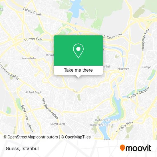
See Guess, Eyüp, on the map
Public Transit to Guess in Eyüp
Wondering how to get to Guess in Eyüp? Moovit helps you find the best way to get to Guess with step-by-step directions from the nearest public transit station.
Moovit provides free maps and live directions to help you navigate through your city. View schedules, routes, timetables, and find out how long does it take to get to Guess in real time.
Looking for the nearest stop or station to Guess? Check out this list of stops closest to your destination: Adnan Menderes Caddesi - Alibeyköy Yönü; Çamlık Caddesi; Saya Hilal Camii - Alibeyköy Yönü; Mimar Sinan Camii - Alibeyköy Yönü; Kavaklı Dere - Küçükköy Yönü.
Bus: 50AT, TM12, TM18, TM11, TM10, A34, A34, TM15, TM19, TM14.Metro: M7.Dolmus & Minibus: A38.
Want to see if there’s another route that gets you there at an earlier time? Moovit helps you find alternative routes or times. Get directions from and directions to Guess easily from the Moovit App or Website.
We make riding to Guess easy, which is why over 1.7 million users, including users in Eyüp, trust Moovit as the best app for public transit. You don’t need to download an individual bus app or train app, Moovit is your all-in-one transit app that helps you find the best bus time or train time available.
For information on prices of metro, bus, Dolmus & Minibus, train and Metrobus, costs and ride fares to Guess, please check the Moovit app.
Use the app to navigate to popular places including to the airport, hospital, stadium, grocery store, mall, coffee shop, school, college, and university.
Guess Address: Yeşilpınar Mh. Girne Cd. street in Eyüp
- Porland Vialand,
- Porland Fabrika Vialand Temapark AVM,
- DP Parfüm ViaLand,
- Joy Park,
- VİALAND AVM,
- Vialand Sinema,
- Joy Park Atlantis bowling,
- Vialand 5D Dynamic Cinema,
- Vialand Necdet Et Ve Köfte,
- Bodrum Gümbet,
- Deniz Park Evleri,
- avea park Ebru Gündeş,
- Mcr Moda Crise,
- Disneyland,
- Cinemaximum,
- Vailantta,
- İsfanbul Avm,
- HD İskender,
- İce Club Cafe - Buz Pateni Pisti,
- Istanbul Vialand
Places Near Guess (Eyüp)
- 41 Burda AVM, Kocaeli Merkezi,
- İstinye Park, Sariyer,
- Başakşehir Çam Ve Sakura Şehir Hastanesi, Basaksehir,
- Şehit Prof. Dr. İlhan Varank Eğitim Ve Araştırma Hastanesi, Sancaktepe,
- Topkule Kışlası 47.Komando Tugay Komutanlığı, Esenler,
- Karaköy Genelevi, Karaköy, Beyoğlu,
- Bakırköy Sosyete Pazarı, Bakirköy,
- Hz. Yuşa Tepesi, Beykoz,
- Hilltown AVM, Maltepe,
- Tersane İstanbul, Beyoğlu,
- VİALAND AVM, Eyüp,
- 2 Nolu Minibüss, Beylikduzu,
- Gebze-Harem Minibüs Hattı, Gebze,
- Beylikdüzü - 4 Nolu Minibüs Hattı, Beylikduzu,
- Mall Of İstanbul, Basaksehir,
- Gebze Koop Durağı, Gebze,
- Mehmet Emin Tokadî Hz. Türbesi, Fatih,
- İstanbul,
- 212 AVM, Bagcilar,
- METROPOL IsTaNBuL, Ataşehir
How to get to popular places in Istanbul with public transit
Get around Eyüp by public transit!
Traveling around Eyüp has never been so easy. See step by step directions as you travel to any attraction, street or major public transit station. View bus and train schedules, arrival times, service alerts and detailed routes on a map, so you know exactly how to get to anywhere in Eyüp.
When traveling to any destination around Eyüp use Moovit's Live Directions with Get Off Notifications to know exactly where and how far to walk, how long to wait for your line, and how many stops are left. Moovit will alert you when it's time to get off — no need to constantly re-check whether yours is the next stop.
Wondering how to use public transit in Eyüp or how to pay for public transit in Eyüp? Moovit public transit app can help you navigate your way with public transit easily, and at minimum cost. It includes public transit fees, ticket prices, and costs. Looking for a map of Eyüp public transit lines? Moovit public transit app shows all public transit maps in Eyüp with all Bus, Train, Metro, Tram, Ferry, Metrobus and Dolmus & Minibus routes and stops on an interactive map.
Istanbul has 7 transit type(s), including: Bus, Train, Metro, Tram, Ferry, Metrobus and Dolmus & Minibus, operated by several transit agencies, including Marmaray, Metro İstanbul, Metrobüs, UAB, İETT, İETT ÇIFT KATLI HATLAR, İETT BÖLGESEL HATLAR, TCDD, Şehir Hatları, Dentur Avrasya, Beyden, Turyol, Mavi Marmara, Havaist and Prenstur
