How to get to Guide 2 Interchange by bus?
Click on the bus route to see step by step directions with maps, line arrival times and updated time schedules.
From Mar A Lago Building, West Palm Beach
51 minFrom John I. Leonard High School, Lake Worth
57 minFrom Forest Hill Blvd / US-1, West Palm Beach
22 minFrom DXN Florida, Boynton Beach-Delray Beach
83 minFrom Whispers All Girl Staff, West Palm Beach
71 minFrom Mar a Lago, West Palm Beach
58 minFrom Forest Hill Community High School, West Palm Beach
49 minFrom West Palm Beach Palm Beach Airport PBI, West Palm Beach
84 minFrom Boynton Beach, FL, Boynton Beach-Delray Beach
31 minFrom Bethesda Hospital East-ER, Boynton Beach-Delray Beach
40 min
Bus stops near Guide 2 Interchange in Boynton Beach-Delray Beach
Train station near Guide 2 Interchange in Boynton Beach-Delray Beach
- Lake Worth Beach Station, 60 min walk,VIEW
Bus lines to Guide 2 Interchange in Boynton Beach-Delray Beach
What are the closest stations to Guide 2 Interchange?
The closest stations to Guide 2 Interchange are:
- BROADWAY at W MINNESOTA ST is 75 yards away, 2 min walk.
- LANTANA RD at BROADWAY is 79 yards away, 2 min walk.
- DIXIE HWY at IRIS AVE is 397 yards away, 5 min walk.
- Lake Worth Beach Station is 5057 yards away, 60 min walk.
Which bus lines stop near Guide 2 Interchange?
These bus lines stop near Guide 2 Interchange: 1, 63, 70.
What’s the nearest bus station to Guide 2 Interchange in Boynton Beach-Delray Beach?
The nearest bus stations to Guide 2 Interchange in Boynton Beach-Delray Beach are BROADWAY at W MINNESOTA ST and LANTANA RD at BROADWAY. The closest one is a 2 min walk away.
What time is the first train to Guide 2 Interchange in Boynton Beach-Delray Beach?
The TRIRAIL is the first train that goes to Guide 2 Interchange in Boynton Beach-Delray Beach. It stops nearby at 4:05 AM.
What time is the last train to Guide 2 Interchange in Boynton Beach-Delray Beach?
The TRIRAIL is the last train that goes to Guide 2 Interchange in Boynton Beach-Delray Beach. It stops nearby at 11:26 PM.
What time is the first bus to Guide 2 Interchange in Boynton Beach-Delray Beach?
The 70 is the first bus that goes to Guide 2 Interchange in Boynton Beach-Delray Beach. It stops nearby at 5:09 AM.
What time is the last bus to Guide 2 Interchange in Boynton Beach-Delray Beach?
The 1 is the last bus that goes to Guide 2 Interchange in Boynton Beach-Delray Beach. It stops nearby at 10:28 PM.
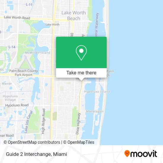
See Guide 2 Interchange, Boynton Beach-Delray Beach, on the map
Public Transit to Guide 2 Interchange in Boynton Beach-Delray Beach
Wondering how to get to Guide 2 Interchange in Boynton Beach-Delray Beach? Moovit helps you find the best way to get to Guide 2 Interchange with step-by-step directions from the nearest public transit station.
Moovit provides free maps and live directions to help you navigate through your city. View schedules, routes, timetables, and find out how long does it take to get to Guide 2 Interchange in real time.
Looking for the nearest stop or station to Guide 2 Interchange? Check out this list of stops closest to your destination: BROADWAY at W MINNESOTA ST; LANTANA RD at BROADWAY; DIXIE HWY at IRIS AVE; Lake Worth Beach Station.
Bus: 1, 63, 70.Train: TRIRAIL.
Want to see if there’s another route that gets you there at an earlier time? Moovit helps you find alternative routes or times. Get directions from and directions to Guide 2 Interchange easily from the Moovit App or Website.
We make riding to Guide 2 Interchange easy, which is why over 1.5 million users, including users in Boynton Beach-Delray Beach, trust Moovit as the best app for public transit. You don’t need to download an individual bus app or train app, Moovit is your all-in-one transit app that helps you find the best bus time or train time available.
For information on prices of bus, costs and ride fares to Guide 2 Interchange, please check the Moovit app.
Use the app to navigate to popular places including to the airport, hospital, stadium, grocery store, mall, coffee shop, school, college, and university.
Guide 2 Interchange Address: 201 W Ocean Ave Lake Worth Beach, FL 33462 street in Boynton Beach-Delray Beach
- Skyview Accounting Services, Inc.,
- Post Office,
- Work Now TV,
- ADT Security,
- Vape Plus Glass,
- Rocco Garage Door Repair,
- BLB Food Market,
- Enterprise,
- Top Locksmith Lantana Fl,
- Cassie Wigs and Bundles,
- J's Smoke Shop & Vapes,
- US-1 / E Lantana Rd,
- Direct SAT TV,
- BF on the Go Restaurant,
- Cryptobase Bitcoin ATM,
- Blizzard Air,
- Ecoairfl,
- Lantana Fishing Derby,
- Florida Elder Law Offices,
- Mica Aviation
Places Near Guide 2 Interchange (Boynton Beach-Delray Beach)
- Port of Miami Cruise Terminal, Miami,
- Hard Rock Stadium, Miami Gardens,
- Richard E. Gerstein Justice Building, Miami,
- Dolphin Mall Bus, Miami,
- Marlins Park, Miami,
- Sawgrass Mall, Miami,
- Zoo Miami, Miami,
- Aventura Mall, Miami,
- Bayside Marketplace, Miami,
- Wynwood, Miami,
- Brickell City Centre, Miami,
- Miami Design District, Miami,
- Little Havana, Miami,
- Keiser University Flagship Campus, West Palm Beach,
- Miami Freedom Park, Miami,
- Miami VA Hospital, Miami,
- Sawgrass mall ( FL ), Miami Beach,
- Aventura Mall, Miami Beach,
- Dolphin Mall, Miami,
- Miami-Dade County Courthouse, Miami
How to get to popular places in Miami with public transit
Get around Boynton Beach-Delray Beach by public transit!
Traveling around Boynton Beach-Delray Beach has never been so easy. See step by step directions as you travel to any attraction, street or major public transit station. View bus and train schedules, arrival times, service alerts and detailed routes on a map, so you know exactly how to get to anywhere in Boynton Beach-Delray Beach.
When traveling to any destination around Boynton Beach-Delray Beach use Moovit's Live Directions with Get Off Notifications to know exactly where and how far to walk, how long to wait for your line, and how many stops are left. Moovit will alert you when it's time to get off — no need to constantly re-check whether yours is the next stop.
Wondering how to use public transit in Boynton Beach-Delray Beach or how to pay for public transit in Boynton Beach-Delray Beach? Moovit public transit app can help you navigate your way with public transit easily, and at minimum cost. It includes public transit fees, ticket prices, and costs. Looking for a map of Boynton Beach-Delray Beach public transit lines? Moovit public transit app shows all public transit maps in Boynton Beach-Delray Beach with all Bus, Train, Light Rail and Ferry routes and stops on an interactive map.
Miami has 4 transit type(s), including: Bus, Train, Light Rail and Ferry, operated by several transit agencies, including Broward County Transit, Miami-Dade Transit, Metrorail, Palm Tran, Tri-Rail, Brightline, MARTY, City of Homestead Trolley, Key West Transit, Treasure Coast Connector, GoLine IRT, Amtrak, Greyhound-us, FlixBus-us and Aventura Express Shuttle Bus