Directions to Guide Maine Maps (Portland, ME) with public transportation
The following transit lines have routes that pass near Guide Maine Maps
 Bus: 9A, 2, 9B.
- Train: DOWNEASTER.
How to get to Guide Maine Maps by bus?
Click on the bus route to see step by step directions with maps, line arrival times and updated time schedules.
From Designs by Lucinda, South Portland
35 minFrom Eyenvy Lash Studio (Ma, Westbrook
48 minFrom KJM Racing Stable, Scarborough
69 minFrom Hannaford Supermarket, South Portland
43 minFrom Cabela's, Scarborough
77 minFrom Troubh Heisler LLC, Scarborough
67 minFrom Bretton Neider LCSW, South Portland
33 minFrom Encore Dance Company, Scarborough
69 minFrom A Tax Service, Scarborough
69 min
Bus stops near Guide Maine Maps in Portland, ME
Train station near Guide Maine Maps in Portland, ME
- Portland Station, 23 min walk,VIEW
Bus lines to Guide Maine Maps in Portland, ME
What are the closest stations to Guide Maine Maps?
The closest stations to Guide Maine Maps are:
- Forest Ave + Morrill St is 677 yards away, 9 min walk.
- Stevens Ave + 716 Stevens Ave is 865 yards away, 11 min walk.
- Stevens Ave + Elmwood St is 869 yards away, 11 min walk.
- Portland Station is 1914 yards away, 23 min walk.
Which bus line stops near Guide Maine Maps?
9A (Portland City Hall→Washington Ave + Auburn St)
What’s the nearest train station to Guide Maine Maps in Portland, ME?
The nearest train station to Guide Maine Maps in Portland, ME is Portland Station. It’s a 23 min walk away.
What’s the nearest bus station to Guide Maine Maps in Portland, ME?
The nearest bus station to Guide Maine Maps in Portland, ME is Forest Ave + Morrill St. It’s a 9 min walk away.
What time is the first train to Guide Maine Maps in Portland, ME?
The DOWNEASTER is the first train that goes to Guide Maine Maps in Portland, ME. It stops nearby at 5:18 AM.
What time is the last train to Guide Maine Maps in Portland, ME?
The DOWNEASTER is the last train that goes to Guide Maine Maps in Portland, ME. It stops nearby at 1:00 AM.
What time is the first bus to Guide Maine Maps in Portland, ME?
The 9A is the first bus that goes to Guide Maine Maps in Portland, ME. It stops nearby at 5:52 AM.
What time is the last bus to Guide Maine Maps in Portland, ME?
The 2 is the last bus that goes to Guide Maine Maps in Portland, ME. It stops nearby at 11:01 PM.
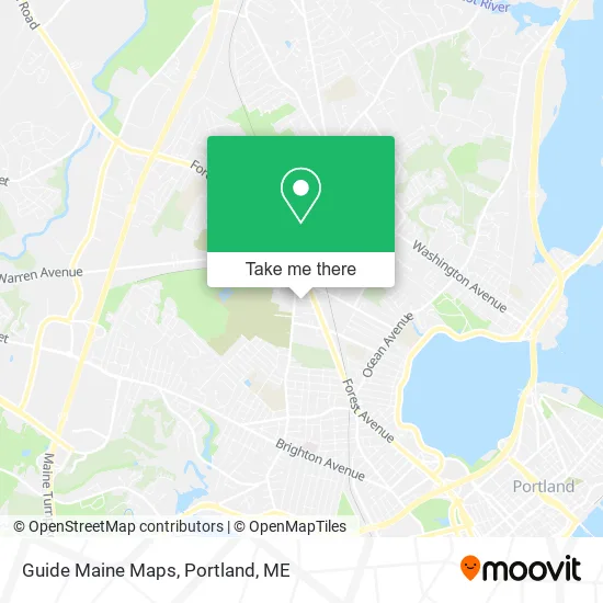
See Guide Maine Maps, Portland, ME, on the map
Public Transit to Guide Maine Maps in Portland, ME
Wondering how to get to Guide Maine Maps in Portland, ME? Moovit helps you find the best way to get to Guide Maine Maps with step-by-step directions from the nearest public transit station.
Moovit provides free maps and live directions to help you navigate through your city. View schedules, routes, timetables, and find out how long does it take to get to Guide Maine Maps in real time.
Looking for the nearest stop or station to Guide Maine Maps? Check out this list of stops closest to your destination: Forest Ave + Morrill St; Stevens Ave + 716 Stevens Ave; Stevens Ave + Elmwood St; Portland Station.
Bus: 9A, 2, 9B.Train: DOWNEASTER.
Want to see if there’s another route that gets you there at an earlier time? Moovit helps you find alternative routes or times. Get directions from and directions to Guide Maine Maps easily from the Moovit App or Website.
We make riding to Guide Maine Maps easy, which is why over 1.5 million users, including users in Portland, ME, trust Moovit as the best app for public transit. You don’t need to download an individual bus app or train app, Moovit is your all-in-one transit app that helps you find the best bus time or train time available.
For information on prices of bus and ferry, costs and ride fares to Guide Maine Maps, please check the Moovit app.
Use the app to navigate to popular places including to the airport, hospital, stadium, grocery store, mall, coffee shop, school, college, and university.
Guide Maine Maps Address: 36 Waverly St Portland, ME 04103 street in Portland, ME
- St Joseph's Parish Center,
- Gary Gurney, Certified Rolfer,
- Our Lady of Hope Parish - St. Joseph and St. Pius X Churches,
- St Joseph's Rectory,
- STARBUCKS,
- Gooeygump Designs,
- Papa John's,
- ARTIST & CRAFTSMAN SUPPLY,
- Unitil Corporate Headquarters,
- Tucker S Son S Moving,
- Cybercopy (Cyber Copy),
- Shelagh Ramage, LCSW,
- University Of New England, Portland Campus,
- Chris Dingwell Studios,
- Bull Moose Music,
- Home Helpers Home Care of Portland and Southern Maine, Me,
- Cor Health Services,
- Chatah Elias M DMD - Chatah, Elias M DMD,
- Maine Ahec Network,
- Mimios Boutique and Cleaning
Places Near Guide Maine Maps (Portland, ME)
- Walmart Scarborough Supercenter,
- Walmart,
- Fort Gorges,
- Exit 45 Park And Ride, South Portland,
- Portland International Jetport (PWM) (Portland International Jetport),
- Jewell Island,
- Mercy Hospital - Fore River Campus,
- Cape Elizabeth, ME, Cape Elizabeth,
- The Old Port,
- Maine Medical Center,
- Fort Williams Park, Cape Elizabeth,
- L. L. Bean Outlet,
- Casco Bay Ferry Terminal,
- Clarion Hotel Portland,
- Southern Maine Community College, South Portland,
- House Island,
- On a bus to Kennebunkport,
- Cross Insurance Arena,
- Portland Transportation Center,
- ZzZzZzZzZzZ, Westbrook
How to get to popular places in Portland, ME with public transit
Get around Portland, ME by public transit!
Traveling around Portland, ME has never been so easy. See step by step directions as you travel to any attraction, street or major public transit station. View bus and train schedules, arrival times, service alerts and detailed routes on a map, so you know exactly how to get to anywhere in Portland, ME.
When traveling to any destination around Portland, ME use Moovit's Live Directions with Get Off Notifications to know exactly where and how far to walk, how long to wait for your line, and how many stops are left. Moovit will alert you when it's time to get off — no need to constantly re-check whether yours is the next stop.
Wondering how to use public transit in Portland, ME or how to pay for public transit in Portland, ME? Moovit public transit app can help you navigate your way with public transit easily, and at minimum cost. It includes public transit fees, ticket prices, and costs. Looking for a map of Portland, ME public transit lines? Moovit public transit app shows all public transit maps in Portland, ME with all Bus, Train and Ferry routes and stops on an interactive map.
Portland, ME has 3 transit type(s), including: Bus, Train and Ferry, operated by several transit agencies, including Greater Portland Metro, City of South Portland, Biddeford Saco Old Orchard Beach Transit, Casco Bay Lines, Amtrak, Greyhound-us and FlixBus-us