Directions to Guildas Moveis (Tatuquara) with public transportation
The following transit lines have routes that pass near Guildas Moveis
How to get to Guildas Moveis by bus?
Click on the bus route to see step by step directions with maps, line arrival times and updated time schedules.
From Rua Lodovico Kaminski 2055, Augusta
62 minFrom puteiro da katlin, Fazenda Rio Grande
50 minFrom Campina Da Barra, Araucária
47 minFrom Estádio José Carlos de Oliveira Sobrinho, Novo Mundo
50 minFrom Rua Professor Algacyr Munhoz Mader, Cic
45 minFrom Rua Paulo Setúbal, Boqueirão
59 minFrom Capela Velha, Araucária
63 minFrom Rua Jussara 2234, Sítio Cercado
43 minFrom Rua Waldemar Loureiro Campos, Boqueirão
54 minFrom João Bettega, 736 - Portão, Portão
49 min
Bus stops near Guildas Moveis in Tatuquara
- Rua Evelázio Augusto Bley 310, 2 min walk,VIEW
- Rua Deputado Vidal Vanhoni, 1495, 2 min walk,VIEW
- Rua Deputado Vidal Vanhoni, 1482, 2 min walk,VIEW
- R. Antônio Zanon, 1406, 5 min walk,VIEW
- Rua Desembargador Ernâni Almeida De Abreu, 201a, 5 min walk,VIEW
- Avenida Santa Rita De Cássia Dos Impossíveis, 2252, 5 min walk,VIEW
- R. Jovenilson Américo de Oliveira, 786, 5 min walk,VIEW
Bus lines to Guildas Moveis in Tatuquara
- 681 DALAGASSA, Terminal Tatuquara → Terminal Pinheirinho,VIEW
- 650 SANTA RITA / PINHEIRINHO, Terminal Pinheirinho → Terminal Tatuquara,VIEW
- 655 JARDIM DA ORDEM, Jardim da Ordem → Terminal Pinheirinho,VIEW
- 708 TATUQUARA / SÍTIO CERCADO, Terminal Tatuquara → Terminal Sítio Cercado,VIEW
- X37 SANTA RITA / PINHEIRINHO (SEMI-DIRETO), Santa Rita (Av. Pero Vaz Caminha) → Terminal Pinheirinho,VIEW
- 685 RIO BONITO / CIC, Terminal CIC → Rio Bonito,VIEW
- 707 TATUQUARA / CENTRO, Praça Rui Barbosa → Terminal Tatuquara,VIEW
What are the closest stations to Guildas Moveis?
The closest stations to Guildas Moveis are:
- Rua Evelázio Augusto Bley 310 is 75 meters away, 2 min walk.
- Rua Deputado Vidal Vanhoni, 1495 is 122 meters away, 2 min walk.
- Rua Deputado Vidal Vanhoni, 1482 is 122 meters away, 2 min walk.
- R. Antônio Zanon, 1406 is 301 meters away, 5 min walk.
- Rua Desembargador Ernâni Almeida De Abreu, 201a is 306 meters away, 5 min walk.
- Avenida Santa Rita De Cássia Dos Impossíveis, 2252 is 325 meters away, 5 min walk.
- R. Jovenilson Américo de Oliveira, 786 is 357 meters away, 5 min walk.
Which bus lines stop near Guildas Moveis?
These bus lines stop near Guildas Moveis: 650 SANTA RITA / PINHEIRINHO, 655 JARDIM DA ORDEM, 681 DALAGASSA, 685 RIO BONITO / CIC, 707 TATUQUARA / CENTRO, 708 TATUQUARA / SÍTIO CERCADO, 773 VIZINHANÇA / SANTA RITA.
What’s the nearest bus station to Guildas Moveis in Tatuquara?
The nearest bus stations to Guildas Moveis in Tatuquara are Rua Evelázio Augusto Bley 310, Rua Deputado Vidal Vanhoni, 1495 and Rua Deputado Vidal Vanhoni, 1482. The closest one is a 2 min walk away.
What time is the first bus to Guildas Moveis in Tatuquara?
The 650 SANTA RITA / PINHEIRINHO is the first bus that goes to Guildas Moveis in Tatuquara. It stops nearby at 4:42 AM.
What time is the last bus to Guildas Moveis in Tatuquara?
The 707 TATUQUARA / CENTRO is the last bus that goes to Guildas Moveis in Tatuquara. It stops nearby at 1:12 AM.
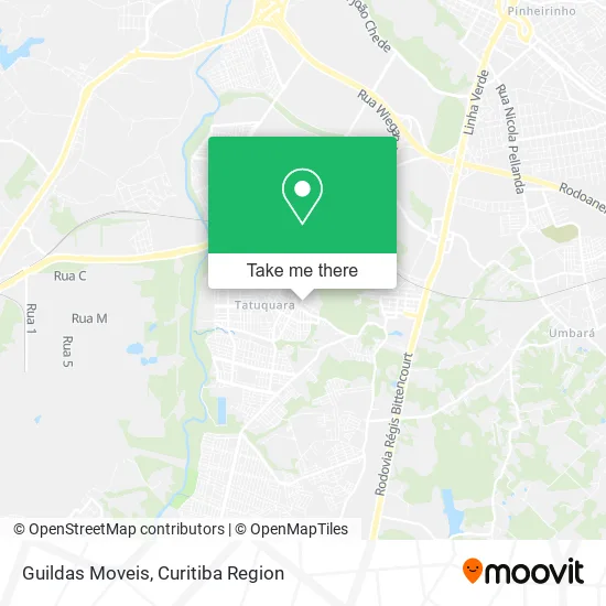
See Guildas Moveis, Tatuquara, on the map
Public Transit to Guildas Moveis in Tatuquara
Wondering how to get to Guildas Moveis in Tatuquara? Moovit helps you find the best way to get to Guildas Moveis with step-by-step directions from the nearest public transit station.
Moovit provides free maps and live directions to help you navigate through your city. View schedules, routes, timetables, and find out how long does it take to get to Guildas Moveis in real time.
Looking for the nearest stop or station to Guildas Moveis? Check out this list of stops closest to your destination: Rua Evelázio Augusto Bley 310; Rua Deputado Vidal Vanhoni; Rua Deputado Vidal Vanhoni; R. Antônio Zanon; Rua Desembargador Ernâni Almeida De Abreu; Avenida Santa Rita De Cássia Dos Impossíveis; R. Jovenilson Américo de Oliveira.
Bus: 650 SANTA RITA / PINHEIRINHO, 655 JARDIM DA ORDEM, 681 DALAGASSA, 685 RIO BONITO / CIC, 707 TATUQUARA / CENTRO, 708 TATUQUARA / SÍTIO CERCADO, 773 VIZINHANÇA / SANTA RITA, X37 SANTA RITA / PINHEIRINHO (SEMI-DIRETO).
Want to see if there’s another route that gets you there at an earlier time? Moovit helps you find alternative routes or times. Get directions from and directions to Guildas Moveis easily from the Moovit App or Website.
We make riding to Guildas Moveis easy, which is why over 1.5 million users, including users in Tatuquara, trust Moovit as the best app for public transit. You don’t need to download an individual bus app or train app, Moovit is your all-in-one transit app that helps you find the best bus time or train time available.
For information on prices of bus, costs and ride fares to Guildas Moveis, please check the Moovit app.
Use the app to navigate to popular places including to the airport, hospital, stadium, grocery store, mall, coffee shop, school, college, and university.
Guildas Moveis Address: Rua Evilázio Augusto Bley, 152 Tatuquara Curitiba-PR 81480-350 street in Tatuquara
- Bernardi17,
- Pastelli Massas Artesanais,
- Toys Mania,
- Condomínio Green Village Tatuquara,
- Trans Tomaz,
- Nova Era Modas,
- CMEI Moradias da Ordem,
- Stips Store,
- Clube da Gente Tatuquara,
- Jhonatan Lino,
- Rua Stella Camargo Arzua,
- Rua Evelázio Augusto Bley 152,
- Imobiliaria Pazini,
- Ipiranga,
- Kevin de Souza,
- C Silva Comércio de Alimentos,
- Rua Desembargador Ernâni Almeida de Abreu 3,
- Jms Cell,
- Portal do Futuro Tatuquara,
- Mk Distribuidora
Places Near Guildas Moveis (Tatuquara)
- Pontifícia Universidade Católica do Paraná (PUCPR), Prado Velho,
- Rua General Mário Tourinho, Campina Do Siqueira,
- Hospital Da Cruz Vermelha, Batel,
- Hospital do Rocio, Campo,
- Hospital Erasto Gaertner, Jardim Das Américas,
- Hospital Angelina Caron, Campina Grande Do Sul,
- Hhhhh, Fazendinha,
- Hospital Nossa Senhora Das Graças, Mercês,
- Jardim Botânico de Curitiba PR, Centro,
- Park Shopping Barigüi, Mossunguê,
- Arena Da Baixada - Curitiba,
- Hospital Madalena Sofia, Bairro Alto,
- Parque Barigui, Mercês,
- Shopping Estação, Rebouças,
- Shopping Palladium, Portão,
- Rua Martim Afonso 558, Mercês,
- Campo Largo, Campo,
- Hospital de Clínicas (HC - UFPR), Centro,
- Hospital Universitário Evangélico de Curitiba, Bigorrilho,
- Jockey Plaza Shopping Center, Tarumã
How to get to popular places in Curitiba Region with public transit
Get around Tatuquara by public transit!
Traveling around Tatuquara has never been so easy. See step by step directions as you travel to any attraction, street or major public transit station. View bus and train schedules, arrival times, service alerts and detailed routes on a map, so you know exactly how to get to anywhere in Tatuquara.
When traveling to any destination around Tatuquara use Moovit's Live Directions with Get Off Notifications to know exactly where and how far to walk, how long to wait for your line, and how many stops are left. Moovit will alert you when it's time to get off — no need to constantly re-check whether yours is the next stop.
Wondering how to use public transit in Tatuquara or how to pay for public transit in Tatuquara? Moovit public transit app can help you navigate your way with public transit easily, and at minimum cost. It includes public transit fees, ticket prices, and costs. Looking for a map of Tatuquara public transit lines? Moovit public transit app shows all public transit maps in Tatuquara with all Bus and Cable Car routes and stops on an interactive map.
Curitiba Region has 2 transit type(s), including: Bus and Cable Car, operated by several transit agencies, including Sistema Integrado de Mobilidade (URBS), Sistema Integrado de Mobilidade (AMEP), URBS (Cartões bancários e Dinheiro), URBS (Cartões bancários / Cartão URBS), AMEP (Cartões bancários / Cartão MetroCard), AMEP (Cartões bancários / Cartão MetroCard / Dinheiro), Viação Colombo (Dinheiro), TRIAR (Cartão TRIAR / Dinheiro), Empresa Curitiba Cerro Azul (Dinheiro), Expresso Nossa Senhora da Penha (Dinheiro), Empresa Campo Alto Tijucas (Dinheiro), Auto Viação São José (Cartão VEM / Dinheiro), BRT S/A (Cartão VEM / Dinheiro), TransPiedade (Cartão Cidadão / Dinheiro) and Oceânica Sul (Cartão Transporte / Dinheiro)