How to get to Guntram Porzig by bus?
Click on the bus route to see step by step directions with maps, line arrival times and updated time schedules.
From Action, Gemeindeverwaltungsverband Eislingen-Ottenbach-Salach
224 minFrom Kaufland Geislingen, Vereinbarte Verwaltungsgemeinschaft Der Stadt Geislingen An Der Steige
121 minFrom Kloster Untermarchtal, Verwaltungsgemeinschaft Munderkingen
129 minFrom Heidenheim an der Brenz, Heidenheim An Der Brenz
140 minFrom Möbel Rieger, Vereinbarte Verwaltungsgemeinschaft Der Stadt Göppingen
231 minFrom Media Markt, Gemeindeverwaltungsverband Eislingen-Ottenbach-Salach
219 minFrom HORNBACH, Vereinbarte Verwaltungsgemeinschaft Der Stadt Göppingen
220 minFrom Amazon-DBX8, Herbrechtingen
213 min
How to get to Guntram Porzig by train?
Click on the train route to see step by step directions with maps, line arrival times and updated time schedules.
Bus stops near Guntram Porzig in Neu-Ulm
Train stations near Guntram Porzig in Neu-Ulm
- Neu-Ulm Bahnhof, 7 min walk,VIEW
Bus lines to Guntram Porzig in Neu-Ulm
- 5, Ulm Söflinger Weinberge,VIEW
- 72, Illertissen Schulz./Nautilla,VIEW
- 72, Illertissen Förder-/Berufssch.,VIEW
- 73, Weißenhorn Bahnhof Bstg 2,VIEW
- 73, Ulm Zob,VIEW
- PF 7, Neu-Ulm Zup,VIEW
- 71, Ludwigsfeld Ulmer Ried,VIEW
- E, Ulm Kuhberg Schulzentrum,VIEW
- 850, Günzburg,VIEW
- 86, Unterfahlheim Flurweg,VIEW
- 86, Ulm Hbf / Zob,VIEW
- 597, Ulm Zob,VIEW
- 597, Ulm Zob Bstg G,VIEW
- 7, Jungingen Rathaus,VIEW
- 737, Senden Paul-Gerhardt-Haus,VIEW
- 737, Ulm Zob Bstg K,VIEW
- 763, Ulm Zob,VIEW
- 763, Ulm Zob Bstg M,VIEW
- 77, Holzschwang Weidachstraße,VIEW
- 77, Holzschwang Weiler Weg,VIEW
What are the closest stations to Guntram Porzig?
The closest stations to Guntram Porzig are:
- Neu-Ulm Fachoberschule is 115 meters away, 2 min walk.
- Neu-Ulm Memminger Straße is 212 meters away, 3 min walk.
- Neu-Ulm Bahnhof is 456 meters away, 7 min walk.
- Neu-Ulm Zup is 479 meters away, 7 min walk.
Which bus lines stop near Guntram Porzig?
These bus lines stop near Guntram Porzig: 46, 5, 585, 73, 86.
Which train lines stop near Guntram Porzig?
These train lines stop near Guntram Porzig: RB15, RS 7, RS71.
What’s the nearest train station to Guntram Porzig in Neu-Ulm?
The nearest train station to Guntram Porzig in Neu-Ulm is Neu-Ulm Bahnhof. It’s a 7 min walk away.
What’s the nearest bus station to Guntram Porzig in Neu-Ulm?
The nearest bus station to Guntram Porzig in Neu-Ulm is Neu-Ulm Fachoberschule. It’s a 2 min walk away.
What time is the first train to Guntram Porzig in Neu-Ulm?
The RE 9 is the first train that goes to Guntram Porzig in Neu-Ulm. It stops nearby at 4:50 AM.
What time is the last train to Guntram Porzig in Neu-Ulm?
The RE 9 is the last train that goes to Guntram Porzig in Neu-Ulm. It stops nearby at 1:02 AM.
What time is the first bus to Guntram Porzig in Neu-Ulm?
The 85 is the first bus that goes to Guntram Porzig in Neu-Ulm. It stops nearby at 4:28 AM.
What time is the last bus to Guntram Porzig in Neu-Ulm?
The PF 7 is the last bus that goes to Guntram Porzig in Neu-Ulm. It stops nearby at 12:55 AM.
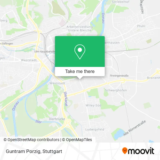
See Guntram Porzig, Neu-Ulm, on the map
Public Transit to Guntram Porzig in Neu-Ulm
Wondering how to get to Guntram Porzig in Neu-Ulm? Moovit helps you find the best way to get to Guntram Porzig with step-by-step directions from the nearest public transit station.
Moovit provides free maps and live directions to help you navigate through your city. View schedules, routes, timetables, and find out how long does it take to get to Guntram Porzig in real time.
Looking for the nearest stop or station to Guntram Porzig? Check out this list of stops closest to your destination: Neu-Ulm Fachoberschule; Neu-Ulm Memminger Straße; Neu-Ulm Bahnhof; Neu-Ulm Zup.
Bus: 46, 5, 585, 73, 86, 71, E, 72, 72, 850, 597, 597, 7, 737, 737.Train: RB15, RS 7, RS71, RE 9, RB 15, RS 71, RE 75, RS7, RE9, RE75.
Want to see if there’s another route that gets you there at an earlier time? Moovit helps you find alternative routes or times. Get directions from and directions to Guntram Porzig easily from the Moovit App or Website.
We make riding to Guntram Porzig easy, which is why over 1.5 million users, including users in Neu-Ulm, trust Moovit as the best app for public transit. You don’t need to download an individual bus app or train app, Moovit is your all-in-one transit app that helps you find the best bus time or train time available.
For information on prices of bus and train, costs and ride fares to Guntram Porzig, please check the Moovit app.
Use the app to navigate to popular places including to the airport, hospital, stadium, grocery store, mall, coffee shop, school, college, and university.
Guntram Porzig Address: Memminger Straße 50 89231 Neu-Ulm street in Neu-Ulm
- Otto Gummi-Mayer,
- EUROMASTER,
- Staatliche Fachoberschule Neu-Ulm,
- Gotischer Bogen (1995),
- Zarroli Car Media,
- Buchbinder,
- Mr. Imbiss,
- Zarroli Car Media E. K.,
- Sparkasse Wiblinger Steig,
- Asia Cuisine,
- Louis,
- Louis Mega Shop Neu-Ulm,
- Fosbos Neu-Ulm,
- Berufliche Oberschule Neu-Ulm,
- Musicline24,
- Werner Gunkel Musicline,
- Sparkasse,
- Tchibo im Supermarkt,
- Fotofix,
- Grocery
Places Near Guntram Porzig (Neu-Ulm)
- Hanns-Martin-Schleyer-Halle (Stuttgart Hans-Martin-Schleyerhalle), Bad Cannstatt,
- Mercedes-Benz Museum, Bad Cannstatt,
- Gleis 101/102 (tief), Stuttgart-Mitte,
- FlixBus Haltestelle, Stuttgart,
- Mettingen Eros-Center Puff Laufhaus, Esslingen Am Neckar,
- Geilhaus Haus 33a, Reutlingen-Betzingen,
- Porsche Museum, Zuffenhausen,
- Mercedes-Benz Museum (Mercedes Museum Stuttgart), Bad Cannstatt,
- Waldfriedhof, Degerloch,
- Hauptbahnhof Stuttgart, Stuttgart-Mitte,
- Hanns-Martin-Schleyer-Halle, Bad Cannstatt,
- Porsche-Arena, Bad Cannstatt,
- Marmorsaal Im Weissenburgpark, Stuttgart-Süd,
- Schleyerhalle, Bad Cannstatt,
- Klinikum Stuttgart - Katharinenhospital, Stuttgart-Mitte,
- Im Wizemann (Halle), Bad Cannstatt,
- Pariser Platz Stuttgart, Stuttgart-Mitte,
- Gasometer Pforzheim, Pforzheim,
- SI-Centrum, Möhringen,
- Wilhelma (U-Bahn Wilhelma), Bad Cannstatt
How to get to popular places in Stuttgart with public transit
Get around Neu-Ulm by public transit!
Traveling around Neu-Ulm has never been so easy. See step by step directions as you travel to any attraction, street or major public transit station. View bus and train schedules, arrival times, service alerts and detailed routes on a map, so you know exactly how to get to anywhere in Neu-Ulm.
When traveling to any destination around Neu-Ulm use Moovit's Live Directions with Get Off Notifications to know exactly where and how far to walk, how long to wait for your line, and how many stops are left. Moovit will alert you when it's time to get off — no need to constantly re-check whether yours is the next stop.
Wondering how to use public transit in Neu-Ulm or how to pay for public transit in Neu-Ulm? Moovit public transit app can help you navigate your way with public transit easily, and at minimum cost. It includes public transit fees, ticket prices, and costs. Looking for a map of Neu-Ulm public transit lines? Moovit public transit app shows all public transit maps in Neu-Ulm with all Bus, Train, Subway, Light Rail, Ferry, S-Bahn and Funicular routes and stops on an interactive map.
Stuttgart has 7 transit type(s), including: Bus, Train, Subway, Light Rail, Ferry, S-Bahn and Funicular, operated by several transit agencies, including SSB - Stadtbahn, SSB, SSB - Seilbahn / Zacke, S-Bahn Stuttgart, Rhein-Neckar-Verkehr GmbH (rnv), Karlsruher Verkehrsverbund, DB AG, DB Regiobus BW, Arverio Baden-Württemberg GmbH, DB RegioNetz Verkehrs GmbH Westfrankenbahn, DB Regio AG Baden-Württemberg, Südwestdeutsche Verkehrs-AG, DB Regio AG Mitte Region Hessen, DB and Bodensee-Oberschwaben-Bahn