How to get to HERRAMIENTAS HECORT, S.A. DE C.V. by bus?
Click on the bus route to see step by step directions with maps, line arrival times and updated time schedules.
From Laboratorio Clínico CMQ, Aguascalientes
45 minFrom Pulgas Pandas, Aguascalientes
44 minFrom carril ecologico el sabinal, Aguascalientes
33 minFrom Claustros de Loma Dorada, Aguascalientes
53 minFrom Residencial La Paloma, Aguascalientes
51 minFrom Villas de Montenegro, Aguascalientes
55 minFrom Fracc. Soberana Convencion, Aguascalientes
50 minFrom Fracc. Ojo Caliente IV, Aguascalientes
44 minFrom Residencial Punta Del Cielo, Aguascalientes
60 minFrom Talamantes Ponce, Aguascalientes
51 min
Bus stops near HERRAMIENTAS HECORT, S.A. DE C.V. in Aguascalientes
Bus lines to HERRAMIENTAS HECORT, S.A. DE C.V. in Aguascalientes
What are the closest stations to HERRAMIENTAS HECORT, S.A. DE C.V.?
The closest stations to HERRAMIENTAS HECORT, S.A. DE C.V. are:
- Jesús Rivera Franco, 403 is 45 meters away, 1 min walk.
- Jesús Rivera Franco C-18e, 403 is 75 meters away, 2 min walk.
- Avenida Siglo Xxi, 13440 is 465 meters away, 7 min walk.
- Jesús Rivera Franco C-18e, 605 is 632 meters away, 9 min walk.
- Boulevard José María Chávez, 1942 is 707 meters away, 10 min walk.
Which bus lines stop near HERRAMIENTAS HECORT, S.A. DE C.V.?
These bus lines stop near HERRAMIENTAS HECORT, S.A. DE C.V.: RUTA 04, RUTA 50.
What’s the nearest bus station to HERRAMIENTAS HECORT, S.A. DE C.V. in Aguascalientes?
The nearest bus station to HERRAMIENTAS HECORT, S.A. DE C.V. in Aguascalientes is Jesús Rivera Franco, 403. It’s a 1 min walk away.
What time is the first bus to HERRAMIENTAS HECORT, S.A. DE C.V. in Aguascalientes?
The RUTA 50 is the first bus that goes to HERRAMIENTAS HECORT, S.A. DE C.V. in Aguascalientes. It stops nearby at 6:06 AM.
What time is the last bus to HERRAMIENTAS HECORT, S.A. DE C.V. in Aguascalientes?
The RUTA 50 is the last bus that goes to HERRAMIENTAS HECORT, S.A. DE C.V. in Aguascalientes. It stops nearby at 10:20 PM.
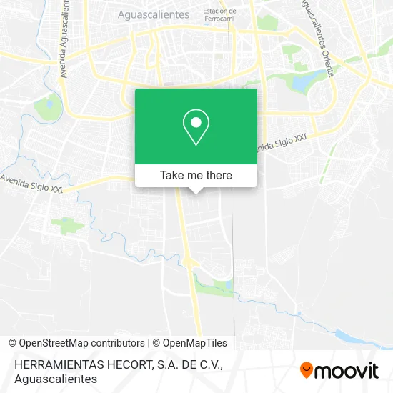
See HERRAMIENTAS HECORT, S.A. DE C.V., Aguascalientes, on the map
Public Transit to HERRAMIENTAS HECORT, S.A. DE C.V. in Aguascalientes
Wondering how to get to HERRAMIENTAS HECORT, S.A. DE C.V. in Aguascalientes? Moovit helps you find the best way to get to HERRAMIENTAS HECORT, S.A. DE C.V. with step-by-step directions from the nearest public transit station.
Moovit provides free maps and live directions to help you navigate through your city. View schedules, routes, timetables, and find out how long does it take to get to HERRAMIENTAS HECORT, S.A. DE C.V. in real time.
Looking for the nearest stop or station to HERRAMIENTAS HECORT, S.A. DE C.V.? Check out this list of stops closest to your destination: Jesús Rivera Franco; Jesús Rivera Franco C-18e; Avenida Siglo Xxi; Jesús Rivera Franco C-18e; Boulevard José María Chávez.
Bus: RUTA 04, RUTA 50, RUTA 33, RUTA 14, RUTA 28, RUTA 42, RUTA 43.
Want to see if there’s another route that gets you there at an earlier time? Moovit helps you find alternative routes or times. Get directions from and directions to HERRAMIENTAS HECORT, S.A. DE C.V. easily from the Moovit App or Website.
We make riding to HERRAMIENTAS HECORT, S.A. DE C.V. easy, which is why over 1.5 million users, including users in Aguascalientes, trust Moovit as the best app for public transit. You don’t need to download an individual bus app or train app, Moovit is your all-in-one transit app that helps you find the best bus time or train time available.
For information on prices of bus, costs and ride fares to HERRAMIENTAS HECORT, S.A. DE C.V., please check the Moovit app.
Use the app to navigate to popular places including to the airport, hospital, stadium, grocery store, mall, coffee shop, school, college, and university.
HERRAMIENTAS HECORT, S.A. DE C.V. Address: HERRAMIENTAS HECORT, S.A. DE C.V., Calle Gregorio Ruíz Velazco 201, Fraccionamiento Ciudad Industri street in Aguascalientes
- ADMINVEST, S.A. DE C.V.,
- TRW,
- Empacadora Celaya SA de CV,
- Sigma,
- Doiter,
- Poliductos de Aguascalientes,
- Forjas y Maquinas,
- Frio Express,
- Reclutamiento Totalplay Myg,
- Leche 19 Diecinueve Hermanos,
- Bonafont Garrafones,
- Frio Express Oficial,
- Frío Express, S.A. de C.V.,
- Vallen Proveedora de Seguridad Industrial,
- Pavimentos y Maquinaria,
- Distribuidora de Tubos y Conexiones de P.V.C.,
- Afirme,
- Banbajio,
- Vianney,
- Planta Bonafont Aguascalientes
Places Near HERRAMIENTAS HECORT, S.A. DE C.V. (Aguascalientes)
- Jesús María, Aguascalientes,
- Centro Comercial Altaria, Aguascalientes,
- Parque Las Tres Centurias, Aguascalientes,
- Ciudad industrial, Aguascalientes,
- Centro, Aguascalientes,
- La Isla San Marcos, Aguascalientes,
- Nuevo Hospital Hidalgo, Aguascalientes,
- Isla San Marcos, Aguascalientes,
- Central De Autobuses, Aguascalientes,
- Universidad Autónoma de Aguascalientes, Aguascalientes,
- Terminal De Combis, Aguascalientes,
- ESPACIOS, Aguascalientes,
- Villasuncion, Aguascalientes,
- Blvd. Luis Donaldo Colosio, Aguascalientes,
- Agropecuario, Aguascalientes,
- clinica 3 uaa, Aguascalientes,
- Aeropuerto de Aguascalientes S.A. de C.V., Aguascalientes,
- Hospital Imss No. 3, Aguascalientes,
- Imss Clinica 1, Aguascalientes,
- Villas de Nuestra Señora de la Asunción, Aguascalientes
How to get to popular places in Aguascalientes with public transit
Get around Aguascalientes by public transit!
Traveling around Aguascalientes has never been so easy. See step by step directions as you travel to any attraction, street or major public transit station. View bus and train schedules, arrival times, service alerts and detailed routes on a map, so you know exactly how to get to anywhere in Aguascalientes.
When traveling to any destination around Aguascalientes use Moovit's Live Directions with Get Off Notifications to know exactly where and how far to walk, how long to wait for your line, and how many stops are left. Moovit will alert you when it's time to get off — no need to constantly re-check whether yours is the next stop.
Wondering how to use public transit in Aguascalientes or how to pay for public transit in Aguascalientes? Moovit public transit app can help you navigate your way with public transit easily, and at minimum cost. It includes public transit fees, ticket prices, and costs. Looking for a map of Aguascalientes public transit lines? Moovit public transit app shows all public transit maps in Aguascalientes with all bus routes and stops on an interactive map.
Aguascalientes has 1 transit type(s), including: bus, operated by several transit agencies, including Coordinación General de Movilidad