How to get to HIRCLEAN by bus?
Click on the bus route to see step by step directions with maps, line arrival times and updated time schedules.
From Quintas Miguel Gerónimo, Aguascalientes
57 minFrom Fraccionamiento Villa Teresa, Aguascalientes
45 minFrom Fracc. Villas de San Nicolás, Aguascalientes
42 minFrom Colosio, Aguascalientes
50 minFrom Tec de Monterrey Campus Ags, Aguascalientes
47 minFrom Corporativo Principal Afore, Aguascalientes
51 minFrom Cbtis 284, Aguascalientes
30 minFrom Tec De Monterrey Campus Aguascalientes, Aguascalientes
50 minFrom Av Eugenio Garza Sada, Aguascalientes
46 min
Bus stops near HIRCLEAN in Aguascalientes
Bus lines to HIRCLEAN in Aguascalientes
- RUTA 28, Jesús María,VIEW
- RUTA 37, Hacienda San Marcos,VIEW
- RUTA 42, Bellavista,VIEW
- RUTA 02, Centro (Jardín Carpio),VIEW
- RUTA 40, Terminal Oriente - Terminal Oriente (N),VIEW
- RUTA 40, Terminal Oriente - Terminal Oriente (S),VIEW
- RUTA 07, Villa Las Palmas,VIEW
- RUTA 18, Lunaria - UAA,VIEW
- RUTA 36, Lunaria - Centro (Mercado Terán),VIEW
What are the closest stations to HIRCLEAN?
The closest stations to HIRCLEAN are:
- Avenida Héroe De Nacozari, 101 is 72 meters away, 2 min walk.
- Aguascalientes Sur, 405b is 327 meters away, 5 min walk.
- Avenida Aguascalientes Sur, 502 is 447 meters away, 6 min walk.
- Avenida Héroe De Nacozari, 1809(1810) is 536 meters away, 7 min walk.
- Avenida Aguascalientes Sur, 1100 is 792 meters away, 11 min walk.
Which bus lines stop near HIRCLEAN?
These bus lines stop near HIRCLEAN: RUTA 02, RUTA 28, RUTA 37, RUTA 40.
What’s the nearest bus station to HIRCLEAN in Aguascalientes?
The nearest bus station to HIRCLEAN in Aguascalientes is Avenida Héroe De Nacozari, 101. It’s a 2 min walk away.
What time is the first bus to HIRCLEAN in Aguascalientes?
The RUTA 40 is the first bus that goes to HIRCLEAN in Aguascalientes. It stops nearby at 5:56 AM.
What time is the last bus to HIRCLEAN in Aguascalientes?
The RUTA 07 is the last bus that goes to HIRCLEAN in Aguascalientes. It stops nearby at 10:56 PM.
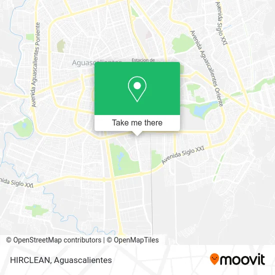
See HIRCLEAN, Aguascalientes, on the map
Public Transit to HIRCLEAN in Aguascalientes
Wondering how to get to HIRCLEAN in Aguascalientes? Moovit helps you find the best way to get to HIRCLEAN with step-by-step directions from the nearest public transit station.
Moovit provides free maps and live directions to help you navigate through your city. View schedules, routes, timetables, and find out how long does it take to get to HIRCLEAN in real time.
Looking for the nearest stop or station to HIRCLEAN? Check out this list of stops closest to your destination: Avenida Héroe De Nacozari; Aguascalientes Sur; Avenida Aguascalientes Sur; Avenida Héroe De Nacozari; Avenida Aguascalientes Sur.
Bus: RUTA 02, RUTA 28, RUTA 37, RUTA 40, RUTA 42, RUTA 07, RUTA 18, RUTA 36.
Want to see if there’s another route that gets you there at an earlier time? Moovit helps you find alternative routes or times. Get directions from and directions to HIRCLEAN easily from the Moovit App or Website.
We make riding to HIRCLEAN easy, which is why over 1.5 million users, including users in Aguascalientes, trust Moovit as the best app for public transit. You don’t need to download an individual bus app or train app, Moovit is your all-in-one transit app that helps you find the best bus time or train time available.
For information on prices of bus, costs and ride fares to HIRCLEAN, please check the Moovit app.
Use the app to navigate to popular places including to the airport, hospital, stadium, grocery store, mall, coffee shop, school, college, and university.
HIRCLEAN Address: HIRCLEAN, Calle San Bartolo 240, Fraccionamiento México, 20270 Aguascalientes, Aguascalientes street in Aguascalientes
- Salón Carmen,
- Autoelectronico Express,
- PANADERIA ELVIRA,
- Clinica Dental Darama,
- Avenida Héroe de Nacozari Sur 2301,
- Axxa Seguros,
- Llantas y Alineaciones Miguel,
- Agro Industrial Hidraulica,
- Jardín del Inegi,
- Banamex Sec Inegi Sede,
- Acuario Mako Reef,
- Crread Zona 1,
- Frutería Piram,
- Sirloin Stockade,
- Jardines de Bugambilias,
- Tienda de Abarrotes Hernandez,
- Patio Sur,
- Avenida Héroe de Nacozari Sur,
- Vidrio y Aluminio Cervantes,
- Imprenta Max
Places Near HIRCLEAN (Aguascalientes)
- Imss Clinica 1, Aguascalientes,
- ESPACIOS, Aguascalientes,
- Central De Autobuses, Aguascalientes,
- Ciudad industrial, Aguascalientes,
- Blvd. Luis Donaldo Colosio, Aguascalientes,
- Centro Comercial Altaria, Aguascalientes,
- Agropecuario, Aguascalientes,
- Terminal De Combis, Aguascalientes,
- Jesús María, Aguascalientes,
- Aeropuerto de Aguascalientes S.A. de C.V., Aguascalientes,
- Nuevo Hospital Hidalgo, Aguascalientes,
- clinica 3 uaa, Aguascalientes,
- Centro, Aguascalientes,
- La Isla San Marcos, Aguascalientes,
- Isla San Marcos, Aguascalientes,
- Villasuncion, Aguascalientes,
- Hospital Imss No. 3, Aguascalientes,
- Universidad Autónoma de Aguascalientes, Aguascalientes,
- Villas de Nuestra Señora de la Asunción, Aguascalientes,
- Parque Las Tres Centurias, Aguascalientes
How to get to popular places in Aguascalientes with public transit
Get around Aguascalientes by public transit!
Traveling around Aguascalientes has never been so easy. See step by step directions as you travel to any attraction, street or major public transit station. View bus and train schedules, arrival times, service alerts and detailed routes on a map, so you know exactly how to get to anywhere in Aguascalientes.
When traveling to any destination around Aguascalientes use Moovit's Live Directions with Get Off Notifications to know exactly where and how far to walk, how long to wait for your line, and how many stops are left. Moovit will alert you when it's time to get off — no need to constantly re-check whether yours is the next stop.
Wondering how to use public transit in Aguascalientes or how to pay for public transit in Aguascalientes? Moovit public transit app can help you navigate your way with public transit easily, and at minimum cost. It includes public transit fees, ticket prices, and costs. Looking for a map of Aguascalientes public transit lines? Moovit public transit app shows all public transit maps in Aguascalientes with all bus routes and stops on an interactive map.
Aguascalientes has 1 transit type(s), including: bus, operated by several transit agencies, including Coordinación General de Movilidad