How to get to HSBC by bus?
Click on the bus route to see step by step directions with maps, line arrival times and updated time schedules.
From Hilton Alexandria Old Town, Alexandria
66 minFrom Alexandria Station - AMTRAK/VRE (ALX), Alexandria
68 minFrom Alexandria, VA, Alexandria
62 minFrom Tomb of the Unknown Soldier, Arlington County
62 minFrom Walmart Supercenter, Washington
57 minFrom Holy Cross Hospital, Montgomery County
60 minFrom Alamo Drafthouse, Washington
47 minFrom Germantown Md, Washington
49 minFrom Kaiser Permanente - Falls Church Medical Center, Falls Church
76 minFrom Montgomery College-Takoma Park/Silver Spring, Montgomery County
77 min
How to get to HSBC by train?
Click on the train route to see step by step directions with maps, line arrival times and updated time schedules.
How to get to HSBC by metro?
Click on the metro route to see step by step directions with maps, line arrival times and updated time schedules.
From Hilton Alexandria Old Town, Alexandria
32 minFrom Alexandria Station - AMTRAK/VRE (ALX), Alexandria
34 minFrom Alexandria, VA, Alexandria
42 minFrom Tomb of the Unknown Soldier, Arlington County
23 minFrom Walmart Supercenter, Washington
61 minFrom Holy Cross Hospital, Montgomery County
51 minFrom Alamo Drafthouse, Washington
35 minFrom Kaiser Permanente - Falls Church Medical Center, Falls Church
42 minFrom Montgomery College-Takoma Park/Silver Spring, Montgomery County
51 min
Bus stops near HSBC in Washington
Metro stations near HSBC in Washington
Bus lines to HSBC in Washington
- D10, West To Foggy Bottom,VIEW
- D74, East To Rhode Island Av,VIEW
- D82, North To Friendship Hts,VIEW
- C85, North To Tenleytown,VIEW
- 220, 220/8 Kent Island,VIEW
- 240, 240/4 Kent Island,VIEW
- 260, 260/1 Washington Dc,VIEW
- 620, 620/6 Washington Dc,VIEW
- 640, 640/7 Waldorf,VIEW
- 650, 650/2 Washington Dc,VIEW
- 725, 725/4 California,VIEW
- D96, South To Potomac Park,VIEW
- A58, East To Farragut Sq,VIEW
- D80, South To Union Station,VIEW
What are the closest stations to HSBC?
The closest stations to HSBC are:
- 25 St Nw+F St NW is 119 yards away, 2 min walk.
- 23 St Nw+G St NW is 458 yards away, 6 min walk.
- New Hampshire Av Nw+24 St NW is 541 yards away, 7 min walk.
- 23rd St & I St NW Sb is 609 yards away, 8 min walk.
- Virginia Av Nw+22 St NW is 659 yards away, 9 min walk.
- Pennsylvania Avenue And 24th Street Nw is 720 yards away, 9 min walk.
- Foggy Bottom Gwu Kennedy Center Metro Station is 1266 yards away, 16 min walk.
- Farragut North is 2140 yards away, 26 min walk.
Which bus lines stop near HSBC?
These bus lines stop near HSBC: A58, D10, D74.
Which train line stops near HSBC?
MANASSAS LINE (Broad Run)
Which metro lines stop near HSBC?
These metro lines stop near HSBC: BLUE, SILVER.
What’s the nearest metro station to HSBC in Washington?
The nearest metro station to HSBC in Washington is Foggy Bottom Gwu Kennedy Center Metro Station. It’s a 16 min walk away.
What’s the nearest bus station to HSBC in Washington?
The nearest bus station to HSBC in Washington is 25 St Nw+F St NW. It’s a 2 min walk away.
What time is the first metro to HSBC in Washington?
The ORANGE is the first metro that goes to HSBC in Washington. It stops nearby at 5:22 AM.
What time is the last metro to HSBC in Washington?
The BLUE is the last metro that goes to HSBC in Washington. It stops nearby at 12:18 AM.
What time is the first bus to HSBC in Washington?
The D80 is the first bus that goes to HSBC in Washington. It stops nearby at 3:01 AM.
What time is the last bus to HSBC in Washington?
The D10 is the last bus that goes to HSBC in Washington. It stops nearby at 3:23 AM.
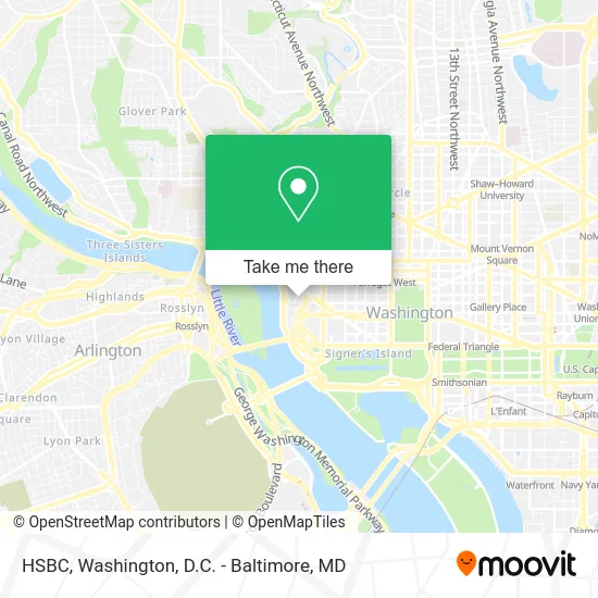
See HSBC, Washington, on the map
Public Transit to HSBC in Washington
Wondering how to get to HSBC in Washington? Moovit helps you find the best way to get to HSBC with step-by-step directions from the nearest public transit station.
Moovit provides free maps and live directions to help you navigate through your city. View schedules, routes, timetables, and find out how long does it take to get to HSBC in real time.
Looking for the nearest stop or station to HSBC? Check out this list of stops closest to your destination: 25 St Nw+F St NW; 23 St Nw+G St NW; New Hampshire Av Nw+24 St NW; 23rd St & I St NW Sb; Virginia Av Nw+22 St NW; Pennsylvania Avenue And 24th Street Nw; Foggy Bottom Gwu Kennedy Center Metro Station; Farragut North.
Bus: A58, D10, D74, D82, C85, 220, 240, 260, 620, 640.Train: MANASSAS LINE.Metro: BLUE, SILVER, ORANGE, RED.
Want to see if there’s another route that gets you there at an earlier time? Moovit helps you find alternative routes or times. Get directions from and directions to HSBC easily from the Moovit App or Website.
We make riding to HSBC easy, which is why over 1.5 million users, including users in Washington, trust Moovit as the best app for public transit. You don’t need to download an individual bus app or train app, Moovit is your all-in-one transit app that helps you find the best bus time or train time available.
For information on prices of bus, metro and train, costs and ride fares to HSBC, please check the Moovit app.
Use the app to navigate to popular places including to the airport, hospital, stadium, grocery store, mall, coffee shop, school, college, and university.
HSBC Address: 601 New Hampshire Ave NW Washington, DC 20037 street in Washington
- Royal Embassy of Saudi Arabia,
- Kennedy Center North Plaza,
- Newman & McIntosh LLC,
- PBG,
- Citybridge Education,
- West Front Strategies,
- Watergate Parking Garage,
- Fawcett & Fawcett,
- Tazza Cafe,
- FedEx,
- Watergate 600,
- Smithsonian Institution,
- Bottom of the Gate Cafe,
- The Watergate,
- Interior Architects,
- Watergate Mall Shops,
- John F. Kennedy Center Eisenhower Theatre,
- West End Public Library,
- Capital Bikeshare - Virginia Ave & 25th St NW,
- Rosslyn Metro Barber Shop
Places Near HSBC (Washington)
- Sibley Memorial Hospital, Washington,
- Marriott Marquis Washington, DC, Washington,
- Basilica of the National Shrine, Washington,
- Warner Theatre, Washington,
- National Museum of African American History and Culture, Washington,
- Washington DC VA Medical Center, Washington,
- Pennsylvania Ave NW (3rd st and pennsylvania), Washington,
- Washington National Cathedral, Washington,
- The Anthem, Washington,
- Museum Of The Bible, Washington,
- M&T Bank Stadium, Baltimore,
- Westfield Montgomery Mall, Montgomery County,
- PG Mall, Prince George's County,
- National Zoo, Washington,
- Capital One Arena, Washington,
- National Theatre, Washington,
- Camden Yards, Baltimore,
- Amazon Hq2, Arlington County,
- Rock Creek Tennis Center, Washington,
- Georgetown, Washington
How to get to popular places in Washington, D.C. - Baltimore, MD with public transit
Get around Washington by public transit!
Traveling around Washington has never been so easy. See step by step directions as you travel to any attraction, street or major public transit station. View bus and train schedules, arrival times, service alerts and detailed routes on a map, so you know exactly how to get to anywhere in Washington.
When traveling to any destination around Washington use Moovit's Live Directions with Get Off Notifications to know exactly where and how far to walk, how long to wait for your line, and how many stops are left. Moovit will alert you when it's time to get off — no need to constantly re-check whether yours is the next stop.
Wondering how to use public transit in Washington or how to pay for public transit in Washington? Moovit public transit app can help you navigate your way with public transit easily, and at minimum cost. It includes public transit fees, ticket prices, and costs. Looking for a map of Washington public transit lines? Moovit public transit app shows all public transit maps in Washington with all Bus, Train, Metro, Light Rail and Ferry routes and stops on an interactive map.
Washington, D.C. - Baltimore, MD has 5 transit type(s), including: Bus, Train, Metro, Light Rail and Ferry, operated by several transit agencies, including WMATA, Montgomery County Ride On, Fairfax Connector, TheBus, PRTC, DASH - Alexandria, Arlington Transit (ART), RTA of Central Maryland, MDOT MTA, MDOT MTA Light RailLink, MDOT MTA Commuter Bus, MDOT MTA Local Bus, FXBGO!, Virginia Railway Express (VRE) and MARC