How to get to HSBC ATM by bus?
Click on the bus route to see step by step directions with maps, line arrival times and updated time schedules.
From Central Lions Senior Centre, Edmonton
54 minFrom Properties of Distinction, Edmonton
53 minFrom Chateau Louis Hotel & Conference Centre, Edmonton
65 minFrom Unity Square Dental, Edmonton
52 minFrom Windermere Neighbourhood, Edmonton
83 minFrom Tory Breezeway, Edmonton
58 minFrom Manulife Place, Edmonton
66 minFrom Stantec Tower, Edmonton
57 minFrom Dr. Gerald Zetter Care Centre, Edmonton
78 minFrom 10180 101 Street Northwest, Edmonton
66 min
Bus stops near HSBC ATM in Edmonton
Bus lines to HSBC ATM in Edmonton
What are the closest stations to HSBC ATM?
The closest stations to HSBC ATM are:
- 178 Street & 68 Avenue is 186 meters away, 3 min walk.
- 177 Street & 69 Avenue is 389 meters away, 6 min walk.
- 178 Street & 69 Avenue is 442 meters away, 6 min walk.
Which bus lines stop near HSBC ATM?
These bus lines stop near HSBC ATM: 913, 918.
What’s the nearest bus station to HSBC ATM in Edmonton?
The nearest bus station to HSBC ATM in Edmonton is 178 Street & 68 Avenue. It’s a 3 min walk away.
What time is the first bus to HSBC ATM in Edmonton?
The 918 is the first bus that goes to HSBC ATM in Edmonton. It stops nearby at 5:26 AM.
What time is the last bus to HSBC ATM in Edmonton?
The 918 is the last bus that goes to HSBC ATM in Edmonton. It stops nearby at 12:36 AM.
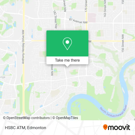
See HSBC ATM, Edmonton, on the map
Public Transit to HSBC ATM in Edmonton
Wondering how to get to HSBC ATM in Edmonton? Moovit helps you find the best way to get to HSBC ATM with step-by-step directions from the nearest public transit station.
Moovit provides free maps and live directions to help you navigate through your city. View schedules, routes, timetables, and find out how long does it take to get to HSBC ATM in real time.
Looking for the nearest stop or station to HSBC ATM? Check out this list of stops closest to your destination: 178 Street & 68 Avenue; 177 Street & 69 Avenue; 178 Street & 69 Avenue.
Bus: 913, 918, 923, 910X, 916.
Want to see if there’s another route that gets you there at an earlier time? Moovit helps you find alternative routes or times. Get directions from and directions to HSBC ATM easily from the Moovit App or Website.
We make riding to HSBC ATM easy, which is why over 1.5 million users, including users in Edmonton, trust Moovit as the best app for public transit. You don’t need to download an individual bus app or train app, Moovit is your all-in-one transit app that helps you find the best bus time or train time available.
For information on prices of bus, costs and ride fares to HSBC ATM, please check the Moovit app.
Use the app to navigate to popular places including to the airport, hospital, stadium, grocery store, mall, coffee shop, school, college, and university.
HSBC ATM Address: 6655 178 St NW Edmonton, AB T5T street in Edmonton
- Kentucky Fried Chicken Callingwood Malll,
- Callingwood Shopping Center,
- Dynalife Lab,
- Dynalife Medical Labs,
- Edward Jones Investments,
- COBS BREAD,
- Bagel Bin Bakery & Bistro,
- Nelson Bispo - TD Financial Planner,
- Michael Oplanich - TD Financial Planner,
- Diange Motia - TD Account Manager Small Business,
- Callingwood Laundry,
- Movie Gallery,
- Love Your Back Massage & Laser Studio,
- Shooting Star Ranc,
- Schooner Lounge,
- Total Duct Cleaning,
- 502 LD Callingwood,
- BMO Bank of Montreal,
- Z&Z General Services,
- Malavazi's Cantina
Places Near HSBC ATM (Edmonton)
- University of Alberta, Edmonton,
- Londonderry Mall, Edmonton,
- Edmonton Valley Zoo, Edmonton,
- Grey Nuns Community Hospital, Edmonton,
- Kingsway Mall, Edmonton,
- West Edmonton Mall, Edmonton,
- Canada Place Service Canada Centre, Edmonton,
- Rogers Place, Edmonton,
- Edmonton EXPO Centre, Edmonton,
- Alberta Legislature Building, Edmonton,
- Northgate Centre, Edmonton,
- Royal Alexandra Hospital, Edmonton,
- Borden Park, Edmonton,
- MacEwan University, Edmonton,
- Kaye Edmonton Clinic, Edmonton,
- Whyte Avenue, Edmonton,
- Cross Cancer Institute, Edmonton,
- Edmonton VIA Rail Station, Edmonton,
- Edmonton Commonwealth Stadium, Edmonton,
- Fort Edmonton Park, Edmonton
How to get to popular places in Edmonton with public transit
Get around Edmonton by public transit!
Traveling around Edmonton has never been so easy. See step by step directions as you travel to any attraction, street or major public transit station. View bus and train schedules, arrival times, service alerts and detailed routes on a map, so you know exactly how to get to anywhere in Edmonton.
When traveling to any destination around Edmonton use Moovit's Live Directions with Get Off Notifications to know exactly where and how far to walk, how long to wait for your line, and how many stops are left. Moovit will alert you when it's time to get off — no need to constantly re-check whether yours is the next stop.
Wondering how to use public transit in Edmonton or how to pay for public transit in Edmonton? Moovit public transit app can help you navigate your way with public transit easily, and at minimum cost. It includes public transit fees, ticket prices, and costs. Looking for a map of Edmonton public transit lines? Moovit public transit app shows all public transit maps in Edmonton with all Bus and Light Rail routes and stops on an interactive map.
Edmonton has 2 transit type(s), including: Bus and Light Rail, operated by several transit agencies, including ETS LRT, ETS, Strathcona County Transit, St. Albert Transit, Spruce Grove Transit, Fort Saskatchewan Transit, Beaumont Transit and Leduc Transit