How to get to HSS by bus?
Click on the bus route to see step by step directions with maps, line arrival times and updated time schedules.
From Broadway and 168th St, Manhattan
65 minFrom Freedom Tower, Manhattan
53 minFrom Broad Street, Manhattan
58 minFrom Rikers Island, Bronx
89 minFrom South Street Seaport, Manhattan
55 minFrom Washington Heights, Manhattan
65 minFrom Henry Street NY USA, Manhattan
52 minFrom 168 St, Manhattan
65 minFrom Armory Track & Field, Manhattan
67 min
How to get to HSS by train?
Click on the train route to see step by step directions with maps, line arrival times and updated time schedules.
How to get to HSS by subway?
Click on the subway route to see step by step directions with maps, line arrival times and updated time schedules.
From Broadway and 168th St, Manhattan
27 minFrom Freedom Tower, Manhattan
26 minFrom Broad Street, Manhattan
24 minFrom South Street Seaport, Manhattan
31 minFrom Washington Heights, Manhattan
27 minFrom Henry Street NY USA, Manhattan
26 minFrom 168 St, Manhattan
28 minFrom Armory Track & Field, Manhattan
30 min
Bus stops near HSS in Manhattan
- 9 Av/W 46 St, 2 min walk,VIEW
- 9 Av/W 42 St, 3 min walk,VIEW
- W 42nd St & 9th Ave, 3 min walk,VIEW
- W 42nd St & 9th Ave (Westbound), 4 min walk,VIEW
- W 44th St & 9th Ave, 4 min walk,VIEW
- 8 Av/W 42 St, 5 min walk,VIEW
- W 42 St/8 Av, 5 min walk,VIEW
- W 42nd St & Port Authority Terminal, 6 min walk,VIEW
- Port Authority Bus Terminal, 14 min walk,VIEW
Subway stations near HSS in Manhattan
Bus lines to HSS in Manhattan
- M11, 42 St,VIEW
- M34A-SBS, Select Bus Pa Bus Trm Via 34 St Via 8 Av,VIEW
- 42ND ST, E 42nd St & 3rd Ave,VIEW
- 59TH ST, Midtown / W 39th Street,VIEW
- M42, East Side U N-1 Av Crosstown,VIEW
- W44, Midtown / W 39th Street,VIEW
- M20, Lincoln Center 66 St Via 8 Av,VIEW
- M104, West Harlem 129 St Via Broadway,VIEW
- SIM8, Arden Hts Via Richmond Av Via Woodrow Rd,VIEW
- SIM22, Eltingville Via Ar Kill Rd Via Richmond,VIEW
- SIM25, Tottenville Via Rossville Av Via Foster,VIEW
- SIM26, Tottenville Via Blmingdale Rd Via Amboy,VIEW
- SIM30, Rosebank Via Forest Av,VIEW
- COMMUNITY COACH, 77 Local,VIEW
- NEWARK AIRPORT EXPRESS, Newark Airport Express,VIEW
- SUBURBAN TRANSIT, 300 - Plainsboro - NYC,VIEW
- 102, Bloomfield Express,VIEW
- 109, D Lyndhurst N Arlington Belleville N Newark,VIEW
- 139, 139 - Lakewood to New York - (Howell Garage - Old Bridge),VIEW
- 720, Port Authority to Willingboro, Westampton,VIEW
What are the closest stations to HSS?
The closest stations to HSS are:
- 9 Av/W 46 St is 128 yards away, 2 min walk.
- 9 Av/W 42 St is 217 yards away, 3 min walk.
- W 42nd St & 9th Ave is 244 yards away, 3 min walk.
- W 42nd St & 9th Ave (Westbound) is 258 yards away, 4 min walk.
- W 44th St & 9th Ave is 324 yards away, 4 min walk.
- 49 St is 359 yards away, 5 min walk.
- 8 Av/W 42 St is 397 yards away, 5 min walk.
- W 42 St/8 Av is 410 yards away, 5 min walk.
- W 42nd St & Port Authority Terminal is 444 yards away, 6 min walk.
- 42 St-Port Authority Bus Terminal is 491 yards away, 6 min walk.
- 50 St is 595 yards away, 8 min walk.
- Port Authority Bus Terminal is 1106 yards away, 14 min walk.
Which bus lines stop near HSS?
These bus lines stop near HSS: M11, M20, M34A-SBS, M42, M55.
Which train lines stop near HSS?
These train lines stop near HSS: RONKONKOMA BRANCH, YEL.
Which subway lines stop near HSS?
These subway lines stop near HSS: 1, 2, A, N, Q.
What’s the nearest subway station to HSS in Manhattan?
The nearest subway station to HSS in Manhattan is 49 St. It’s a 5 min walk away.
What’s the nearest bus station to HSS in Manhattan?
The nearest bus station to HSS in Manhattan is 9 Av/W 46 St. It’s a 2 min walk away.
What time is the first subway to HSS in Manhattan?
The 2 is the first subway that goes to HSS in Manhattan. It stops nearby at 3:00 AM.
What time is the last subway to HSS in Manhattan?
The N is the last subway that goes to HSS in Manhattan. It stops nearby at 4:02 AM.
What time is the first bus to HSS in Manhattan?
The M42 is the first bus that goes to HSS in Manhattan. It stops nearby at 3:04 AM.
What time is the last bus to HSS in Manhattan?
The M42 is the last bus that goes to HSS in Manhattan. It stops nearby at 3:05 AM.
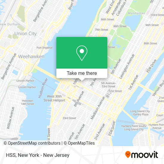
See HSS, Manhattan, on the map
Public Transit to HSS in Manhattan
Wondering how to get to HSS in Manhattan? Moovit helps you find the best way to get to HSS with step-by-step directions from the nearest public transit station.
Moovit provides free maps and live directions to help you navigate through your city. View schedules, routes, timetables, and find out how long does it take to get to HSS in real time.
Looking for the nearest stop or station to HSS? Check out this list of stops closest to your destination: 9 Av/W 46 St; 9 Av/W 42 St; W 42nd St & 9th Ave; W 42nd St & 9th Ave (Westbound); W 44th St & 9th Ave; 49 St; 8 Av/W 42 St; W 42 St/8 Av; W 42nd St & Port Authority Terminal; 42 St-Port Authority Bus Terminal; 50 St; Port Authority Bus Terminal.
Bus: M11, M20, M34A-SBS, M42, M55, 42ND ST, 59TH ST.Train: RONKONKOMA BRANCH, YEL.Subway: 1, 2, A, N, Q, R, W, C, E.
Want to see if there’s another route that gets you there at an earlier time? Moovit helps you find alternative routes or times. Get directions from and directions to HSS easily from the Moovit App or Website.
We make riding to HSS easy, which is why over 1.5 million users, including users in Manhattan, trust Moovit as the best app for public transit. You don’t need to download an individual bus app or train app, Moovit is your all-in-one transit app that helps you find the best bus time or train time available.
For information on prices of subway, bus and train, costs and ride fares to HSS, please check the Moovit app.
Use the app to navigate to popular places including to the airport, hospital, stadium, grocery store, mall, coffee shop, school, college, and university.
Location: Manhattan, New York - New Jersey
- Color Jewels,
- Cieri Media International,
- Ucm Rug Cleaning Manhattan,
- Heart and Music,
- The Handpulled Noodle | Hell’S Kitchen,
- Jason Chaos Solo,
- Quinn's Bar & Grill,
- John Pallotta Studio Of Acting,
- West 44 Candy Store,
- Nyc Huskers,
- Wake Up and Smell the Coffee,
- Christmas Carol Cocktails,
- Ebanks Comedy,
- Pain Physicians Ny: Tamer Elbaz, Md,
- The Village Lantern Comedy Club,
- The Friki Tiki,
- Backstage Photography Nyc,
- New York City Indie Film Festival,
- The 4th Wall Actors Workshop,
- Sonnet Theater
Places Near HSS (Manhattan)
- Rockefeller Center, Manhattan,
- Times Square, Manhattan,
- San Gennaro Feast, Manhattan,
- 3 Stone St, Manhattan,
- 111 Centre New York City Supreme Court, Manhattan,
- SoHo, Manhattan,
- 376 Hudson Street, Manhattan,
- Pier 83, Manhattan,
- Queens Center Mall, Queens,
- Katz's Deli, Manhattan,
- 26 Federal Plaza, Manhattan,
- Chinatown, Manhattan,
- 66 John Street, Manhattan,
- 1 Police Plaza, Manhattan,
- Wall Street, Manhattan,
- Bellevue Hospital, Manhattan,
- 911 Memorial, Manhattan,
- Mountainside Hospital, Glen Ridge,
- Hudson Yards, Manhattan,
- qqqq, Manhattan
How to get to popular places in New York - New Jersey with public transit
Get around Manhattan by public transit!
Traveling around Manhattan has never been so easy. See step by step directions as you travel to any attraction, street or major public transit station. View bus and train schedules, arrival times, service alerts and detailed routes on a map, so you know exactly how to get to anywhere in Manhattan.
When traveling to any destination around Manhattan use Moovit's Live Directions with Get Off Notifications to know exactly where and how far to walk, how long to wait for your line, and how many stops are left. Moovit will alert you when it's time to get off — no need to constantly re-check whether yours is the next stop.
Wondering how to use public transit in Manhattan or how to pay for public transit in Manhattan? Moovit public transit app can help you navigate your way with public transit easily, and at minimum cost. It includes public transit fees, ticket prices, and costs. Looking for a map of Manhattan public transit lines? Moovit public transit app shows all public transit maps in Manhattan with all Bus, Train, Subway, Light Rail, Ferry and Cable Car routes and stops on an interactive map.
New York - New Jersey has 6 transit type(s), including: Bus, Train, Subway, Light Rail, Ferry and Cable Car, operated by several transit agencies, including MTA Subway, Metro-North Railroad, LIRR, PATH, MTA New York City Transit - Express routes, MTA Bus, NJ Transit, NYC Ferry, NICE bus, Bee-Line Bus, NJ Transit Rail, Norwalk Transit District, Hartford Line, River Valley Transit and HART