How to get to Hackerstolz by bus?
Click on the bus route to see step by step directions with maps, line arrival times and updated time schedules.
From Möbel Höffner, Schwetzingen
49 minFrom Hans-Warsch-Platz,Ludwigshafen Oggersheim, Ludwigshafen-Oggersheim
57 minFrom Globus Getränkecenter, Ludwigshafen-Oggersheim
81 minFrom Universitätsklinikum Heidelberg-Notaufnahme, Neuenheim
110 minFrom GRN-Klinik Schwetzingen, Schwetzingen
90 minFrom Thoraxklinik Heidelberg, Neuenheim
141 minFrom Friedhof Käfertal, Käfertal
49 minFrom Marie-Baum-Schule Heidelberg, Wieblingen
139 minFrom Globus Getränkemarkt, Ludwigshafen-Oggersheim
82 min
How to get to Hackerstolz by train?
Click on the train route to see step by step directions with maps, line arrival times and updated time schedules.
Light Rail stations near Hackerstolz in Innenstadt/Jungbusch
Bus stops near Hackerstolz in Innenstadt/Jungbusch
Bus lines to Hackerstolz in Innenstadt/Jungbusch
- 60, Wasserturm,VIEW
- 60E, Luzenberg,VIEW
- 61, Bonifatiuskirche,VIEW
- RNV 60, Mannheim, Pfeifferswörth,VIEW
- RNV 65, Mannheim, Popakademie,VIEW
- 5, Käfertal Bahnhof - MA Hauptbahnhof,VIEW
- 64, MA Hauptbahnhof - Wasserturm - Fahrlach - Käfertal Bf,VIEW
- 7, Vogelstang - MA Hauptbahnhof,VIEW
- RNV 5, Mannheim, Hauptbahnhof,VIEW
- RNV 63, Lindenhof, Pfalzplatz,VIEW
- RNV 64, Käfertal, Bahnhof (Rnv),VIEW
What are the closest stations to Hackerstolz?
The closest stations to Hackerstolz are:
- Paradeplatz is 82 meters away, 2 min walk.
- Mannheim, Paradeplatz is 112 meters away, 2 min walk.
- MA Schloss is 336 meters away, 5 min walk.
- Mannheim, Mensa am Schloss is 604 meters away, 8 min walk.
- Kunsthalle is 636 meters away, 9 min walk.
- Mannheim, Wasserturm is 798 meters away, 11 min walk.
Which train lines stop near Hackerstolz?
These train lines stop near Hackerstolz: RB35, RE60, S3, S6.
Which light rail lines stop near Hackerstolz?
These light rail lines stop near Hackerstolz: 1, 15, 4A, 5, RNV 4, RNV 5, RNV 6.
Which bus lines stop near Hackerstolz?
These bus lines stop near Hackerstolz: 60, 710, 74, 76, RNV 53, RNV 65.
What’s the nearest light rail station to Hackerstolz in Innenstadt/Jungbusch?
The nearest light rail stations to Hackerstolz in Innenstadt/Jungbusch are Paradeplatz and Mannheim, Paradeplatz. The closest one is a 2 min walk away.
What’s the nearest bus station to Hackerstolz in Innenstadt/Jungbusch?
The nearest bus station to Hackerstolz in Innenstadt/Jungbusch is MA Schloss. It’s a 5 min walk away.
What time is the first light rail to Hackerstolz in Innenstadt/Jungbusch?
The 1 is the first light rail that goes to Hackerstolz in Innenstadt/Jungbusch. It stops nearby at 3:00 AM.
What time is the last light rail to Hackerstolz in Innenstadt/Jungbusch?
The 1 is the last light rail that goes to Hackerstolz in Innenstadt/Jungbusch. It stops nearby at 3:00 AM.
What time is the first bus to Hackerstolz in Innenstadt/Jungbusch?
The E is the first bus that goes to Hackerstolz in Innenstadt/Jungbusch. It stops nearby at 4:19 AM.
What time is the last bus to Hackerstolz in Innenstadt/Jungbusch?
The RNV 60 is the last bus that goes to Hackerstolz in Innenstadt/Jungbusch. It stops nearby at 1:08 AM.
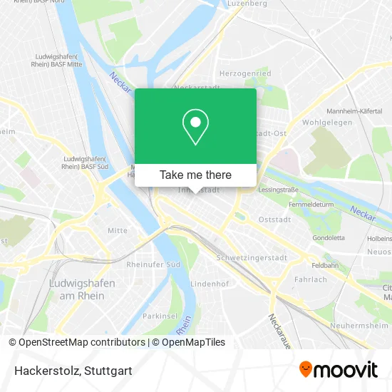
See Hackerstolz, Innenstadt/Jungbusch, on the map
Public Transit to Hackerstolz in Innenstadt/Jungbusch
Wondering how to get to Hackerstolz in Innenstadt/Jungbusch? Moovit helps you find the best way to get to Hackerstolz with step-by-step directions from the nearest public transit station.
Moovit provides free maps and live directions to help you navigate through your city. View schedules, routes, timetables, and find out how long does it take to get to Hackerstolz in real time.
Looking for the nearest stop or station to Hackerstolz? Check out this list of stops closest to your destination: Paradeplatz; Mannheim; MA Schloss; Mannheim; Kunsthalle; Mannheim.
Train: RB35, RE60, S3, S6.Light Rail: 1, 15, 4A, 5, RNV 4, RNV 5, RNV 6.Bus: 60, 710, 74, 76, RNV 53, RNV 65, 60E, 61, RNV 60, 5, 64, 7, RNV 5, RNV 63, RNV 64.
Want to see if there’s another route that gets you there at an earlier time? Moovit helps you find alternative routes or times. Get directions from and directions to Hackerstolz easily from the Moovit App or Website.
We make riding to Hackerstolz easy, which is why over 1.5 million users, including users in Innenstadt/Jungbusch, trust Moovit as the best app for public transit. You don’t need to download an individual bus app or train app, Moovit is your all-in-one transit app that helps you find the best bus time or train time available.
For information on prices of bus, light rail and train, costs and ride fares to Hackerstolz, please check the Moovit app.
Use the app to navigate to popular places including to the airport, hospital, stadium, grocery store, mall, coffee shop, school, college, and university.
Hackerstolz Address: Kunststraße 68161 Mannheim street in Innenstadt/Jungbusch
- Förderverein Kinderhaus Rosa Grünbaum,
- Holy Ghost Headquarters Church of God in Christ,
- Designzentrum Rhein Neckar Vereinigung zur Förderung des Designs,
- Bta Bildungs-& Trainingsakademie,
- Asia-Pacific Management Club,
- Infinity Mannheim,
- Made Kooperative, Mannheimer Design Kooperative,
- Beratungsstelle Geschlechtliche Vielfalt,
- Förderverein Kinderhaus Dresdener Straße,
- 2lit,
- It-Matic,
- Netzwerk smart Production,
- H + W Haus-und Wohnungseigentum,
- Verein von Belegschaftsaktionären der Bilfinger Se,
- Fsv Mannheim,
- Clever X Lohnsteuerhilfeverein,
- Thk-Kassen,
- Cure Mannheim,
- Freundschaftsverein Multi-Kulti,
- Legis
Places Near Hackerstolz (Innenstadt/Jungbusch)
- FlixBus Haltestelle, Stuttgart,
- Waldfriedhof, Degerloch,
- Marmorsaal Im Weissenburgpark, Stuttgart-Süd,
- Gasometer Pforzheim, Pforzheim,
- Mercedes-Benz Museum, Bad Cannstatt,
- Hauptbahnhof Stuttgart, Stuttgart-Mitte,
- Klinikum Stuttgart - Katharinenhospital, Stuttgart-Mitte,
- Mettingen Eros-Center Puff Laufhaus, Esslingen Am Neckar,
- Gleis 101/102 (tief), Stuttgart-Mitte,
- Hanns-Martin-Schleyer-Halle, Bad Cannstatt,
- Hanns-Martin-Schleyer-Halle (Stuttgart Hans-Martin-Schleyerhalle), Bad Cannstatt,
- Schleyerhalle, Bad Cannstatt,
- Porsche-Arena, Bad Cannstatt,
- Pariser Platz Stuttgart, Stuttgart-Mitte,
- Porsche Museum, Zuffenhausen,
- Wilhelma (U-Bahn Wilhelma), Bad Cannstatt,
- Im Wizemann (Halle), Bad Cannstatt,
- Mercedes-Benz Museum (Mercedes Museum Stuttgart), Bad Cannstatt,
- Geilhaus Haus 33a, Reutlingen-Betzingen,
- SI-Centrum, Möhringen
How to get to popular places in Stuttgart with public transit
Get around Innenstadt/Jungbusch by public transit!
Traveling around Innenstadt/Jungbusch has never been so easy. See step by step directions as you travel to any attraction, street or major public transit station. View bus and train schedules, arrival times, service alerts and detailed routes on a map, so you know exactly how to get to anywhere in Innenstadt/Jungbusch.
When traveling to any destination around Innenstadt/Jungbusch use Moovit's Live Directions with Get Off Notifications to know exactly where and how far to walk, how long to wait for your line, and how many stops are left. Moovit will alert you when it's time to get off — no need to constantly re-check whether yours is the next stop.
Wondering how to use public transit in Innenstadt/Jungbusch or how to pay for public transit in Innenstadt/Jungbusch? Moovit public transit app can help you navigate your way with public transit easily, and at minimum cost. It includes public transit fees, ticket prices, and costs. Looking for a map of Innenstadt/Jungbusch public transit lines? Moovit public transit app shows all public transit maps in Innenstadt/Jungbusch with all Bus, Train, Subway, Light Rail, Ferry, S-Bahn and Funicular routes and stops on an interactive map.
Stuttgart has 7 transit type(s), including: Bus, Train, Subway, Light Rail, Ferry, S-Bahn and Funicular, operated by several transit agencies, including SSB - Stadtbahn, SSB, SSB - Seilbahn / Zacke, S-Bahn Stuttgart, Rhein-Neckar-Verkehr GmbH (rnv), Karlsruher Verkehrsverbund, DB AG, DB Regiobus BW, Arverio Baden-Württemberg GmbH, DB RegioNetz Verkehrs GmbH Westfrankenbahn, DB Regio AG Baden-Württemberg, Südwestdeutsche Verkehrs-AG, DB Regio AG Mitte Region Hessen, DB and Bodensee-Oberschwaben-Bahn
Public transit lines with stations closest to Hackerstolz in Innenstadt/Jungbusch
Bus lines with stations closest to Hackerstolz in Innenstadt/Jungbusch
MA Schloss
 60Pfeifferswörth - Ulmenweg - Herzogenried - Neckarstadt West - Hafenstraße - Schloss - Universität - MA Hauptbahnhof - Fernmeldeturm
- 60EPfeifferswörth - Ulmenweg - Herzogenried - Neckarstadt West - Hafenstraße - Schloss - Universität - MA Hauptbahnhof - Fernmeldeturm
- 61Pfalzplatz - MA Hbf - Neckarstadt West - Herzogenriedbad - Bonifatiuskirche - Wohlgelegen EKZ