Directions to Haight and Ashbury (Haight Ashbury, Sf) with public transportation
The following transit lines have routes that pass near Haight and Ashbury
 Bus: 33, 43, 6, 7, 37.
- BART: GREEN, RED, YELLOW.
How to get to Haight and Ashbury by bus?
Click on the bus route to see step by step directions with maps, line arrival times and updated time schedules.
How to get to Haight and Ashbury by BART?
Click on the BART route to see step by step directions with maps, line arrival times and updated time schedules.
Bus stops near Haight and Ashbury in Haight Ashbury, Sf
- Ashbury St & Haight St, 1 min walk,
- Masonic Ave & Haight St, 2 min walk,
- Haight St & Masonic Ave, 2 min walk,
Light Rail stations near Haight and Ashbury in Haight Ashbury, Sf
- 17th St & Castro St, 6 min walk,
- Carl St & Cole St, 35 min walk,
Bus lines to Haight and Ashbury in Haight Ashbury, Sf
- 33, Sacramento + Cherry,
- 37, Masonic + Haight,
- 6, Civic Center Station,
- N BUS, Judah Bus,
- N OWL, Owl Judah,
- 7, Haight - Noriega,
- 43, Munich + Geneva,
What are the closest stations to Haight and Ashbury?
The closest stations to Haight and Ashbury are:
- Ashbury St & Haight St is 12 yards away, 1 min walk.
- Masonic Ave & Haight St is 136 yards away, 2 min walk.
- Haight St & Masonic Ave is 137 yards away, 2 min walk.
- 17th St & Castro St is 483 yards away, 6 min walk.
- Carl St & Cole St is 2953 yards away, 35 min walk.
Which bus lines stop near Haight and Ashbury?
These bus lines stop near Haight and Ashbury: 33, 43, 6, 7.
Which BART lines stop near Haight and Ashbury?
These BART lines stop near Haight and Ashbury: GREEN, RED, YELLOW.
What’s the nearest light rail station to Haight and Ashbury in Haight Ashbury, Sf?
The nearest light rail station to Haight and Ashbury in Haight Ashbury, Sf is 17th St & Castro St. It’s a 6 min walk away.
What’s the nearest bus station to Haight and Ashbury in Haight Ashbury, Sf?
The nearest bus station to Haight and Ashbury in Haight Ashbury, Sf is Ashbury St & Haight St. It’s a 1 min walk away.
What time is the first light rail to Haight and Ashbury in Haight Ashbury, Sf?
The N is the first light rail that goes to Haight and Ashbury in Haight Ashbury, Sf. It stops nearby at 4:52 AM.
What time is the last light rail to Haight and Ashbury in Haight Ashbury, Sf?
The N is the last light rail that goes to Haight and Ashbury in Haight Ashbury, Sf. It stops nearby at 1:01 AM.
What time is the first bus to Haight and Ashbury in Haight Ashbury, Sf?
The N OWL is the first bus that goes to Haight and Ashbury in Haight Ashbury, Sf. It stops nearby at 3:00 AM.
What time is the last bus to Haight and Ashbury in Haight Ashbury, Sf?
The N OWL is the last bus that goes to Haight and Ashbury in Haight Ashbury, Sf. It stops nearby at 3:06 AM.
See Haight and Ashbury, Haight Ashbury, Sf, on the map
Public Transit to Haight and Ashbury in Haight Ashbury, Sf
Wondering how to get to Haight and Ashbury in Haight Ashbury, Sf? Moovit helps you find the best way to get to Haight and Ashbury with step-by-step directions from the nearest public transit station.
Moovit provides free maps and live directions to help you navigate through your city. View schedules, routes, timetables, and find out how long does it take to get to Haight and Ashbury in real time.
Looking for the nearest stop or station to Haight and Ashbury? Check out this list of stops closest to your destination: Ashbury St & Haight St; Masonic Ave & Haight St; Haight St & Masonic Ave; 17th St & Castro St; Carl St & Cole St.
Bus: 33, 43, 6, 7, 37, N BUS, N OWL.BART: GREEN, RED, YELLOW.
Want to see if there’s another route that gets you there at an earlier time? Moovit helps you find alternative routes or times. Get directions from and directions to Haight and Ashbury easily from the Moovit App or Website.
We make riding to Haight and Ashbury easy, which is why over 1.5 million users, including users in Haight Ashbury, Sf, trust Moovit as the best app for public transit. You don’t need to download an individual bus app or train app, Moovit is your all-in-one transit app that helps you find the best bus time or train time available.
For information on prices of bus, BART and light rail, costs and ride fares to Haight and Ashbury, please check the Moovit app.
Use the app to navigate to popular places including to the airport, hospital, stadium, grocery store, mall, coffee shop, school, college, and university.
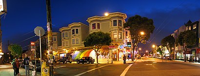
Haight and Ashbury Address: Ashbury St San Francisco, CA 94117 street in Haight Ashbury, Sf
- Flagstar Bank Atm,
- Planet Juice - Haight ATM,
- Haight-Ashbury,
- Lamia Cuisine Baking,
- Sharon Lee, Od,
- Green Carpet Cleaning,
- Random Musical Instrument Guy,
- Piedmont Boutique,
- Welcome Haight & Ashbury,
- Richard P. Doolan-Norman T. Larson Residence and Storefronts,
- Gallery 1506,
- Veganburg (Vegan Burg),
- Pet and Home Care,
- Jimi Hendrix Red House,
- Huge Legs Hanging Out the Window,
- Cal Surplus,
- Sean Heskett Urban Arborist,
- All Saints Episcopal Church (Protestant Episcopal Church in the Diocese of California),
- Haight Street Market,
- Auto Locksmith
Places Near Haight and Ashbury (Haight Ashbury, Sf)
- Serramonte Center, Daly City,
- Tesla Shuttle Stop - HQ, Palo Alto,
- Google Shuttle - Main Campus,
- Chinatown, Chinatown,
- Westfield Valley Fair, San Jose,
- San Jose Airport, San Jose,
- San Francisco Conservatory of Flowers, Golden Gate Park,
- Ghirardelli Square (Ghirardelli Square San Francisco), Russian Hill,
- Tesla Shuttle Stop - Fremont, Fremont,
- Amtrak, Emeryville,
- The Masonic, Nob Hill,
- San Francisco Premium Outlets, Livermore,
- Oakland Zoo, Oakland,
- Polo Fields, Golden Gate Park,
- Dr Bruce E Ellison MD, Mission,
- Great Mall, Milpitas,
- Palace of Fine Arts, Marina,
- Frontier Airlines Gates - Terminal 1, Sfo,
- Apple shuttle (from Cupertino), Cupertino,
- Google Shuttle - Tech Corner, Sunnyvale
How to get to popular places in San Francisco - San Jose, CA with public transit
Get around Haight Ashbury, Sf by public transit!
Traveling around Haight Ashbury, Sf has never been so easy. See step by step directions as you travel to any attraction, street or major public transit station. View bus and train schedules, arrival times, service alerts and detailed routes on a map, so you know exactly how to get to anywhere in Haight Ashbury, Sf.
When traveling to any destination around Haight Ashbury, Sf use Moovit's Live Directions with Get Off Notifications to know exactly where and how far to walk, how long to wait for your line, and how many stops are left. Moovit will alert you when it's time to get off — no need to constantly re-check whether yours is the next stop.
Wondering how to use public transit in Haight Ashbury, Sf or how to pay for public transit in Haight Ashbury, Sf? Moovit public transit app can help you navigate your way with public transit easily, and at minimum cost. It includes public transit fees, ticket prices, and costs. Looking for a map of Haight Ashbury, Sf public transit lines? Moovit public transit app shows all public transit maps in Haight Ashbury, Sf with all Bus, Train, BART, Light Rail, Ferry and Cable Car routes and stops on an interactive map.
San Francisco - San Jose, CA has 6 transit type(s), including: Bus, Train, BART, Light Rail, Ferry and Cable Car, operated by several transit agencies, including BART, Muni Metro, Caltrain, VTA, Capitol Corridor, Sonoma Marin Area Rail Transit, MUNI, SF Cable Car, AC Transit, Dumbarton Express, Golden Gate Transit, County Connection, SamTrans, SamTrans / City of Menlo Park and Sonoma County Transit