How to get to Hailee Rae Styling by bus?
Click on the bus route to see step by step directions with maps, line arrival times and updated time schedules.
From Congress/45th Street, West Palm Beach
71 minFrom Marriott s Ocean Pointe Palm Beach Shores, Riviera Beach
82 minFrom St. Mary's Medical Center, West Palm Beach
48 minFrom Saint Marys Hospital, West Palm Beach
44 minFrom Suncoast High School, Riviera Beach
49 minFrom Phil Foster Park (Blue Heron Foster Park), Riviera Beach
37 minFrom Donald Ross Rd / Military Trl, Jupiter
54 minFrom Singer Island, Riviera Beach
41 minFrom Tri-Rail-Mangonia Park Station, West Palm Beach
69 minFrom HCA Florida JFK North Hospital-ER, West Palm Beach
103 min
Bus stops near Hailee Rae Styling in Riviera Beach
Bus lines to Hailee Rae Styling in Riviera Beach
What are the closest stations to Hailee Rae Styling?
The closest stations to Hailee Rae Styling are:
- UNIVERSE BLVD @ FLORIDA POWER & LIGHT is 582 yards away, 7 min walk.
- PGA BLVD at FEDERAL HWY is 1182 yards away, 15 min walk.
Which bus line stops near Hailee Rae Styling?
1 (Rt 1 Northbound)
What’s the nearest bus station to Hailee Rae Styling in Riviera Beach?
The nearest bus station to Hailee Rae Styling in Riviera Beach is UNIVERSE BLVD @ FLORIDA POWER & LIGHT. It’s a 7 min walk away.
What time is the first bus to Hailee Rae Styling in Riviera Beach?
The 1 is the first bus that goes to Hailee Rae Styling in Riviera Beach. It stops nearby at 6:21 AM.
What time is the last bus to Hailee Rae Styling in Riviera Beach?
The 1 is the last bus that goes to Hailee Rae Styling in Riviera Beach. It stops nearby at 9:30 PM.
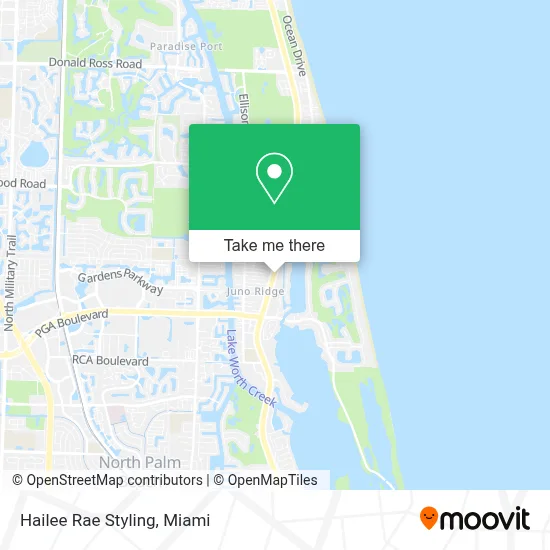
See Hailee Rae Styling, Riviera Beach, on the map
Public Transit to Hailee Rae Styling in Riviera Beach
Wondering how to get to Hailee Rae Styling in Riviera Beach? Moovit helps you find the best way to get to Hailee Rae Styling with step-by-step directions from the nearest public transit station.
Moovit provides free maps and live directions to help you navigate through your city. View schedules, routes, timetables, and find out how long does it take to get to Hailee Rae Styling in real time.
Looking for the nearest stop or station to Hailee Rae Styling? Check out this list of stops closest to your destination: UNIVERSE BLVD @ FLORIDA POWER & LIGHT; PGA BLVD at FEDERAL HWY.
Bus: 1, 20X.
Want to see if there’s another route that gets you there at an earlier time? Moovit helps you find alternative routes or times. Get directions from and directions to Hailee Rae Styling easily from the Moovit App or Website.
We make riding to Hailee Rae Styling easy, which is why over 1.7 million users, including users in Riviera Beach, trust Moovit as the best app for public transit. You don’t need to download an individual bus app or train app, Moovit is your all-in-one transit app that helps you find the best bus time or train time available.
For information on prices of bus, costs and ride fares to Hailee Rae Styling, please check the Moovit app.
Use the app to navigate to popular places including to the airport, hospital, stadium, grocery store, mall, coffee shop, school, college, and university.
Hailee Rae Styling Address: 11940 US Highway 1 street in Riviera Beach
- Michael Onorato,
- Fpl / Juno Beach 06,
- Lake Park,
- Neighborhood Kids,
- The Meadows FL,
- Truist,
- Palm Beach Gardens Car Title Loans,
- Threadology Bar,
- The Blowzone,
- Purepoint Financial,
- Kaogang Thai Sushi & Noodle Bar,
- Hangry Kitchen,
- Adskinz,
- Acupuncturemd,
- Ashley Chin, Psy.D,
- Jeff Hallas P.A.,
- Abby Orris, Florida Lifestyle Realtor,
- Team Fink Real Estate Advisors,
- David Chirico - Realtor With An Appetite,
- Lisa Cole, Realtor
Places Near Hailee Rae Styling (Riviera Beach)
- Marlins Park, Miami,
- Sawgrass mall ( FL ), Miami Beach,
- Keiser University Flagship Campus, West Palm Beach,
- Sawgrass Mall, Miami,
- Dolphin Mall Bus, Miami,
- Richard E. Gerstein Justice Building, Miami,
- Aventura Mall, Miami,
- Hard Rock Stadium, Miami Gardens,
- Wynwood, Miami,
- Bayside Marketplace, Miami,
- Miami Freedom Park, Miami,
- Miami-Dade County Courthouse, Miami,
- Aventura Mall, Miami Beach,
- Miami VA Hospital, Miami,
- Brickell City Centre, Miami,
- Port of Miami Cruise Terminal, Miami,
- Dolphin Mall, Miami,
- Miami Design District, Miami,
- Zoo Miami, Miami,
- Little Havana, Miami
How to get to popular places in Miami with public transit
Get around Riviera Beach by public transit!
Traveling around Riviera Beach has never been so easy. See step by step directions as you travel to any attraction, street or major public transit station. View bus and train schedules, arrival times, service alerts and detailed routes on a map, so you know exactly how to get to anywhere in Riviera Beach.
When traveling to any destination around Riviera Beach use Moovit's Live Directions with Get Off Notifications to know exactly where and how far to walk, how long to wait for your line, and how many stops are left. Moovit will alert you when it's time to get off — no need to constantly re-check whether yours is the next stop.
Wondering how to use public transit in Riviera Beach or how to pay for public transit in Riviera Beach? Moovit public transit app can help you navigate your way with public transit easily, and at minimum cost. It includes public transit fees, ticket prices, and costs. Looking for a map of Riviera Beach public transit lines? Moovit public transit app shows all public transit maps in Riviera Beach with all Bus, Train, Light Rail and Ferry routes and stops on an interactive map.
Miami has 4 transit type(s), including: Bus, Train, Light Rail and Ferry, operated by several transit agencies, including Broward County Transit, Miami-Dade Transit, Metrorail, Palm Tran, Tri-Rail, Brightline, MARTY, City of Homestead Trolley, Key West Transit, Treasure Coast Connector, GoLine IRT, Amtrak, Greyhound-us, FlixBus-us and Aventura Express Shuttle Bus