How to get to Hair Cuttery by bus?
Click on the bus route to see step by step directions with maps, line arrival times and updated time schedules.
From Blue Lagoon, Miami
51 minFrom Doral Voice, North Westside
90 minFrom Sam's Club, North Westside
68 minFrom Tropical Park, Miami
54 minFrom Spin Group, North Westside
88 minFrom Miami Dade College West Campus, North Westside
98 minFrom West Kendall Baptist Hospital, Kendale Lakes-Tamiami
76 minFrom BrandsMart USA, Kendall-Palmetto Bay
86 min
Bus stop near Hair Cuttery in Kendale Lakes-Tamiami
- Sw 122 Av @ Sw 26 St, 6 min walk,VIEW
Bus lines to Hair Cuttery in Kendale Lakes-Tamiami
- 8, 8 - SW 26 St/152 Av,VIEW
What are the closest stations to Hair Cuttery?
The closest stations to Hair Cuttery are:
- Sw 122 Av @ Sw 26 St is 444 yards away, 6 min walk.
Which bus lines stop near Hair Cuttery?
These bus lines stop near Hair Cuttery: 40, 8.
What’s the nearest bus station to Hair Cuttery in Kendale Lakes-Tamiami?
The nearest bus station to Hair Cuttery in Kendale Lakes-Tamiami is Sw 122 Av @ Sw 26 St. It’s a 6 min walk away.
What time is the first bus to Hair Cuttery in Kendale Lakes-Tamiami?
The 8 is the first bus that goes to Hair Cuttery in Kendale Lakes-Tamiami. It stops nearby at 4:36 AM.
What time is the last bus to Hair Cuttery in Kendale Lakes-Tamiami?
The 8 is the last bus that goes to Hair Cuttery in Kendale Lakes-Tamiami. It stops nearby at 1:41 AM.
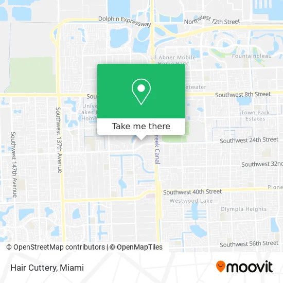
See Hair Cuttery, Kendale Lakes-Tamiami, on the map
Public Transit to Hair Cuttery in Kendale Lakes-Tamiami
Wondering how to get to Hair Cuttery in Kendale Lakes-Tamiami? Moovit helps you find the best way to get to Hair Cuttery with step-by-step directions from the nearest public transit station.
Moovit provides free maps and live directions to help you navigate through your city. View schedules, routes, timetables, and find out how long does it take to get to Hair Cuttery in real time.
Looking for the nearest stop or station to Hair Cuttery? Check out this list of stops closest to your destination: Sw 122 Av @ Sw 26 St.
Bus: 40, 8.
Want to see if there’s another route that gets you there at an earlier time? Moovit helps you find alternative routes or times. Get directions from and directions to Hair Cuttery easily from the Moovit App or Website.
We make riding to Hair Cuttery easy, which is why over 1.5 million users, including users in Kendale Lakes-Tamiami, trust Moovit as the best app for public transit. You don’t need to download an individual bus app or train app, Moovit is your all-in-one transit app that helps you find the best bus time or train time available.
For information on prices of bus, costs and ride fares to Hair Cuttery, please check the Moovit app.
Use the app to navigate to popular places including to the airport, hospital, stadium, grocery store, mall, coffee shop, school, college, and university.
Hair Cuttery Address: 11865 SW 26th St Miami, FL 33175 street in Kendale Lakes-Tamiami
- Wash Away Coin Laundry L,
- Enriko Shoes,
- Studio Lombait,
- AT&T Store,
- Plaza Las Americas,
- El Cantones Chinese Restaurant ,
- Wellcare Clinic,
- Amc Theatres (Amc Tamiami 18),
- Los Chingones Mexican Grill,
- Davy Croquette Bakery,
- American Driving School (America International Driving and Traffic School),
- Tamer A Sabry DC,
- Fritanga El Volcan (Nica),
- USPS Collection Box - Blue Box,
- Chef Brian's Restaurant,
- U-Haul,
- Garage,
- T-Mobile,
- Miami Wic Office,
- Youfit Gyms
Places Near Hair Cuttery (Kendale Lakes-Tamiami)
- Wynwood, Miami,
- Port of Miami Cruise Terminal, Miami,
- Keiser University Flagship Campus, West Palm Beach,
- Little Havana, Miami,
- Miami VA Hospital, Miami,
- Brickell City Centre, Miami,
- Marlins Park, Miami,
- Miami Freedom Park, Miami,
- Aventura Mall, Miami,
- Bayside Marketplace, Miami,
- Richard E. Gerstein Justice Building, Miami,
- Miami-Dade County Courthouse, Miami,
- Zoo Miami, Miami,
- Miami Design District, Miami,
- Aventura Mall, Miami Beach,
- Hard Rock Stadium, Miami Gardens,
- Sawgrass mall ( FL ), Miami Beach,
- Dolphin Mall Bus, Miami,
- Dolphin Mall, Miami,
- Sawgrass Mall, Miami
How to get to popular places in Miami with public transit
Get around Kendale Lakes-Tamiami by public transit!
Traveling around Kendale Lakes-Tamiami has never been so easy. See step by step directions as you travel to any attraction, street or major public transit station. View bus and train schedules, arrival times, service alerts and detailed routes on a map, so you know exactly how to get to anywhere in Kendale Lakes-Tamiami.
When traveling to any destination around Kendale Lakes-Tamiami use Moovit's Live Directions with Get Off Notifications to know exactly where and how far to walk, how long to wait for your line, and how many stops are left. Moovit will alert you when it's time to get off — no need to constantly re-check whether yours is the next stop.
Wondering how to use public transit in Kendale Lakes-Tamiami or how to pay for public transit in Kendale Lakes-Tamiami? Moovit public transit app can help you navigate your way with public transit easily, and at minimum cost. It includes public transit fees, ticket prices, and costs. Looking for a map of Kendale Lakes-Tamiami public transit lines? Moovit public transit app shows all public transit maps in Kendale Lakes-Tamiami with all Bus, Train, Light Rail and Ferry routes and stops on an interactive map.
Miami has 4 transit type(s), including: Bus, Train, Light Rail and Ferry, operated by several transit agencies, including Broward County Transit, Miami-Dade Transit, Metrorail, Palm Tran, Tri-Rail, Brightline, MARTY, City of Homestead Trolley, Key West Transit, Treasure Coast Connector, GoLine IRT, Amtrak, Greyhound-us, FlixBus-us and Aventura Express Shuttle Bus