How to get to Hallmark by bus?
Click on the bus route to see step by step directions with maps, line arrival times and updated time schedules.
From [I-495] Exit 54 - Braddock Road, Fairfax County
73 minFrom Embassy Suites-Alexandria Old Town, Alexandria
61 minFrom FSI, Arlington County
73 minFrom Army-Navy Country Club (ARL), Arlington County
71 minFrom Hilton Alexandria Old Town, Alexandria
53 minFrom Lorton, VA - Amtrak Auto Train Station (LOR), Fairfax County
66 minFrom AMC Theatres-Hoffman Center 22, Alexandria
53 minFrom Days Inn by Wyndham Arlington Pentagon, Arlington County
61 minFrom The Capital Wheel at the National Harbor, Prince George's County
85 minFrom National Geospatial-Intelligence Agency (NGA), Fairfax County
66 min
How to get to Hallmark by train?
Click on the train route to see step by step directions with maps, line arrival times and updated time schedules.
How to get to Hallmark by metro?
Click on the metro route to see step by step directions with maps, line arrival times and updated time schedules.
Bus stops near Hallmark in Fairfax County
Metro station near Hallmark in Fairfax County
- Van Dorn Street Metro Station, 40 min walk,VIEW
Train station near Hallmark in Fairfax County
- Franconia-Springfield Vre Station, 51 min walk,VIEW
Bus lines to Hallmark in Fairfax County
What are the closest stations to Hallmark?
The closest stations to Hallmark are:
- S Van Dorn St @ Kingstowne Blvd is 297 yards away, 4 min walk.
- Kingstowne Blvd @ Sir Viceroy Dr is 336 yards away, 5 min walk.
- Van Dorn Street Metro Station is 3386 yards away, 40 min walk.
- Franconia-Springfield Vre Station is 4208 yards away, 51 min walk.
Which bus lines stop near Hallmark?
These bus lines stop near Hallmark: 231, 232, 321, 322.
Which train line stops near Hallmark?
FREDERICKSBURG LINE (Spotsylvania)
Which metro line stops near Hallmark?
BLUE (Franconia-Springfield)
What’s the nearest bus station to Hallmark in Fairfax County?
The nearest bus station to Hallmark in Fairfax County is S Van Dorn St @ Kingstowne Blvd. It’s a 4 min walk away.
What time is the first metro to Hallmark in Fairfax County?
The BLUE is the first metro that goes to Hallmark in Fairfax County. It stops nearby at 5:00 AM.
What time is the last metro to Hallmark in Fairfax County?
The BLUE is the last metro that goes to Hallmark in Fairfax County. It stops nearby at 12:44 AM.
What time is the first train to Hallmark in Fairfax County?
The FREDERICKSBURG LINE is the first train that goes to Hallmark in Fairfax County. It stops nearby at 6:13 AM.
What time is the last train to Hallmark in Fairfax County?
The FREDERICKSBURG LINE is the last train that goes to Hallmark in Fairfax County. It stops nearby at 7:24 PM.
What time is the first bus to Hallmark in Fairfax County?
The 322 is the first bus that goes to Hallmark in Fairfax County. It stops nearby at 4:51 AM.
What time is the last bus to Hallmark in Fairfax County?
The 321 is the last bus that goes to Hallmark in Fairfax County. It stops nearby at 1:01 AM.
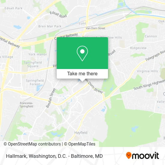
See Hallmark, Fairfax County, on the map
Public Transit to Hallmark in Fairfax County
Wondering how to get to Hallmark in Fairfax County? Moovit helps you find the best way to get to Hallmark with step-by-step directions from the nearest public transit station.
Moovit provides free maps and live directions to help you navigate through your city. View schedules, routes, timetables, and find out how long does it take to get to Hallmark in real time.
Looking for the nearest stop or station to Hallmark? Check out this list of stops closest to your destination: S Van Dorn St @ Kingstowne Blvd; Kingstowne Blvd @ Sir Viceroy Dr; Van Dorn Street Metro Station; Franconia-Springfield Vre Station.
Bus: 231, 232, 321, 322.Train: FREDERICKSBURG LINE.Metro: BLUE.
Want to see if there’s another route that gets you there at an earlier time? Moovit helps you find alternative routes or times. Get directions from and directions to Hallmark easily from the Moovit App or Website.
We make riding to Hallmark easy, which is why over 1.5 million users, including users in Fairfax County, trust Moovit as the best app for public transit. You don’t need to download an individual bus app or train app, Moovit is your all-in-one transit app that helps you find the best bus time or train time available.
For information on prices of bus, metro and train, costs and ride fares to Hallmark, please check the Moovit app.
Use the app to navigate to popular places including to the airport, hospital, stadium, grocery store, mall, coffee shop, school, college, and university.
Hallmark Address: 5840 Kingstowne Ctr Alexandria, VA 22315 street in Fairfax County
- Felix & Oscar,
- Amazon Locker-Pangaion,
- Hand & Stone Franchise,
- Claymore Home Services,
- Coinstar,
- STARBUCKS,
- First National Bank ATM,
- Libertyx Bitcoin ATM,
- Best Buy Windows,
- Black House Coffee,
- Novena Cards,
- Fres Construction,
- Cava,
- Uno Pizzeria & Grill,
- T & C Home Management,
- Five Below,
- Smashburger,
- PNC Mortgage,
- Crumbl - Kingstowne,
- TACO BELL
Places Near Hallmark (Fairfax County)
- Washington National Cathedral, Washington,
- Capital One Arena, Washington,
- Marriott Marquis Washington, DC, Washington,
- Camden Yards, Baltimore,
- Amazon Hq2, Arlington County,
- National Museum of African American History and Culture, Washington,
- Rock Creek Tennis Center, Washington,
- National Mall, Washington,
- Pennsylvania Ave NW (3rd st and pennsylvania), Washington,
- Sibley Memorial Hospital, Washington,
- Georgetown, Washington,
- M&T Bank Stadium, Baltimore,
- The Anthem, Washington,
- Basilica of the National Shrine, Washington,
- Westfield Montgomery Mall, Montgomery County,
- Warner Theatre, Washington,
- PG Mall, Prince George's County,
- National Zoo, Washington,
- Washington DC VA Medical Center, Washington,
- Museum Of The Bible, Washington
How to get to popular places in Washington, D.C. - Baltimore, MD with public transit
Get around Fairfax County by public transit!
Traveling around Fairfax County has never been so easy. See step by step directions as you travel to any attraction, street or major public transit station. View bus and train schedules, arrival times, service alerts and detailed routes on a map, so you know exactly how to get to anywhere in Fairfax County.
When traveling to any destination around Fairfax County use Moovit's Live Directions with Get Off Notifications to know exactly where and how far to walk, how long to wait for your line, and how many stops are left. Moovit will alert you when it's time to get off — no need to constantly re-check whether yours is the next stop.
Wondering how to use public transit in Fairfax County or how to pay for public transit in Fairfax County? Moovit public transit app can help you navigate your way with public transit easily, and at minimum cost. It includes public transit fees, ticket prices, and costs. Looking for a map of Fairfax County public transit lines? Moovit public transit app shows all public transit maps in Fairfax County with all Bus, Train, Metro, Light Rail and Ferry routes and stops on an interactive map.
Washington, D.C. - Baltimore, MD has 5 transit type(s), including: Bus, Train, Metro, Light Rail and Ferry, operated by several transit agencies, including WMATA, Montgomery County Ride On, Fairfax Connector, TheBus, PRTC, DASH - Alexandria, Arlington Transit (ART), RTA of Central Maryland, MDOT MTA, MDOT MTA Light RailLink, MDOT MTA Commuter Bus, MDOT MTA Local Bus, FXBGO!, Virginia Railway Express (VRE) and MARC