Hamburg U Alsterdorf stop - Sunday schedule
| Line | Direction | Time |
|---|---|---|
| 19 | Hamburg U Alsterdorf | 03:29 |
| 19 | Hamburg U Alsterdorf | 04:09 |
| 19 | Hamburg U Alsterdorf | 04:49 |
| 19 | Hamburg U Alsterdorf | 05:29 |
| 19 | Hamburg U Alsterdorf | 06:09 |
| 19 | Hamburg U Alsterdorf | 06:49 |
| 19 | Hamburg U Alsterdorf | 07:29 |
| 19 | Hamburg U Alsterdorf | 08:09 |
| 19 | Hamburg U Alsterdorf | 08:49 |
| 19 | Hamburg U Alsterdorf | 09:09 |
| 19 | Hamburg U Alsterdorf | 09:30 |
| 19 | Hamburg U Alsterdorf | 09:50 |
| 19 | Hamburg U Alsterdorf | 10:10 |
| 19 | Hamburg U Alsterdorf | 10:30 |
| 19 | Hamburg U Alsterdorf | 10:40 |
| 19 | Hamburg U Alsterdorf | 10:50 |
| 19 | Hamburg U Alsterdorf | 11:00 |
| 19 | Hamburg U Alsterdorf | 11:10 |
| 19 | Hamburg U Alsterdorf | 11:24 |
| 19 | Hamburg U Alsterdorf | 11:34 |
| 19 | Hamburg U Alsterdorf | 11:44 |
| 19 | Hamburg U Alsterdorf | 11:54 |
| 19 | Hamburg U Alsterdorf | 12:04 |
| 19 | Hamburg U Alsterdorf | 12:14 |
| 19 | Hamburg U Alsterdorf | 12:24 |
Directions to Hamburg U Alsterdorf (Hamburg-Nord) with public transportation
The following transit lines have routes that pass near Hamburg U Alsterdorf
How to get to Hamburg U Alsterdorf by bus?
Click on the bus route to see step by step directions with maps, line arrival times and updated time schedules.
How to get to Hamburg U Alsterdorf by train?
Click on the train route to see step by step directions with maps, line arrival times and updated time schedules.
How to get to Hamburg U Alsterdorf by subway?
Click on the subway route to see step by step directions with maps, line arrival times and updated time schedules.
Bus stops near Hamburg U Alsterdorf in Hamburg-Nord
- Hamburg U Alsterdorf, 1 min walk,
- U Alsterdorf, 1 min walk,
Subway stations near Hamburg U Alsterdorf in Hamburg-Nord
- Sengelmannstraße (City Nord), 6 min walk,
- Hamburg Sengelmannstraße (City Nord), 7 min walk,
Bus lines to Hamburg U Alsterdorf in Hamburg-Nord
- 19, Hamburg U Alsterdorf - Hamburg Hauptbahnhof/ZOB,
- 179, Hamburg U Borgweg - Hamburg S Poppenbüttel (Wentzelplatz),
- 606, Rathausmarkt - Hamburg U Langenhorn Markt,
- 19, Hauptbahnhof/Zob,
- 179, U Borgweg,
- 606, Rathausmarkt,
- 23, Hamburg U Billstedt,
- 28, Hamburg U Wandsbek Markt,
- 218, Hamburg U Fuhlsbüttel,
- 23, Straßburger Platz,
- 28, Lufthansa-Basis (Haupteingang),
- 218, Heukoppel,
What are the closest stations to Hamburg U Alsterdorf?
The closest stations to Hamburg U Alsterdorf are:
- Hamburg U Alsterdorf is 36 meters away, 1 min walk.
- U Alsterdorf is 40 meters away, 1 min walk.
- Sengelmannstraße (City Nord) is 460 meters away, 6 min walk.
- Hamburg Sengelmannstraße (City Nord) is 493 meters away, 7 min walk.
Which train line stops near Hamburg U Alsterdorf?
S1
Which subway line stops near Hamburg U Alsterdorf?
U1
Which bus lines stop near Hamburg U Alsterdorf?
These bus lines stop near Hamburg U Alsterdorf: 179, 19, 20, 218, 23.
What’s the nearest subway station to Hamburg U Alsterdorf in Hamburg-Nord?
The nearest subway station to Hamburg U Alsterdorf in Hamburg-Nord is Sengelmannstraße (City Nord). It’s a 6 min walk away.
What’s the nearest bus stop to Hamburg U Alsterdorf in Hamburg-Nord?
The nearest bus stops to Hamburg U Alsterdorf in Hamburg-Nord are Hamburg U Alsterdorf and U Alsterdorf. The closest one is a 1 min walk away.
What time is the first subway to Hamburg U Alsterdorf in Hamburg-Nord?
The U1 is the first subway that goes to Hamburg U Alsterdorf in Hamburg-Nord. It stops nearby at 3:07 AM.
What time is the last subway to Hamburg U Alsterdorf in Hamburg-Nord?
The U1 is the last subway that goes to Hamburg U Alsterdorf in Hamburg-Nord. It stops nearby at 1:14 AM.
What time is the first bus to Hamburg U Alsterdorf in Hamburg-Nord?
The 19 is the first bus that goes to Hamburg U Alsterdorf in Hamburg-Nord. It stops nearby at 3:18 AM.
What time is the last bus to Hamburg U Alsterdorf in Hamburg-Nord?
The 606 is the last bus that goes to Hamburg U Alsterdorf in Hamburg-Nord. It stops nearby at 2:31 AM.
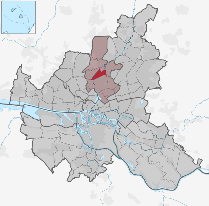
See Hamburg U Alsterdorf, Hamburg-Nord, on the map
Public transit to Hamburg U Alsterdorf stop in Hamburg-Nord
Looking for directions to Hamburg U Alsterdorf in Hamburg-Nord, Germany?
Download the Moovit App to find the current schedule and step-by-step directions for Bus, Subway, Train or S-Bahn routes that pass through Hamburg U Alsterdorf.
Looking for the nearest stops closest to Hamburg U Alsterdorf ? Check out this list of closest stops to your destination: Hamburg U Alsterdorf; U Alsterdorf; Sengelmannstraße (City Nord); Hamburg Sengelmannstraße (City Nord).
Train: S1.Subway: U1.Bus: 179, 19, 20, 218, 23, 606, 606, 28, 28.
We make riding on public transit to Hamburg U Alsterdorf easy, which is why over 1.5 million users, including users in Hamburg-Nord trust Moovit as the best app for public transit.
Use the app to navigate to popular places including to the airport, hospital, stadium, grocery store, mall, coffee shop, school, college, and university.
The first line to this stop is 19, at 03:29, and the last line is 19 at 00:49.
Heubergredder 41, Hamburg, Germany
This stop serves Hochbahn Bus’s lines
Subway stations near Hamburg U Alsterdorf
Popular public transit stations in Hamburg-Nord
Get around Hamburg & Schleswig-Holstein by public transit!
Traveling around Hamburg & Schleswig-Holstein has never been so easy. See step by step directions as you travel to any attraction, street or major public transit station. View bus and train schedules, arrival times, service alerts and detailed routes on a map, so you know exactly how to get to anywhere in Hamburg & Schleswig-Holstein.
When traveling to any destination around Hamburg & Schleswig-Holstein use Moovit's Live Directions with Get Off Notifications to know exactly where and how far to walk, how long to wait for your line, and how many stops are left. Moovit will alert you when it's time to get off — no need to constantly re-check whether yours is the next stop.
Wondering how to use public transit in Hamburg & Schleswig-Holstein or how to pay for public transit in Hamburg & Schleswig-Holstein? Moovit public transit app can help you navigate your way with public transit easily, and at minimum cost. It includes public transit fees, ticket prices, and costs. Looking for a map of Hamburg & Schleswig-Holstein public transit lines? Moovit public transit app shows all public transit maps in Hamburg & Schleswig-Holstein with all Bus, Train, Subway, Light Rail, Ferry and S-Bahn routes and stops on an interactive map.
Hamburg & Schleswig-Holstein has 6 transit type(s), including: Bus, Train, Subway, Light Rail, Ferry and S-Bahn, operated by several transit agencies, including Hamburger Verkehrsverbund (hvv), Hamburger Hochbahn AG, Deutsche Bahn AG, Verkehrsbetriebe Schleswig-Flensburg GmbH, Metronom, SchnellBusse, cantus Verkehrsgesellschaft, Nahreisezug, Nordbahn Eisenbahngesellschaft, CeBus GmbH & Co. KG, Schlepp- und Fährgesellschaft Kiel mbh (SFK), NordWestBahn, AKN, erixx, Sylter Verkehrsgesellschaft