How to get to Hammerschmidt Recycling by bus?
Click on the bus route to see step by step directions with maps, line arrival times and updated time schedules.
From Scharnhausen, Ostfildern
60 minFrom Haltestelle Bad Cannstatt Wilhelmsplatz, Bad Cannstatt
58 minFrom Pflanzen-Kölle, Fellbach
54 minFrom Mettingen Eros-Center Puff Laufhaus, Esslingen Am Neckar
101 minFrom Koelle, Fellbach
55 minFrom Sonnenberg sunflower field, Vaihingen
48 minFrom Porsche, Zuffenhausen
95 minFrom Gospel Forum, Feuerbach
56 minFrom Kappelberg, Fellbach
141 minFrom Schwabenlandhalle (Schwabenlandhalle Fellbach), Fellbach
62 min
How to get to Hammerschmidt Recycling by train?
Click on the train route to see step by step directions with maps, line arrival times and updated time schedules.
How to get to Hammerschmidt Recycling by subway?
Click on the subway route to see step by step directions with maps, line arrival times and updated time schedules.
From Scharnhausen, Ostfildern
62 minFrom Haltestelle Bad Cannstatt Wilhelmsplatz, Bad Cannstatt
28 minFrom Pflanzen-Kölle, Fellbach
41 minFrom Mettingen Eros-Center Puff Laufhaus, Esslingen Am Neckar
61 minFrom Koelle, Fellbach
39 minFrom Porsche, Zuffenhausen
50 minFrom Gospel Forum, Feuerbach
34 minFrom Kappelberg, Fellbach
61 minFrom Schwabenlandhalle (Schwabenlandhalle Fellbach), Fellbach
43 min
Subway station near Hammerschmidt Recycling in Stuttgart-Süd
- Bihlplatz, 5 min walk,VIEW
Light Rail stations near Hammerschmidt Recycling in Stuttgart-Süd
- Bihlplatz, 5 min walk,VIEW
Bus stops near Hammerschmidt Recycling in Stuttgart-Süd
Bus lines to Hammerschmidt Recycling in Stuttgart-Süd
What are the closest stations to Hammerschmidt Recycling?
The closest stations to Hammerschmidt Recycling are:
- Bihlplatz is 324 meters away, 5 min walk.
- Dornhaldenstraße is 372 meters away, 5 min walk.
- Erwin-Schoettle-Platz is 411 meters away, 6 min walk.
- Ulmenstraße is 947 meters away, 13 min walk.
Which train line stops near Hammerschmidt Recycling?
S3 (Stuttgart-Vaihingen)
Which subway lines stop near Hammerschmidt Recycling?
These subway lines stop near Hammerschmidt Recycling: U1, U14.
Which bus lines stop near Hammerschmidt Recycling?
These bus lines stop near Hammerschmidt Recycling: 41, 42, 43, 73, 74, 92, N1.
What’s the nearest light rail station to Hammerschmidt Recycling in Stuttgart-Süd?
The nearest light rail station to Hammerschmidt Recycling in Stuttgart-Süd is Bihlplatz. It’s a 5 min walk away.
What’s the nearest subway station to Hammerschmidt Recycling in Stuttgart-Süd?
The nearest subway station to Hammerschmidt Recycling in Stuttgart-Süd is Bihlplatz. It’s a 5 min walk away.
What’s the nearest bus station to Hammerschmidt Recycling in Stuttgart-Süd?
The nearest bus station to Hammerschmidt Recycling in Stuttgart-Süd is Dornhaldenstraße. It’s a 5 min walk away.
What time is the first light rail to Hammerschmidt Recycling in Stuttgart-Süd?
The U1 is the first light rail that goes to Hammerschmidt Recycling in Stuttgart-Süd. It stops nearby at 4:11 AM.
What time is the last light rail to Hammerschmidt Recycling in Stuttgart-Süd?
The U1 is the last light rail that goes to Hammerschmidt Recycling in Stuttgart-Süd. It stops nearby at 12:53 AM.
What time is the first subway to Hammerschmidt Recycling in Stuttgart-Süd?
The U1 is the first subway that goes to Hammerschmidt Recycling in Stuttgart-Süd. It stops nearby at 4:11 AM.
What time is the last subway to Hammerschmidt Recycling in Stuttgart-Süd?
The U1 is the last subway that goes to Hammerschmidt Recycling in Stuttgart-Süd. It stops nearby at 12:53 AM.
What time is the first bus to Hammerschmidt Recycling in Stuttgart-Süd?
The N1 is the first bus that goes to Hammerschmidt Recycling in Stuttgart-Süd. It stops nearby at 3:18 AM.
What time is the last bus to Hammerschmidt Recycling in Stuttgart-Süd?
The N10 is the last bus that goes to Hammerschmidt Recycling in Stuttgart-Süd. It stops nearby at 2:50 AM.
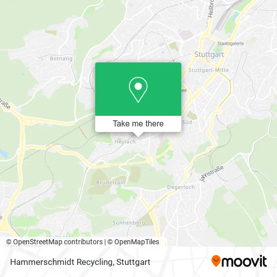
See Hammerschmidt Recycling, Stuttgart-Süd, on the map
Public Transit to Hammerschmidt Recycling in Stuttgart-Süd
Wondering how to get to Hammerschmidt Recycling in Stuttgart-Süd? Moovit helps you find the best way to get to Hammerschmidt Recycling with step-by-step directions from the nearest public transit station.
Moovit provides free maps and live directions to help you navigate through your city. View schedules, routes, timetables, and find out how long does it take to get to Hammerschmidt Recycling in real time.
Looking for the nearest stop or station to Hammerschmidt Recycling? Check out this list of stops closest to your destination: Bihlplatz; Dornhaldenstraße; Erwin-Schoettle-Platz; Ulmenstraße.
Train: S3.Subway: U1, U14.Bus: 41, 42, 43, 73, 74, 92, N1, N10, N10.
Want to see if there’s another route that gets you there at an earlier time? Moovit helps you find alternative routes or times. Get directions from and directions to Hammerschmidt Recycling easily from the Moovit App or Website.
We make riding to Hammerschmidt Recycling easy, which is why over 1.5 million users, including users in Stuttgart-Süd, trust Moovit as the best app for public transit. You don’t need to download an individual bus app or train app, Moovit is your all-in-one transit app that helps you find the best bus time or train time available.
For information on prices of subway, bus, train, light rail and S-Bahn, costs and ride fares to Hammerschmidt Recycling, please check the Moovit app.
Use the app to navigate to popular places including to the airport, hospital, stadium, grocery store, mall, coffee shop, school, college, and university.
Hammerschmidt Recycling Address: Möhringer Straße 87 Süd, 70199 Stuttgart street in Stuttgart-Süd
- Gesellschaft für Mobile Jugendarbeit Stuttgart-Süd,
- Storychangers,
- Kindergarten Matthäus,
- Ev. Matthäuskindergarten,
- Esdem Uluslararasi Insaat Sirketi Zweigniederlassung Deutschland,
- Chris Kreymborg Hochzeitsfotograf,
- Henkel Beiz und Elektro Poliertechnik GmbH & Co,
- Heslacher Bürgerstüble,
- Pönig-Mechanik Dieter Pönig,
- Pizza la Mamma,
- Milberg Studios,
- Hebammenpraxis Jeannine Irmscher,
- Orthodoxe Kirche Stuttgart,
- Srpska Pravoslavna Crkva Stuttgart,
- Der,
- Versicherungsdienst Keller,
- Architektur Krumpe,
- Konzept SZ,
- Serbische Orthodoxe Kirche,
- Portia Capital
Places Near Hammerschmidt Recycling (Stuttgart-Süd)
- Gasometer Pforzheim, Pforzheim,
- Klinikum Stuttgart - Katharinenhospital, Stuttgart-Mitte,
- FlixBus Haltestelle, Stuttgart,
- Mercedes-Benz Museum (Mercedes Museum Stuttgart), Bad Cannstatt,
- Pariser Platz Stuttgart, Stuttgart-Mitte,
- Porsche Museum, Zuffenhausen,
- Im Wizemann (Halle), Bad Cannstatt,
- Hanns-Martin-Schleyer-Halle (Stuttgart Hans-Martin-Schleyerhalle), Bad Cannstatt,
- Mercedes-Benz Museum, Bad Cannstatt,
- Marmorsaal Im Weissenburgpark, Stuttgart-Süd,
- Hanns-Martin-Schleyer-Halle, Bad Cannstatt,
- Wilhelma (U-Bahn Wilhelma), Bad Cannstatt,
- Hauptbahnhof Stuttgart, Stuttgart-Mitte,
- Gleis 101/102 (tief), Stuttgart-Mitte,
- SI-Centrum, Möhringen,
- Porsche-Arena, Bad Cannstatt,
- Geilhaus Haus 33a, Reutlingen-Betzingen,
- Waldfriedhof, Degerloch,
- Mettingen Eros-Center Puff Laufhaus, Esslingen Am Neckar,
- Schleyerhalle, Bad Cannstatt
How to get to popular places in Stuttgart with public transit
Get around Stuttgart-Süd by public transit!
Traveling around Stuttgart-Süd has never been so easy. See step by step directions as you travel to any attraction, street or major public transit station. View bus and train schedules, arrival times, service alerts and detailed routes on a map, so you know exactly how to get to anywhere in Stuttgart-Süd.
When traveling to any destination around Stuttgart-Süd use Moovit's Live Directions with Get Off Notifications to know exactly where and how far to walk, how long to wait for your line, and how many stops are left. Moovit will alert you when it's time to get off — no need to constantly re-check whether yours is the next stop.
Wondering how to use public transit in Stuttgart-Süd or how to pay for public transit in Stuttgart-Süd? Moovit public transit app can help you navigate your way with public transit easily, and at minimum cost. It includes public transit fees, ticket prices, and costs. Looking for a map of Stuttgart-Süd public transit lines? Moovit public transit app shows all public transit maps in Stuttgart-Süd with all Bus, Train, Subway, Light Rail, Ferry, S-Bahn and Funicular routes and stops on an interactive map.
Stuttgart has 7 transit type(s), including: Bus, Train, Subway, Light Rail, Ferry, S-Bahn and Funicular, operated by several transit agencies, including SSB - Stadtbahn, SSB, SSB - Seilbahn / Zacke, S-Bahn Stuttgart, Rhein-Neckar-Verkehr GmbH (rnv), Karlsruher Verkehrsverbund, DB AG, DB Regiobus BW, Arverio Baden-Württemberg GmbH, DB RegioNetz Verkehrs GmbH Westfrankenbahn, DB Regio AG Baden-Württemberg, Südwestdeutsche Verkehrs-AG, DB Regio AG Mitte Region Hessen, DB and Bodensee-Oberschwaben-Bahn