Directions to Hanck (Xaxim) with public transportation
The following transit lines have routes that pass near Hanck
How to get to Hanck by bus?
Click on the bus route to see step by step directions with maps, line arrival times and updated time schedules.
From Avenida Victor Ferreira do Amaral, Tarumã
66 minFrom Estrada Delegado Bruno de Almeida, Campo De Santana
46 minFrom Capão Da Imbuia, Capão Da Imbúia
69 minFrom Hospital Vita Batel, Batel
55 minFrom Tarumã, Tarumã
77 minFrom Praça Nossa Senhora de Salette, Centro Cívico
64 minFrom Estação Tubo Constantino Marochi, Alto Da Glória
59 minFrom Hospital Ônix, Seminário
56 minFrom Rua Vereador Angelo Burbello, Umbará
51 minFrom Rua Candido De Abreu, Centro Cívico
59 min
Bus stops near Hanck in Xaxim
Bus lines to Hanck in Xaxim
- 525 HAUER / CAPÃO RASO, Terminal Capão Raso → Terminal Hauer,VIEW
- 689 MAD. SÃO PEDRO / RIO NEGRO, Praça Rui Barbosa ↺ São Pedro / Rio Negro (Circular),VIEW
- 030 INTERBAIRROS III, Terminal Santa Cândida → Terminal Capão Raso,VIEW
- 625 GRAMADOS, Terminal Capão Raso → Terminal Sítio Cercado,VIEW
- 526 ITAMARATI / VILA SÃO PEDRO, Terminal Hauer → Terminal Capão Raso ,VIEW
- 665 VILA REX, Vila Rex → Praça Rui Barbosa,VIEW
What are the closest stations to Hanck?
The closest stations to Hanck are:
- Rua Leôncio Derosso 924 is 357 meters away, 5 min walk.
- R. Omar Raymundo Picheth, 288 is 562 meters away, 8 min walk.
- R. Hermenegildo Bonat, 323 is 703 meters away, 10 min walk.
Which bus lines stop near Hanck?
These bus lines stop near Hanck: 030 INTERBAIRROS III, 350 ATUBA / PINHEIRINHO, 525 HAUER / CAPÃO RASO, 550 LIGEIRÃO PINHEIRINHO / CARLOS GOMES, 625 GRAMADOS.
What’s the nearest bus station to Hanck in Xaxim?
The nearest bus station to Hanck in Xaxim is Rua Leôncio Derosso 924. It’s a 5 min walk away.
What time is the first bus to Hanck in Xaxim?
The 689 MAD. SÃO PEDRO / RIO NEGRO is the first bus that goes to Hanck in Xaxim. It stops nearby at 3:18 AM.
What time is the last bus to Hanck in Xaxim?
The 689 MAD. SÃO PEDRO / RIO NEGRO is the last bus that goes to Hanck in Xaxim. It stops nearby at 3:19 AM.
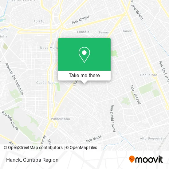
See Hanck, Xaxim, on the map
Public Transit to Hanck in Xaxim
Wondering how to get to Hanck in Xaxim? Moovit helps you find the best way to get to Hanck with step-by-step directions from the nearest public transit station.
Moovit provides free maps and live directions to help you navigate through your city. View schedules, routes, timetables, and find out how long does it take to get to Hanck in real time.
Looking for the nearest stop or station to Hanck? Check out this list of stops closest to your destination: Rua Leôncio Derosso 924; R. Omar Raymundo Picheth; R. Hermenegildo Bonat.
Bus: 030 INTERBAIRROS III, 350 ATUBA / PINHEIRINHO, 525 HAUER / CAPÃO RASO, 550 LIGEIRÃO PINHEIRINHO / CARLOS GOMES, 625 GRAMADOS, 689 MAD. SÃO PEDRO / RIO NEGRO, 526 ITAMARATI / VILA SÃO PEDRO, 665 VILA REX.
Want to see if there’s another route that gets you there at an earlier time? Moovit helps you find alternative routes or times. Get directions from and directions to Hanck easily from the Moovit App or Website.
We make riding to Hanck easy, which is why over 1.5 million users, including users in Xaxim, trust Moovit as the best app for public transit. You don’t need to download an individual bus app or train app, Moovit is your all-in-one transit app that helps you find the best bus time or train time available.
For information on prices of bus, costs and ride fares to Hanck, please check the Moovit app.
Use the app to navigate to popular places including to the airport, hospital, stadium, grocery store, mall, coffee shop, school, college, and university.
Hanck Address: Rua Des. João Antônio de Barros Júnior, Xaxim Curitiba-PR 81810-300 street in Xaxim
- Evidence Gestao de Condominios,
- Igreja Pentecostal Unida do Brasil Distrito do Parana,
- L B Construcoes,
- Universidade das Unhas and Unibrocas,
- Gota de Orvalho,
- Transportes Mariane,
- Sg Automacao e Seguranca,
- Fabiano Manutencao,
- Rua João Nicoletti Daros,
- Motoboy Entregas and Coletas Cowboy,
- R.J. Pecas Para a Veiculos,
- A and a Transportes,
- Luis Carlos,
- Ewerson Luiz Lima Bientinesi,
- Linhas Esportivas Venenosa,
- Carol Presentes,
- Agm Transportes,
- Medicao Solucoes Metrologicas Integradas,
- Residencial Novo Milenio,
- Jrd Construcao
Places Near Hanck (Xaxim)
- Hospital Nossa Senhora Das Graças, Mercês,
- Pontifícia Universidade Católica do Paraná (PUCPR), Prado Velho,
- Rua General Mário Tourinho, Campina Do Siqueira,
- Hospital Universitário Evangélico de Curitiba, Bigorrilho,
- Rua Martim Afonso 558, Mercês,
- Hospital Angelina Caron, Campina Grande Do Sul,
- Park Shopping Barigüi, Mossunguê,
- Shopping Palladium, Portão,
- Jardim Botânico de Curitiba PR, Centro,
- Hospital Da Cruz Vermelha, Batel,
- Hhhhh, Fazendinha,
- Hospital Do Senhor - Madre Virgínia, São José Dos Pinhais,
- Shopping Estação, Rebouças,
- Hospital do Rocio, Campo,
- Parque Barigui, Mercês,
- Jockey Plaza Shopping Center, Tarumã,
- Arena Da Baixada - Curitiba,
- Hospital Madalena Sofia, Bairro Alto,
- Hospital Erasto Gaertner, Jardim Das Américas,
- Hospital de Clínicas (HC - UFPR), Centro
How to get to popular places in Curitiba Region with public transit
Get around Xaxim by public transit!
Traveling around Xaxim has never been so easy. See step by step directions as you travel to any attraction, street or major public transit station. View bus and train schedules, arrival times, service alerts and detailed routes on a map, so you know exactly how to get to anywhere in Xaxim.
When traveling to any destination around Xaxim use Moovit's Live Directions with Get Off Notifications to know exactly where and how far to walk, how long to wait for your line, and how many stops are left. Moovit will alert you when it's time to get off — no need to constantly re-check whether yours is the next stop.
Wondering how to use public transit in Xaxim or how to pay for public transit in Xaxim? Moovit public transit app can help you navigate your way with public transit easily, and at minimum cost. It includes public transit fees, ticket prices, and costs. Looking for a map of Xaxim public transit lines? Moovit public transit app shows all public transit maps in Xaxim with all Bus and Cable Car routes and stops on an interactive map.
Curitiba Region has 2 transit type(s), including: Bus and Cable Car, operated by several transit agencies, including Sistema Integrado de Mobilidade (URBS), Sistema Integrado de Mobilidade (AMEP), URBS (Cartões bancários e Dinheiro), URBS (Cartões bancários / Cartão URBS), AMEP (Cartões bancários / Cartão MetroCard), AMEP (Cartões bancários / Cartão MetroCard / Dinheiro), Viação Colombo (Dinheiro), TRIAR (Cartão TRIAR / Dinheiro), Empresa Curitiba Cerro Azul (Dinheiro), Expresso Nossa Senhora da Penha (Dinheiro), Empresa Campo Alto Tijucas (Dinheiro), Auto Viação São José (Cartão VEM / Dinheiro), BRT S/A (Cartão VEM / Dinheiro), TransPiedade (Cartão Cidadão / Dinheiro) and Oceânica Sul (Cartão Transporte / Dinheiro)