How to get to Handy Tech by bus?
Click on the bus route to see step by step directions with maps, line arrival times and updated time schedules.
From Beatparade, Verwaltungsgemeinschaft Horb am Neckar
42 minFrom Hotel Palmenwald, Vereinbarte Verwaltungsgemeinschaft Freudenstadt
102 minFrom Berghütte Lauterbad, Vereinbarte Verwaltungsgemeinschaft Freudenstadt
110 minFrom Krankenhaus Herrenberg, Herrenberg (Stadt)
134 minFrom Fachklinik Sonnenhof Waldachtal, Verwaltungsverband Dornstetten
57 minFrom Panorama-Bad Freudenstadt, Vereinbarte Verwaltungsgemeinschaft Freudenstadt
92 minFrom Klinik Hohenfreudenstadt, Vereinbarte Verwaltungsgemeinschaft Freudenstadt
85 minFrom Lützenhardt, Verwaltungsverband Dornstetten
51 minFrom Krankenhaus Freudenstadt, Vereinbarte Verwaltungsgemeinschaft Freudenstadt
84 minFrom Waldfriedhof, Herrenberg (Stadt)
150 min
How to get to Handy Tech by train?
Click on the train route to see step by step directions with maps, line arrival times and updated time schedules.
From Hotel Palmenwald, Vereinbarte Verwaltungsgemeinschaft Freudenstadt
94 minFrom Krankenhaus Herrenberg, Herrenberg (Stadt)
72 minFrom Panorama-Bad Freudenstadt, Vereinbarte Verwaltungsgemeinschaft Freudenstadt
159 minFrom Klinik Hohenfreudenstadt, Vereinbarte Verwaltungsgemeinschaft Freudenstadt
172 minFrom Krankenhaus Freudenstadt, Vereinbarte Verwaltungsgemeinschaft Freudenstadt
165 min
Bus stops near Handy Tech in Verwaltungsgemeinschaft Horb am Neckar
Train stations near Handy Tech in Verwaltungsgemeinschaft Horb am Neckar
Bus lines to Handy Tech in Verwaltungsgemeinschaft Horb am Neckar
What are the closest stations to Handy Tech?
The closest stations to Handy Tech are:
- Nordstetten Schule Bstg 1 is 524 meters away, 7 min walk.
- Nordstetten Rathaus Bstg 2 is 878 meters away, 12 min walk.
- Nordstetten Rathaus Bstg 1 is 878 meters away, 12 min walk.
- Horb (N) is 1617 meters away, 21 min walk.
- Horb Bahnhof/Zob is 1617 meters away, 22 min walk.
- Mühlen Bahnhof is 3642 meters away, 47 min walk.
Which train lines stop near Handy Tech?
These train lines stop near Handy Tech: RB 74, RB74, RE 87, RE14A.
Which bus lines stop near Handy Tech?
These bus lines stop near Handy Tech: 310, 41, 7402, 7405.
What’s the nearest train station to Handy Tech in Verwaltungsgemeinschaft Horb am Neckar?
The nearest train station to Handy Tech in Verwaltungsgemeinschaft Horb am Neckar is Horb (N). It’s a 21 min walk away.
What’s the nearest bus station to Handy Tech in Verwaltungsgemeinschaft Horb am Neckar?
The nearest bus station to Handy Tech in Verwaltungsgemeinschaft Horb am Neckar is Nordstetten Schule Bstg 1. It’s a 7 min walk away.
What time is the first train to Handy Tech in Verwaltungsgemeinschaft Horb am Neckar?
The RB74 is the first train that goes to Handy Tech in Verwaltungsgemeinschaft Horb am Neckar. It stops nearby at 4:52 AM.
What time is the last train to Handy Tech in Verwaltungsgemeinschaft Horb am Neckar?
The RE14 is the last train that goes to Handy Tech in Verwaltungsgemeinschaft Horb am Neckar. It stops nearby at 1:01 AM.
What time is the first bus to Handy Tech in Verwaltungsgemeinschaft Horb am Neckar?
The 310 is the first bus that goes to Handy Tech in Verwaltungsgemeinschaft Horb am Neckar. It stops nearby at 5:49 AM.
What time is the last bus to Handy Tech in Verwaltungsgemeinschaft Horb am Neckar?
The 7402 is the last bus that goes to Handy Tech in Verwaltungsgemeinschaft Horb am Neckar. It stops nearby at 8:54 PM.
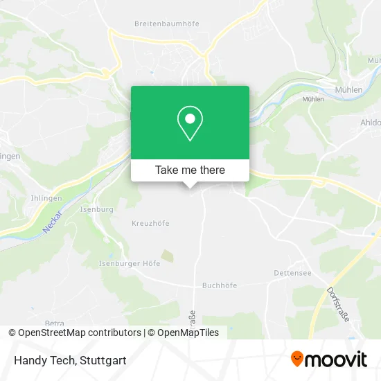
See Handy Tech, Verwaltungsgemeinschaft Horb am Neckar, on the map
Public Transit to Handy Tech in Verwaltungsgemeinschaft Horb am Neckar
Wondering how to get to Handy Tech in Verwaltungsgemeinschaft Horb am Neckar? Moovit helps you find the best way to get to Handy Tech with step-by-step directions from the nearest public transit station.
Moovit provides free maps and live directions to help you navigate through your city. View schedules, routes, timetables, and find out how long does it take to get to Handy Tech in real time.
Looking for the nearest stop or station to Handy Tech? Check out this list of stops closest to your destination: Nordstetten Schule Bstg 1; Nordstetten Rathaus Bstg 2; Nordstetten Rathaus Bstg 1; Horb (N); Horb Bahnhof/Zob; Mühlen Bahnhof.
Train: RB 74, RB74, RE 87, RE14A, SVG, RE4, RE14, RE4, RE4, RE6, RB 6, 7417.Bus: 310, 41, 7402, 7405, 7408, F 20, 7626A.
Want to see if there’s another route that gets you there at an earlier time? Moovit helps you find alternative routes or times. Get directions from and directions to Handy Tech easily from the Moovit App or Website.
We make riding to Handy Tech easy, which is why over 1.5 million users, including users in Verwaltungsgemeinschaft Horb am Neckar, trust Moovit as the best app for public transit. You don’t need to download an individual bus app or train app, Moovit is your all-in-one transit app that helps you find the best bus time or train time available.
For information on prices of bus and train, costs and ride fares to Handy Tech, please check the Moovit app.
Use the app to navigate to popular places including to the airport, hospital, stadium, grocery store, mall, coffee shop, school, college, and university.
Handy Tech Address: Brunnenstraße 10 Nordstetten, 72160 Horb am Neckar street in Verwaltungsgemeinschaft Horb am Neckar
- Efu,
- Hilfeshop,
- Htrius,
- Wgv Versicherungen Werner Bock,
- Damian Konietzny,
- Schwarzwald Anker,
- Asc Küchenmontagen,
- Pfeffer Präzision,
- Tuch Gartengestaltung & Pflege Garten- und Landschaftsgestaltung,
- Reinhold Buchta,
- Dein Trostpflaster,
- Blackpower,
- Bps,
- Zg Raiffeisen,
- Stg-Sitzler,
- Piercing,
- Neckar River Bbq,
- M. Rempp,
- Runest,
- Revolten Stube
Places Near Handy Tech (Verwaltungsgemeinschaft Horb am Neckar)
- Hanns-Martin-Schleyer-Halle (Stuttgart Hans-Martin-Schleyerhalle), Bad Cannstatt,
- Gleis 101/102 (tief), Stuttgart-Mitte,
- Klinikum Stuttgart - Katharinenhospital, Stuttgart-Mitte,
- Hanns-Martin-Schleyer-Halle, Bad Cannstatt,
- Gasometer Pforzheim, Pforzheim,
- FlixBus Haltestelle, Stuttgart,
- Im Wizemann (Halle), Bad Cannstatt,
- Porsche-Arena, Bad Cannstatt,
- Marmorsaal Im Weissenburgpark, Stuttgart-Süd,
- Hauptbahnhof Stuttgart, Stuttgart-Mitte,
- Mercedes-Benz Museum (Mercedes Museum Stuttgart), Bad Cannstatt,
- Porsche Museum, Zuffenhausen,
- Mettingen Eros-Center Puff Laufhaus, Esslingen Am Neckar,
- Geilhaus Haus 33a, Reutlingen-Betzingen,
- Wilhelma (U-Bahn Wilhelma), Bad Cannstatt,
- SI-Centrum, Möhringen,
- Schleyerhalle, Bad Cannstatt,
- Mercedes-Benz Museum, Bad Cannstatt,
- Waldfriedhof, Degerloch,
- Pariser Platz Stuttgart, Stuttgart-Mitte
How to get to popular places in Stuttgart with public transit
Get around Verwaltungsgemeinschaft Horb am Neckar by public transit!
Traveling around Verwaltungsgemeinschaft Horb am Neckar has never been so easy. See step by step directions as you travel to any attraction, street or major public transit station. View bus and train schedules, arrival times, service alerts and detailed routes on a map, so you know exactly how to get to anywhere in Verwaltungsgemeinschaft Horb am Neckar.
When traveling to any destination around Verwaltungsgemeinschaft Horb am Neckar use Moovit's Live Directions with Get Off Notifications to know exactly where and how far to walk, how long to wait for your line, and how many stops are left. Moovit will alert you when it's time to get off — no need to constantly re-check whether yours is the next stop.
Wondering how to use public transit in Verwaltungsgemeinschaft Horb am Neckar or how to pay for public transit in Verwaltungsgemeinschaft Horb am Neckar? Moovit public transit app can help you navigate your way with public transit easily, and at minimum cost. It includes public transit fees, ticket prices, and costs. Looking for a map of Verwaltungsgemeinschaft Horb am Neckar public transit lines? Moovit public transit app shows all public transit maps in Verwaltungsgemeinschaft Horb am Neckar with all Bus, Train, Subway, Light Rail, Ferry, S-Bahn and Funicular routes and stops on an interactive map.
Stuttgart has 7 transit type(s), including: Bus, Train, Subway, Light Rail, Ferry, S-Bahn and Funicular, operated by several transit agencies, including SSB - Stadtbahn, SSB, SSB - Seilbahn / Zacke, S-Bahn Stuttgart, Rhein-Neckar-Verkehr GmbH (rnv), Karlsruher Verkehrsverbund, DB AG, DB Regiobus BW, Arverio Baden-Württemberg GmbH, DB RegioNetz Verkehrs GmbH Westfrankenbahn, DB Regio AG Baden-Württemberg, Südwestdeutsche Verkehrs-AG, DB Regio AG Mitte Region Hessen, DB and Bodensee-Oberschwaben-Bahn