How to get to Hanedan Cafe - Pendik by bus?
Click on the bus route to see step by step directions with maps, line arrival times and updated time schedules.
From Maltepe Vapur İskelesi
67 minFrom Sultanbeyli Yollarında
93 minFrom Atlas Park Alışveriş Merkezi
123 minFrom Piazza Avm
56 minFrom Maltepe Devlet Hastanesi
57 minFrom Sancaktepe Ağız ve Diş Sağlığı Merkezi
58 minFrom Orhanlı Mahallesi
95 minFrom Dr. Lütfi Kırdar Durağı
54 minFrom Sancaktepe ORMAN Parkı
57 min
How to get to Hanedan Cafe - Pendik by train?
Click on the train route to see step by step directions with maps, line arrival times and updated time schedules.
How to get to Hanedan Cafe - Pendik by metro?
Click on the metro route to see step by step directions with maps, line arrival times and updated time schedules.
Dolmus & Minibus stations near Hanedan Cafe - Pendik
Bus stops near Hanedan Cafe - Pendik
Bus lines to Hanedan Cafe - Pendik
- C72, Pendik - Tuzla,VIEW
- C109, Pendik - Şifa Mahallesi,VIEW
- KM10, Aydınlı Toki / İçmeler - Pendik Metro/Yht - Kartal,VIEW
- KM11, Aydınlı Toki / A.Yesevi - Pendik Köprüsü,VIEW
- KM12, Tuzla Deniz Harp Okulu - Kartal Metro,VIEW
- KM13, Tuzla - Pendik Metro/ Yht / Pendik,VIEW
- KM24, Kavakpınar - Pendik Metro/Yht/Pendik,VIEW
- KM29, Yenişehir/Marmara Ü. Hast. - Kartal Metro/Cevizli,VIEW
- 130A, Deniz Harp Okulu - Kadıköy,VIEW
- 130E, Tuzla / Evora Konutları - Kartal Metro / Cevizli,VIEW
- 130Ş, Şifa Mahallesi - Kadıköy,VIEW
- 132T, Tepeören - Kartal Metro,VIEW
- 132Y, Hilal Konutları / Yayalar - Kartal Metro,VIEW
- 133T, Deniz Harp Okulu-Maltepe Peronlar,VIEW
- 500T, Tuzla Şifa Mahallesi - 4. Levent Metro,VIEW
- KM14, Cemil Meriç İlkokulu-Sultanbeyli Peronlar,VIEW
- MR60, Pendik-Sabiha Gökçen Havalimanı,VIEW
- 132F, Kartal-Pendik Mesleki Ve Teknik Anadolu Lisesi,VIEW
- C83, Pendik - Yakacık,VIEW
- C88, Pendik - Kiptaş,VIEW
What are the closest stations to Hanedan Cafe - Pendik?
The closest stations to Hanedan Cafe - Pendik are:
- Ahmet Kutsi Tecer İlkokulu - Gözdağı Yönü is 246 meters away, 4 min walk.
- Kartopu Sokak - Kadıköy Yönü is 339 meters away, 5 min walk.
- Mehmet Ali Tunga Cami - Kadıköy Yönü is 342 meters away, 5 min walk.
- Mehmet Ali Tunga Camii - Tuzla Yönü is 422 meters away, 6 min walk.
- Pendik Köprüsü - Ankara Cd Yönü is 538 meters away, 8 min walk.
- Pendik Köprüsü - Kadıköy (E-5) Yönü is 634 meters away, 9 min walk.
Which bus lines stop near Hanedan Cafe - Pendik?
These bus lines stop near Hanedan Cafe - Pendik: 133GP, 200, 251, 500T, KM11, KM12, KM23, KM26.
Which metro line stops near Hanedan Cafe - Pendik?
M4 (Kadıköy→Sabiha Gökçen Havalimanı)
Which train line stops near Hanedan Cafe - Pendik?
B1 (Gebze)
Which Dolmus & Minibus lines stop near Hanedan Cafe - Pendik?
These Dolmus & Minibus lines stop near Hanedan Cafe - Pendik: C109, C72.
What’s the nearest bus station to Hanedan Cafe - Pendik?
The nearest bus station to Hanedan Cafe - Pendik is Mehmet Ali Tunga Cami - Kadıköy Yönü. It’s a 5 min walk away.
What’s the nearest Dolmus & Minibus station to Hanedan Cafe - Pendik?
The nearest Dolmus & Minibus station to Hanedan Cafe - Pendik is Ahmet Kutsi Tecer İlkokulu - Gözdağı Yönü. It’s a 4 min walk away.
What time is the first bus to Hanedan Cafe - Pendik?
The E-10 is the first bus that goes to Hanedan Cafe - Pendik. It stops nearby at 3:09 AM.
What time is the last bus to Hanedan Cafe - Pendik?
The E-10 is the last bus that goes to Hanedan Cafe - Pendik. It stops nearby at 4:02 AM.
What time is the first Dolmus & Minibus to Hanedan Cafe - Pendik?
The C319 is the first Dolmus & Minibus that goes to Hanedan Cafe - Pendik. It stops nearby at 5:53 AM.
What time is the last Dolmus & Minibus to Hanedan Cafe - Pendik?
The C319 is the last Dolmus & Minibus that goes to Hanedan Cafe - Pendik. It stops nearby at 1:43 AM.
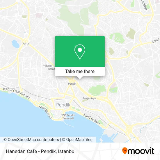
See Hanedan Cafe - Pendik on the map
Public Transportation to Hanedan Cafe - Pendik
Wondering how to get to Hanedan Cafe - Pendik? Moovit helps you find the best way to get to Hanedan Cafe - Pendik with step-by-step directions from the nearest public transit station.
Moovit provides free maps and live directions to help you navigate through your city. View schedules, routes, timetables, and find out how long does it take to get to Hanedan Cafe - Pendik in real time.
Looking for the nearest stop or station to Hanedan Cafe - Pendik? Check out this list of stops closest to your destination: Ahmet Kutsi Tecer İlkokulu - Gözdağı Yönü; Kartopu Sokak - Kadıköy Yönü; Mehmet Ali Tunga Cami - Kadıköy Yönü; Mehmet Ali Tunga Camii - Tuzla Yönü; Pendik Köprüsü - Ankara Cd Yönü; Pendik Köprüsü - Kadıköy (E-5) Yönü.
Bus: 133GP, 200, 251, 500T, KM11, KM12, KM23, KM26, C72, C109, KM10, KM14, MR60, 132F, C83, C88, C88, C88, C88.Metro: M4.Train: B1.Dolmus & Minibus: C109, C72, C125, 132G, C89, C89, C89, C89, C319.
Want to see if there’s another route that gets you there at an earlier time? Moovit helps you find alternative routes or times. Get directions from and directions to Hanedan Cafe - Pendik easily from the Moovit App or Website.
We make riding to Hanedan Cafe - Pendik easy, which is why over 1.7 million users, including users in Pendik, trust Moovit as the best app for public transit. You don’t need to download an individual bus app or train app, Moovit is your all-in-one transit app that helps you find the best bus time or train time available.
For information on prices of bus, metro, Dolmus & Minibus and train, costs and ride fares to Hanedan Cafe - Pendik, please check the Moovit app.
Use the app to navigate to popular places including to the airport, hospital, stadium, grocery store, mall, coffee shop, school, college, and university.
Hanedan Cafe - Pendik Address: 50. Yil caddesi street in Pendik
- Gürsel Mehmet Özçivici Aile Sağlığı Merkezi,
- Orta Mahallesi Muhtarlığı,
- Kemal Kalkuz Parkı Zemin Altı Otoparkı,
- 50. Yıl Cad.,
- Polikarbonat Polikarbon Levha,
- Orta Mahallesi,
- Taşlıbayır semt pazarı,
- Pendik Devlet Hastanesi,
- Ahmet Kutsi Tecer İlkokulu,
- Tezcan Kostum,
- Ahmet Kutsi Tecer İ.Ö.O.,
- Taşlıbayır,
- Demirhan A.Ş. Esenyalı İstikbal Centroom,
- Sait Halim Paşa Caddesi 23A,
- Zorlu Kırtasıye,
- Enönsa Turizm Taşımacılık ve Servis Hizmetleri San. Tic. Ltd. Şti,
- Bağdat Caddesi,
- Pendik Rota Gençlik Ve Spor Kulübü,
- Nazar Dürüm Ruhi Usta,
- Avrasya Spot
Places Near Hanedan Cafe - Pendik
- Karaköy Genelevi, Karaköy, Beyoğlu,
- Bakırköy Sosyete Pazarı, Bakirköy,
- Gebze Koop Durağı, Gebze,
- Tersane İstanbul, Beyoğlu,
- Mehmet Emin Tokadî Hz. Türbesi, Fatih,
- 212 AVM, Bagcilar,
- Hz. Yuşa Tepesi, Beykoz,
- İstanbul,
- METROPOL IsTaNBuL, Ataşehir,
- Mall Of İstanbul, Basaksehir,
- Gebze-Harem Minibüs Hattı, Gebze,
- İstinye Park, Sariyer,
- Beylikdüzü - 4 Nolu Minibüs Hattı, Beylikduzu,
- Şehit Prof. Dr. İlhan Varank Eğitim Ve Araştırma Hastanesi, Sancaktepe,
- Topkule Kışlası 47.Komando Tugay Komutanlığı, Esenler,
- 2 Nolu Minibüss, Beylikduzu,
- 41 Burda AVM, Kocaeli Merkezi,
- Hilltown AVM, Maltepe,
- VİALAND AVM, Eyüp,
- Başakşehir Çam Ve Sakura Şehir Hastanesi, Basaksehir
How to get to popular places in Istanbul with public transit
Get around Pendik by public transit!
Traveling around Pendik has never been so easy. See step by step directions as you travel to any attraction, street or major public transit station. View bus and train schedules, arrival times, service alerts and detailed routes on a map, so you know exactly how to get to anywhere in Pendik.
When traveling to any destination around Pendik use Moovit's Live Directions with Get Off Notifications to know exactly where and how far to walk, how long to wait for your line, and how many stops are left. Moovit will alert you when it's time to get off — no need to constantly re-check whether yours is the next stop.
Wondering how to use public transit in Pendik or how to pay for public transit in Pendik? Moovit public transit app can help you navigate your way with public transit easily, and at minimum cost. It includes public transit fees, ticket prices, and costs. Looking for a map of Pendik public transit lines? Moovit public transit app shows all public transit maps in Pendik with all Bus, Train, Metro, Tram, Ferry, Metrobus and Dolmus & Minibus routes and stops on an interactive map.
Istanbul has 7 transit type(s), including: Bus, Train, Metro, Tram, Ferry, Metrobus and Dolmus & Minibus, operated by several transit agencies, including Marmaray, Metro İstanbul, Metrobüs, UAB, İETT, İETT ÇIFT KATLI HATLAR, İETT BÖLGESEL HATLAR, TCDD, Şehir Hatları, Dentur Avrasya, Beyden, Turyol, Mavi Marmara, Havaist and Prenstur
