Directions to Harbor Charters Llc (Sag Harbor) with public transportation
The following transit lines have routes that pass near Harbor Charters Llc
 Bus: 92, HAMPTON JITNEY MONTAUK, 1, 2.
How to get to Harbor Charters Llc by bus?
Click on the bus route to see step by step directions with maps, line arrival times and updated time schedules.
Bus stops near Harbor Charters Llc in Sag Harbor
Bus lines to Harbor Charters Llc in Sag Harbor
What are the closest stations to Harbor Charters Llc?
The closest stations to Harbor Charters Llc are:
- Bridgehampton Sag Harbor Tpk/Paumanok Path is 1264 yards away, 15 min walk.
- Pierson Hs is 1364 yards away, 16 min walk.
Which bus lines stop near Harbor Charters Llc?
These bus lines stop near Harbor Charters Llc: 92, HAMPTON JITNEY MONTAUK.
What’s the nearest bus station to Harbor Charters Llc in Sag Harbor?
The nearest bus station to Harbor Charters Llc in Sag Harbor is Bridgehampton Sag Harbor Tpk/Paumanok Path. It’s a 15 min walk away.
What time is the first bus to Harbor Charters Llc in Sag Harbor?
The 1 is the first bus that goes to Harbor Charters Llc in Sag Harbor. It stops nearby at 7:00 AM.
What time is the last bus to Harbor Charters Llc in Sag Harbor?
The 92 is the last bus that goes to Harbor Charters Llc in Sag Harbor. It stops nearby at 10:16 PM.
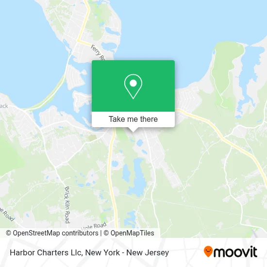
See Harbor Charters Llc, Sag Harbor, on the map
Public Transit to Harbor Charters Llc in Sag Harbor
Wondering how to get to Harbor Charters Llc in Sag Harbor? Moovit helps you find the best way to get to Harbor Charters Llc with step-by-step directions from the nearest public transit station.
Moovit provides free maps and live directions to help you navigate through your city. View schedules, routes, timetables, and find out how long does it take to get to Harbor Charters Llc in real time.
Looking for the nearest stop or station to Harbor Charters Llc? Check out this list of stops closest to your destination: Bridgehampton Sag Harbor Tpk/Paumanok Path; Pierson Hs.
Bus: 92, HAMPTON JITNEY MONTAUK, 1, 2.
Want to see if there’s another route that gets you there at an earlier time? Moovit helps you find alternative routes or times. Get directions from and directions to Harbor Charters Llc easily from the Moovit App or Website.
We make riding to Harbor Charters Llc easy, which is why over 1.5 million users, including users in Sag Harbor, trust Moovit as the best app for public transit. You don’t need to download an individual bus app or train app, Moovit is your all-in-one transit app that helps you find the best bus time or train time available.
For information on prices of bus and train, costs and ride fares to Harbor Charters Llc, please check the Moovit app.
Use the app to navigate to popular places including to the airport, hospital, stadium, grocery store, mall, coffee shop, school, college, and university.
Harbor Charters Llc Address: 44 Joels Ln street in Sag Harbor
- Sag Harbor Park Tennis,
- Rm Steffens Plumbing & Heating Inc,
- Serenity Estate Management,
- Sag Harbor Whalers,
- Stepfamily Foundation,
- J.S. Services Inc.,
- Diverse Property Management & Homework,
- Dortronics Systems, Inc.,
- Getty,
- Bridgehampton Autospo,
- Hometown Asset Management,
- Hamptons Creative Media,
- Brogan Lane,
- Jcp Landscaping Inc,
- Wellness Hampton,
- Sag Harbor Park Tennis,
- Dr Fedorenko True Organic,
- Dr. Fedorenko,
- Frank Greenwald Architect,
- D&D Harvey Architects
Places Near Harbor Charters Llc (Sag Harbor)
- 66 John Street, Manhattan,
- Queens Center Mall, Queens,
- Pier 83, Manhattan,
- 911 Memorial, Manhattan,
- 376 Hudson Street, Manhattan,
- Wall Street, Manhattan,
- San Gennaro Feast, Manhattan,
- Times Square, Manhattan,
- Chinatown, Manhattan,
- Mountainside Hospital, Glen Ridge,
- Hudson Yards, Manhattan,
- SoHo, Manhattan,
- 3 Stone St, Manhattan,
- 111 Centre New York City Supreme Court, Manhattan,
- 1 Police Plaza, Manhattan,
- Katz's Deli, Manhattan,
- Rockefeller Center, Manhattan,
- 26 Federal Plaza, Manhattan,
- Bellevue Hospital, Manhattan,
- qqqq, Manhattan
How to get to popular places in New York - New Jersey with public transit
Get around Sag Harbor by public transit!
Traveling around Sag Harbor has never been so easy. See step by step directions as you travel to any attraction, street or major public transit station. View bus and train schedules, arrival times, service alerts and detailed routes on a map, so you know exactly how to get to anywhere in Sag Harbor.
When traveling to any destination around Sag Harbor use Moovit's Live Directions with Get Off Notifications to know exactly where and how far to walk, how long to wait for your line, and how many stops are left. Moovit will alert you when it's time to get off — no need to constantly re-check whether yours is the next stop.
Wondering how to use public transit in Sag Harbor or how to pay for public transit in Sag Harbor? Moovit public transit app can help you navigate your way with public transit easily, and at minimum cost. It includes public transit fees, ticket prices, and costs. Looking for a map of Sag Harbor public transit lines? Moovit public transit app shows all public transit maps in Sag Harbor with all Bus, Train, Subway, Light Rail, Ferry and Cable Car routes and stops on an interactive map.
New York - New Jersey has 6 transit type(s), including: Bus, Train, Subway, Light Rail, Ferry and Cable Car, operated by several transit agencies, including MTA Subway, Metro-North Railroad, LIRR, PATH, MTA New York City Transit - Express routes, MTA Bus, NJ Transit, NYC Ferry, NICE bus, Bee-Line Bus, NJ Transit Rail, Norwalk Transit District, Hartford Line, River Valley Transit and HART