How to get to Harbor Freight Tools by bus?
Click on the bus route to see step by step directions with maps, line arrival times and updated time schedules.
Bus stops near Harbor Freight Tools in Roseland
Bus lines to Harbor Freight Tools in Roseland
What are the closest stations to Harbor Freight Tools?
The closest stations to Harbor Freight Tools are:
- Riverwalk Plaza NB is 305 yards away, 4 min walk.
- Roseland Plaza is 336 yards away, 5 min walk.
Which bus line stops near Harbor Freight Tools?
RT 5 (Sebastian River Medical Center)
What’s the nearest bus station to Harbor Freight Tools in Roseland?
The nearest bus station to Harbor Freight Tools in Roseland is Riverwalk Plaza NB. It’s a 4 min walk away.
What time is the first bus to Harbor Freight Tools in Roseland?
The RT 5 is the first bus that goes to Harbor Freight Tools in Roseland. It stops nearby at 6:00 AM.
What time is the last bus to Harbor Freight Tools in Roseland?
The RT 5 is the last bus that goes to Harbor Freight Tools in Roseland. It stops nearby at 6:59 PM.
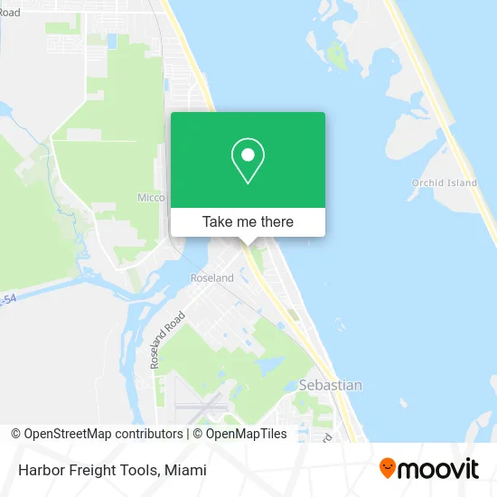
See Harbor Freight Tools, Roseland, on the map
Public Transit to Harbor Freight Tools in Roseland
Wondering how to get to Harbor Freight Tools in Roseland? Moovit helps you find the best way to get to Harbor Freight Tools with step-by-step directions from the nearest public transit station.
Moovit provides free maps and live directions to help you navigate through your city. View schedules, routes, timetables, and find out how long does it take to get to Harbor Freight Tools in real time.
Looking for the nearest stop or station to Harbor Freight Tools? Check out this list of stops closest to your destination: Riverwalk Plaza NB; Roseland Plaza.
Bus: RT 5, RT 11.
Want to see if there’s another route that gets you there at an earlier time? Moovit helps you find alternative routes or times. Get directions from and directions to Harbor Freight Tools easily from the Moovit App or Website.
We make riding to Harbor Freight Tools easy, which is why over 1.5 million users, including users in Roseland, trust Moovit as the best app for public transit. You don’t need to download an individual bus app or train app, Moovit is your all-in-one transit app that helps you find the best bus time or train time available.
For information on prices of bus, costs and ride fares to Harbor Freight Tools, please check the Moovit app.
Use the app to navigate to popular places including to the airport, hospital, stadium, grocery store, mall, coffee shop, school, college, and university.
Harbor Freight Tools Address: 13550 US Highway 1 Sebastian, FL 32958 street in Roseland
- PNC Mortgage,
- David E Cherry - TD Wealth Financial Advisor,
- Passionate Lilies & Roses Flower Arrangement,
- American Express,
- Riverwalk Cafe,
- Rack'm,
- Pettastic Boutique,
- Lucys Hair Salon,
- Sherri's Floral Shoppe,
- Sebastian Discount Pharmacy,
- Inlet Wines & Brew,
- Miso Ramen and Poke Bar,
- Truist Bank,
- Richard's Hot Dog Stand,
- 13361 US-1 Parking,
- Penske Auto Center,
- Minute Key,
- Sebastian Primary Care,
- Advanced Foot and Ankle of Indian River,
- Dr. Eileen Fermin, MD
Places Near Harbor Freight Tools (Roseland)
- Miami-Dade County Courthouse, Miami,
- Port of Miami Cruise Terminal, Miami,
- Richard E. Gerstein Justice Building, Miami,
- Hard Rock Stadium, Miami Gardens,
- Dolphin Mall Bus, Miami,
- Dolphin Mall, Miami,
- Aventura Mall, Miami Beach,
- Miami Freedom Park, Miami,
- Sawgrass Mall, Miami,
- Aventura Mall, Miami,
- Little Havana, Miami,
- Miami Design District, Miami,
- Miami VA Hospital, Miami,
- Brickell City Centre, Miami,
- Zoo Miami, Miami,
- Sawgrass mall ( FL ), Miami Beach,
- Keiser University Flagship Campus, West Palm Beach,
- Wynwood, Miami,
- Bayside Marketplace, Miami,
- Marlins Park, Miami
How to get to popular places in Miami with public transit
Get around Roseland by public transit!
Traveling around Roseland has never been so easy. See step by step directions as you travel to any attraction, street or major public transit station. View bus and train schedules, arrival times, service alerts and detailed routes on a map, so you know exactly how to get to anywhere in Roseland.
When traveling to any destination around Roseland use Moovit's Live Directions with Get Off Notifications to know exactly where and how far to walk, how long to wait for your line, and how many stops are left. Moovit will alert you when it's time to get off — no need to constantly re-check whether yours is the next stop.
Wondering how to use public transit in Roseland or how to pay for public transit in Roseland? Moovit public transit app can help you navigate your way with public transit easily, and at minimum cost. It includes public transit fees, ticket prices, and costs. Looking for a map of Roseland public transit lines? Moovit public transit app shows all public transit maps in Roseland with all Bus, Train, Light Rail and Ferry routes and stops on an interactive map.
Miami has 4 transit type(s), including: Bus, Train, Light Rail and Ferry, operated by several transit agencies, including Broward County Transit, Miami-Dade Transit, Metrorail, Palm Tran, Tri-Rail, Brightline, MARTY, City of Homestead Trolley, Key West Transit, Treasure Coast Connector, GoLine IRT, Amtrak, Greyhound-us, FlixBus-us and Aventura Express Shuttle Bus