How to get to Harbor Freight Tools by bus?
Click on the bus route to see step by step directions with maps, line arrival times and updated time schedules.
From United Palace Theatre, Manhattan
54 minFrom Harlem Hospital, Manhattan
66 minFrom College Point DMV, Queens
80 minFrom Apollo Theater, Manhattan
58 minFrom Broadway and 168th St, Manhattan
55 minFrom W 120th St / Broadway, Manhattan
68 minFrom Whitestone, NY, Queens
81 minFrom Baruch College, Manhattan
47 minFrom Central Park - Conservatory Garden, Manhattan
43 minFrom Astoria Park, Queens
102 min
How to get to Harbor Freight Tools by train?
Click on the train route to see step by step directions with maps, line arrival times and updated time schedules.
How to get to Harbor Freight Tools by subway?
Click on the subway route to see step by step directions with maps, line arrival times and updated time schedules.
From United Palace Theatre, Manhattan
68 minFrom Harlem Hospital, Manhattan
33 minFrom College Point DMV, Queens
117 minFrom Apollo Theater, Manhattan
42 minFrom Broadway and 168th St, Manhattan
64 minFrom W 120th St / Broadway, Manhattan
56 minFrom Baruch College, Manhattan
38 minFrom Central Park - Conservatory Garden, Manhattan
48 minFrom Astoria Park, Queens
83 min
Bus stops near Harbor Freight Tools in Bronx
Subway station near Harbor Freight Tools in Bronx
- Pelham Pkwy, 5 min walk,VIEW
Bus lines to Harbor Freight Tools in Bronx
- 60, White Plains Bus Terminal Lane B,VIEW
- 61, Larchmont,VIEW
- 62, N Broadway @ Main St,VIEW
- BX39, Wakefield 241 St Via White Pls Rd,VIEW
- BX30, Co-Op City Earhart La Via Boston Rd,VIEW
- BXM11, East Midtown 23 St Via Bronx Zoo Via 5 Av,VIEW
- BX25, Co-Op City Bay Plaza Via Allerton Av,VIEW
- BX26, Co-Op City Earhart Lane Via Allerton Av,VIEW
What are the closest stations to Harbor Freight Tools?
The closest stations to Harbor Freight Tools are:
- Boston Rd @ Waring Ave is 140 yards away, 2 min walk.
- Waring Av/White Plains Rd is 195 yards away, 3 min walk.
- Boston Rd/Holland Av is 205 yards away, 3 min walk.
- White Plains Rd/Waring Av is 219 yards away, 3 min walk.
- Pelham Pkwy is 337 yards away, 5 min walk.
- Allerton Av/White Plains Rd is 479 yards away, 6 min walk.
Which bus lines stop near Harbor Freight Tools?
These bus lines stop near Harbor Freight Tools: 60, BX12-SBS, BX39, BXM11.
Which train line stops near Harbor Freight Tools?
2 (513#| North White Plains)
Which subway line stops near Harbor Freight Tools?
2 (Uptown & The Bronx)
What’s the nearest subway station to Harbor Freight Tools in Bronx?
The nearest subway station to Harbor Freight Tools in Bronx is Pelham Pkwy. It’s a 5 min walk away.
What’s the nearest bus station to Harbor Freight Tools in Bronx?
The nearest bus station to Harbor Freight Tools in Bronx is Boston Rd @ Waring Ave. It’s a 2 min walk away.
What time is the first subway to Harbor Freight Tools in Bronx?
The 2 is the first subway that goes to Harbor Freight Tools in Bronx. It stops nearby at 3:01 AM.
What time is the last subway to Harbor Freight Tools in Bronx?
The 2 is the last subway that goes to Harbor Freight Tools in Bronx. It stops nearby at 4:32 AM.
What time is the first bus to Harbor Freight Tools in Bronx?
The BX39 is the first bus that goes to Harbor Freight Tools in Bronx. It stops nearby at 5:16 AM.
What time is the last bus to Harbor Freight Tools in Bronx?
The BXM11 is the last bus that goes to Harbor Freight Tools in Bronx. It stops nearby at 12:59 AM.
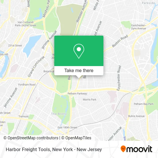
See Harbor Freight Tools, Bronx, on the map
Public Transit to Harbor Freight Tools in Bronx
Wondering how to get to Harbor Freight Tools in Bronx? Moovit helps you find the best way to get to Harbor Freight Tools with step-by-step directions from the nearest public transit station.
Moovit provides free maps and live directions to help you navigate through your city. View schedules, routes, timetables, and find out how long does it take to get to Harbor Freight Tools in real time.
Looking for the nearest stop or station to Harbor Freight Tools? Check out this list of stops closest to your destination: Boston Rd @ Waring Ave; Waring Av/White Plains Rd; Boston Rd/Holland Av; White Plains Rd/Waring Av; Pelham Pkwy; Allerton Av/White Plains Rd.
Bus: 60, BX12-SBS, BX39, BXM11, 61, 62, BX30, BX25, BX26.Train: 2.Subway: 2, 5.
Want to see if there’s another route that gets you there at an earlier time? Moovit helps you find alternative routes or times. Get directions from and directions to Harbor Freight Tools easily from the Moovit App or Website.
We make riding to Harbor Freight Tools easy, which is why over 1.5 million users, including users in Bronx, trust Moovit as the best app for public transit. You don’t need to download an individual bus app or train app, Moovit is your all-in-one transit app that helps you find the best bus time or train time available.
For information on prices of bus, subway and train, costs and ride fares to Harbor Freight Tools, please check the Moovit app.
Use the app to navigate to popular places including to the airport, hospital, stadium, grocery store, mall, coffee shop, school, college, and university.
Harbor Freight Tools Address: 2441 Boston Rd street in Bronx
- Salvation Army,
- Harbor Freight,
- Salvation Army Family Store & Donation Center,
- Construction Life,
- Praise Temple Pa Of Jesus Christ Apostolic,
- FedEx,
- Libertyx Bitcoin Atm,
- Harvest Army World Revival Arena,
- NYCHA - Boston Road Plaza,
- Leokarichell Beauty Salon,
- Center Light Healthcare,
- Clean Rite Center,
- Raptors Freight & Packging Llc,
- Ecoatm,
- Western Union,
- Aspire Preparatory Middle School,
- 24 Hour Truck Tire Service,
- Mace Ave and Boston Rd,
- Holland Ave (boston road holland avenue),
- Marie
Places Near Harbor Freight Tools (Bronx)
- Bellevue Hospital, Manhattan,
- Times Square, Manhattan,
- 66 John Street, Manhattan,
- 376 Hudson Street, Manhattan,
- San Gennaro Feast, Manhattan,
- Mountainside Hospital, Glen Ridge,
- Hudson Yards, Manhattan,
- Pier 83, Manhattan,
- Chinatown, Manhattan,
- 26 Federal Plaza, Manhattan,
- qqqq, Manhattan,
- Rockefeller Center, Manhattan,
- SoHo, Manhattan,
- Queens Center Mall, Queens,
- 911 Memorial, Manhattan,
- Katz's Deli, Manhattan,
- 111 Centre New York City Supreme Court, Manhattan,
- 1 Police Plaza, Manhattan,
- 3 Stone St, Manhattan,
- Wall Street, Manhattan
How to get to popular places in New York - New Jersey with public transit
Get around Bronx by public transit!
Traveling around Bronx has never been so easy. See step by step directions as you travel to any attraction, street or major public transit station. View bus and train schedules, arrival times, service alerts and detailed routes on a map, so you know exactly how to get to anywhere in Bronx.
When traveling to any destination around Bronx use Moovit's Live Directions with Get Off Notifications to know exactly where and how far to walk, how long to wait for your line, and how many stops are left. Moovit will alert you when it's time to get off — no need to constantly re-check whether yours is the next stop.
Wondering how to use public transit in Bronx or how to pay for public transit in Bronx? Moovit public transit app can help you navigate your way with public transit easily, and at minimum cost. It includes public transit fees, ticket prices, and costs. Looking for a map of Bronx public transit lines? Moovit public transit app shows all public transit maps in Bronx with all Bus, Train, Subway, Light Rail, Ferry and Cable Car routes and stops on an interactive map.
New York - New Jersey has 6 transit type(s), including: Bus, Train, Subway, Light Rail, Ferry and Cable Car, operated by several transit agencies, including MTA Subway, Metro-North Railroad, LIRR, PATH, MTA New York City Transit - Express routes, MTA Bus, NJ Transit, NYC Ferry, NICE bus, Bee-Line Bus, NJ Transit Rail, Norwalk Transit District, Hartford Line, River Valley Transit and HART