How to get to Hard Charters by bus?
Click on the bus route to see step by step directions with maps, line arrival times and updated time schedules.
From CCA Calvary Christian Academy, Fort Lauderdale
73 minFrom Wilton Manors, Fort Lauderdale
72 minFrom Sensual Asian Massage, Boca Raton
70 minFrom Margate, FL, Coral Springs-Margate
52 minFrom Inter Miami CF, Fort Lauderdale
73 minFrom The Westin Fort Lauderdale, Fort Lauderdale
53 minFrom Cam Transfer, Coral Springs-Margate
56 minFrom Butterfly World, Pompano Beach
58 minFrom Mai-Kai Restaurant And Polynesian Show, Fort Lauderdale
29 minFrom Jay's Professional Enterprises, Fort Lauderdale
65 min
Bus stops near Hard Charters in Pompano Beach
Bus lines to Hard Charters in Pompano Beach
What are the closest stations to Hard Charters?
The closest stations to Hard Charters are:
- US 1/Northeast 14th Street is 195 yards away, 3 min walk.
- Northeast 14th Street/Northeast 23rd Avenue is 224 yards away, 4 min walk.
- US 1/# 1900 - (Pompano Beach) is 671 yards away, 9 min walk.
Which bus lines stop near Hard Charters?
These bus lines stop near Hard Charters: 10, 83.
What’s the nearest bus station to Hard Charters in Pompano Beach?
The nearest bus station to Hard Charters in Pompano Beach is US 1/Northeast 14th Street. It’s a 3 min walk away.
What time is the first bus to Hard Charters in Pompano Beach?
The 11 is the first bus that goes to Hard Charters in Pompano Beach. It stops nearby at 4:33 AM.
What time is the last bus to Hard Charters in Pompano Beach?
The 11 is the last bus that goes to Hard Charters in Pompano Beach. It stops nearby at 12:40 AM.
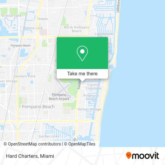
See Hard Charters, Pompano Beach, on the map
Public Transit to Hard Charters in Pompano Beach
Wondering how to get to Hard Charters in Pompano Beach? Moovit helps you find the best way to get to Hard Charters with step-by-step directions from the nearest public transit station.
Moovit provides free maps and live directions to help you navigate through your city. View schedules, routes, timetables, and find out how long does it take to get to Hard Charters in real time.
Looking for the nearest stop or station to Hard Charters? Check out this list of stops closest to your destination: US 1/Northeast 14th Street; Northeast 14th Street/Northeast 23rd Avenue; US 1/# 1900 - (Pompano Beach).
Bus: 10, 83, 11.
Want to see if there’s another route that gets you there at an earlier time? Moovit helps you find alternative routes or times. Get directions from and directions to Hard Charters easily from the Moovit App or Website.
We make riding to Hard Charters easy, which is why over 1.5 million users, including users in Pompano Beach, trust Moovit as the best app for public transit. You don’t need to download an individual bus app or train app, Moovit is your all-in-one transit app that helps you find the best bus time or train time available.
For information on prices of bus, costs and ride fares to Hard Charters, please check the Moovit app.
Use the app to navigate to popular places including to the airport, hospital, stadium, grocery store, mall, coffee shop, school, college, and university.
Hard Charters Address: Pompano Beach, FL 33062 street in Pompano Beach
- Trec Development and Construction,
- Merolla Yacht & Boat Marine Surveyors,
- Alpha Motors,
- Auto Tags of Oakland Park,
- Diskomp Computer Sales,
- Coach House East & West Condomium,
- Hayes Farms Christmas Trees,
- Marina Groceries,
- Cash Club USA,
- Marriot Hotel,
- Elite Marinelife by Captive Seas,
- Avalon Harbor,
- Broward Medical Specialist,
- R. Manceri Mark Pa,
- L King Jane Attorney at Law,
- 1653 US-1,
- Movieco,
- Luxury Portfolio International,
- Christine Gentile,
- South Florida Homes for Sale Fort Lauderdale Fl
Places Near Hard Charters (Pompano Beach)
- Marlins Park, Miami,
- Port of Miami Cruise Terminal, Miami,
- Miami Freedom Park, Miami,
- Miami-Dade County Courthouse, Miami,
- Keiser University Flagship Campus, West Palm Beach,
- Richard E. Gerstein Justice Building, Miami,
- Brickell City Centre, Miami,
- Little Havana, Miami,
- Zoo Miami, Miami,
- Miami Design District, Miami,
- Sawgrass mall ( FL ), Miami Beach,
- Aventura Mall, Miami,
- Wynwood, Miami,
- Bayside Marketplace, Miami,
- Miami VA Hospital, Miami,
- Sawgrass Mall, Miami,
- Dolphin Mall, Miami,
- Hard Rock Stadium, Miami Gardens,
- Dolphin Mall Bus, Miami,
- Aventura Mall, Miami Beach
How to get to popular places in Miami with public transit
Get around Pompano Beach by public transit!
Traveling around Pompano Beach has never been so easy. See step by step directions as you travel to any attraction, street or major public transit station. View bus and train schedules, arrival times, service alerts and detailed routes on a map, so you know exactly how to get to anywhere in Pompano Beach.
When traveling to any destination around Pompano Beach use Moovit's Live Directions with Get Off Notifications to know exactly where and how far to walk, how long to wait for your line, and how many stops are left. Moovit will alert you when it's time to get off — no need to constantly re-check whether yours is the next stop.
Wondering how to use public transit in Pompano Beach or how to pay for public transit in Pompano Beach? Moovit public transit app can help you navigate your way with public transit easily, and at minimum cost. It includes public transit fees, ticket prices, and costs. Looking for a map of Pompano Beach public transit lines? Moovit public transit app shows all public transit maps in Pompano Beach with all Bus, Train, Light Rail and Ferry routes and stops on an interactive map.
Miami has 4 transit type(s), including: Bus, Train, Light Rail and Ferry, operated by several transit agencies, including Broward County Transit, Miami-Dade Transit, Metrorail, Palm Tran, Tri-Rail, Brightline, MARTY, City of Homestead Trolley, Key West Transit, Treasure Coast Connector, GoLine IRT, Amtrak, Greyhound-us, FlixBus-us and Aventura Express Shuttle Bus