Directions to Harding Ford Vision (Queens) with public transportation
The following transit lines have routes that pass near Harding Ford Vision
 Bus: Q112, Q25, Q44-SBS, Q54, Q60.
- Train: CITY TERMINAL ZONE, LONG BEACH BRANCH, RONKONKOMA BRANCH, AIRTRAIN, BABYLON BRANCH.
- Subway: E, J, Z, F, FX.
How to get to Harding Ford Vision by bus?
Click on the bus route to see step by step directions with maps, line arrival times and updated time schedules.
How to get to Harding Ford Vision by train?
Click on the train route to see step by step directions with maps, line arrival times and updated time schedules.
How to get to Harding Ford Vision by subway?
Click on the subway route to see step by step directions with maps, line arrival times and updated time schedules.
Bus stops near Harding Ford Vision in Queens
Subway stations near Harding Ford Vision in Queens
Train station near Harding Ford Vision in Queens
- Jamaica, 17 min walk,VIEW
Bus lines to Harding Ford Vision in Queens
- Q112, East New York,VIEW
- Q111, Rush Cedarhurst Peninsula Bl Via Brewer Bl Via 147 Av,VIEW
- Q113, Limited Jamaica Parsons-Hillside Via Nassau Exy Via Brewer Bl,VIEW
- Q114, Rush Far Rockaway Seagirt Bl Via Brewer Bl,VIEW
- Q115, Springfield Gardens Via Brewer Bl,VIEW
- Q20, College Point,VIEW
- Q85, Rush Jamaica Center,VIEW
- Q89, Rush Jamaica Center Via Rochdale,VIEW
- Q42, Addisleigh Park Sayres Av,VIEW
What are the closest stations to Harding Ford Vision?
The closest stations to Harding Ford Vision are:
- Tuskegee Airmen Way/160 St is 93 yards away, 2 min walk.
- Archer Av /160 St is 222 yards away, 3 min walk.
- Archer Av/160 St is 253 yards away, 4 min walk.
- Jamaica Center-Parsons/Archer is 255 yards away, 4 min walk.
- Jamaica is 1336 yards away, 17 min walk.
- 169 St is 3080 yards away, 36 min walk.
Which bus lines stop near Harding Ford Vision?
These bus lines stop near Harding Ford Vision: Q112, Q25, Q44-SBS, Q54, Q60.
Which train lines stop near Harding Ford Vision?
These train lines stop near Harding Ford Vision: CITY TERMINAL ZONE, LONG BEACH BRANCH, RONKONKOMA BRANCH.
Which subway lines stop near Harding Ford Vision?
These subway lines stop near Harding Ford Vision: E, J.
What’s the nearest subway station to Harding Ford Vision in Queens?
The nearest subway station to Harding Ford Vision in Queens is Jamaica Center-Parsons/Archer. It’s a 4 min walk away.
What’s the nearest train station to Harding Ford Vision in Queens?
The nearest train station to Harding Ford Vision in Queens is Jamaica. It’s a 17 min walk away.
What’s the nearest bus station to Harding Ford Vision in Queens?
The nearest bus station to Harding Ford Vision in Queens is Tuskegee Airmen Way/160 St. It’s a 2 min walk away.
What time is the first light rail to Harding Ford Vision in Queens?
The AIRTRAIN is the first light rail that goes to Harding Ford Vision in Queens. It stops nearby at 3:00 AM.
What time is the last light rail to Harding Ford Vision in Queens?
The AIRTRAIN is the last light rail that goes to Harding Ford Vision in Queens. It stops nearby at 3:06 AM.
What time is the first subway to Harding Ford Vision in Queens?
The F is the first subway that goes to Harding Ford Vision in Queens. It stops nearby at 3:00 AM.
What time is the last subway to Harding Ford Vision in Queens?
The F is the last subway that goes to Harding Ford Vision in Queens. It stops nearby at 4:28 AM.
What time is the first train to Harding Ford Vision in Queens?
The BABYLON BRANCH is the first train that goes to Harding Ford Vision in Queens. It stops nearby at 3:07 AM.
What time is the last train to Harding Ford Vision in Queens?
The BABYLON BRANCH is the last train that goes to Harding Ford Vision in Queens. It stops nearby at 3:07 AM.
What time is the first bus to Harding Ford Vision in Queens?
The Q111 is the first bus that goes to Harding Ford Vision in Queens. It stops nearby at 3:01 AM.
What time is the last bus to Harding Ford Vision in Queens?
The Q20 is the last bus that goes to Harding Ford Vision in Queens. It stops nearby at 3:34 AM.
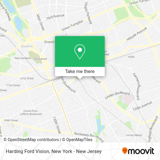
See Harding Ford Vision, Queens, on the map
Public Transit to Harding Ford Vision in Queens
Wondering how to get to Harding Ford Vision in Queens? Moovit helps you find the best way to get to Harding Ford Vision with step-by-step directions from the nearest public transit station.
Moovit provides free maps and live directions to help you navigate through your city. View schedules, routes, timetables, and find out how long does it take to get to Harding Ford Vision in real time.
Looking for the nearest stop or station to Harding Ford Vision? Check out this list of stops closest to your destination: Tuskegee Airmen Way/160 St; Archer Av /160 St; Archer Av/160 St; Jamaica Center-Parsons/Archer; Jamaica; 169 St.
Bus: Q112, Q25, Q44-SBS, Q54, Q60, Q111, Q113, Q114, Q115, Q20, Q85, Q89.Train: CITY TERMINAL ZONE, LONG BEACH BRANCH, RONKONKOMA BRANCH, AIRTRAIN, BABYLON BRANCH, FAR ROCKAWAY BRANCH, HEMPSTEAD BRANCH.Subway: E, J, Z, F, FX.
Want to see if there’s another route that gets you there at an earlier time? Moovit helps you find alternative routes or times. Get directions from and directions to Harding Ford Vision easily from the Moovit App or Website.
We make riding to Harding Ford Vision easy, which is why over 1.5 million users, including users in Queens, trust Moovit as the best app for public transit. You don’t need to download an individual bus app or train app, Moovit is your all-in-one transit app that helps you find the best bus time or train time available.
For information on prices of subway, bus and train, costs and ride fares to Harding Ford Vision, please check the Moovit app.
Use the app to navigate to popular places including to the airport, hospital, stadium, grocery store, mall, coffee shop, school, college, and university.
Harding Ford Vision Address: 157-22 Tuskegee Airmen Way street in Queens
- 159th St (159th street south),
- 106-15 159th St,
- Amazon Locker - Vessel,
- Amazon Locker - Signatory,
- Dcap Jamaica,
- 157 Auto Collision Inc.,
- Amazon Locker - Trend,
- Amazon Locker - Gold,
- Careema Cares Daycare,
- V & G Auto Center Inc,
- Aaa Live Poultry and Meat Market,
- NYCHA - South Jamaica II Houses,
- Encomiendas Delsy,
- The United House Of Prayer For All People,
- Amazon Locker - Murray,
- South Jamaica Housing,
- Jr Finest Auto Repair Inc.,
- Chosen Generation,
- Rccg Icq,
- V P Records Retail Store NY
Places Near Harding Ford Vision (Queens)
- 3 Stone St, Manhattan,
- Queens Center Mall, Queens,
- 911 Memorial, Manhattan,
- Hudson Yards, Manhattan,
- Bellevue Hospital, Manhattan,
- 66 John Street, Manhattan,
- Rockefeller Center, Manhattan,
- San Gennaro Feast, Manhattan,
- qqqq, Manhattan,
- Katz's Deli, Manhattan,
- 1 Police Plaza, Manhattan,
- Wall Street, Manhattan,
- Pier 83, Manhattan,
- 26 Federal Plaza, Manhattan,
- Chinatown, Manhattan,
- 376 Hudson Street, Manhattan,
- SoHo, Manhattan,
- Mountainside Hospital, Glen Ridge,
- 111 Centre New York City Supreme Court, Manhattan,
- Times Square, Manhattan
How to get to popular places in New York - New Jersey with public transit
Get around Queens by public transit!
Traveling around Queens has never been so easy. See step by step directions as you travel to any attraction, street or major public transit station. View bus and train schedules, arrival times, service alerts and detailed routes on a map, so you know exactly how to get to anywhere in Queens.
When traveling to any destination around Queens use Moovit's Live Directions with Get Off Notifications to know exactly where and how far to walk, how long to wait for your line, and how many stops are left. Moovit will alert you when it's time to get off — no need to constantly re-check whether yours is the next stop.
Wondering how to use public transit in Queens or how to pay for public transit in Queens? Moovit public transit app can help you navigate your way with public transit easily, and at minimum cost. It includes public transit fees, ticket prices, and costs. Looking for a map of Queens public transit lines? Moovit public transit app shows all public transit maps in Queens with all Bus, Train, Subway, Light Rail, Ferry and Cable Car routes and stops on an interactive map.
New York - New Jersey has 6 transit type(s), including: Bus, Train, Subway, Light Rail, Ferry and Cable Car, operated by several transit agencies, including MTA Subway, Metro-North Railroad, LIRR, PATH, MTA New York City Transit - Express routes, MTA Bus, NJ Transit, NYC Ferry, NICE bus, Bee-Line Bus, NJ Transit Rail, Norwalk Transit District, Hartford Line, River Valley Transit and HART