How to get to Hardtec by bus?
Click on the bus route to see step by step directions with maps, line arrival times and updated time schedules.
From Hospital HM Universitario Torrelodones, Torrelodones
25 minFrom Universidad Alfonso X El Sabio (UAX), Villanueva De La Cañada
95 minFrom Hospital Público de Collado Villalba, Collado Villalba
77 minFrom The Style Outlets Las Rozas, Las Rozas De Madrid
62 minFrom Polígono P-29, Collado Villalba
31 minFrom Universidad Camilo José Cela (UCJC), Villanueva De La Cañada
69 minFrom Polígono Európolis, Las Rozas De Madrid
79 minFrom Gran Plaza 2 Majadahonda, Área Metropolitana De Madrid Y Corredor Del Henares
47 minFrom Heron City Madrid, Área Metropolitana De Madrid Y Corredor Del Henares
61 minFrom Costco Wholesale, Las Rozas De Madrid
48 min
Bus stops near Hardtec in Colmenarejo
Bus lines to Hardtec in Colmenarejo
What are the closest stations to Hardtec?
The closest stations to Hardtec are:
- Prado Marinero - Reserva is 158 meters away, 3 min walk.
- Cañada De Las Merinas - Ctra. Galapagar is 196 meters away, 3 min walk.
Which bus lines stop near Hardtec?
These bus lines stop near Hardtec: 630, 631, 633.
What’s the nearest bus station to Hardtec in Colmenarejo?
The nearest bus stations to Hardtec in Colmenarejo are Prado Marinero - Reserva and Cañada De Las Merinas - Ctra. Galapagar. The closest one is a 3 min walk away.
What time is the first bus to Hardtec in Colmenarejo?
The 630 is the first bus that goes to Hardtec in Colmenarejo. It stops nearby at 3:00 AM.
What time is the last bus to Hardtec in Colmenarejo?
The N904 is the last bus that goes to Hardtec in Colmenarejo. It stops nearby at 2:13 AM.
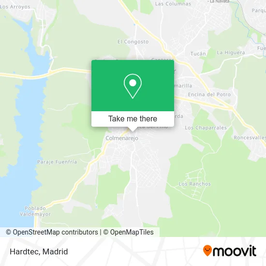
See Hardtec, Colmenarejo, on the map
Public Transit to Hardtec in Colmenarejo
Wondering how to get to Hardtec in Colmenarejo? Moovit helps you find the best way to get to Hardtec with step-by-step directions from the nearest public transit station.
Moovit provides free maps and live directions to help you navigate through your city. View schedules, routes, timetables, and find out how long does it take to get to Hardtec in real time.
Looking for the nearest stop or station to Hardtec? Check out this list of stops closest to your destination: Prado Marinero - Reserva; Cañada De Las Merinas - Ctra. Galapagar.
Bus: 630, 631, 633, 634, N904.
Want to see if there’s another route that gets you there at an earlier time? Moovit helps you find alternative routes or times. Get directions from and directions to Hardtec easily from the Moovit App or Website.
We make riding to Hardtec easy, which is why over 1.5 million users, including users in Colmenarejo, trust Moovit as the best app for public transit. You don’t need to download an individual bus app or train app, Moovit is your all-in-one transit app that helps you find the best bus time or train time available.
For information on prices of bus, costs and ride fares to Hardtec, please check the Moovit app.
Use the app to navigate to popular places including to the airport, hospital, stadium, grocery store, mall, coffee shop, school, college, and university.
Hardtec Address: Calle Esla, 5 28270 Colmenarejo street in Colmenarejo
- Lopesan,
- Avenida Pablo Iglesias, 19,
- Elvira Garcia M. Pilar,
- Florencio Gala Garcia,
- Ingenieria Técnica y Proyectos,
- Julio Garcia Elvira,
- La Libélula,
- Jardinería Jeymo Jardín,
- Locutorio Internet,
- Amazon Counter-Cafeteria Nuria,
- Fombuena Licer Ricardo,
- Pub Sector 3,
- Parada Bus 630-631,
- inmobiliaria garsierra,
- Pangea,
- Lowisky Gerardo Anselmo,
- Martín Garcia C,
- Repsol,
- Nativo Restaurante,
- Meteoran Urban Grill
Places Near Hardtec (Colmenarejo)
- Estacion de Chamartin, Madrid,
- Sala La Riviera, Madrid,
- Centro Comercial Oasiz Madrid, Área Metropolitana De Madrid Y Corredor Del Henares,
- Plaza Mayor, Madrid,
- Estadio Wanda Metropolitano, Área Metropolitana De Madrid Y Corredor Del Henares,
- Palacio De Vistalegre, Área Metropolitana De Madrid Y Corredor Del Henares,
- Calle de López de Hoyos 169, Madrid,
- Rastro De Madrid, Área Metropolitana De Madrid Y Corredor Del Henares,
- Wizink Center, Madrid,
- Nassica, Área Metropolitana De Madrid Y Corredor Del Henares,
- Hospital Universitario Ramón y Cajal, Madrid,
- Centro Comercial Islazul, Área Metropolitana De Madrid Y Corredor Del Henares,
- Tres Aguas, Alcorcón,
- Hospital Universitario La Paz, Madrid,
- Mercadillo de Majadahonda, Majadahonda,
- Centro Comercial La Gavia, Área Metropolitana De Madrid Y Corredor Del Henares,
- Hospital Clínico Universitario San Carlos, Madrid,
- Centro Comercial La Vaguada, Área Metropolitana De Madrid Y Corredor Del Henares,
- Mendez Alvaro, Madrid,
- Plenilunio, Área Metropolitana De Madrid Y Corredor Del Henares
How to get to popular places in Madrid with public transit
Get around Colmenarejo by public transit!
Traveling around Colmenarejo has never been so easy. See step by step directions as you travel to any attraction, street or major public transit station. View bus and train schedules, arrival times, service alerts and detailed routes on a map, so you know exactly how to get to anywhere in Colmenarejo.
When traveling to any destination around Colmenarejo use Moovit's Live Directions with Get Off Notifications to know exactly where and how far to walk, how long to wait for your line, and how many stops are left. Moovit will alert you when it's time to get off — no need to constantly re-check whether yours is the next stop.
Wondering how to use public transit in Colmenarejo or how to pay for public transit in Colmenarejo? Moovit public transit app can help you navigate your way with public transit easily, and at minimum cost. It includes public transit fees, ticket prices, and costs. Looking for a map of Colmenarejo public transit lines? Moovit public transit app shows all public transit maps in Colmenarejo with all Bus, Train, Metro and Light Rail routes and stops on an interactive map.
Madrid has 4 transit type(s), including: Bus, Train, Metro and Light Rail, operated by several transit agencies, including Metro de Madrid, Metro Ligero, Tranvía de Parla, Renfe Cercanías - Servicios de Autobús especiales, Renfe Cercanias, Renfe Cercanías, EMT, Interurbanos, Urbanos de Alcalá de Henares, Urbanos de Alcobendas, Urbanos de Alcorcón, Urbanos de Algete, Urbanos de Aranjuez, Urbanos de Arganda del Rey and Urbanos de Arroyomolinos