How to get to Haring by bus?
Click on the bus route to see step by step directions with maps, line arrival times and updated time schedules.
From Emil-Kessler-Straße / Mercedes-Benz Werk Mettingen Tor 3, Esslingen Am Neckar
59 minFrom Inselstraße, Stuttgart
72 minFrom Messe Stuttgart, Leinfelden-Echterdingen
50 minFrom Kleintierzüchterverein Z 165 Stuttgart-wangen, Stuttgart
71 minFrom Medius Klinik Ostfildern-Ruit, Stuttgart
57 minFrom Kelley Barracks, Möhringen
95 minFrom Stuttgart Airport Busterminal (SAB), Stuttgart
33 minFrom Rotenberger Weingärtle, Untertürkheim
73 minFrom U-Bahn Wasenstraße, Stuttgart
74 minFrom Weinstube Onkel Otto, Stuttgart
90 min
How to get to Haring by subway?
Click on the subway route to see step by step directions with maps, line arrival times and updated time schedules.
From Emil-Kessler-Straße / Mercedes-Benz Werk Mettingen Tor 3, Esslingen Am Neckar
123 minFrom Inselstraße, Stuttgart
88 minFrom Messe Stuttgart, Leinfelden-Echterdingen
105 minFrom Kleintierzüchterverein Z 165 Stuttgart-wangen, Stuttgart
93 minFrom Medius Klinik Ostfildern-Ruit, Stuttgart
66 minFrom Kelley Barracks, Möhringen
103 minFrom Stuttgart Airport Busterminal (SAB), Stuttgart
98 minFrom Rotenberger Weingärtle, Untertürkheim
112 minFrom U-Bahn Wasenstraße, Stuttgart
86 minFrom Weinstube Onkel Otto, Stuttgart
101 min
Bus stops near Haring in Denkendorf
Light Rail stations near Haring in Denkendorf
- Nellingen Ostfildern, 38 min walk,VIEW
Subway station near Haring in Denkendorf
- Nellingen Ostfildern, 38 min walk,VIEW
Bus lines to Haring in Denkendorf
What are the closest stations to Haring?
The closest stations to Haring are:
- Denkendorf Esslinger Str. is 355 meters away, 5 min walk.
- Denkendorf Weingartstraße is 433 meters away, 6 min walk.
- Denkendorf Auferstehungskirche is 708 meters away, 10 min walk.
- Nellingen Ostfildern is 2946 meters away, 38 min walk.
Which bus lines stop near Haring?
These bus lines stop near Haring: 119, X10.
Which subway line stops near Haring?
U7 (Ostfildern)
What’s the nearest bus station to Haring in Denkendorf?
The nearest bus station to Haring in Denkendorf is Denkendorf Esslinger Str.. It’s a 5 min walk away.
What time is the first light rail to Haring in Denkendorf?
The U8 is the first light rail that goes to Haring in Denkendorf. It stops nearby at 4:28 AM.
What time is the last light rail to Haring in Denkendorf?
The U8 is the last light rail that goes to Haring in Denkendorf. It stops nearby at 1:05 AM.
What time is the first subway to Haring in Denkendorf?
The U8 is the first subway that goes to Haring in Denkendorf. It stops nearby at 4:28 AM.
What time is the last subway to Haring in Denkendorf?
The U8 is the last subway that goes to Haring in Denkendorf. It stops nearby at 1:05 AM.
What time is the first bus to Haring in Denkendorf?
The N19 is the first bus that goes to Haring in Denkendorf. It stops nearby at 3:35 AM.
What time is the last bus to Haring in Denkendorf?
The 119 is the last bus that goes to Haring in Denkendorf. It stops nearby at 1:09 AM.
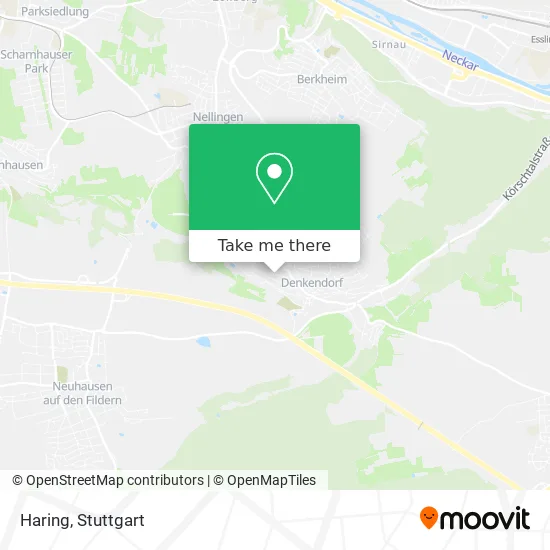
See Haring, Denkendorf, on the map
Public Transit to Haring in Denkendorf
Wondering how to get to Haring in Denkendorf? Moovit helps you find the best way to get to Haring with step-by-step directions from the nearest public transit station.
Moovit provides free maps and live directions to help you navigate through your city. View schedules, routes, timetables, and find out how long does it take to get to Haring in real time.
Looking for the nearest stop or station to Haring? Check out this list of stops closest to your destination: Denkendorf Esslinger Str.; Denkendorf Weingartstraße; Denkendorf Auferstehungskirche; Nellingen Ostfildern.
Bus: 119, X10, N19, N19, 121.Subway: U7, U8.
Want to see if there’s another route that gets you there at an earlier time? Moovit helps you find alternative routes or times. Get directions from and directions to Haring easily from the Moovit App or Website.
We make riding to Haring easy, which is why over 1.5 million users, including users in Denkendorf, trust Moovit as the best app for public transit. You don’t need to download an individual bus app or train app, Moovit is your all-in-one transit app that helps you find the best bus time or train time available.
For information on prices of bus, subway, S-Bahn and light rail, costs and ride fares to Haring, please check the Moovit app.
Use the app to navigate to popular places including to the airport, hospital, stadium, grocery store, mall, coffee shop, school, college, and university.
Haring Address: Weingartstraße 41 73770 Denkendorf street in Denkendorf
- Dr. med. Elisabeth Kirchesch Knoll,
- Narrenzunft Denkendorf e.V. Hoaga-Ma,
- Raissle Innenausbau,
- Cis,
- Gabi's Naildesign Denkendorf Gabriela Pongo,
- Hohenheimer Straße 41,
- Dr. med. Tilmann Meder,
- Metzgerei Munz,
- Bäckerei Schill,
- Jozsef Torok T,
- Familientreff,
- Posaunenchor,
- Hirschmann Eisstadion,
- Jubi Jubi,
- Temco Vermögensverwaltungs,
- Nikoll Gashi,
- Boulefreunde Denkendorf,
- Vereinsheim Kleintierz.,
- Hasenhäusle,
- Schlauchdienst GmbH - Mobiler Hydraulikschlauch-Service
Places Near Haring (Denkendorf)
- Pariser Platz Stuttgart, Stuttgart-Mitte,
- Geilhaus Haus 33a, Reutlingen-Betzingen,
- Hanns-Martin-Schleyer-Halle (Stuttgart Hans-Martin-Schleyerhalle), Bad Cannstatt,
- Porsche-Arena, Bad Cannstatt,
- Porsche Museum, Zuffenhausen,
- Im Wizemann (Halle), Bad Cannstatt,
- Mettingen Eros-Center Puff Laufhaus, Esslingen Am Neckar,
- Mercedes-Benz Museum, Bad Cannstatt,
- Schleyerhalle, Bad Cannstatt,
- Mercedes-Benz Museum (Mercedes Museum Stuttgart), Bad Cannstatt,
- Hauptbahnhof Stuttgart, Stuttgart-Mitte,
- Klinikum Stuttgart - Katharinenhospital, Stuttgart-Mitte,
- Wilhelma (U-Bahn Wilhelma), Bad Cannstatt,
- SI-Centrum, Möhringen,
- Gasometer Pforzheim, Pforzheim,
- FlixBus Haltestelle, Stuttgart,
- Marmorsaal Im Weissenburgpark, Stuttgart-Süd,
- Waldfriedhof, Degerloch,
- Gleis 101/102 (tief), Stuttgart-Mitte,
- Hanns-Martin-Schleyer-Halle, Bad Cannstatt
How to get to popular places in Stuttgart with public transit
Get around Denkendorf by public transit!
Traveling around Denkendorf has never been so easy. See step by step directions as you travel to any attraction, street or major public transit station. View bus and train schedules, arrival times, service alerts and detailed routes on a map, so you know exactly how to get to anywhere in Denkendorf.
When traveling to any destination around Denkendorf use Moovit's Live Directions with Get Off Notifications to know exactly where and how far to walk, how long to wait for your line, and how many stops are left. Moovit will alert you when it's time to get off — no need to constantly re-check whether yours is the next stop.
Wondering how to use public transit in Denkendorf or how to pay for public transit in Denkendorf? Moovit public transit app can help you navigate your way with public transit easily, and at minimum cost. It includes public transit fees, ticket prices, and costs. Looking for a map of Denkendorf public transit lines? Moovit public transit app shows all public transit maps in Denkendorf with all Bus, Train, Subway, Light Rail, Ferry, S-Bahn and Funicular routes and stops on an interactive map.
Stuttgart has 7 transit type(s), including: Bus, Train, Subway, Light Rail, Ferry, S-Bahn and Funicular, operated by several transit agencies, including SSB - Stadtbahn, SSB, SSB - Seilbahn / Zacke, S-Bahn Stuttgart, Rhein-Neckar-Verkehr GmbH (rnv), Karlsruher Verkehrsverbund, DB AG, DB Regiobus BW, Arverio Baden-Württemberg GmbH, DB RegioNetz Verkehrs GmbH Westfrankenbahn, DB Regio AG Baden-Württemberg, Südwestdeutsche Verkehrs-AG, DB Regio AG Mitte Region Hessen, DB and Bodensee-Oberschwaben-Bahn