Directions to Harry S. Truman Building (Washington) with public transportation
The following transit lines have routes that pass near Harry S. Truman Building
 Bus: 971, D10, D74, D96, F19.
- Train: MANASSAS LINE, MARC.
- Metro: BLUE, ORANGE, SILVER, RED.
How to get to Harry S. Truman Building by bus?
Click on the bus route to see step by step directions with maps, line arrival times and updated time schedules.
How to get to Harry S. Truman Building by train?
Click on the train route to see step by step directions with maps, line arrival times and updated time schedules.
How to get to Harry S. Truman Building by metro?
Click on the metro route to see step by step directions with maps, line arrival times and updated time schedules.
Bus stops near Harry S. Truman Building in Washington
- Constitution Av Nw+22 St NW, 5 min walk,
- Virginia Av Nw+21 St NW, 6 min walk,
- Virginia Ave @ 21st St Nw, 6 min walk,
- Virginia Ave NW @ 21st St NW, 6 min walk,
- Virginia Ave AM, 6 min walk,
- Virginia Ave & 21st St - State Dept, 6 min walk,
- Virginia Ave & E St, 7 min walk,
- Virginia Ave PM, 7 min walk,
- 20th St & E St NW Nb, 8 min walk,
Metro stations near Harry S. Truman Building in Washington
- Foggy Bottom Gwu Kennedy Center Metro Station, 14 min walk,
- Farragut North, 24 min walk,
Bus lines to Harry S. Truman Building in Washington
- A49, East To Metro Center,
- D96, South To Potomac Park,
- 541, Stafford to Washington DC/State Dpt,
- 611, Gainesville Washington DC Express,
- 611-FR, Front Royal to Washington DC,
- 971, Dale City Washington DC Express,
- 972-M, Eastern Lot Connector,
- 981, Lake Ridge Washington Express,
- 699, 699 Downtown D.C.,
- 220, 220/4 Washington Dc,
- 240, 240/1 Washington Dc,
- 260, 260/7 Severna Park,
- 620, 620/22 Waldorf,
- 640, 640/7 Waldorf,
- 650, 650/11 La Plata,
- 725, 725/4 California,
- 281, H ST & 4TH ST - Stone Ridge II,
- 481, H ST & 4TH ST - Leesburg P&R,
- 483, H ST & 4TH ST - Harmony Park and Ride,
- 484, H ST & 4TH ST - Harmony Park and Ride,
What are the closest stations to Harry S. Truman Building?
The closest stations to Harry S. Truman Building are:
- Constitution Av Nw+22 St NW is 302 yards away, 5 min walk.
- Virginia Av Nw+21 St NW is 370 yards away, 6 min walk.
- Virginia Ave @ 21st St Nw is 375 yards away, 6 min walk.
- Virginia Ave NW @ 21st St NW is 387 yards away, 6 min walk.
- Virginia Ave AM is 402 yards away, 6 min walk.
- Virginia Ave & 21st St - State Dept is 420 yards away, 6 min walk.
- Virginia Ave & E St is 457 yards away, 7 min walk.
- Virginia Ave PM is 457 yards away, 7 min walk.
- 20th St & E St NW Nb is 599 yards away, 8 min walk.
- Foggy Bottom Gwu Kennedy Center Metro Station is 1032 yards away, 14 min walk.
- Farragut North is 1917 yards away, 24 min walk.
Which bus lines stop near Harry S. Truman Building?
These bus lines stop near Harry S. Truman Building: 971, D10, D74, D96, F19.
Which train lines stop near Harry S. Truman Building?
These train lines stop near Harry S. Truman Building: MANASSAS LINE, MARC.
Which metro lines stop near Harry S. Truman Building?
These metro lines stop near Harry S. Truman Building: BLUE, ORANGE, SILVER.
What’s the nearest metro station to Harry S. Truman Building in Washington?
The nearest metro station to Harry S. Truman Building in Washington is Foggy Bottom Gwu Kennedy Center Metro Station. It’s a 14 min walk away.
What’s the nearest bus station to Harry S. Truman Building in Washington?
The nearest bus station to Harry S. Truman Building in Washington is Constitution Av Nw+22 St NW. It’s a 5 min walk away.
What time is the first metro to Harry S. Truman Building in Washington?
The BLUE is the first metro that goes to Harry S. Truman Building in Washington. It stops nearby at 5:23 AM.
What time is the last metro to Harry S. Truman Building in Washington?
The BLUE is the last metro that goes to Harry S. Truman Building in Washington. It stops nearby at 12:18 AM.
What time is the first bus to Harry S. Truman Building in Washington?
The 725 is the first bus that goes to Harry S. Truman Building in Washington. It stops nearby at 5:45 AM.
What time is the last bus to Harry S. Truman Building in Washington?
The D96 is the last bus that goes to Harry S. Truman Building in Washington. It stops nearby at 12:18 AM.
See Harry S. Truman Building, Washington, on the map
Public Transit to Harry S. Truman Building in Washington
Wondering how to get to Harry S. Truman Building in Washington? Moovit helps you find the best way to get to Harry S. Truman Building with step-by-step directions from the nearest public transit station.
Moovit provides free maps and live directions to help you navigate through your city. View schedules, routes, timetables, and find out how long does it take to get to Harry S. Truman Building in real time.
Looking for the nearest stop or station to Harry S. Truman Building? Check out this list of stops closest to your destination: Constitution Av Nw+22 St NW; Virginia Av Nw+21 St NW; Virginia Ave @ 21st St Nw; Virginia Ave NW @ 21st St NW; Virginia Ave AM; Virginia Ave & 21st St - State Dept; Virginia Ave & E St; Virginia Ave PM; 20th St & E St NW Nb; Foggy Bottom Gwu Kennedy Center Metro Station; Farragut North.
Bus: 971, D10, D74, D96, F19, A49, 541, 611, 611-FR, 972-M, 699.Train: MANASSAS LINE, MARC.Metro: BLUE, ORANGE, SILVER, RED.
Want to see if there’s another route that gets you there at an earlier time? Moovit helps you find alternative routes or times. Get directions from and directions to Harry S. Truman Building easily from the Moovit App or Website.
We make riding to Harry S. Truman Building easy, which is why over 1.5 million users, including users in Washington, trust Moovit as the best app for public transit. You don’t need to download an individual bus app or train app, Moovit is your all-in-one transit app that helps you find the best bus time or train time available.
For information on prices of bus, metro and train, costs and ride fares to Harry S. Truman Building, please check the Moovit app.
Use the app to navigate to popular places including to the airport, hospital, stadium, grocery store, mall, coffee shop, school, college, and university.
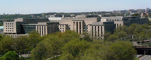
Harry S. Truman Building Address: Harry S. Truman Building, 2201 C St NW, Washington, DC 20037, USA street in Washington
- U.S. Department of State, Harry S Truman Building,
- State Department (Department of State),
- 22nd St NW C St,
- State Department,
- Downtown Washington DC,
- 23rd St NW & C,
- Virginia Ave NW & E St NW,
- Virginia Ave & 21st St, NW Bus Stop,
- 22nd St & Constitution Ave NW,
- Albert Einstein Memorial,
- State Dept (21st & Virginia Ave Metro Bus Stop),
- 23rd St NW & Maury Cir,
- Federal Reserve Board~Martin Building,
- State Plaza Hotel Washington,
- Constitution Avenue & 22nd Street,
- United States Institute of Peace,
- Jackson & Kelly (Edward J. Kelly Park),
- Paho,
- Paho (Paho Emergencies),
- Federal Reserve Board - Eccles Building
Places Near Harry S. Truman Building (Washington)
- Capital One Arena, Washington,
- National Mall, Washington,
- Warner Theatre, Washington,
- National Museum of African American History and Culture, Washington,
- The Anthem, Washington,
- Museum Of The Bible, Washington,
- Sibley Memorial Hospital, Washington,
- White House, Washington,
- Georgetown, Washington,
- National Zoo, Washington,
- Washington Monument, Washington,
- Washington DC VA Medical Center, Washington,
- Westfield Montgomery Mall, Montgomery County,
- Amazon Hq2, Arlington County,
- Basilica of the National Shrine, Washington,
- Washington National Cathedral, Washington,
- M&T Bank Stadium, Baltimore,
- Camden Yards, Baltimore,
- Marriott Marquis Washington, DC, Washington,
- 14th Street NW, Washington
How to get to popular places in Washington, D.C. - Baltimore, MD with public transit
Get around Washington by public transit!
Traveling around Washington has never been so easy. See step by step directions as you travel to any attraction, street or major public transit station. View bus and train schedules, arrival times, service alerts and detailed routes on a map, so you know exactly how to get to anywhere in Washington.
When traveling to any destination around Washington use Moovit's Live Directions with Get Off Notifications to know exactly where and how far to walk, how long to wait for your line, and how many stops are left. Moovit will alert you when it's time to get off — no need to constantly re-check whether yours is the next stop.
Wondering how to use public transit in Washington or how to pay for public transit in Washington? Moovit public transit app can help you navigate your way with public transit easily, and at minimum cost. It includes public transit fees, ticket prices, and costs. Looking for a map of Washington public transit lines? Moovit public transit app shows all public transit maps in Washington with all Bus, Train, Metro, Light Rail and Ferry routes and stops on an interactive map.
Washington, D.C. - Baltimore, MD has 5 transit type(s), including: Bus, Train, Metro, Light Rail and Ferry, operated by several transit agencies, including WMATA, Montgomery County Ride On, Fairfax Connector, TheBus, PRTC, DASH - Alexandria, Arlington Transit (ART), DC Streetcar, RTA of Central Maryland, FXBGO!, MDOT MTA, Marc, Virginia Railway Express (VRE), University of Maryland Shuttle-UM and CUE Bus - City of Fairfax