How to get to Hasenheide by bus?
Click on the bus route to see step by step directions with maps, line arrival times and updated time schedules.
From Vulpiusklinik, Bad Rappenau
98 minFrom Agaplesion Bethanien Krankenhaus Heidelberg, Südstadt
138 minFrom SAP Campus, Walldorf
65 minFrom SAP Walldorf P18, Walldorf
67 minFrom Luxor Filmpalast, Bahnstadt
124 minFrom SAP Headquarters, Walldorf
69 minFrom Neuenheimer Feld, Neuenheim
129 minFrom Antalya Pizza & Kebaphaus, Verwaltungsgemeinschaft Eppingen
139 min
How to get to Hasenheide by train?
Click on the train route to see step by step directions with maps, line arrival times and updated time schedules.
Bus stops near Hasenheide in Hoffenheim
Train stations near Hasenheide in Hoffenheim
What are the closest stations to Hasenheide?
The closest stations to Hasenheide are:
- Hoffenheim, Oberer Friedhof is 315 meters away, 5 min walk.
- Hoffenheim, Sinsheimer Straße is 893 meters away, 12 min walk.
- Hoffenheim, Bahnhof is 4187 meters away, 54 min walk.
- Sinsheim (Elsenz) Hbf is 4382 meters away, 56 min walk.
- Sinsheim, Hauptbahnhof is 4386 meters away, 56 min walk.
Which train lines stop near Hasenheide?
These train lines stop near Hasenheide: RE7, S7.
Which bus lines stop near Hasenheide?
These bus lines stop near Hasenheide: 762, 796, 797.
What’s the nearest bus station to Hasenheide in Hoffenheim?
The nearest bus station to Hasenheide in Hoffenheim is Hoffenheim, Oberer Friedhof. It’s a 5 min walk away.
What time is the first light rail to Hasenheide in Hoffenheim?
The S5 is the first light rail that goes to Hasenheide in Hoffenheim. It stops nearby at 4:52 AM.
What time is the last light rail to Hasenheide in Hoffenheim?
The S5 is the last light rail that goes to Hasenheide in Hoffenheim. It stops nearby at 1:16 AM.
What time is the first train to Hasenheide in Hoffenheim?
The S42 is the first train that goes to Hasenheide in Hoffenheim. It stops nearby at 4:40 AM.
What time is the last train to Hasenheide in Hoffenheim?
The S7 is the last train that goes to Hasenheide in Hoffenheim. It stops nearby at 1:20 AM.
What time is the first bus to Hasenheide in Hoffenheim?
The 762 is the first bus that goes to Hasenheide in Hoffenheim. It stops nearby at 6:05 AM.
What time is the last bus to Hasenheide in Hoffenheim?
The 755 is the last bus that goes to Hasenheide in Hoffenheim. It stops nearby at 12:10 AM.
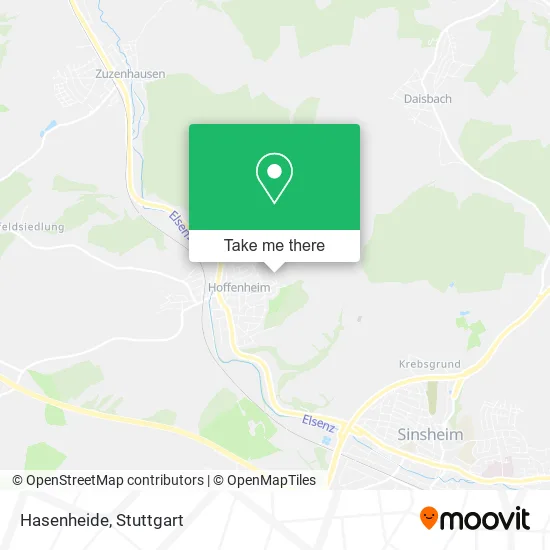
See Hasenheide, Hoffenheim, on the map
Public Transit to Hasenheide in Hoffenheim
Wondering how to get to Hasenheide in Hoffenheim? Moovit helps you find the best way to get to Hasenheide with step-by-step directions from the nearest public transit station.
Moovit provides free maps and live directions to help you navigate through your city. View schedules, routes, timetables, and find out how long does it take to get to Hasenheide in real time.
Looking for the nearest stop or station to Hasenheide? Check out this list of stops closest to your destination: Hoffenheim, Oberer Friedhof; Hoffenheim, Sinsheimer Straße; Hoffenheim, Bahnhof; Sinsheim (Elsenz) Hbf; Sinsheim.
Train: RE7, S7, RE 5, S5, S42, RE10B, S42.Bus: 762, 796, 797, 755.
Want to see if there’s another route that gets you there at an earlier time? Moovit helps you find alternative routes or times. Get directions from and directions to Hasenheide easily from the Moovit App or Website.
We make riding to Hasenheide easy, which is why over 1.5 million users, including users in Hoffenheim, trust Moovit as the best app for public transit. You don’t need to download an individual bus app or train app, Moovit is your all-in-one transit app that helps you find the best bus time or train time available.
For information on prices of bus, train and light rail, costs and ride fares to Hasenheide, please check the Moovit app.
Use the app to navigate to popular places including to the airport, hospital, stadium, grocery store, mall, coffee shop, school, college, and university.
Hasenheide Address: Daisbacher Straße 29 Hoffenheim, 74889 Sinsheim street in Hoffenheim
- Hühner Ranch,
- Logopädie in Hoffenheim,
- Hausmeisterservice Erdle,
- Bima-Wohnbau,
- Franziska Fabig,
- Schachfreunde Hoffenheim,
- Friedhof Hoffenheim,
- Angela Hamatschek Kanzlei4you,
- Allround - die Kreative Nähwerkstatt,
- Knowware EDV Marcel Fink,
- Viktor Hilscher,
- Ernst Jürgen Dipl.-Ing. Büro für Alarm- und Sicherheitstechnik,
- Angel- und Naturfreunde Hoffenheim,
- Städtischer Kindergarten Hoffenheim,
- Weltentdecker,
- Heiligwald,
- Flipedu,
- Andreas Spanjer,
- Werner Bischoff,
- Sachverständigenbüro Engelhardt
Places Near Hasenheide (Hoffenheim)
- FlixBus Haltestelle, Stuttgart,
- Pariser Platz Stuttgart, Stuttgart-Mitte,
- Wilhelma (U-Bahn Wilhelma), Bad Cannstatt,
- Im Wizemann (Halle), Bad Cannstatt,
- Gasometer Pforzheim, Pforzheim,
- Mercedes-Benz Museum (Mercedes Museum Stuttgart), Bad Cannstatt,
- Gleis 101/102 (tief), Stuttgart-Mitte,
- Schleyerhalle, Bad Cannstatt,
- SI-Centrum, Möhringen,
- Porsche Museum, Zuffenhausen,
- Mettingen Eros-Center Puff Laufhaus, Esslingen Am Neckar,
- Waldfriedhof, Degerloch,
- Mercedes-Benz Museum, Bad Cannstatt,
- Marmorsaal Im Weissenburgpark, Stuttgart-Süd,
- Porsche-Arena, Bad Cannstatt,
- Hanns-Martin-Schleyer-Halle, Bad Cannstatt,
- Hanns-Martin-Schleyer-Halle (Stuttgart Hans-Martin-Schleyerhalle), Bad Cannstatt,
- Hauptbahnhof Stuttgart, Stuttgart-Mitte,
- Geilhaus Haus 33a, Reutlingen-Betzingen,
- Klinikum Stuttgart - Katharinenhospital, Stuttgart-Mitte
How to get to popular places in Stuttgart with public transit
Get around Hoffenheim by public transit!
Traveling around Hoffenheim has never been so easy. See step by step directions as you travel to any attraction, street or major public transit station. View bus and train schedules, arrival times, service alerts and detailed routes on a map, so you know exactly how to get to anywhere in Hoffenheim.
When traveling to any destination around Hoffenheim use Moovit's Live Directions with Get Off Notifications to know exactly where and how far to walk, how long to wait for your line, and how many stops are left. Moovit will alert you when it's time to get off — no need to constantly re-check whether yours is the next stop.
Wondering how to use public transit in Hoffenheim or how to pay for public transit in Hoffenheim? Moovit public transit app can help you navigate your way with public transit easily, and at minimum cost. It includes public transit fees, ticket prices, and costs. Looking for a map of Hoffenheim public transit lines? Moovit public transit app shows all public transit maps in Hoffenheim with all Bus, Train, Subway, Light Rail, Ferry, S-Bahn and Funicular routes and stops on an interactive map.
Stuttgart has 7 transit type(s), including: Bus, Train, Subway, Light Rail, Ferry, S-Bahn and Funicular, operated by several transit agencies, including SSB - Stadtbahn, SSB, SSB - Seilbahn / Zacke, S-Bahn Stuttgart, Rhein-Neckar-Verkehr GmbH (rnv), Karlsruher Verkehrsverbund, DB AG, DB Regiobus BW, Arverio Baden-Württemberg GmbH, DB RegioNetz Verkehrs GmbH Westfrankenbahn, DB Regio AG Baden-Württemberg, Südwestdeutsche Verkehrs-AG, DB Regio AG Mitte Region Hessen, DB and Bodensee-Oberschwaben-Bahn