How to get to Havana Multiservices at Decatur by bus?
Click on the bus route to see step by step directions with maps, line arrival times and updated time schedules.
From Las Vegas Premium Outlets-North, Enterprise
67 minFrom Oussama Hajal, Pac, Las Vegas
47 minFrom Warm Springs @ LV Outlet Center (E), Enterprise
67 minFrom S Tenaya Way / W Charleston Blvd, Las Vegas
57 minFrom Hyde Park Middle School, Las Vegas
53 minFrom Anime Sokutsu, Paradise
59 minFrom Amazon Fulfillment Center-DLV2, North Las Vegas
73 minFrom Mountasia Family Fun Center, Henderson
68 minFrom Rtc bus stop at Las Vegas Premium Outlet South, Enterprise
67 minFrom Las Vegas Festival Grounds, Paradise
57 min
Bus stops near Havana Multiservices at Decatur in Las Vegas
Monorail station near Havana Multiservices at Decatur in Las Vegas
- Westgate Station, 32 min walk,VIEW
Bus lines to Havana Multiservices at Decatur in Las Vegas
What are the closest stations to Havana Multiservices at Decatur?
The closest stations to Havana Multiservices at Decatur are:
- Wb Sahara After Maryland is 271 yards away, 4 min walk.
- Sb Maryland After Sahara is 331 yards away, 5 min walk.
- Westgate Station is 2662 yards away, 32 min walk.
Which bus lines stop near Havana Multiservices at Decatur?
These bus lines stop near Havana Multiservices at Decatur: 109, SX.
What’s the nearest bus station to Havana Multiservices at Decatur in Las Vegas?
The nearest bus station to Havana Multiservices at Decatur in Las Vegas is Wb Sahara After Maryland. It’s a 4 min walk away.
What time is the first bus to Havana Multiservices at Decatur in Las Vegas?
The SX is the first bus that goes to Havana Multiservices at Decatur in Las Vegas. It stops nearby at 3:03 AM.
What time is the last bus to Havana Multiservices at Decatur in Las Vegas?
The SX is the last bus that goes to Havana Multiservices at Decatur in Las Vegas. It stops nearby at 3:26 AM.
What time is the first Monorail to Havana Multiservices at Decatur in Las Vegas?
The LVM is the first Monorail that goes to Havana Multiservices at Decatur in Las Vegas. It stops nearby at 7:00 AM.
What time is the last Monorail to Havana Multiservices at Decatur in Las Vegas?
The LVM is the last Monorail that goes to Havana Multiservices at Decatur in Las Vegas. It stops nearby at 12:02 AM.
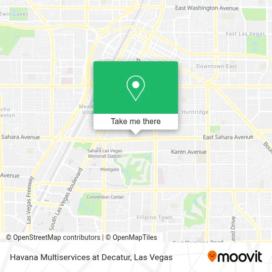
See Havana Multiservices at Decatur, Las Vegas, on the map
Public Transit to Havana Multiservices at Decatur in Las Vegas
Wondering how to get to Havana Multiservices at Decatur in Las Vegas? Moovit helps you find the best way to get to Havana Multiservices at Decatur with step-by-step directions from the nearest public transit station.
Moovit provides free maps and live directions to help you navigate through your city. View schedules, routes, timetables, and find out how long does it take to get to Havana Multiservices at Decatur in real time.
Looking for the nearest stop or station to Havana Multiservices at Decatur? Check out this list of stops closest to your destination: Wb Sahara After Maryland; Sb Maryland After Sahara; Westgate Station.
Bus: 109, SX.Monorail: LVM.
Want to see if there’s another route that gets you there at an earlier time? Moovit helps you find alternative routes or times. Get directions from and directions to Havana Multiservices at Decatur easily from the Moovit App or Website.
We make riding to Havana Multiservices at Decatur easy, which is why over 1.7 million users, including users in Las Vegas, trust Moovit as the best app for public transit. You don’t need to download an individual bus app or train app, Moovit is your all-in-one transit app that helps you find the best bus time or train time available.
For information on prices of bus and Monorail, costs and ride fares to Havana Multiservices at Decatur, please check the Moovit app.
Use the app to navigate to popular places including to the airport, hospital, stadium, grocery store, mall, coffee shop, school, college, and university.
Havana Multiservices at Decatur Address: 812 E Sahara Ave street in Las Vegas
- Nevada Coin Minting,
- Sin City Tattoo Shop,
- Sahara And Paradise,
- Machine Studio,
- 이조곰탕,
- Tacos Por Favor,
- Tony Roma's Ribs, Seafood, & Steaks,
- Grupo Nueva Vida,
- Iglesia De Restauracion Mision Internacional,
- Las Vegas Bridge Center,
- Oficina Central Hispana Las Vegas Aa,
- Golfjoy Of Las Vegas,
- Entourage Vegas Spa and Health Club,
- Bujinkan Tatsujin Dojo,
- El Palacio Del Sol Banquet Hall,
- Las Palmas Restaurant & Nightclub,
- Ups Access Point Location,
- Ksos Radio,
- Pep Boys Auto Service & Tires,
- Frama Studios Martial Arts
Places Near Havana Multiservices at Decatur (Las Vegas)
- Walmart Supercenter, Las Vegas,
- Omega Mart, Las Vegas,
- Lee Canyon, Las Vegas,
- The Palms Casino Resort, Paradise,
- The Neon Museum, Las Vegas,
- Las Vegas Premium Outlets-North, Enterprise,
- Town Square, Enterprise,
- Las Vegas South Premium Outlets, Enterprise,
- Koolsville Tattoos, Las Vegas,
- Las Vegas North Premium Outlets, Las Vegas,
- Arte Museum Las Vegas, Paradise,
- Gold & Silver Pawn Shop, Las Vegas,
- Meow Wolf - Las Vegas (Meow Wolf's Omega Mart), Las Vegas,
- Welcome To Fabulous Las Vegas Sign, Paradise,
- Area15, Las Vegas,
- The Deuce Bus Stop at Fremont St, Las Vegas,
- Trump International Hotel Las Vegas, Paradise,
- Allegiant Stadium, Paradise,
- Zak Bagans Haunted Museum, Las Vegas,
- Walmart, Las Vegas
How to get to popular places in Las Vegas with public transit
Get around Las Vegas by public transit!
Traveling around Las Vegas has never been so easy. See step by step directions as you travel to any attraction, street or major public transit station. View bus and train schedules, arrival times, service alerts and detailed routes on a map, so you know exactly how to get to anywhere in Las Vegas.
When traveling to any destination around Las Vegas use Moovit's Live Directions with Get Off Notifications to know exactly where and how far to walk, how long to wait for your line, and how many stops are left. Moovit will alert you when it's time to get off — no need to constantly re-check whether yours is the next stop.
Wondering how to use public transit in Las Vegas or how to pay for public transit in Las Vegas? Moovit public transit app can help you navigate your way with public transit easily, and at minimum cost. It includes public transit fees, ticket prices, and costs. Looking for a map of Las Vegas public transit lines? Moovit public transit app shows all public transit maps in Las Vegas with all Bus and Monorail routes and stops on an interactive map.
Las Vegas has 2 transit type(s), including: Bus and Monorail, operated by several transit agencies, including RTCSNV, City of Las Vegas, Alvand Transportation, Vegas Airporter, Las Vegas Monorail, FlixBus-us and Greyhound-us