How to get to Hdpnet by bus?
Click on the bus route to see step by step directions with maps, line arrival times and updated time schedules.
From MVV Energie Ladestation, Käfertal
169 minFrom Möbel Höffner, Schwetzingen
93 minFrom SAP Campus, Walldorf
54 minFrom SAP Walldorf P18, Walldorf
69 minFrom SAP Headquarters, Walldorf
68 minFrom Hauptfeuerwache, Berufsfeuerwehr Mannheim, Neckarau
121 minFrom Friedhof Käfertal, Käfertal
172 minFrom GRN-Klinik Schwetzingen, Schwetzingen
70 min
How to get to Hdpnet by train?
Click on the train route to see step by step directions with maps, line arrival times and updated time schedules.
Light Rail stations near Hdpnet in Neuenheim
Bus stops near Hdpnet in Neuenheim
Bus lines to Hdpnet in Neuenheim
- 31, Universitätsklinikum - Neuenheim - Technologiepark - Bismarckplatz - Universitätsplatz,VIEW
- E, Sportzentrum Nord - Kopfklinik - Jahnstraße - Theodor-Heuss-Brücke - Alte Brücke Nord - Neckarschule - Heidebuckelweg,VIEW
- M5, Kirschnerstraße - S-Bahnhof Altstadt,VIEW
- RNV 31, Heidelberg, Bismarckplatz,VIEW
- RNV 39, Heidelberg, Königstuhl,VIEW
- RNV 39A, Emmertsgrund, Mombertplatz,VIEW
- RNV MOONLINER 5, Heidelberg, Altstadt,VIEW
- 37E, Sportzentrum Nord,VIEW
- E, Jugendherberge,VIEW
- M5, Neuenheimer Feld,VIEW
- RNV 37, Neuenheim, Sportzentrum Nord,VIEW
What are the closest stations to Hdpnet?
The closest stations to Hdpnet are:
- Kußmaulstraße is 244 meters away, 4 min walk.
- Neuenheim, Kußmaulstraße is 244 meters away, 4 min walk.
- Mönchhofschule is 305 meters away, 4 min walk.
- Neuenheim, Mönchhofschule is 305 meters away, 4 min walk.
- Lutherstraße is 345 meters away, 5 min walk.
- Neuenheim, Lutherstraße is 348 meters away, 5 min walk.
Which bus lines stop near Hdpnet?
These bus lines stop near Hdpnet: 31, 713, RNV 31, RNV 39A.
Which train lines stop near Hdpnet?
These train lines stop near Hdpnet: RB68, S3.
Which light rail lines stop near Hdpnet?
These light rail lines stop near Hdpnet: 5, RNV 26, RNV 5.
What’s the nearest light rail station to Hdpnet in Neuenheim?
The nearest light rail stations to Hdpnet in Neuenheim are Kußmaulstraße and Neuenheim, Kußmaulstraße. The closest one is a 4 min walk away.
What’s the nearest bus station to Hdpnet in Neuenheim?
The nearest bus stations to Hdpnet in Neuenheim are Mönchhofschule and Neuenheim, Mönchhofschule. The closest one is a 4 min walk away.
What time is the first light rail to Hdpnet in Neuenheim?
The RNV 5 is the first light rail that goes to Hdpnet in Neuenheim. It stops nearby at 4:36 AM.
What time is the last light rail to Hdpnet in Neuenheim?
The RNV 5 is the last light rail that goes to Hdpnet in Neuenheim. It stops nearby at 1:16 AM.
What time is the first bus to Hdpnet in Neuenheim?
The RNV 31 is the first bus that goes to Hdpnet in Neuenheim. It stops nearby at 5:34 AM.
What time is the last bus to Hdpnet in Neuenheim?
The M5 is the last bus that goes to Hdpnet in Neuenheim. It stops nearby at 12:43 AM.
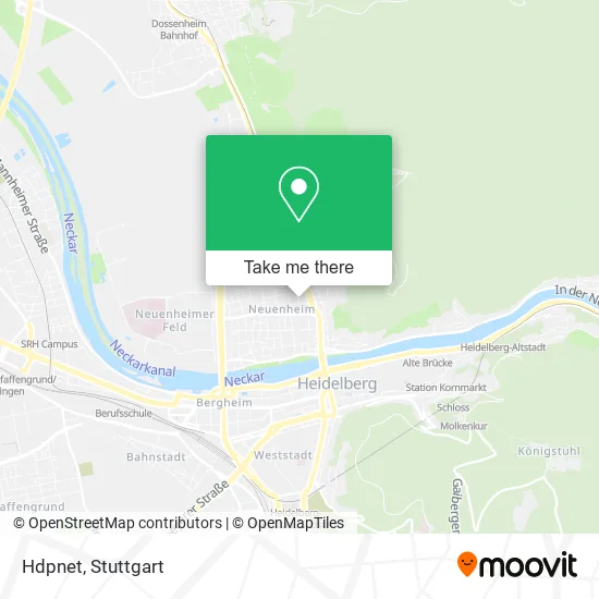
See Hdpnet, Neuenheim, on the map
Public Transit to Hdpnet in Neuenheim
Wondering how to get to Hdpnet in Neuenheim? Moovit helps you find the best way to get to Hdpnet with step-by-step directions from the nearest public transit station.
Moovit provides free maps and live directions to help you navigate through your city. View schedules, routes, timetables, and find out how long does it take to get to Hdpnet in real time.
Looking for the nearest stop or station to Hdpnet? Check out this list of stops closest to your destination: Kußmaulstraße; Neuenheim, Kußmaulstraße; Mönchhofschule; Neuenheim, Mönchhofschule; Lutherstraße; Neuenheim, Lutherstraße.
Bus: 31, 713, RNV 31, RNV 39A, E, M5, RNV 39, RNV MOONLINER 5, 37E, E, M5, RNV 37.Train: RB68, S3.Light Rail: 5, RNV 26, RNV 5.
Want to see if there’s another route that gets you there at an earlier time? Moovit helps you find alternative routes or times. Get directions from and directions to Hdpnet easily from the Moovit App or Website.
We make riding to Hdpnet easy, which is why over 1.5 million users, including users in Neuenheim, trust Moovit as the best app for public transit. You don’t need to download an individual bus app or train app, Moovit is your all-in-one transit app that helps you find the best bus time or train time available.
For information on prices of bus, light rail and train, costs and ride fares to Hdpnet, please check the Moovit app.
Use the app to navigate to popular places including to the airport, hospital, stadium, grocery store, mall, coffee shop, school, college, and university.
Hdpnet Address: Erwin-Rohde-Straße 18 Neuenheim, 69120 Heidelberg street in Neuenheim
- Moh.Immo Alpha,
- Hdpsoft,
- Dr.Med. Michael Heck Facharzt,
- Psychotherapie Praxis Sibylle Grabowsky,
- Yoga Shala,
- Spezial Polymer Mannheim,
- Lucia „Lucie“ Kuhn,
- Werner Kuhn,
- Bernadett Brado,
- Oeser Oliver,
- Angiologie Heidelberg,
- Thienemann, Verena Rechtsanwältin,
- Immobilien Röth Georg,
- Matthias Herbold Dipl.-Bankbetriebswirt Adg,
- Rich Immobilien,
- Vitamaze,
- @Newandable,
- Keiper Co,
- Ak Friedhofs- und Bestattungskultur Götz Stehr,
- Forstverwaltungen
Places Near Hdpnet (Neuenheim)
- Im Wizemann (Halle), Bad Cannstatt,
- Gleis 101/102 (tief), Stuttgart-Mitte,
- Mercedes-Benz Museum (Mercedes Museum Stuttgart), Bad Cannstatt,
- SI-Centrum, Möhringen,
- Hanns-Martin-Schleyer-Halle, Bad Cannstatt,
- Gasometer Pforzheim, Pforzheim,
- Mercedes-Benz Museum, Bad Cannstatt,
- Marmorsaal Im Weissenburgpark, Stuttgart-Süd,
- Porsche Museum, Zuffenhausen,
- Schleyerhalle, Bad Cannstatt,
- Wilhelma (U-Bahn Wilhelma), Bad Cannstatt,
- FlixBus Haltestelle, Stuttgart,
- Hauptbahnhof Stuttgart, Stuttgart-Mitte,
- Hanns-Martin-Schleyer-Halle (Stuttgart Hans-Martin-Schleyerhalle), Bad Cannstatt,
- Waldfriedhof, Degerloch,
- Klinikum Stuttgart - Katharinenhospital, Stuttgart-Mitte,
- Porsche-Arena, Bad Cannstatt,
- Mettingen Eros-Center Puff Laufhaus, Esslingen Am Neckar,
- Pariser Platz Stuttgart, Stuttgart-Mitte,
- Geilhaus Haus 33a, Reutlingen-Betzingen
How to get to popular places in Stuttgart with public transit
Get around Neuenheim by public transit!
Traveling around Neuenheim has never been so easy. See step by step directions as you travel to any attraction, street or major public transit station. View bus and train schedules, arrival times, service alerts and detailed routes on a map, so you know exactly how to get to anywhere in Neuenheim.
When traveling to any destination around Neuenheim use Moovit's Live Directions with Get Off Notifications to know exactly where and how far to walk, how long to wait for your line, and how many stops are left. Moovit will alert you when it's time to get off — no need to constantly re-check whether yours is the next stop.
Wondering how to use public transit in Neuenheim or how to pay for public transit in Neuenheim? Moovit public transit app can help you navigate your way with public transit easily, and at minimum cost. It includes public transit fees, ticket prices, and costs. Looking for a map of Neuenheim public transit lines? Moovit public transit app shows all public transit maps in Neuenheim with all Bus, Train, Subway, Light Rail, Ferry, S-Bahn and Funicular routes and stops on an interactive map.
Stuttgart has 7 transit type(s), including: Bus, Train, Subway, Light Rail, Ferry, S-Bahn and Funicular, operated by several transit agencies, including SSB - Stadtbahn, SSB, SSB - Seilbahn / Zacke, S-Bahn Stuttgart, Rhein-Neckar-Verkehr GmbH (rnv), Karlsruher Verkehrsverbund, DB AG, DB Regiobus BW, Arverio Baden-Württemberg GmbH, DB RegioNetz Verkehrs GmbH Westfrankenbahn, DB Regio AG Baden-Württemberg, Südwestdeutsche Verkehrs-AG, DB Regio AG Mitte Region Hessen, DB and Bodensee-Oberschwaben-Bahn