Directions to Health In Focus (Fort Salonga) with public transportation
The following transit lines have routes that pass near Health In Focus
 Bus: 7.
- Train: PORT JEFFERSON BRANCH.
How to get to Health In Focus by bus?
Click on the bus route to see step by step directions with maps, line arrival times and updated time schedules.
From Hauppauge ny, Hauppauge
101 minFrom Brentwood, NY, Brentwood
68 minFrom Paramount, Huntington
87 minFrom Jake's 58 Casino, Islandia
114 minFrom Tanger Outlets, Deer Park, Deer Park
92 minFrom Woodbury Long Island, Woodbury
108 minFrom Crest Hollow Country Club, Woodbury
104 minFrom Plainview, NY, Plainview
120 minFrom Good Samaritan Hospital Medical Center, West Islip
117 minFrom Tanger Outlets, Deer Park
89 min
How to get to Health In Focus by train?
Click on the train route to see step by step directions with maps, line arrival times and updated time schedules.
Train station near Health In Focus in Fort Salonga
- Northport, 19 min walk,VIEW
What are the closest stations to Health In Focus?
The closest stations to Health In Focus are:
- Northport is 1568 yards away, 19 min walk.
Which bus line stops near Health In Focus?
7 (Northport Va Medical Center)
Which train line stops near Health In Focus?
PORT JEFFERSON BRANCH (Port Jefferson)
What’s the nearest train station to Health In Focus in Fort Salonga?
The nearest train station to Health In Focus in Fort Salonga is Northport. It’s a 19 min walk away.
What time is the first train to Health In Focus in Fort Salonga?
The PORT JEFFERSON BRANCH is the first train that goes to Health In Focus in Fort Salonga. It stops nearby at 4:56 AM.
What time is the last train to Health In Focus in Fort Salonga?
The PORT JEFFERSON BRANCH is the last train that goes to Health In Focus in Fort Salonga. It stops nearby at 1:59 AM.
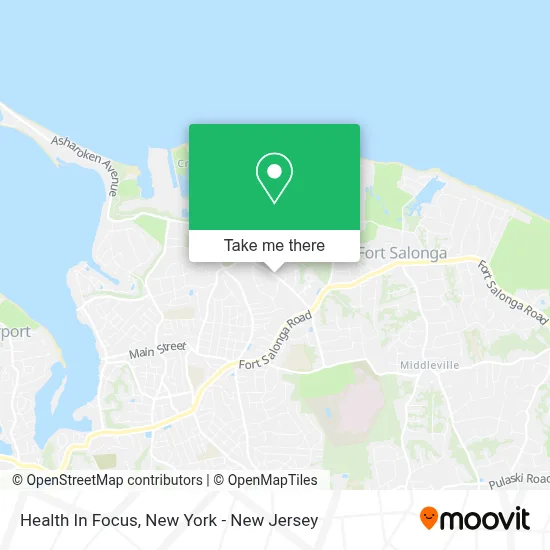
See Health In Focus, Fort Salonga, on the map
Public Transit to Health In Focus in Fort Salonga
Wondering how to get to Health In Focus in Fort Salonga? Moovit helps you find the best way to get to Health In Focus with step-by-step directions from the nearest public transit station.
Moovit provides free maps and live directions to help you navigate through your city. View schedules, routes, timetables, and find out how long does it take to get to Health In Focus in real time.
Looking for the nearest stop or station to Health In Focus? Check out this list of stops closest to your destination: Northport.
Bus: 7.Train: PORT JEFFERSON BRANCH.
Want to see if there’s another route that gets you there at an earlier time? Moovit helps you find alternative routes or times. Get directions from and directions to Health In Focus easily from the Moovit App or Website.
We make riding to Health In Focus easy, which is why over 1.5 million users, including users in Fort Salonga, trust Moovit as the best app for public transit. You don’t need to download an individual bus app or train app, Moovit is your all-in-one transit app that helps you find the best bus time or train time available.
For information on prices of bus and train, costs and ride fares to Health In Focus, please check the Moovit app.
Use the app to navigate to popular places including to the airport, hospital, stadium, grocery store, mall, coffee shop, school, college, and university.
Health In Focus Address: 4703 Norwood Road street in Fort Salonga
- Ups Access Point Location,
- Crab Meadow Golf Course,
- Tiger Soccer Academy,
- Jerome A. Ambro Memorial Wetlands Preserve,
- Del Vino Vineyards,
- S. Scherer and Sons,
- Citgo,
- Waterside Car Care,
- Airway Health Solutions,
- Old Fashioned Rx Llc.,
- House Of D,
- Elder Care Advisors Of Long Island,
- Dr Daniel E Galvin,
- Evolve Smoke Shop,
- Nyhandymannow.Com,
- Santander Bank Atm,
- Front Page Hair Design,
- Blackfish Tavern,
- Sea Stars Marine Camp Cornell Cooperative Extension Of Suffolk County,
- Shred Nations
Places Near Health In Focus (Fort Salonga)
- 26 Federal Plaza, Manhattan,
- Pier 83, Manhattan,
- Mountainside Hospital, Glen Ridge,
- 1 Police Plaza, Manhattan,
- 3 Stone St, Manhattan,
- San Gennaro Feast, Manhattan,
- Rockefeller Center, Manhattan,
- 111 Centre New York City Supreme Court, Manhattan,
- Hudson Yards, Manhattan,
- Katz's Deli, Manhattan,
- Times Square, Manhattan,
- Queens Center Mall, Queens,
- SoHo, Manhattan,
- Chinatown, Manhattan,
- qqqq, Manhattan,
- Bellevue Hospital, Manhattan,
- 376 Hudson Street, Manhattan,
- 911 Memorial, Manhattan,
- 66 John Street, Manhattan,
- Wall Street, Manhattan
How to get to popular places in New York - New Jersey with public transit
Get around Fort Salonga by public transit!
Traveling around Fort Salonga has never been so easy. See step by step directions as you travel to any attraction, street or major public transit station. View bus and train schedules, arrival times, service alerts and detailed routes on a map, so you know exactly how to get to anywhere in Fort Salonga.
When traveling to any destination around Fort Salonga use Moovit's Live Directions with Get Off Notifications to know exactly where and how far to walk, how long to wait for your line, and how many stops are left. Moovit will alert you when it's time to get off — no need to constantly re-check whether yours is the next stop.
Wondering how to use public transit in Fort Salonga or how to pay for public transit in Fort Salonga? Moovit public transit app can help you navigate your way with public transit easily, and at minimum cost. It includes public transit fees, ticket prices, and costs. Looking for a map of Fort Salonga public transit lines? Moovit public transit app shows all public transit maps in Fort Salonga with all Bus, Train, Subway, Light Rail, Ferry and Cable Car routes and stops on an interactive map.
New York - New Jersey has 6 transit type(s), including: Bus, Train, Subway, Light Rail, Ferry and Cable Car, operated by several transit agencies, including MTA Subway, Metro-North Railroad, LIRR, PATH, MTA New York City Transit - Express routes, MTA Bus, NJ Transit, NYC Ferry, NICE bus, Bee-Line Bus, NJ Transit Rail, Norwalk Transit District, Hartford Line, River Valley Transit and HART