How to get to Health Insurance Plans Chiropractic by bus?
Click on the bus route to see step by step directions with maps, line arrival times and updated time schedules.
From MD Live Casino Arundel Mills, Anne Arundel County
20 minFrom Laurel, Maryland, Prince George's County
35 minFrom I-95 Exit 33 - Laurel/Burtonsville (Sandy Spring Rd/MD 198), Prince George's County
70 minFrom Maryland Live! Casino, Anne Arundel County
24 minFrom Guinness Open Gate Brewery & Barrel House, Baltimore County
153 minFrom University Of Maryland Baltimore (Umbc), Baltimore County
163 minFrom NSA Friendship Annex (FANX), Anne Arundel County
63 minFrom Archbishop Spalding High School, Severn
207 min
How to get to Health Insurance Plans Chiropractic by train?
Click on the train route to see step by step directions with maps, line arrival times and updated time schedules.
Bus stops near Health Insurance Plans Chiropractic in Howard County
Train station near Health Insurance Plans Chiropractic in Howard County
- Jessup Marc Sb, 36 min walk,VIEW
Bus lines to Health Insurance Plans Chiropractic in Howard County
What are the closest stations to Health Insurance Plans Chiropractic?
The closest stations to Health Insurance Plans Chiropractic are:
- Assateague Dr & Washington Blvd is 267 yards away, 4 min walk.
- Assateague Dr / Maryland Food Center is 303 yards away, 5 min walk.
- Jessup Marc Sb is 3002 yards away, 36 min walk.
Which bus lines stop near Health Insurance Plans Chiropractic?
These bus lines stop near Health Insurance Plans Chiropractic: 409, 501.
Which train line stops near Health Insurance Plans Chiropractic?
MARC (Inbound - Camden)
What’s the nearest bus station to Health Insurance Plans Chiropractic in Howard County?
The nearest bus station to Health Insurance Plans Chiropractic in Howard County is Assateague Dr & Washington Blvd. It’s a 4 min walk away.
What time is the first train to Health Insurance Plans Chiropractic in Howard County?
The MARC is the first train that goes to Health Insurance Plans Chiropractic in Howard County. It stops nearby at 6:53 AM.
What time is the last train to Health Insurance Plans Chiropractic in Howard County?
The MARC is the last train that goes to Health Insurance Plans Chiropractic in Howard County. It stops nearby at 5:59 PM.
What time is the first bus to Health Insurance Plans Chiropractic in Howard County?
The 320 is the first bus that goes to Health Insurance Plans Chiropractic in Howard County. It stops nearby at 5:44 AM.
What time is the last bus to Health Insurance Plans Chiropractic in Howard County?
The 501 is the last bus that goes to Health Insurance Plans Chiropractic in Howard County. It stops nearby at 10:26 PM.
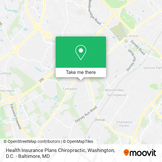
See Health Insurance Plans Chiropractic, Howard County, on the map
Public Transit to Health Insurance Plans Chiropractic in Howard County
Wondering how to get to Health Insurance Plans Chiropractic in Howard County? Moovit helps you find the best way to get to Health Insurance Plans Chiropractic with step-by-step directions from the nearest public transit station.
Moovit provides free maps and live directions to help you navigate through your city. View schedules, routes, timetables, and find out how long does it take to get to Health Insurance Plans Chiropractic in real time.
Looking for the nearest stop or station to Health Insurance Plans Chiropractic? Check out this list of stops closest to your destination: Assateague Dr & Washington Blvd; Assateague Dr / Maryland Food Center; Jessup Marc Sb.
Bus: 409, 501, 320.Train: MARC.
Want to see if there’s another route that gets you there at an earlier time? Moovit helps you find alternative routes or times. Get directions from and directions to Health Insurance Plans Chiropractic easily from the Moovit App or Website.
We make riding to Health Insurance Plans Chiropractic easy, which is why over 1.5 million users, including users in Howard County, trust Moovit as the best app for public transit. You don’t need to download an individual bus app or train app, Moovit is your all-in-one transit app that helps you find the best bus time or train time available.
For information on prices of bus and train, costs and ride fares to Health Insurance Plans Chiropractic, please check the Moovit app.
Get to Health Insurance Plans Chiropractic with public transit and pay for the ride in the Moovit app. In addition to all info you may need for your trip to Health Insurance Plans Chiropractic, including live directions, real-time arrivals and fare prices, you can also buy public transit passes for your rides. No need for cash or paper tickets to get to Health Insurance Plans Chiropractic - everything you need is accessible in the app with a click of the button.
Use the app to navigate to popular places including to the airport, hospital, stadium, grocery store, mall, coffee shop, school, college, and university.
Health Insurance Plans Chiropractic Address: 7460 Conowingo Ave Jessup, MD 20794 street in Howard County
- MD Interprise,
- Green Paradise,
- Class Produce Group,
- IHOP (International House of Pancakes),
- Ideal Auto & Lock Service,
- Produmex,
- Agri-Mix Produce (Tropical Foods & Produce),
- USPS Collection Box - Blue Box,
- FedEx,
- Firebrand Exterminators,
- bp,
- Travelcenters of America (Truck Stops of America Baltimore),
- Baltimore South Ta (Ta Truck Service),
- McDonald's,
- Meatballs Etc of Jessup,
- Ryder Truck Rental and Leasing,
- Pocomoke MD-175,
- Amazon Locker-Travel,
- Red Roof Inn-Columbia Jessup (Red Roof Inn Washington DC - Columbia / Fort Meade),
- Howard County Detention Center
Places Near Health Insurance Plans Chiropractic (Howard County)
- Amazon Hq2, Arlington County,
- Rock Creek Tennis Center, Washington,
- Washington DC VA Medical Center, Washington,
- Museum Of The Bible, Washington,
- Camden Yards, Baltimore,
- PG Mall, Prince George's County,
- Westfield Montgomery Mall, Montgomery County,
- Sibley Memorial Hospital, Washington,
- The Anthem, Washington,
- Pennsylvania Ave NW (3rd st and pennsylvania), Washington,
- Marriott Marquis Washington, DC, Washington,
- National Zoo, Washington,
- Washington National Cathedral, Washington,
- M&T Bank Stadium, Baltimore,
- Warner Theatre, Washington,
- Basilica of the National Shrine, Washington,
- National Mall, Washington,
- Capital One Arena, Washington,
- Georgetown, Washington,
- National Museum of African American History and Culture, Washington
How to get to popular places in Washington, D.C. - Baltimore, MD with public transit
Get around Howard County by public transit!
Traveling around Howard County has never been so easy. See step by step directions as you travel to any attraction, street or major public transit station. View bus and train schedules, arrival times, service alerts and detailed routes on a map, so you know exactly how to get to anywhere in Howard County.
When traveling to any destination around Howard County use Moovit's Live Directions with Get Off Notifications to know exactly where and how far to walk, how long to wait for your line, and how many stops are left. Moovit will alert you when it's time to get off — no need to constantly re-check whether yours is the next stop.
Wondering how to use public transit in Howard County or how to pay for public transit in Howard County? Moovit public transit app can help you navigate your way with public transit easily, and at minimum cost. It includes public transit fees, ticket prices, and costs. Looking for a map of Howard County public transit lines? Moovit public transit app shows all public transit maps in Howard County with all Bus, Train, Metro, Light Rail and Ferry routes and stops on an interactive map.
Washington, D.C. - Baltimore, MD has 5 transit type(s), including: Bus, Train, Metro, Light Rail and Ferry, operated by several transit agencies, including WMATA, Montgomery County Ride On, Fairfax Connector, TheBus, PRTC, DASH - Alexandria, Arlington Transit (ART), RTA of Central Maryland, MDOT MTA, MDOT MTA Light RailLink, MDOT MTA Commuter Bus, MDOT MTA Local Bus, FXBGO!, Virginia Railway Express (VRE) and MARC