How to get to Health One by bus?
Click on the bus route to see step by step directions with maps, line arrival times and updated time schedules.
From George Mason University, Fairfax County
59 minFrom EagleBank Arena, Fairfax County
68 minFrom Hollywood Casino at Charles Town Races, Fairfax County
98 minFrom Reston Town Center, Fairfax County
54 minFrom Inova employee Shuttle, Fairfax County
54 minFrom Eden Center, Falls Church
57 minFrom Carderock Division of the Naval Surface Warfare Center, Montgomery County
120 minFrom Fair Oaks Mall, Fairfax County
52 minFrom Fairfax County Courthouse, Fairfax County
59 min
How to get to Health One by metro?
Click on the metro route to see step by step directions with maps, line arrival times and updated time schedules.
Bus stops near Health One in Fairfax County
Metro stations near Health One in Fairfax County
Bus lines to Health One in Fairfax County
What are the closest stations to Health One?
The closest stations to Health One are:
- Maple Ave @ East St is 78 yards away, 2 min walk.
- Church St NE @ East St NE is 245 yards away, 4 min walk.
- Maple Ave @ Mashie Dr is 290 yards away, 4 min walk.
- Greensboro is 3094 yards away, 36 min walk.
- Dunn Loring Merrifield Metro Station is 3373 yards away, 40 min walk.
Which bus lines stop near Health One?
These bus lines stop near Health One: 462, 463.
Which metro line stops near Health One?
SILVER (Largo)
What’s the nearest bus station to Health One in Fairfax County?
The nearest bus station to Health One in Fairfax County is Maple Ave @ East St. It’s a 2 min walk away.
What time is the first metro to Health One in Fairfax County?
The ORANGE is the first metro that goes to Health One in Fairfax County. It stops nearby at 5:00 AM.
What time is the last metro to Health One in Fairfax County?
The SILVER is the last metro that goes to Health One in Fairfax County. It stops nearby at 12:43 AM.
What time is the first bus to Health One in Fairfax County?
The 463 is the first bus that goes to Health One in Fairfax County. It stops nearby at 5:13 AM.
What time is the last bus to Health One in Fairfax County?
The 463 is the last bus that goes to Health One in Fairfax County. It stops nearby at 11:40 PM.
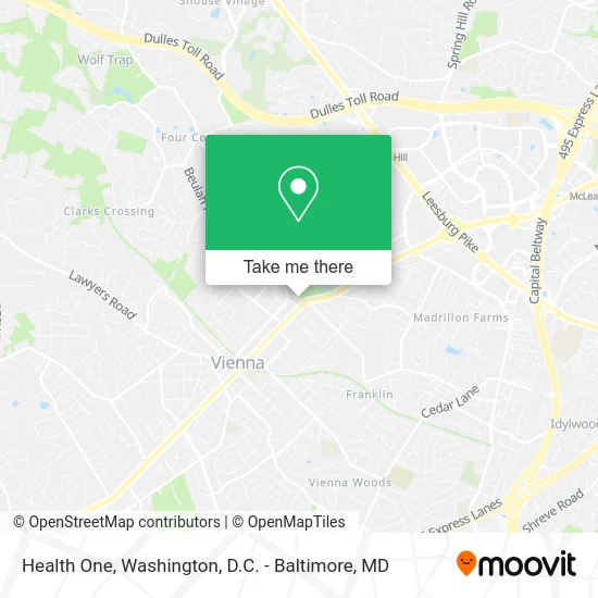
See Health One, Fairfax County, on the map
Public Transit to Health One in Fairfax County
Wondering how to get to Health One in Fairfax County? Moovit helps you find the best way to get to Health One with step-by-step directions from the nearest public transit station.
Moovit provides free maps and live directions to help you navigate through your city. View schedules, routes, timetables, and find out how long does it take to get to Health One in real time.
Looking for the nearest stop or station to Health One? Check out this list of stops closest to your destination: Maple Ave @ East St; Church St NE @ East St NE; Maple Ave @ Mashie Dr; Greensboro; Dunn Loring Merrifield Metro Station.
Bus: 462, 463, 467, 432.Metro: SILVER, ORANGE.
Want to see if there’s another route that gets you there at an earlier time? Moovit helps you find alternative routes or times. Get directions from and directions to Health One easily from the Moovit App or Website.
We make riding to Health One easy, which is why over 1.5 million users, including users in Fairfax County, trust Moovit as the best app for public transit. You don’t need to download an individual bus app or train app, Moovit is your all-in-one transit app that helps you find the best bus time or train time available.
For information on prices of bus and metro, costs and ride fares to Health One, please check the Moovit app.
Use the app to navigate to popular places including to the airport, hospital, stadium, grocery store, mall, coffee shop, school, college, and university.
Health One Address: 131 East St NE Vienna, VA 22180 street in Fairfax County
- Noodles & Company,
- SH- East St NE,
- Rodent / Rat / Mice Removal Exterminators,
- DC College Counseling,
- Pamir Consulting,
- United Healthcare,
- Triple C Travel & Tours,
- Anthony Ford, Realtor,
- Dobson, Davanzo & Associates,
- Elite Latin Multiservices,
- The Grille Room,
- Westwood Country Club,
- VHC Health - ob / Gyn Physician Group,
- Big Planet Comics,
- Christine Primus, LCSW,
- Tegbiz,
- PS Catering,
- Washington Communities,
- SH-123 Berry St SE,
- Security Locks Vienna
Places Near Health One (Fairfax County)
- National Museum of African American History and Culture, Washington,
- Sibley Memorial Hospital, Washington,
- National Zoo, Washington,
- Georgetown, Washington,
- Westfield Montgomery Mall, Montgomery County,
- Pennsylvania Ave NW (3rd st and pennsylvania), Washington,
- PG Mall, Prince George's County,
- Rock Creek Tennis Center, Washington,
- Basilica of the National Shrine, Washington,
- M&T Bank Stadium, Baltimore,
- Washington National Cathedral, Washington,
- The Anthem, Washington,
- Capital One Arena, Washington,
- Museum Of The Bible, Washington,
- National Mall, Washington,
- Warner Theatre, Washington,
- Amazon Hq2, Arlington County,
- Camden Yards, Baltimore,
- Marriott Marquis Washington, DC, Washington,
- Washington DC VA Medical Center, Washington
How to get to popular places in Washington, D.C. - Baltimore, MD with public transit
Get around Fairfax County by public transit!
Traveling around Fairfax County has never been so easy. See step by step directions as you travel to any attraction, street or major public transit station. View bus and train schedules, arrival times, service alerts and detailed routes on a map, so you know exactly how to get to anywhere in Fairfax County.
When traveling to any destination around Fairfax County use Moovit's Live Directions with Get Off Notifications to know exactly where and how far to walk, how long to wait for your line, and how many stops are left. Moovit will alert you when it's time to get off — no need to constantly re-check whether yours is the next stop.
Wondering how to use public transit in Fairfax County or how to pay for public transit in Fairfax County? Moovit public transit app can help you navigate your way with public transit easily, and at minimum cost. It includes public transit fees, ticket prices, and costs. Looking for a map of Fairfax County public transit lines? Moovit public transit app shows all public transit maps in Fairfax County with all Bus, Train, Metro, Light Rail and Ferry routes and stops on an interactive map.
Washington, D.C. - Baltimore, MD has 5 transit type(s), including: Bus, Train, Metro, Light Rail and Ferry, operated by several transit agencies, including WMATA, Montgomery County Ride On, Fairfax Connector, TheBus, PRTC, DASH - Alexandria, Arlington Transit (ART), RTA of Central Maryland, MDOT MTA, MDOT MTA Light RailLink, MDOT MTA Commuter Bus, MDOT MTA Local Bus, FXBGO!, Virginia Railway Express (VRE) and MARC