How to get to Healthy Options Corner by bus?
Click on the bus route to see step by step directions with maps, line arrival times and updated time schedules.
From Ziff Ballet Opera House, Miami
74 minFrom Adrienne Arsht Center for the Performing Arts, Miami
74 minFrom Miami VA Hospital, Miami
82 minFrom Southwest Miami Senior High School, South Westside
57 minFrom James L. Knight Center, Miami
67 minFrom The Salvation Army, Miami
78 minFrom Brickell Key Trolley Stop, Miami
64 minFrom Northwest 12th Avenue & Northwest 12th Street, Miami
69 minFrom Miami-Dade County School Board Administration Building, Miami
82 minFrom Patricia and Phillip Frost Museum of Science, Miami
72 min
How to get to Healthy Options Corner by train?
Click on the train route to see step by step directions with maps, line arrival times and updated time schedules.
From Ziff Ballet Opera House, Miami
47 minFrom Adrienne Arsht Center for the Performing Arts, Miami
47 minFrom Miami VA Hospital, Miami
36 minFrom James L. Knight Center, Miami
36 minFrom The Salvation Army, Miami
46 minFrom Brickell Key Trolley Stop, Miami
43 minFrom Northwest 12th Avenue & Northwest 12th Street, Miami
41 minFrom Miami-Dade County School Board Administration Building, Miami
48 minFrom Patricia and Phillip Frost Museum of Science, Miami
46 min
Bus stops near Healthy Options Corner in Miami
Train station near Healthy Options Corner in Miami
- Douglas Road, 29 min walk,VIEW
Bus lines to Healthy Options Corner in Miami
What are the closest stations to Healthy Options Corner?
The closest stations to Healthy Options Corner are:
- Ponce De Leon Bd & Blue Rd is 339 yards away, 5 min walk.
- Sw 42 Av & Menendez Av is 360 yards away, 5 min walk.
- Sw 42 Av & Granello Av is 468 yards away, 6 min walk.
- Armbrister Park is 764 yards away, 10 min walk.
- Douglas Road is 2397 yards away, 29 min walk.
Which bus lines stop near Healthy Options Corner?
These bus lines stop near Healthy Options Corner: 37, 42, 57, CGABLE, MIACOCO.
Which train lines stop near Healthy Options Corner?
These train lines stop near Healthy Options Corner: GREEN, ORANGE.
What’s the nearest train station to Healthy Options Corner in Miami?
The nearest train station to Healthy Options Corner in Miami is Douglas Road. It’s a 29 min walk away.
What’s the nearest bus station to Healthy Options Corner in Miami?
The nearest bus stations to Healthy Options Corner in Miami are Ponce De Leon Bd & Blue Rd and Sw 42 Av & Menendez Av. The closest one is a 5 min walk away.
What time is the first train to Healthy Options Corner in Miami?
The GREEN is the first train that goes to Healthy Options Corner in Miami. It stops nearby at 5:04 AM.
What time is the last train to Healthy Options Corner in Miami?
The GREEN is the last train that goes to Healthy Options Corner in Miami. It stops nearby at 1:00 AM.
What time is the first bus to Healthy Options Corner in Miami?
The 57 is the first bus that goes to Healthy Options Corner in Miami. It stops nearby at 6:07 AM.
What time is the last bus to Healthy Options Corner in Miami?
The MIACOCO is the last bus that goes to Healthy Options Corner in Miami. It stops nearby at 11:20 PM.
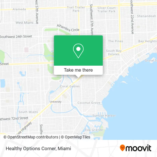
See Healthy Options Corner, Miami, on the map
Public Transit to Healthy Options Corner in Miami
Wondering how to get to Healthy Options Corner in Miami? Moovit helps you find the best way to get to Healthy Options Corner with step-by-step directions from the nearest public transit station.
Moovit provides free maps and live directions to help you navigate through your city. View schedules, routes, timetables, and find out how long does it take to get to Healthy Options Corner in real time.
Looking for the nearest stop or station to Healthy Options Corner? Check out this list of stops closest to your destination: Ponce De Leon Bd & Blue Rd; Sw 42 Av & Menendez Av; Sw 42 Av & Granello Av; Armbrister Park; Douglas Road.
Bus: 37, 42, 57, CGABLE, MIACOCO, CGABDT, 136, CGABGA.Train: GREEN, ORANGE.
Want to see if there’s another route that gets you there at an earlier time? Moovit helps you find alternative routes or times. Get directions from and directions to Healthy Options Corner easily from the Moovit App or Website.
We make riding to Healthy Options Corner easy, which is why over 1.5 million users, including users in Miami, trust Moovit as the best app for public transit. You don’t need to download an individual bus app or train app, Moovit is your all-in-one transit app that helps you find the best bus time or train time available.
For information on prices of train, bus and light rail, costs and ride fares to Healthy Options Corner, please check the Moovit app.
Use the app to navigate to popular places including to the airport, hospital, stadium, grocery store, mall, coffee shop, school, college, and university.
Healthy Options Corner Address: 473 S Dixie Hwy Miami, FL 33146 street in Miami
- STARBUCKS,
- The Appliance Repair Gurus,
- Ssaiba 3,
- Municipal Lot 12&16,
- Nicole Valdes PHD & Associates P.A.,
- Mark R Antonelli Aty,
- Medipath,
- Riviera Professional Building,
- Gulfstream Companies,
- Ghantous Ibrahim,
- Lopez & Duran Interpreting & Translating,
- Verizon Wireless,
- CK at Lejeune,
- Lip House of Wellness,
- Munch by Pump & Munch,
- Maria R. Lopez- Galan Dental Office,
- Dr Daniel Campos,
- Appliance Repair Samsung Repair Service,
- Vieramarthamd,
- Zarr Norman DDS Pa
Places Near Healthy Options Corner (Miami)
- Wynwood, Miami,
- Port of Miami Cruise Terminal, Miami,
- Keiser University Flagship Campus, West Palm Beach,
- Little Havana, Miami,
- Miami VA Hospital, Miami,
- Brickell City Centre, Miami,
- Marlins Park, Miami,
- Miami Freedom Park, Miami,
- Aventura Mall, Miami,
- Bayside Marketplace, Miami,
- Richard E. Gerstein Justice Building, Miami,
- Miami-Dade County Courthouse, Miami,
- Zoo Miami, Miami,
- Miami Design District, Miami,
- Aventura Mall, Miami Beach,
- Hard Rock Stadium, Miami Gardens,
- Sawgrass mall ( FL ), Miami Beach,
- Dolphin Mall Bus, Miami,
- Dolphin Mall, Miami,
- Sawgrass Mall, Miami
How to get to popular places in Miami with public transit
Get around Miami by public transit!
Traveling around Miami has never been so easy. See step by step directions as you travel to any attraction, street or major public transit station. View bus and train schedules, arrival times, service alerts and detailed routes on a map, so you know exactly how to get to anywhere in Miami.
When traveling to any destination around Miami use Moovit's Live Directions with Get Off Notifications to know exactly where and how far to walk, how long to wait for your line, and how many stops are left. Moovit will alert you when it's time to get off — no need to constantly re-check whether yours is the next stop.
Wondering how to use public transit in Miami or how to pay for public transit in Miami? Moovit public transit app can help you navigate your way with public transit easily, and at minimum cost. It includes public transit fees, ticket prices, and costs. Looking for a map of Miami public transit lines? Moovit public transit app shows all public transit maps in Miami with all Bus, Train, Light Rail and Ferry routes and stops on an interactive map.
Miami has 4 transit type(s), including: Bus, Train, Light Rail and Ferry, operated by several transit agencies, including Broward County Transit, Miami-Dade Transit, Metrorail, Palm Tran, Tri-Rail, Brightline, MARTY, City of Homestead Trolley, Key West Transit, Treasure Coast Connector, GoLine IRT, Amtrak, Greyhound-us, FlixBus-us and Aventura Express Shuttle Bus