Directions to Heartvslogic (Baltimore County) with public transportation
The following transit lines have routes that pass near Heartvslogic
 Bus: 81.
How to get to Heartvslogic by bus?
Click on the bus route to see step by step directions with maps, line arrival times and updated time schedules.
From I-70 at Security Blvd Baltimore City Lot Park & Ride, Baltimore
84 minFrom Mva, Baltimore
54 minFrom I-695 @ Exit 17 (Security Blvd/MD 122), Baltimore County
45 minFrom Owings Mills, Maryland, Baltimore County
83 minFrom Sinai Hospital, Baltimore
62 minFrom Pimlico Race Course, Baltimore
62 minFrom Walmart, Baltimore County
46 minFrom Reisterstown Road Plaza, Baltimore
49 minFrom Johns Hopkins Medicine at Green Spring Station, Baltimore County
82 minFrom I-695 @ Exit 18 (Liberty Rd/MD 26), Baltimore County
24 min
Bus stop near Heartvslogic in Baltimore County
- Randallstown Loop, 1 min walk,VIEW
Bus lines to Heartvslogic in Baltimore County
- 81, Deer Park,VIEW
What are the closest stations to Heartvslogic?
The closest stations to Heartvslogic are:
- Randallstown Loop is 27 yards away, 1 min walk.
Which bus line stops near Heartvslogic?
81 (Deer Park)
What’s the nearest bus station to Heartvslogic in Baltimore County?
The nearest bus station to Heartvslogic in Baltimore County is Randallstown Loop. It’s a 1 min walk away.
What time is the first bus to Heartvslogic in Baltimore County?
The 81 is the first bus that goes to Heartvslogic in Baltimore County. It stops nearby at 4:05 AM.
What time is the last bus to Heartvslogic in Baltimore County?
The 81 is the last bus that goes to Heartvslogic in Baltimore County. It stops nearby at 2:32 AM.
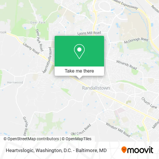
See Heartvslogic, Baltimore County, on the map
Public Transit to Heartvslogic in Baltimore County
Wondering how to get to Heartvslogic in Baltimore County? Moovit helps you find the best way to get to Heartvslogic with step-by-step directions from the nearest public transit station.
Moovit provides free maps and live directions to help you navigate through your city. View schedules, routes, timetables, and find out how long does it take to get to Heartvslogic in real time.
Looking for the nearest stop or station to Heartvslogic? Check out this list of stops closest to your destination: Randallstown Loop.
Bus: 81.
Want to see if there’s another route that gets you there at an earlier time? Moovit helps you find alternative routes or times. Get directions from and directions to Heartvslogic easily from the Moovit App or Website.
We make riding to Heartvslogic easy, which is why over 1.5 million users, including users in Baltimore County, trust Moovit as the best app for public transit. You don’t need to download an individual bus app or train app, Moovit is your all-in-one transit app that helps you find the best bus time or train time available.
For information on prices of bus and metro, costs and ride fares to Heartvslogic, please check the Moovit app.
Use the app to navigate to popular places including to the airport, hospital, stadium, grocery store, mall, coffee shop, school, college, and university.
Heartvslogic Address: 3604 Chapman Rd Randallstown, MD 21133 street in Baltimore County
- Bodyguard Plus, Inc.,
- Flex Tag and Title,
- The Platinium Restaurant,
- Wylie Funeral Home,
- Ocean Cutz,
- Mickty Sweet Catering,
- Locd N Love,
- Long Lasting Braids,
- Faith Cleaning Company,
- Diaspora Realty Enterprise,
- H2O 2u Mobile IV Hydration Services,
- Community 247,
- Atlantis Aquatics,
- Mowtown Services,
- Mitchell Services,
- Fine Finish Landscaping and Addition,
- Turf Doc Landscaping,
- Hoopla Connection,
- Content Complex,
- Agape' Christian Baptist Church
Places Near Heartvslogic (Baltimore County)
- Marriott Marquis Washington, DC, Washington,
- National Theatre, Washington,
- Washington National Cathedral, Washington,
- M&T Bank Stadium, Baltimore,
- Capital One Arena, Washington,
- Washington DC VA Medical Center, Washington,
- Georgetown, Washington,
- National Zoo, Washington,
- Pennsylvania Ave NW (3rd st and pennsylvania), Washington,
- National Museum of African American History and Culture, Washington,
- Camden Yards, Baltimore,
- PG Mall, Prince George's County,
- Museum Of The Bible, Washington,
- Warner Theatre, Washington,
- Rock Creek Tennis Center, Washington,
- Amazon Hq2, Arlington County,
- Westfield Montgomery Mall, Montgomery County,
- Sibley Memorial Hospital, Washington,
- The Anthem, Washington,
- Basilica of the National Shrine, Washington
How to get to popular places in Washington, D.C. - Baltimore, MD with public transit
Get around Baltimore County by public transit!
Traveling around Baltimore County has never been so easy. See step by step directions as you travel to any attraction, street or major public transit station. View bus and train schedules, arrival times, service alerts and detailed routes on a map, so you know exactly how to get to anywhere in Baltimore County.
When traveling to any destination around Baltimore County use Moovit's Live Directions with Get Off Notifications to know exactly where and how far to walk, how long to wait for your line, and how many stops are left. Moovit will alert you when it's time to get off — no need to constantly re-check whether yours is the next stop.
Wondering how to use public transit in Baltimore County or how to pay for public transit in Baltimore County? Moovit public transit app can help you navigate your way with public transit easily, and at minimum cost. It includes public transit fees, ticket prices, and costs. Looking for a map of Baltimore County public transit lines? Moovit public transit app shows all public transit maps in Baltimore County with all Bus, Train, Metro, Light Rail and Ferry routes and stops on an interactive map.
Washington, D.C. - Baltimore, MD has 5 transit type(s), including: Bus, Train, Metro, Light Rail and Ferry, operated by several transit agencies, including WMATA, Montgomery County Ride On, Fairfax Connector, TheBus, PRTC, DASH - Alexandria, Arlington Transit (ART), RTA of Central Maryland, MDOT MTA, MDOT MTA Light RailLink, MDOT MTA Commuter Bus, MDOT MTA Local Bus, FXBGO!, Virginia Railway Express (VRE) and MARC