How to get to Heisig Klaus by bus?
Click on the bus route to see step by step directions with maps, line arrival times and updated time schedules.
From Möbel Höffner, Schwetzingen
79 minFrom Hauptfeuerwache, Berufsfeuerwehr Mannheim, Neckarau
127 minFrom SAP Campus, Walldorf
37 minFrom Universitätsklinikum Heidelberg-Notaufnahme, Neuenheim
74 minFrom Thingstätte, Handschuhsheim
72 minFrom SAP Headquarters, Walldorf
66 minFrom Luxor Filmpalast, Bahnstadt
64 minFrom Thermen & Badewelt Sinsheim, Sinsheim
136 min
How to get to Heisig Klaus by train?
Click on the train route to see step by step directions with maps, line arrival times and updated time schedules.
Bus stops near Heisig Klaus in Stuttgart
Train station near Heisig Klaus in Stuttgart
- St. Ilgen, Bahnhof, 9 min walk,VIEW
Light Rail stations near Heisig Klaus in Stuttgart
Bus lines to Heisig Klaus in Stuttgart
- 726, Sandhausen, Schulzentrum West - Nußloch, Kurpfalzstraße,VIEW
- 751, Leimen, Kurpfalz-Centrum - Leimen, Kurpfalz-Centrum,VIEW
- 758, Sandhausen, Nord - Leimen, Steige,VIEW
- 7902, St. Ilgen, Heidelberger Weg - Leimen, Kurpfalz-Centrum,VIEW
- 759, St. Ilgen, Bahnhof West - St. Ilgen, Bahnhof West,VIEW
- 7923, Sandhausen, Ecke Leimbachring - St. Ilgen, Bahnhof West,VIEW
- 725, St. Ilgen, Bahnhof West,VIEW
What are the closest stations to Heisig Klaus?
The closest stations to Heisig Klaus are:
- Fasanerie, Salierallee is 278 meters away, 4 min walk.
- St. Ilgen, Bahnhof West is 663 meters away, 9 min walk.
- St. Ilgen, Bahnhof is 666 meters away, 9 min walk.
- St. Ilgen-Sandhausen Bahnhof is 666 meters away, 9 min walk.
- Georgi-Marktplatz is 1371 meters away, 18 min walk.
Which bus lines stop near Heisig Klaus?
These bus lines stop near Heisig Klaus: 720, 721, 725, 749, 758.
Which train lines stop near Heisig Klaus?
These train lines stop near Heisig Klaus: RB68, S3.
Which light rail lines stop near Heisig Klaus?
These light rail lines stop near Heisig Klaus: S3, S4.
What’s the nearest light rail station to Heisig Klaus in Stuttgart?
The nearest light rail station to Heisig Klaus in Stuttgart is St. Ilgen-Sandhausen Bahnhof. It’s a 9 min walk away.
What’s the nearest train station to Heisig Klaus in Stuttgart?
The nearest train station to Heisig Klaus in Stuttgart is St. Ilgen, Bahnhof. It’s a 9 min walk away.
What’s the nearest bus station to Heisig Klaus in Stuttgart?
The nearest bus station to Heisig Klaus in Stuttgart is Fasanerie, Salierallee. It’s a 4 min walk away.
What time is the first light rail to Heisig Klaus in Stuttgart?
The S1 is the first light rail that goes to Heisig Klaus in Stuttgart. It stops nearby at 3:57 AM.
What time is the last light rail to Heisig Klaus in Stuttgart?
The S3 is the last light rail that goes to Heisig Klaus in Stuttgart. It stops nearby at 1:48 AM.
What time is the first train to Heisig Klaus in Stuttgart?
The S3 is the first train that goes to Heisig Klaus in Stuttgart. It stops nearby at 4:09 AM.
What time is the last train to Heisig Klaus in Stuttgart?
The S3 is the last train that goes to Heisig Klaus in Stuttgart. It stops nearby at 1:48 AM.
What time is the first bus to Heisig Klaus in Stuttgart?
The 751 is the first bus that goes to Heisig Klaus in Stuttgart. It stops nearby at 6:07 AM.
What time is the last bus to Heisig Klaus in Stuttgart?
The 7902 is the last bus that goes to Heisig Klaus in Stuttgart. It stops nearby at 1:55 AM.
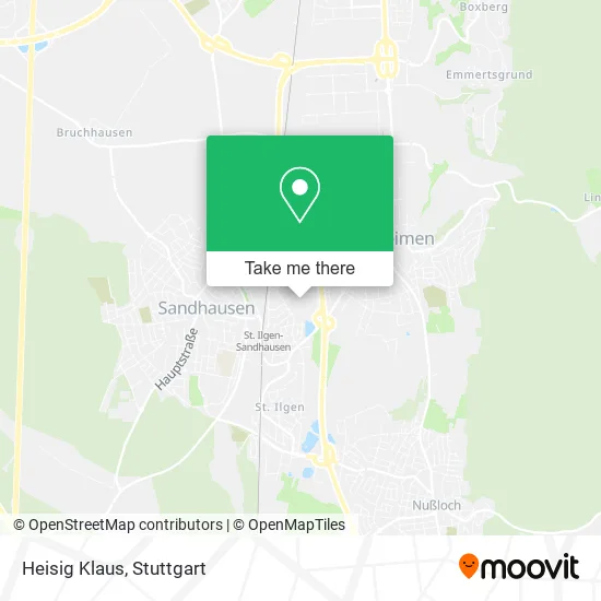
See Heisig Klaus, Stuttgart, on the map
Public Transit to Heisig Klaus in Stuttgart
Wondering how to get to Heisig Klaus in Stuttgart? Moovit helps you find the best way to get to Heisig Klaus with step-by-step directions from the nearest public transit station.
Moovit provides free maps and live directions to help you navigate through your city. View schedules, routes, timetables, and find out how long does it take to get to Heisig Klaus in real time.
Looking for the nearest stop or station to Heisig Klaus? Check out this list of stops closest to your destination: Fasanerie; St. Ilgen; St. Ilgen; St. Ilgen-Sandhausen Bahnhof; Georgi-Marktplatz.
Bus: 720, 721, 725, 749, 758, 726, 751, 7902, 759, 7923.Train: RB68, S3.Light Rail: S3, S4.
Want to see if there’s another route that gets you there at an earlier time? Moovit helps you find alternative routes or times. Get directions from and directions to Heisig Klaus easily from the Moovit App or Website.
We make riding to Heisig Klaus easy, which is why over 1.5 million users, including users in Stuttgart, trust Moovit as the best app for public transit. You don’t need to download an individual bus app or train app, Moovit is your all-in-one transit app that helps you find the best bus time or train time available.
For information on prices of bus, train and light rail, costs and ride fares to Heisig Klaus, please check the Moovit app.
Use the app to navigate to popular places including to the airport, hospital, stadium, grocery store, mall, coffee shop, school, college, and university.
Heisig Klaus Address: Centgrafenweg 9 Sankt Ilgen, 69181 Leimen street in Stuttgart
- Vimi Ug (Haftungsbeschränkt),
- Flugticketservice24,
- Curt George Geier und Phian Bunkasin-Geier,
- Bernward Tonak Handelsvermittlung,
- Hundewiese Leimen,
- Calisthenics Anlage,
- Städtischer Kindergarten Nikolaus-Lenau,
- Nikolaus-Lenau-Haus,
- Goethestraße,
- Am Fischwasser II / Kleinspielfeld,
- St Ilgen Salierallee,
- Kurfürstenallee 5,
- Züchterklause,
- Marketing und Mehr,
- Making Faces,
- Bernhard Schnetzer,
- Fliesenlegerfachbetrieb Kay Junkers,
- Kaninchen- Und Geflügelzuchtverein 1931 St. Ilgen E.V.,
- Firma Hubert Reith,
- @Forscherfreunde
Places Near Heisig Klaus (Stuttgart)
- Wilhelma (U-Bahn Wilhelma), Bad Cannstatt,
- Porsche Museum, Zuffenhausen,
- Pariser Platz Stuttgart, Stuttgart-Mitte,
- Hanns-Martin-Schleyer-Halle (Stuttgart Hans-Martin-Schleyerhalle), Bad Cannstatt,
- Hanns-Martin-Schleyer-Halle, Bad Cannstatt,
- Marmorsaal Im Weissenburgpark, Stuttgart-Süd,
- Im Wizemann (Halle), Bad Cannstatt,
- Schleyerhalle, Bad Cannstatt,
- Mercedes-Benz Museum (Mercedes Museum Stuttgart), Bad Cannstatt,
- Hauptbahnhof Stuttgart, Stuttgart-Mitte,
- Mettingen Eros-Center Puff Laufhaus, Esslingen Am Neckar,
- Gleis 101/102 (tief), Stuttgart-Mitte,
- Klinikum Stuttgart - Katharinenhospital, Stuttgart-Mitte,
- FlixBus Haltestelle, Stuttgart,
- Mercedes-Benz Museum, Bad Cannstatt,
- Porsche-Arena, Bad Cannstatt,
- Geilhaus Haus 33a, Reutlingen-Betzingen,
- Waldfriedhof, Degerloch,
- SI-Centrum, Möhringen,
- Gasometer Pforzheim, Pforzheim
How to get to popular places in Stuttgart with public transit
Get around Stuttgart by public transit!
Traveling around Stuttgart has never been so easy. See step by step directions as you travel to any attraction, street or major public transit station. View bus and train schedules, arrival times, service alerts and detailed routes on a map, so you know exactly how to get to anywhere in Stuttgart.
When traveling to any destination around Stuttgart use Moovit's Live Directions with Get Off Notifications to know exactly where and how far to walk, how long to wait for your line, and how many stops are left. Moovit will alert you when it's time to get off — no need to constantly re-check whether yours is the next stop.
Wondering how to use public transit in Stuttgart or how to pay for public transit in Stuttgart? Moovit public transit app can help you navigate your way with public transit easily, and at minimum cost. It includes public transit fees, ticket prices, and costs. Looking for a map of Stuttgart public transit lines? Moovit public transit app shows all public transit maps in Stuttgart with all Bus, Train, Subway, Light Rail, Ferry, S-Bahn and Funicular routes and stops on an interactive map.
Stuttgart has 7 transit type(s), including: Bus, Train, Subway, Light Rail, Ferry, S-Bahn and Funicular, operated by several transit agencies, including SSB - Stadtbahn, SSB, SSB - Seilbahn / Zacke, S-Bahn Stuttgart, Rhein-Neckar-Verkehr GmbH (rnv), Karlsruher Verkehrsverbund, DB AG, DB Regiobus BW, Arverio Baden-Württemberg GmbH, DB RegioNetz Verkehrs GmbH Westfrankenbahn, DB Regio AG Baden-Württemberg, Südwestdeutsche Verkehrs-AG, DB Regio AG Mitte Region Hessen, DB and Bodensee-Oberschwaben-Bahn