How to get to Helmut Ruckser by bus?
Click on the bus route to see step by step directions with maps, line arrival times and updated time schedules.
From Schwaben Park, Vereinbarte Verwaltungsgemeinschaft Der Stadt Welzheim
163 minFrom Kunsthalle Würth, Verwaltungsgemeinschaft Schwäbisch Hall
58 minFrom Schönblick Christliches Tagungszentrum, Verwaltungsgemeinschaft Schwäbisch Gmünd
184 minFrom Himmelsgarten, Verwaltungsgemeinschaft Schwäbisch Gmünd
174 minFrom Ostalb-Klinikum, Verwaltungsgemeinschaft Aalen
113 minFrom Syntegon Technology Gmbh, Verwaltungsverband Crailsheim
89 minFrom Prooptik, Verwaltungsgemeinschaft Ellwangen (Jagst)
85 minFrom Kaufland Schwäbisch Hall Hessental, Verwaltungsgemeinschaft Schwäbisch Hall
12 minFrom Bucher Stausee, Verwaltungsgemeinschaft Ellwangen (Jagst)
125 min
Bus stops near Helmut Ruckser in Verwaltungsverband Oberes Bühlertal
Bus lines to Helmut Ruckser in Verwaltungsverband Oberes Bühlertal
What are the closest stations to Helmut Ruckser?
The closest stations to Helmut Ruckser are:
- Hausen Abzw. is 210 meters away, 3 min walk.
- Hausen Erlenstraße is 272 meters away, 4 min walk.
Which bus lines stop near Helmut Ruckser?
These bus lines stop near Helmut Ruckser: 12, 13, 49, RB14.
What’s the nearest bus station to Helmut Ruckser in Verwaltungsverband Oberes Bühlertal?
The nearest bus station to Helmut Ruckser in Verwaltungsverband Oberes Bühlertal is Hausen Abzw.. It’s a 3 min walk away.
What time is the first bus to Helmut Ruckser in Verwaltungsverband Oberes Bühlertal?
The 12 is the first bus that goes to Helmut Ruckser in Verwaltungsverband Oberes Bühlertal. It stops nearby at 5:49 AM.
What time is the last bus to Helmut Ruckser in Verwaltungsverband Oberes Bühlertal?
The 17 is the last bus that goes to Helmut Ruckser in Verwaltungsverband Oberes Bühlertal. It stops nearby at 9:39 PM.
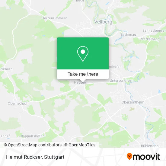
See Helmut Ruckser, Verwaltungsverband Oberes Bühlertal, on the map
Public Transit to Helmut Ruckser in Verwaltungsverband Oberes Bühlertal
Wondering how to get to Helmut Ruckser in Verwaltungsverband Oberes Bühlertal? Moovit helps you find the best way to get to Helmut Ruckser with step-by-step directions from the nearest public transit station.
Moovit provides free maps and live directions to help you navigate through your city. View schedules, routes, timetables, and find out how long does it take to get to Helmut Ruckser in real time.
Looking for the nearest stop or station to Helmut Ruckser? Check out this list of stops closest to your destination: Hausen Abzw.; Hausen Erlenstraße.
Bus: 12, 13, 49, RB14, 17, 17A.
Want to see if there’s another route that gets you there at an earlier time? Moovit helps you find alternative routes or times. Get directions from and directions to Helmut Ruckser easily from the Moovit App or Website.
We make riding to Helmut Ruckser easy, which is why over 1.5 million users, including users in Verwaltungsverband Oberes Bühlertal, trust Moovit as the best app for public transit. You don’t need to download an individual bus app or train app, Moovit is your all-in-one transit app that helps you find the best bus time or train time available.
For information on prices of bus and train, costs and ride fares to Helmut Ruckser, please check the Moovit app.
Use the app to navigate to popular places including to the airport, hospital, stadium, grocery store, mall, coffee shop, school, college, and university.
Helmut Ruckser Address: Lindenstraße 50 Hausen, 74423 Obersontheim street in Verwaltungsverband Oberes Bühlertal
- De House,
- Evang.Freizeitheim Hausen,
- Metallbau Wörz,
- Dierolf,
- Adolf Rüger,
- Stukkateurbetriebes Martin,
- Hundeservice Bedingungslos Hund,
- Walter Schmidt & Sigrid,
- Volker Marek,
- Bauwagen Hausen,
- Bestattungen Peter Setzer Ug (Haftungsbeschränkt),
- Erich Sack Gartengestaltung & Außenanlage,
- Andreas Lay & Erich Lay GbR Nudelfabrikation,
- Rösch,
- Gas-Verkaufsstelle Obersontheim,
- Chrischi's Kneipp,
- Karl Häussermann,
- Reichert Hermann,
- Vms-Maschinenbau,
- Perfect Green
Places Near Helmut Ruckser (Verwaltungsverband Oberes Bühlertal)
- Mettingen Eros-Center Puff Laufhaus, Esslingen Am Neckar,
- Geilhaus Haus 33a, Reutlingen-Betzingen,
- SI-Centrum, Möhringen,
- FlixBus Haltestelle, Stuttgart,
- Gleis 101/102 (tief), Stuttgart-Mitte,
- Waldfriedhof, Degerloch,
- Mercedes-Benz Museum, Bad Cannstatt,
- Porsche-Arena, Bad Cannstatt,
- Hanns-Martin-Schleyer-Halle (Stuttgart Hans-Martin-Schleyerhalle), Bad Cannstatt,
- Klinikum Stuttgart - Katharinenhospital, Stuttgart-Mitte,
- Marmorsaal Im Weissenburgpark, Stuttgart-Süd,
- Hanns-Martin-Schleyer-Halle, Bad Cannstatt,
- Im Wizemann (Halle), Bad Cannstatt,
- Wilhelma (U-Bahn Wilhelma), Bad Cannstatt,
- Mercedes-Benz Museum (Mercedes Museum Stuttgart), Bad Cannstatt,
- Pariser Platz Stuttgart, Stuttgart-Mitte,
- Schleyerhalle, Bad Cannstatt,
- Porsche Museum, Zuffenhausen,
- Gasometer Pforzheim, Pforzheim,
- Hauptbahnhof Stuttgart, Stuttgart-Mitte
How to get to popular places in Stuttgart with public transit
Get around Verwaltungsverband Oberes Bühlertal by public transit!
Traveling around Verwaltungsverband Oberes Bühlertal has never been so easy. See step by step directions as you travel to any attraction, street or major public transit station. View bus and train schedules, arrival times, service alerts and detailed routes on a map, so you know exactly how to get to anywhere in Verwaltungsverband Oberes Bühlertal.
When traveling to any destination around Verwaltungsverband Oberes Bühlertal use Moovit's Live Directions with Get Off Notifications to know exactly where and how far to walk, how long to wait for your line, and how many stops are left. Moovit will alert you when it's time to get off — no need to constantly re-check whether yours is the next stop.
Wondering how to use public transit in Verwaltungsverband Oberes Bühlertal or how to pay for public transit in Verwaltungsverband Oberes Bühlertal? Moovit public transit app can help you navigate your way with public transit easily, and at minimum cost. It includes public transit fees, ticket prices, and costs. Looking for a map of Verwaltungsverband Oberes Bühlertal public transit lines? Moovit public transit app shows all public transit maps in Verwaltungsverband Oberes Bühlertal with all Bus, Train, Subway, Light Rail, Ferry, S-Bahn and Funicular routes and stops on an interactive map.
Stuttgart has 7 transit type(s), including: Bus, Train, Subway, Light Rail, Ferry, S-Bahn and Funicular, operated by several transit agencies, including SSB - Stadtbahn, SSB, SSB - Seilbahn / Zacke, S-Bahn Stuttgart, Rhein-Neckar-Verkehr GmbH (rnv), Karlsruher Verkehrsverbund, DB AG, DB Regiobus BW, Arverio Baden-Württemberg GmbH, DB RegioNetz Verkehrs GmbH Westfrankenbahn, DB Regio AG Baden-Württemberg, Südwestdeutsche Verkehrs-AG, DB Regio AG Mitte Region Hessen, DB and Bodensee-Oberschwaben-Bahn