How to get to Helmut Sell by bus?
Click on the bus route to see step by step directions with maps, line arrival times and updated time schedules.
From Gewerbliche Schule Derendingen, Tübingen
115 minFrom Lützenhardt, Verwaltungsverband Dornstetten
88 minFrom Beatparade, Verwaltungsgemeinschaft Horb am Neckar
167 minFrom Neckar-Camping Tübingen, Tübingen
120 minFrom Paul-Horn-Arena, Tübingen
117 minFrom Landratsamt Tübingen, Tübingen
123 minFrom Fachklinik Sonnenhof Waldachtal, Verwaltungsverband Dornstetten
93 minFrom Campingplatz Schüttehof Horb, Gemarkung Horb am Neckar
61 minFrom Bläsibad, Tübingen
136 minFrom Festplatz, Tübingen
120 min
Bus stop near Helmut Sell in Haigerloch
- Haigerloch Freibad, 3 min walk,VIEW
Train station near Helmut Sell in Haigerloch
- Haigerloch Bahnhof, 13 min walk,VIEW
Bus lines to Helmut Sell in Haigerloch
- 310, Haigerloch Oberstadt - Trillfingen Firma Sidler,VIEW
- 311, Trillfingen Firma Sidler - Eyach Bahnhof Bstg 2,VIEW
- 319, Bittelbronn Weildorfer Straße - Haigerloch Schulzentrum Bstg 5,VIEW
- 320, Haigerloch Schulzentrum Bstg 3 - Balingen Bahnhof/Busbf Bstg 10,VIEW
- 329, Haigerloch Marktplatz - Rosenfeld Postplatz,VIEW
What are the closest stations to Helmut Sell?
The closest stations to Helmut Sell are:
- Haigerloch Freibad is 163 meters away, 3 min walk.
- Haigerloch Bahnhof is 1001 meters away, 13 min walk.
Which bus line stops near Helmut Sell?
310 (Haigerloch Unterstadt/Abzw.Bf)
What’s the nearest train station to Helmut Sell in Haigerloch?
The nearest train station to Helmut Sell in Haigerloch is Haigerloch Bahnhof. It’s a 13 min walk away.
What’s the nearest bus station to Helmut Sell in Haigerloch?
The nearest bus station to Helmut Sell in Haigerloch is Haigerloch Freibad. It’s a 3 min walk away.
What time is the first bus to Helmut Sell in Haigerloch?
The 310 is the first bus that goes to Helmut Sell in Haigerloch. It stops nearby at 5:13 AM.
What time is the last bus to Helmut Sell in Haigerloch?
The 320 is the last bus that goes to Helmut Sell in Haigerloch. It stops nearby at 10:17 PM.
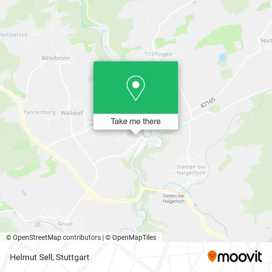
See Helmut Sell, Haigerloch, on the map
Public Transit to Helmut Sell in Haigerloch
Wondering how to get to Helmut Sell in Haigerloch? Moovit helps you find the best way to get to Helmut Sell with step-by-step directions from the nearest public transit station.
Moovit provides free maps and live directions to help you navigate through your city. View schedules, routes, timetables, and find out how long does it take to get to Helmut Sell in real time.
Looking for the nearest stop or station to Helmut Sell? Check out this list of stops closest to your destination: Haigerloch Freibad; Haigerloch Bahnhof.
Train: RB67.Bus: 310, 311, 319, 320, 329.
Want to see if there’s another route that gets you there at an earlier time? Moovit helps you find alternative routes or times. Get directions from and directions to Helmut Sell easily from the Moovit App or Website.
We make riding to Helmut Sell easy, which is why over 1.5 million users, including users in Haigerloch, trust Moovit as the best app for public transit. You don’t need to download an individual bus app or train app, Moovit is your all-in-one transit app that helps you find the best bus time or train time available.
For information on prices of bus and train, costs and ride fares to Helmut Sell, please check the Moovit app.
Use the app to navigate to popular places including to the airport, hospital, stadium, grocery store, mall, coffee shop, school, college, and university.
Helmut Sell Address: Großbayerstraße 72401 Haigerloch street in Haigerloch
- Dr. Barbara Jahn,
- Jugendbüro,
- Städtischer Kindergarten Haigerloch,
- Galerie,
- Kindergarten,
- Fahrschule Benno Alex,
- Lernforum Silvia Brandelik, Schule für Nachhilfe und Förderung,
- Ruf U. Godawa,
- Sparkasse,
- Kosmetikstudio Lichtblick,
- Sparkasse Zollernalb,
- Volksbank,
- Pfadfinder Haigerloch,
- Hohenzollern-Haigerloch,
- Mondo Verde,
- Volksbank Hohenzollern,
- Dz Bank AG Deutsche Zentral Genossenschaftsbank,
- Cutting Crew One Friseursalon,
- R+V Versicherung,
- Volksbank Hohenzollern-Balingen
Places Near Helmut Sell (Haigerloch)
- Mercedes-Benz Museum, Bad Cannstatt,
- Hanns-Martin-Schleyer-Halle, Bad Cannstatt,
- Gasometer Pforzheim, Pforzheim,
- Porsche-Arena, Bad Cannstatt,
- Marmorsaal Im Weissenburgpark, Stuttgart-Süd,
- Mettingen Eros-Center Puff Laufhaus, Esslingen Am Neckar,
- Gleis 101/102 (tief), Stuttgart-Mitte,
- FlixBus Haltestelle, Stuttgart,
- Waldfriedhof, Degerloch,
- Schleyerhalle, Bad Cannstatt,
- Hauptbahnhof Stuttgart, Stuttgart-Mitte,
- Wilhelma (U-Bahn Wilhelma), Bad Cannstatt,
- Pariser Platz Stuttgart, Stuttgart-Mitte,
- SI-Centrum, Möhringen,
- Hanns-Martin-Schleyer-Halle (Stuttgart Hans-Martin-Schleyerhalle), Bad Cannstatt,
- Mercedes-Benz Museum (Mercedes Museum Stuttgart), Bad Cannstatt,
- Im Wizemann (Halle), Bad Cannstatt,
- Porsche Museum, Zuffenhausen,
- Klinikum Stuttgart - Katharinenhospital, Stuttgart-Mitte,
- Geilhaus Haus 33a, Reutlingen-Betzingen
How to get to popular places in Stuttgart with public transit
Get around Haigerloch by public transit!
Traveling around Haigerloch has never been so easy. See step by step directions as you travel to any attraction, street or major public transit station. View bus and train schedules, arrival times, service alerts and detailed routes on a map, so you know exactly how to get to anywhere in Haigerloch.
When traveling to any destination around Haigerloch use Moovit's Live Directions with Get Off Notifications to know exactly where and how far to walk, how long to wait for your line, and how many stops are left. Moovit will alert you when it's time to get off — no need to constantly re-check whether yours is the next stop.
Wondering how to use public transit in Haigerloch or how to pay for public transit in Haigerloch? Moovit public transit app can help you navigate your way with public transit easily, and at minimum cost. It includes public transit fees, ticket prices, and costs. Looking for a map of Haigerloch public transit lines? Moovit public transit app shows all public transit maps in Haigerloch with all Bus, Train, Subway, Light Rail, Ferry, S-Bahn and Funicular routes and stops on an interactive map.
Stuttgart has 7 transit type(s), including: Bus, Train, Subway, Light Rail, Ferry, S-Bahn and Funicular, operated by several transit agencies, including SSB - Stadtbahn, SSB, SSB - Seilbahn / Zacke, S-Bahn Stuttgart, Rhein-Neckar-Verkehr GmbH (rnv), Karlsruher Verkehrsverbund, DB AG, DB Regiobus BW, Arverio Baden-Württemberg GmbH, DB RegioNetz Verkehrs GmbH Westfrankenbahn, DB Regio AG Baden-Württemberg, Südwestdeutsche Verkehrs-AG, DB Regio AG Mitte Region Hessen, DB and Bodensee-Oberschwaben-Bahn