How to get to Help - High End Low Price by bus?
Click on the bus route to see step by step directions with maps, line arrival times and updated time schedules.
From Waldfriedhof, Herrenberg (Stadt)
57 minFrom 71106, Magstadt
54 minFrom Krankenhaus Herrenberg, Herrenberg (Stadt)
54 minFrom Parkhaus P305, Sindelfingen (Stadt)
66 minFrom Monbachtal, Liebenzell
39 minFrom Cts-Klinik Schloßberg, Liebenzell
33 minFrom Kibungu, Verwaltungsverband Heckengäu
130 minFrom Naturfreundehaus Herrenberg, Herrenberg (Stadt)
58 minFrom 71120, Grafenau
60 minFrom IBM Campus Ehningen, Gemeindeverwaltungsverband Gärtringen/Ehningen
83 min
How to get to Help - High End Low Price by train?
Click on the train route to see step by step directions with maps, line arrival times and updated time schedules.
Train stations near Help - High End Low Price in Verwaltungsgemeinschaft Calw
Bus stops near Help - High End Low Price in Verwaltungsgemeinschaft Calw
Bus lines to Help - High End Low Price in Verwaltungsgemeinschaft Calw
- 670, Weil der Stadt - Schafhausen - Dätzingen - Althengstett - Calw,VIEW
- 670.2, Klinikum NSW - Hirsau - Calw - Althengstett - Weil der Stadt,VIEW
- 744, (Sindelfingen -) Böblingen - Aidlingen - Dachtel (- Gechingen),VIEW
- 763, (Sindelfingen -) Böblingen - Aidlingen - Deufringen - Dachtel - Gechingen - Stammheim (CW) - Calw,VIEW
- 770, RegioBus: Herrenberg - Deckenpfronn - Calw,VIEW
- 630, Calw, Bauknecht,VIEW
- 668, Stammheim, Gymnasium,VIEW
- 670, Calw, Klinikum Nsw,VIEW
- 670, Weil Der Stadt Gymnasium,VIEW
- 690, Ostelsheim, Calwer Straße,VIEW
- 744, Böblingen,VIEW
- 763, Sindelf. Mercedes-Benz Hst. P,VIEW
- 770, Calw, Zob,VIEW
- 632, Calw, ZOB Bstg 2 - Bad Wildbad, Bhf Steig 6,VIEW
- 633, Calw, ZOB Bstg 2 - Neuweiler,Rathaus Ri. Altensteig,VIEW
- 634, Neubulach, Schulzentrum - Neuweiler, Waldschule,VIEW
- 635, Calw, ZOB Bstg 3 - Calw, ZOB Bstg 1,VIEW
- 636, Neub., Mathildenstr. Ri.Obhgst. - Calw, ZOB Bstg 1,VIEW
- 640, Oberhaugstett, Molkerei Ri. Neubulach - Calw, ZOB Bstg 3,VIEW
- 641, Calw, ZOB Bstg 2 - Calw, ZOB Bstg 3,VIEW
What are the closest stations to Help - High End Low Price?
The closest stations to Help - High End Low Price are:
- Calw, Bahnhof/Zob is 155 meters away, 3 min walk.
- Calw Linde is 157 meters away, 3 min walk.
- Calw, Linde is 161 meters away, 3 min walk.
- Calw is 263 meters away, 4 min walk.
- Calw, Zob is 325 meters away, 5 min walk.
Which train lines stop near Help - High End Low Price?
These train lines stop near Help - High End Low Price: RB 74, RB76.
Which bus lines stop near Help - High End Low Price?
These bus lines stop near Help - High End Low Price: 670, 670.2, 763, 770.
What’s the nearest train station to Help - High End Low Price in Verwaltungsgemeinschaft Calw?
The nearest train station to Help - High End Low Price in Verwaltungsgemeinschaft Calw is Calw, Bahnhof/Zob. It’s a 3 min walk away.
What’s the nearest bus station to Help - High End Low Price in Verwaltungsgemeinschaft Calw?
The nearest bus stations to Help - High End Low Price in Verwaltungsgemeinschaft Calw are Calw Linde and Calw, Linde. The closest one is a 3 min walk away.
What time is the first train to Help - High End Low Price in Verwaltungsgemeinschaft Calw?
The RB74 is the first train that goes to Help - High End Low Price in Verwaltungsgemeinschaft Calw. It stops nearby at 5:03 AM.
What time is the last train to Help - High End Low Price in Verwaltungsgemeinschaft Calw?
The RB76 is the last train that goes to Help - High End Low Price in Verwaltungsgemeinschaft Calw. It stops nearby at 12:41 AM.
What time is the first bus to Help - High End Low Price in Verwaltungsgemeinschaft Calw?
The 670.2 is the first bus that goes to Help - High End Low Price in Verwaltungsgemeinschaft Calw. It stops nearby at 4:29 AM.
What time is the last bus to Help - High End Low Price in Verwaltungsgemeinschaft Calw?
The X63 is the last bus that goes to Help - High End Low Price in Verwaltungsgemeinschaft Calw. It stops nearby at 1:02 AM.
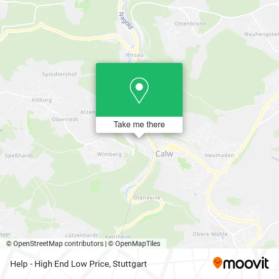
See Help - High End Low Price, Verwaltungsgemeinschaft Calw, on the map
Public Transit to Help - High End Low Price in Verwaltungsgemeinschaft Calw
Wondering how to get to Help - High End Low Price in Verwaltungsgemeinschaft Calw? Moovit helps you find the best way to get to Help - High End Low Price with step-by-step directions from the nearest public transit station.
Moovit provides free maps and live directions to help you navigate through your city. View schedules, routes, timetables, and find out how long does it take to get to Help - High End Low Price in real time.
Looking for the nearest stop or station to Help - High End Low Price? Check out this list of stops closest to your destination: Calw; Calw Linde; Calw; Calw; Calw.
Train: RB 74, RB76, RB74.Bus: 670, 670.2, 763, 770, 744, 630, 668, 690, 632, 633, 634, 635, 636.
Want to see if there’s another route that gets you there at an earlier time? Moovit helps you find alternative routes or times. Get directions from and directions to Help - High End Low Price easily from the Moovit App or Website.
We make riding to Help - High End Low Price easy, which is why over 1.5 million users, including users in Verwaltungsgemeinschaft Calw, trust Moovit as the best app for public transit. You don’t need to download an individual bus app or train app, Moovit is your all-in-one transit app that helps you find the best bus time or train time available.
For information on prices of bus, train and S-Bahn, costs and ride fares to Help - High End Low Price, please check the Moovit app.
Use the app to navigate to popular places including to the airport, hospital, stadium, grocery store, mall, coffee shop, school, college, and university.
Help - High End Low Price Address: Altburger Straße 12 75365 Calw street in Verwaltungsgemeinschaft Calw
- Eisenbahnmuseum Stellwerk 1 Auskunft bei Hans-Ulrich Bay,
- Reha- und Behindertensportgruppe Calw E. V,
- Verein für Soziale Heimstättenin Baden-Württemberg,
- Salon Uschi,
- Alcina,
- Dr. med. Irma Schmitt,
- Felizita Wachsmann,
- Rabenthing,
- Sylvia Bongartz,
- Leone Pizza-Express,
- Calwer Naturkost-Fachgeschäft,
- Biokaufladen Wiesmeyer,
- Evangelische Kirche Peter und Paul,
- Saskia Esken,
- Monteur-Unterkunft Ferienwohnungen Calwer Höfle City,
- Jetty's Zwergenimbiss,
- Sozialverband Vdk Beratungsstelle Calw,
- Fraulein Samst,
- Apero Genuß U,
- Weingut Bremer
Places Near Help - High End Low Price (Verwaltungsgemeinschaft Calw)
- SI-Centrum, Möhringen,
- Pariser Platz Stuttgart, Stuttgart-Mitte,
- Marmorsaal Im Weissenburgpark, Stuttgart-Süd,
- Waldfriedhof, Degerloch,
- Gasometer Pforzheim, Pforzheim,
- Hanns-Martin-Schleyer-Halle, Bad Cannstatt,
- Wilhelma (U-Bahn Wilhelma), Bad Cannstatt,
- Gleis 101/102 (tief), Stuttgart-Mitte,
- Schleyerhalle, Bad Cannstatt,
- Hanns-Martin-Schleyer-Halle (Stuttgart Hans-Martin-Schleyerhalle), Bad Cannstatt,
- Mercedes-Benz Museum (Mercedes Museum Stuttgart), Bad Cannstatt,
- Klinikum Stuttgart - Katharinenhospital, Stuttgart-Mitte,
- FlixBus Haltestelle, Stuttgart,
- Porsche Museum, Zuffenhausen,
- Hauptbahnhof Stuttgart, Stuttgart-Mitte,
- Mercedes-Benz Museum, Bad Cannstatt,
- Im Wizemann (Halle), Bad Cannstatt,
- Geilhaus Haus 33a, Reutlingen-Betzingen,
- Porsche-Arena, Bad Cannstatt,
- Mettingen Eros-Center Puff Laufhaus, Esslingen Am Neckar
How to get to popular places in Stuttgart with public transit
Get around Verwaltungsgemeinschaft Calw by public transit!
Traveling around Verwaltungsgemeinschaft Calw has never been so easy. See step by step directions as you travel to any attraction, street or major public transit station. View bus and train schedules, arrival times, service alerts and detailed routes on a map, so you know exactly how to get to anywhere in Verwaltungsgemeinschaft Calw.
When traveling to any destination around Verwaltungsgemeinschaft Calw use Moovit's Live Directions with Get Off Notifications to know exactly where and how far to walk, how long to wait for your line, and how many stops are left. Moovit will alert you when it's time to get off — no need to constantly re-check whether yours is the next stop.
Wondering how to use public transit in Verwaltungsgemeinschaft Calw or how to pay for public transit in Verwaltungsgemeinschaft Calw? Moovit public transit app can help you navigate your way with public transit easily, and at minimum cost. It includes public transit fees, ticket prices, and costs. Looking for a map of Verwaltungsgemeinschaft Calw public transit lines? Moovit public transit app shows all public transit maps in Verwaltungsgemeinschaft Calw with all Bus, Train, Subway, Light Rail, Ferry, S-Bahn and Funicular routes and stops on an interactive map.
Stuttgart has 7 transit type(s), including: Bus, Train, Subway, Light Rail, Ferry, S-Bahn and Funicular, operated by several transit agencies, including SSB - Stadtbahn, SSB, SSB - Seilbahn / Zacke, S-Bahn Stuttgart, Rhein-Neckar-Verkehr GmbH (rnv), Karlsruher Verkehrsverbund, DB AG, DB Regiobus BW, Arverio Baden-Württemberg GmbH, DB RegioNetz Verkehrs GmbH Westfrankenbahn, DB Regio AG Baden-Württemberg, Südwestdeutsche Verkehrs-AG, DB Regio AG Mitte Region Hessen, DB and Bodensee-Oberschwaben-Bahn
Public transit lines with stations closest to Help - High End Low Price in Verwaltungsgemeinschaft Calw
Train lines with stations closest to Help - High End Low Price in Verwaltungsgemeinschaft Calw
Bus lines with stations closest to Help - High End Low Price in Verwaltungsgemeinschaft Calw
Calw Linde
 670Weil der Stadt - Schafhausen - Dätzingen - Althengstett - Calw
- 670.2Klinikum NSW - Hirsau - Calw - Althengstett - Weil der Stadt
- 744(Sindelfingen -) Böblingen - Aidlingen - Dachtel (- Gechingen)
- 763(Sindelfingen -) Böblingen - Aidlingen - Deufringen - Dachtel - Gechingen - Stammheim (CW) - Calw
- 770RegioBus: Herrenberg - Deckenpfronn - Calw