How to get to Henbo Vision Multimedia by bus?
Click on the bus route to see step by step directions with maps, line arrival times and updated time schedules.
From Palm Beach County Courthouse Jurors Assembly Room, West Palm Beach
54 minFrom Brightline Station, West Palm Beach
57 minFrom Tri-Rail-Mangonia Park Station, West Palm Beach
31 minFrom Downtown West Palm Beach, West Palm Beach
59 minFrom Tanger Outlets Palm Beach, West Palm Beach
48 minFrom A W Dreyfoos School of the Arts, West Palm Beach
65 minFrom Alexander W Dreyfoos School of Arts, West Palm Beach
62 minFrom The Breakers hotel, West Palm Beach
86 minFrom Palm Beach County Courthouse, Court Room 4C, West Palm Beach
52 minFrom Keiser University Flagship Campus, West Palm Beach
63 min
Bus stops near Henbo Vision Multimedia in Riviera Beach
Bus lines to Henbo Vision Multimedia in Riviera Beach
What are the closest stations to Henbo Vision Multimedia?
The closest stations to Henbo Vision Multimedia are:
- PARK AVE at 9TH ST is 22 yards away, 1 min walk.
- OLD DIXIE HWY at WATERTOWER RD is 819 yards away, 10 min walk.
Which bus line stops near Henbo Vision Multimedia?
33 (Rt 33 Northbound)
What’s the nearest bus station to Henbo Vision Multimedia in Riviera Beach?
The nearest bus station to Henbo Vision Multimedia in Riviera Beach is PARK AVE at 9TH ST. It’s a 1 min walk away.
What time is the first bus to Henbo Vision Multimedia in Riviera Beach?
The 20 is the first bus that goes to Henbo Vision Multimedia in Riviera Beach. It stops nearby at 5:05 AM.
What time is the last bus to Henbo Vision Multimedia in Riviera Beach?
The 33 is the last bus that goes to Henbo Vision Multimedia in Riviera Beach. It stops nearby at 9:50 PM.
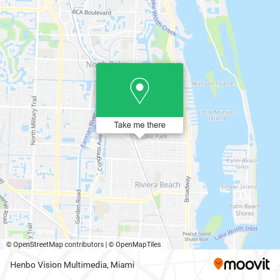
See Henbo Vision Multimedia, Riviera Beach, on the map
Public Transit to Henbo Vision Multimedia in Riviera Beach
Wondering how to get to Henbo Vision Multimedia in Riviera Beach? Moovit helps you find the best way to get to Henbo Vision Multimedia with step-by-step directions from the nearest public transit station.
Moovit provides free maps and live directions to help you navigate through your city. View schedules, routes, timetables, and find out how long does it take to get to Henbo Vision Multimedia in real time.
Looking for the nearest stop or station to Henbo Vision Multimedia? Check out this list of stops closest to your destination: PARK AVE at 9TH ST; OLD DIXIE HWY at WATERTOWER RD.
Bus: 33, 20.
Want to see if there’s another route that gets you there at an earlier time? Moovit helps you find alternative routes or times. Get directions from and directions to Henbo Vision Multimedia easily from the Moovit App or Website.
We make riding to Henbo Vision Multimedia easy, which is why over 1.5 million users, including users in Riviera Beach, trust Moovit as the best app for public transit. You don’t need to download an individual bus app or train app, Moovit is your all-in-one transit app that helps you find the best bus time or train time available.
For information on prices of bus, costs and ride fares to Henbo Vision Multimedia, please check the Moovit app.
Use the app to navigate to popular places including to the airport, hospital, stadium, grocery store, mall, coffee shop, school, college, and university.
Henbo Vision Multimedia Address: 907 Park Ave West Palm Beach, FL 33403 street in Riviera Beach
- Martavious Cook - Intuit Turbotax Verified Pro,
- Big Bear Taxes,
- Tony Barber Shop,
- Post Office,
- Tentacion Mexican Restaurant,
- Creole Social,
- Mellow Munchiez,
- Naturally TC,
- Direct SAT TV,
- Foresteria Park,
- Surry Co Smoke House,
- Tacos Y Antojitos Mexicanos,
- Iconic JB Creations,
- Easel Art Supply Palm Beach,
- Flowers for All Occasions by Betty,
- Park Ave & 8th St,
- Kelly Arnold,
- Palm Beach County Fire Rescue Station 68,
- Academy Health Solutions,
- Thee Eyebrow Surgeon Beauty Studio
Places Near Henbo Vision Multimedia (Riviera Beach)
- Marlins Park, Miami,
- Port of Miami Cruise Terminal, Miami,
- Miami Freedom Park, Miami,
- Miami-Dade County Courthouse, Miami,
- Keiser University Flagship Campus, West Palm Beach,
- Richard E. Gerstein Justice Building, Miami,
- Brickell City Centre, Miami,
- Little Havana, Miami,
- Zoo Miami, Miami,
- Miami Design District, Miami,
- Sawgrass mall ( FL ), Miami Beach,
- Aventura Mall, Miami,
- Wynwood, Miami,
- Bayside Marketplace, Miami,
- Miami VA Hospital, Miami,
- Sawgrass Mall, Miami,
- Dolphin Mall, Miami,
- Hard Rock Stadium, Miami Gardens,
- Dolphin Mall Bus, Miami,
- Aventura Mall, Miami Beach
How to get to popular places in Miami with public transit
Get around Riviera Beach by public transit!
Traveling around Riviera Beach has never been so easy. See step by step directions as you travel to any attraction, street or major public transit station. View bus and train schedules, arrival times, service alerts and detailed routes on a map, so you know exactly how to get to anywhere in Riviera Beach.
When traveling to any destination around Riviera Beach use Moovit's Live Directions with Get Off Notifications to know exactly where and how far to walk, how long to wait for your line, and how many stops are left. Moovit will alert you when it's time to get off — no need to constantly re-check whether yours is the next stop.
Wondering how to use public transit in Riviera Beach or how to pay for public transit in Riviera Beach? Moovit public transit app can help you navigate your way with public transit easily, and at minimum cost. It includes public transit fees, ticket prices, and costs. Looking for a map of Riviera Beach public transit lines? Moovit public transit app shows all public transit maps in Riviera Beach with all Bus, Train, Light Rail and Ferry routes and stops on an interactive map.
Miami has 4 transit type(s), including: Bus, Train, Light Rail and Ferry, operated by several transit agencies, including Broward County Transit, Miami-Dade Transit, Metrorail, Palm Tran, Tri-Rail, Brightline, MARTY, City of Homestead Trolley, Key West Transit, Treasure Coast Connector, GoLine IRT, Amtrak, Greyhound-us, FlixBus-us and Aventura Express Shuttle Bus