How to get to Henderson Code Enforcement by bus?
Click on the bus route to see step by step directions with maps, line arrival times and updated time schedules.
From Horizon Ridge, Green Valley Pkwy Intersection
69 minFrom Motel 6-Las Vegas-Boulder Highway (Las Vegas Motel 6)
41 minFrom Longhorn Hotel & Casino
29 minFrom Sunset And Mountain Vista
26 minFrom E Sahara Ave / S Nellis Blvd
70 minFrom Janet's Old Fashioned Shoe Shine Stand
51 minFrom Sunset Park
38 minFrom Mountasia Family Fun Center
30 minFrom Allegiant Stadium
59 min
Bus stops near Henderson Code Enforcement
Bus lines to Henderson Code Enforcement
What are the closest stations to Henderson Code Enforcement?
The closest stations to Henderson Code Enforcement are:
- Wb Sunset After Haren is 455 yards away, 6 min walk.
- Sb Boulder After Sunset is 763 yards away, 10 min walk.
Which bus lines stop near Henderson Code Enforcement?
These bus lines stop near Henderson Code Enforcement: 212, BHX.
What’s the nearest bus station to Henderson Code Enforcement?
The nearest bus station to Henderson Code Enforcement is Wb Sunset After Haren. It’s a 6 min walk away.
What time is the first bus to Henderson Code Enforcement?
The BHX is the first bus that goes to Henderson Code Enforcement. It stops nearby at 3:16 AM.
What time is the last bus to Henderson Code Enforcement?
The BHX is the last bus that goes to Henderson Code Enforcement. It stops nearby at 3:25 AM.
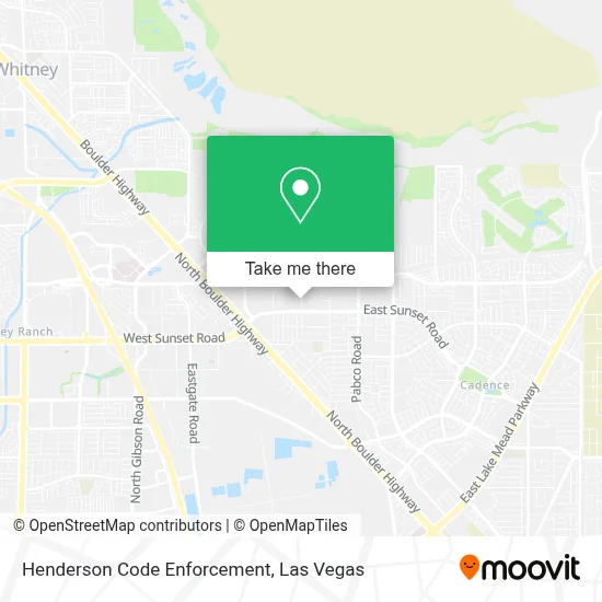
See Henderson Code Enforcement on the map
Public Transportation to Henderson Code Enforcement
Wondering how to get to Henderson Code Enforcement? Moovit helps you find the best way to get to Henderson Code Enforcement with step-by-step directions from the nearest public transit station.
Moovit provides free maps and live directions to help you navigate through your city. View schedules, routes, timetables, and find out how long does it take to get to Henderson Code Enforcement in real time.
Looking for the nearest stop or station to Henderson Code Enforcement? Check out this list of stops closest to your destination: Wb Sunset After Haren; Sb Boulder After Sunset.
Bus: 212, BHX.
Want to see if there’s another route that gets you there at an earlier time? Moovit helps you find alternative routes or times. Get directions from and directions to Henderson Code Enforcement easily from the Moovit App or Website.
We make riding to Henderson Code Enforcement easy, which is why over 1.7 million users, including users in Henderson, trust Moovit as the best app for public transit. You don’t need to download an individual bus app or train app, Moovit is your all-in-one transit app that helps you find the best bus time or train time available.
For information on prices of bus, costs and ride fares to Henderson Code Enforcement, please check the Moovit app.
Use the app to navigate to popular places including to the airport, hospital, stadium, grocery store, mall, coffee shop, school, college, and university.
Henderson Code Enforcement Address: 2101 Moser Dr street in Henderson
- Skyline Casino,
- North Boulder Highway & Galleria Drive,
- Jokers Wild Casino,
- Cowabunga Bay Water Park,
- Turf Area,
- Weston Hills Park,
- Turf Area,
- E Warm Springs Rd / N Boulder Hwy,
- Steinberg Diagnostic Medical Imaging,
- Henderson Hospital,
- CSN - Henderson,
- Walmart Supercenter,
- Coral Academy of Science Eastgate Campus,
- Costco Wholesale,
- Boulder Hwy / E Russell Rd,
- Pinecrest Academy Cadence,
- Sunset Station Hotel And Casino Valet Parking,
- Galleria Mall Dr,
- Seville Bar,
- Regal Sunset Station
Places Near Henderson Code Enforcement
- Gold & Silver Pawn Shop, Las Vegas,
- The Neon Museum, Las Vegas,
- Meow Wolf - Las Vegas (Meow Wolf's Omega Mart), Las Vegas,
- Las Vegas Premium Outlets-North, Enterprise,
- Zak Bagans Haunted Museum, Las Vegas,
- Walmart, Las Vegas,
- Las Vegas South Premium Outlets, Enterprise,
- The Deuce Bus Stop at Fremont St, Las Vegas,
- Lee Canyon, Las Vegas,
- Walmart Supercenter, Las Vegas,
- Trump International Hotel Las Vegas, Paradise,
- Omega Mart, Las Vegas,
- Welcome To Fabulous Las Vegas Sign, Paradise,
- Las Vegas North Premium Outlets, Las Vegas,
- Arte Museum Las Vegas, Paradise,
- Area15, Las Vegas,
- Town Square, Enterprise,
- Allegiant Stadium, Paradise,
- Koolsville Tattoos, Las Vegas,
- The Palms Casino Resort, Paradise
How to get to popular places in Las Vegas with public transit
Get around Henderson by public transit!
Traveling around Henderson has never been so easy. See step by step directions as you travel to any attraction, street or major public transit station. View bus and train schedules, arrival times, service alerts and detailed routes on a map, so you know exactly how to get to anywhere in Henderson.
When traveling to any destination around Henderson use Moovit's Live Directions with Get Off Notifications to know exactly where and how far to walk, how long to wait for your line, and how many stops are left. Moovit will alert you when it's time to get off — no need to constantly re-check whether yours is the next stop.
Wondering how to use public transit in Henderson or how to pay for public transit in Henderson? Moovit public transit app can help you navigate your way with public transit easily, and at minimum cost. It includes public transit fees, ticket prices, and costs. Looking for a map of Henderson public transit lines? Moovit public transit app shows all public transit maps in Henderson with all Bus and Monorail routes and stops on an interactive map.
Las Vegas has 2 transit type(s), including: Bus and Monorail, operated by several transit agencies, including RTCSNV, City of Las Vegas, Alvand Transportation, Vegas Airporter, Las Vegas Monorail, FlixBus-us and Greyhound-us