Directions to Henrietta Lacks Project Benefit (Baltimore) with public transportation
The following transit lines have routes that pass near Henrietta Lacks Project Benefit
 Bus: 154, 94, CITYLINK BLUE, CITYLINK GREEN, CITYLINK PINK.
- Train: MARC.
- Metro: METRO.
- Light Rail: LIGHT RAILLINK.
How to get to Henrietta Lacks Project Benefit by bus?
Click on the bus route to see step by step directions with maps, line arrival times and updated time schedules.
From Johns Hopkins Bayview Medical Center, Baltimore
37 minFrom Sinai Hospital, Baltimore
51 minFrom Baltimore Polytechnic Institute, Baltimore
31 minFrom I-70 at Security Blvd Baltimore City Lot Park & Ride, Baltimore
46 minFrom Walmart, Baltimore County
52 minFrom MVA Glen Burnie, Anne Arundel County
42 minFrom Guinness Open Gate Brewery & Barrel House, Baltimore County
77 minFrom Dundalk, Maryland, Baltimore County
53 minFrom I-695 @ Exit 17 (Security Blvd/MD 122), Baltimore County
46 minFrom Towson Town Center, Baltimore County
54 min
How to get to Henrietta Lacks Project Benefit by train?
Click on the train route to see step by step directions with maps, line arrival times and updated time schedules.
Bus stops near Henrietta Lacks Project Benefit in Baltimore
Light Rail stations near Henrietta Lacks Project Benefit in Baltimore
- Mt. Vernon (Centre Street), 5 min walk,VIEW
Metro station near Henrietta Lacks Project Benefit in Baltimore
- State Center Metro, 9 min walk,VIEW
Bus lines to Henrietta Lacks Project Benefit in Baltimore
- 51, Towson Town Center,VIEW
- 94, Fort Mchenry,VIEW
- CITYLINK PINK, W Baltimore Marc,VIEW
- 54, Carney Park & Ride,VIEW
- 154, Hillendale,VIEW
- CITYLINK GREEN, Towson Town Center,VIEW
- CITYLINK SILVER, Station North,VIEW
- 95, Roland Park,VIEW
- 103, Cromwell Bridge Park & Ride,VIEW
- CITYLINK LIME, Harbor East,VIEW
- 53, Sheppard Pratt,VIEW
- 91, Downtown,VIEW
What are the closest stations to Henrietta Lacks Project Benefit?
The closest stations to Henrietta Lacks Project Benefit are:
- Cathedral St & Madison Sb is 189 yards away, 3 min walk.
- Howard St & Madison St Sb is 211 yards away, 3 min walk.
- Madison St & Eutaw St Wb is 315 yards away, 4 min walk.
- Mt. Vernon (Centre Street) is 392 yards away, 5 min walk.
- Eutaw St & Madison Ave Sb is 396 yards away, 5 min walk.
- Charles St & Read St Nb is 422 yards away, 6 min walk.
- Mlk Blvd & Linden Ave Ns is 436 yards away, 6 min walk.
- State Center Metro is 664 yards away, 9 min walk.
Which bus lines stop near Henrietta Lacks Project Benefit?
These bus lines stop near Henrietta Lacks Project Benefit: 154, 94, CITYLINK BLUE, CITYLINK GREEN, CITYLINK PINK, CITYLINK SILVER.
Which train line stops near Henrietta Lacks Project Benefit?
MARC (Inbound - Penn)
Which light rail line stops near Henrietta Lacks Project Benefit?
LIGHT RAILLINK (Northbound)
What’s the nearest light rail station to Henrietta Lacks Project Benefit in Baltimore?
The nearest light rail station to Henrietta Lacks Project Benefit in Baltimore is Mt. Vernon (Centre Street). It’s a 5 min walk away.
What’s the nearest metro station to Henrietta Lacks Project Benefit in Baltimore?
The nearest metro station to Henrietta Lacks Project Benefit in Baltimore is State Center Metro. It’s a 9 min walk away.
What’s the nearest bus station to Henrietta Lacks Project Benefit in Baltimore?
The nearest bus stations to Henrietta Lacks Project Benefit in Baltimore are Cathedral St & Madison Sb and Howard St & Madison St Sb. The closest one is a 3 min walk away.
What time is the first light rail to Henrietta Lacks Project Benefit in Baltimore?
The LIGHT RAILLINK is the first light rail that goes to Henrietta Lacks Project Benefit in Baltimore. It stops nearby at 3:50 AM.
What time is the last light rail to Henrietta Lacks Project Benefit in Baltimore?
The LIGHT RAILLINK is the last light rail that goes to Henrietta Lacks Project Benefit in Baltimore. It stops nearby at 1:26 AM.
What time is the first metro to Henrietta Lacks Project Benefit in Baltimore?
The METRO is the first metro that goes to Henrietta Lacks Project Benefit in Baltimore. It stops nearby at 5:07 AM.
What time is the last metro to Henrietta Lacks Project Benefit in Baltimore?
The METRO is the last metro that goes to Henrietta Lacks Project Benefit in Baltimore. It stops nearby at 12:23 AM.
What time is the first bus to Henrietta Lacks Project Benefit in Baltimore?
The 54 is the first bus that goes to Henrietta Lacks Project Benefit in Baltimore. It stops nearby at 3:01 AM.
What time is the last bus to Henrietta Lacks Project Benefit in Baltimore?
The 54 is the last bus that goes to Henrietta Lacks Project Benefit in Baltimore. It stops nearby at 3:02 AM.
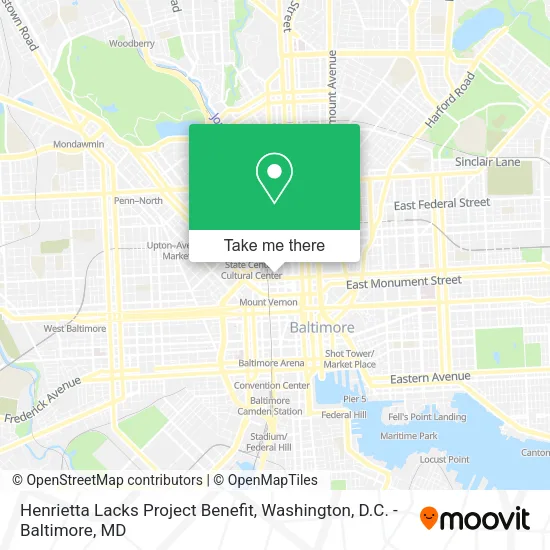
See Henrietta Lacks Project Benefit, Baltimore, on the map
Public Transit to Henrietta Lacks Project Benefit in Baltimore
Wondering how to get to Henrietta Lacks Project Benefit in Baltimore? Moovit helps you find the best way to get to Henrietta Lacks Project Benefit with step-by-step directions from the nearest public transit station.
Moovit provides free maps and live directions to help you navigate through your city. View schedules, routes, timetables, and find out how long does it take to get to Henrietta Lacks Project Benefit in real time.
Looking for the nearest stop or station to Henrietta Lacks Project Benefit? Check out this list of stops closest to your destination: Cathedral St & Madison Sb; Howard St & Madison St Sb; Madison St & Eutaw St Wb; Mt. Vernon (Centre Street); Eutaw St & Madison Ave Sb; Charles St & Read St Nb; Mlk Blvd & Linden Ave Ns; State Center Metro.
Bus: 154, 94, CITYLINK BLUE, CITYLINK GREEN, CITYLINK PINK, CITYLINK SILVER, 51, 54, 95, 103.Train: MARC.Metro: METRO.Light Rail: LIGHT RAILLINK.
Want to see if there’s another route that gets you there at an earlier time? Moovit helps you find alternative routes or times. Get directions from and directions to Henrietta Lacks Project Benefit easily from the Moovit App or Website.
We make riding to Henrietta Lacks Project Benefit easy, which is why over 1.5 million users, including users in Baltimore, trust Moovit as the best app for public transit. You don’t need to download an individual bus app or train app, Moovit is your all-in-one transit app that helps you find the best bus time or train time available.
For information on prices of bus, light rail and train, costs and ride fares to Henrietta Lacks Project Benefit, please check the Moovit app.
Use the app to navigate to popular places including to the airport, hospital, stadium, grocery store, mall, coffee shop, school, college, and university.
Henrietta Lacks Project Benefit Address: 808 Park Ave Baltimore, MD 21201 street in Baltimore
- First & Franklin,
- Catonsville Real Estate 21228,
- The Hall at 801 Park,
- Awesome Blossoms,
- Inside,
- Irene's Emporium,
- Opal Tresses Beauty Studio,
- WRH Midtown Properties,
- Urban Choral Arts Society,
- Mary Elizabeth Granger and Associates,
- Grace & St Peter's Episcopal Church & Day School,
- Nomunomu,
- Wound Healing Center at Ummc Midtown Campus,
- PIAZZA 27,
- La Petite Cafe,
- Woofotel,
- Whishful Hair,
- Ornate Photos,
- Triple Fam Mart,
- MLK Holdings
Places Near Henrietta Lacks Project Benefit (Baltimore)
- Warner Theatre, Washington,
- The Anthem, Washington,
- PG Mall, Prince George's County,
- Washington DC VA Medical Center, Washington,
- Westfield Montgomery Mall, Montgomery County,
- Rock Creek Tennis Center, Washington,
- Basilica of the National Shrine, Washington,
- National Museum of African American History and Culture, Washington,
- Amazon Hq2, Arlington County,
- National Zoo, Washington,
- Marriott Marquis Washington, DC, Washington,
- Washington National Cathedral, Washington,
- National Theatre, Washington,
- Museum Of The Bible, Washington,
- Camden Yards, Baltimore,
- Sibley Memorial Hospital, Washington,
- M&T Bank Stadium, Baltimore,
- Capital One Arena, Washington,
- Pennsylvania Ave NW (3rd st and pennsylvania), Washington,
- Georgetown, Washington
How to get to popular places in Washington, D.C. - Baltimore, MD with public transit
Get around Baltimore by public transit!
Traveling around Baltimore has never been so easy. See step by step directions as you travel to any attraction, street or major public transit station. View bus and train schedules, arrival times, service alerts and detailed routes on a map, so you know exactly how to get to anywhere in Baltimore.
When traveling to any destination around Baltimore use Moovit's Live Directions with Get Off Notifications to know exactly where and how far to walk, how long to wait for your line, and how many stops are left. Moovit will alert you when it's time to get off — no need to constantly re-check whether yours is the next stop.
Wondering how to use public transit in Baltimore or how to pay for public transit in Baltimore? Moovit public transit app can help you navigate your way with public transit easily, and at minimum cost. It includes public transit fees, ticket prices, and costs. Looking for a map of Baltimore public transit lines? Moovit public transit app shows all public transit maps in Baltimore with all Bus, Train, Metro, Light Rail and Ferry routes and stops on an interactive map.
Washington, D.C. - Baltimore, MD has 5 transit type(s), including: Bus, Train, Metro, Light Rail and Ferry, operated by several transit agencies, including WMATA, Montgomery County Ride On, Fairfax Connector, TheBus, PRTC, DASH - Alexandria, Arlington Transit (ART), RTA of Central Maryland, MDOT MTA, MDOT MTA Light RailLink, MDOT MTA Commuter Bus, MDOT MTA Local Bus, FXBGO!, Virginia Railway Express (VRE) and MARC